The instrument's own words
page 1 · read by Gemma vision
37
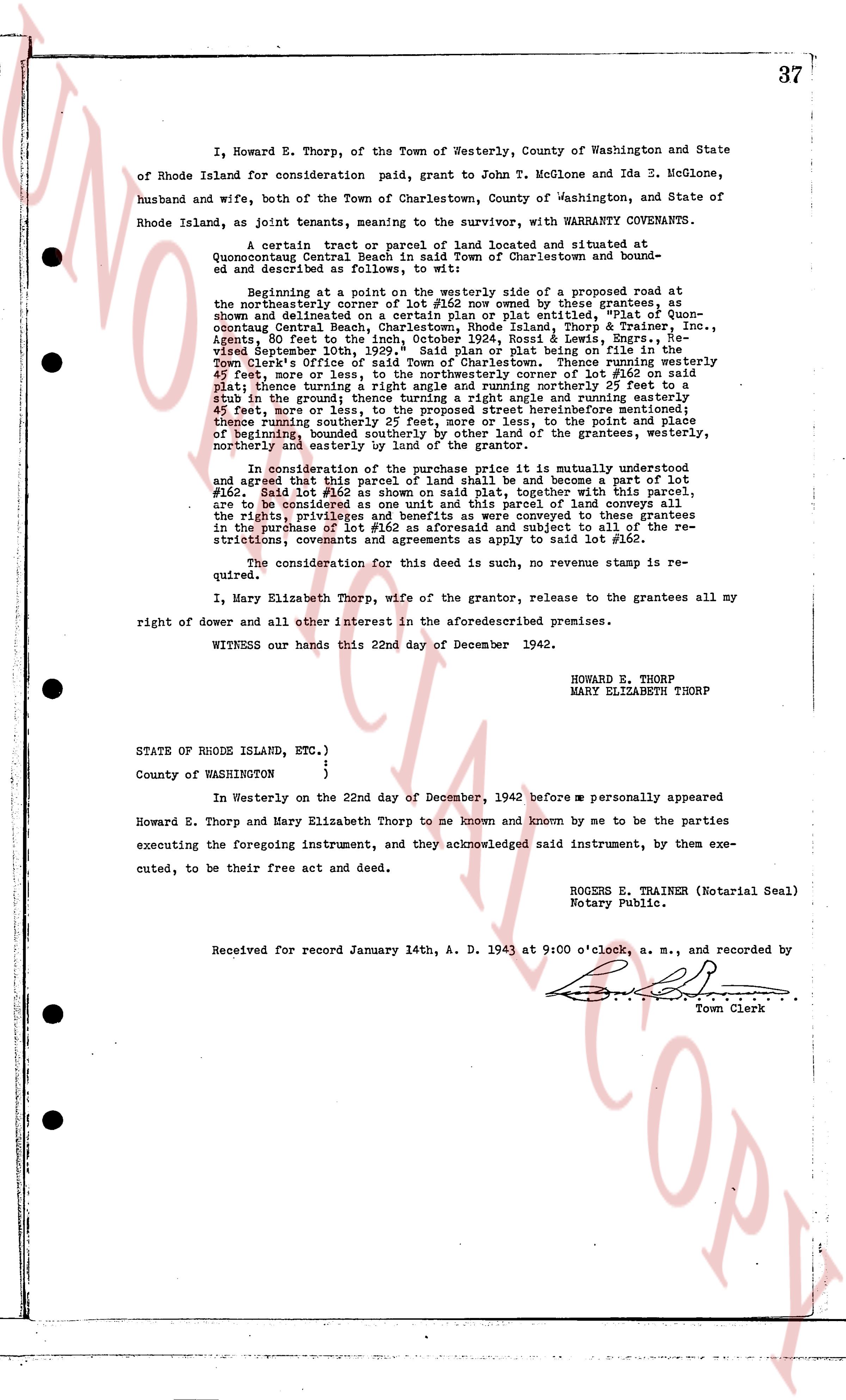
I, Howard E. Thorp, of the Town of Westerly, County of Washington and State of Rhode Island for consideration paid, grant to John T. McGlone and Ida E. McGlone, husband and wife, both of the Town of Charlestown, County of Washington, and State of Rhode Island, as joint tenants, meaning to the survivor, with WARRANTY COVENANTS.
A certain tract or parcel of land located and situated at Quonocutcong Central Beach in said Town of Charlestown and bounded and described as follows, namely:
Beginning at a point on the westerly side of a proposed road at the northeasterly corner of lot #162 now owned by these grantees, as shown and delineated on a certain plan made by A. plat outlines, #1936, Quonocutcong Central Beach, Town of Charlestown, Rhode Island, Thorp & Trainer, Inc., Agents, 80 feet to the inch, October 1936, Rozell & Lewis, Engrs., hereinafter referred to as the "plan", said plat being on file with the Register of Town Clerk's Office of said Town of Charlestown. Thence running westerly 45 1/2 feet, more or less to the northwesterly corner of lot #162, as shown on said plat; thence turning a right angle and running northerly 25 feet to a stub to the ground, thence turning a right angle and running easterly 45 1/2 feet, more or less, to the proposed street heretofore mentioned; thence turning south easterly 25 feet, more or less, to the point of beginning, bounded northerly and easterly by other land of the grantees, westerly northerly and easterly by boundary of lot #162.
In consideration of the above premises it is mutually understood and agreed that this parcel of land shall be and become a part of lot #162. Said lot #162 as shown on said plan, together with this parcel, are to be considered as one lot. This parcel of land conveys all benefits to the rights privileges and benefits as were conveyed to these grantees in the purchase of lot #162 and is subject to all of the restrictions, covenants and agreements as apply to said lot #162.
The consideration for this deed is such, no revenue stamp is required.
I, Mary Elizabeth Thorp, wife of the grantor, release to the grantees all my right of dower and all other interest in the aforesaid premises.
WITNESS our hands this 22nd day of December 1942.
HOWARD E. THORP
MARY ELIZABETH THORP
STATE OF RHODE ISLAND, ETC.)
)
County of WASHINGTON )
)
In Westerly on the 22nd day of December, 1942 before me personally appeared Howard E. Thorp and Mary Elizabeth Thorp to me known and known by me to be the parties executing, to the foregoing instrument, and they acknowledged said instrument, by them executing, to be their free act and deed.
ROGERS E. TRAINER (Notarial Seal)
Notary Public.
Received for record January 14th, A. D. 1943 at 9:00 o'clock, a. m., and recorded by [?]
Town Clerk
The page as recorded