The instrument's own words
page 1 · read by Gemma vision
498
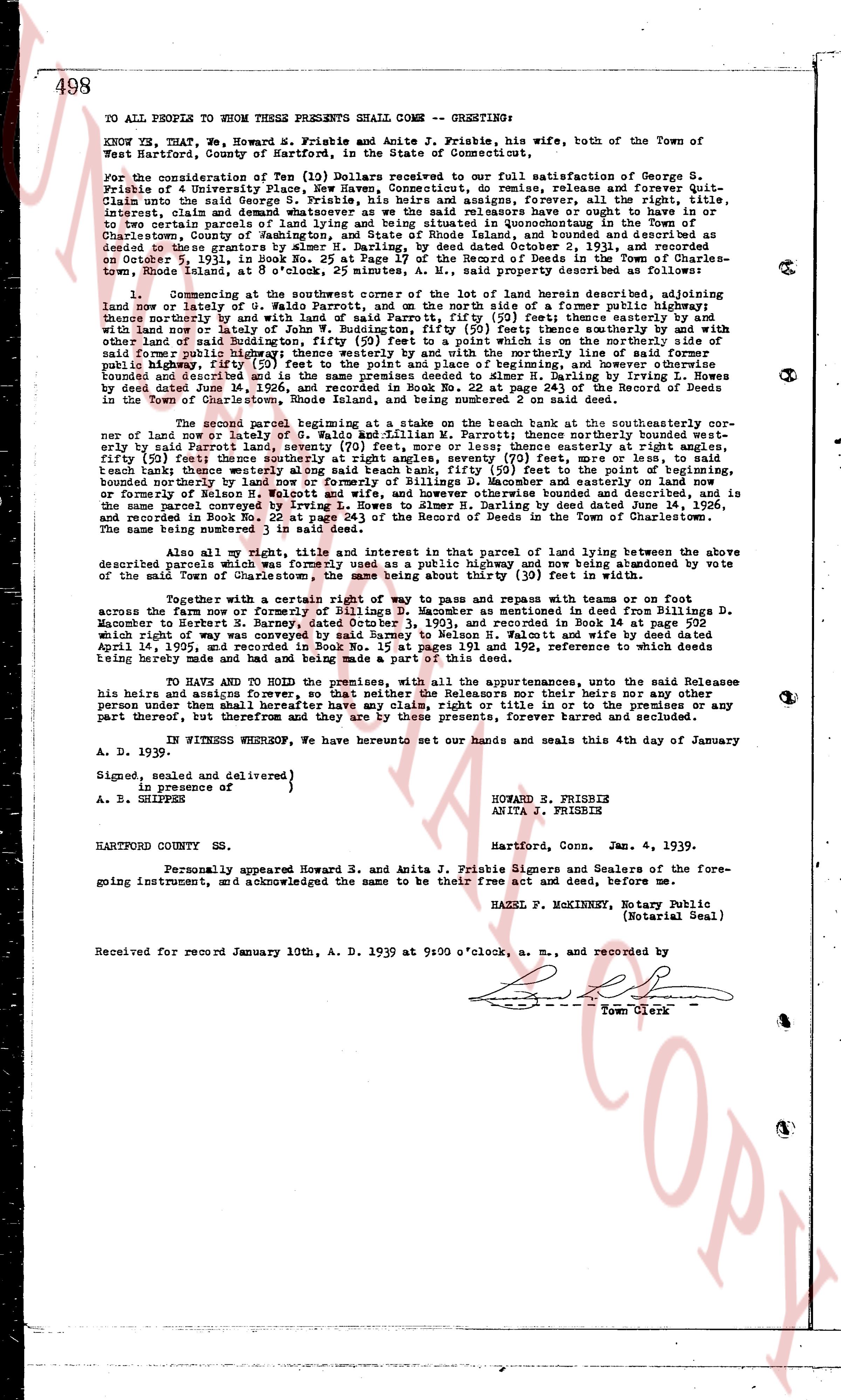
TO ALL PEOPLE TO WHOM THESE PRESENTS SHALL COME -- GREETINGS:
KNOW YE, THAT, we, Howard E. Frisbie and Anita J. Frisbie, his wife, both of the Town of Hartford, County of Hartford, in the State of Connecticut,
for the consideration of Ten (10) Dollars received to our full satisfaction of George S. Frisbie of 4 University Place, New Haven, Connecticut, do remise, release and forever Quit-Claim to the said George S. Frisbie, his heirs and assigns forever, all our right, title, interest, claim and demand whatsoever we as the said releasors have or ought to have in or to the following described parcel of land situated in the Town of Charlestown, County of Washington, and State of Rhode Island, and bounded and described as and deemed to be granted to the grantors by Albert H. Frisbie, by deed dated December 2, 1926 and recorded in Book de 25, page 408 of the Records of Deeds in the Town of Charlestown, Rhode Island, at 5 o'clock, 2 minutes, A. M., said property described as follows:
1. Commencing at the southwest corner of the lot of land herein described adjoining land owned by [?] of the same town, and running thence north 50 degrees east 100 feet thence northeasterly by and with said land of Parrot, fifty (50) feet thence easterly by and with land of [?] fifty (50) feet thence southerly by and with the same land 100 feet to a point which is on the northerly side of land owned by Buddington, fifty (50) feet to a point which is on the northerly side of said Buddington's land, 100 feet thence northwesterly 50 feet to a point on the public highway, fifty (50) feet to the point and place of beginning, and however otherwise described in the deed dated December 2, 1926, and recorded in Book de 25, page 408 of the Records of Deeds in the Town of Charlestown, Rhode Island.
2. A second parcel beginning at a stake on the bank home at the southeasterly corner of new land or lot number 9 of Waldo and William F. Marriott, north 70 degrees westerly bound east by the same land 100 feet thence northerly 50 feet thence westerly by and with land of [?] fifty (50) feet thence southerly at right angles, seventy (70) feet, or more or less, to said beach bank thence westerly along said beach bank, fifty (50) feet to the point of beginning, bounded on the north by land of Waldo and William F. Marriott, on the east by land of [?] or formerly of Nelson H. Walcott and wife, and however otherwise bounded and described, and is the same land conveyed to the grantors by Albert H. Frisbie by deed dated December 2, 1926 and recorded in Book de 25, page 408 of the Records of Deeds in the Town of Charlestown. The same is described as Lot 10.
Also all my right, title and interest in that parcel of land lying between the above described parcels which was formerly used as a public highway and now being abandoned by vote of the Town Council of Charlestown, 100 feet by 50 feet in the center.
Together with a certain right of way to pass and repass with teams or on foot across the farm now or formerly of Billings D. Monson as mentioned in said deed from Billings D. Monson to Albert H. Frisbie, by deed dated April 14, 1922, and recorded in said Book de 25, which right of way was conveyed by said Sammy to Nelson H. Walcott and wife by deed dated April 14, 1922, and recorded in Book de 191 and 192, reference to which deeds being herein made and being made a part of said conveyance.
TO HAVE AND TO HOLD the premises, with all the appurtenances unto, the said Releasee his heirs and assigns forever, so that neither the Releasors nor their heirs nor any other person under them shall hereafter have any right, title, interest, claim or demand in or to any part thereof, but therefore and they are by these presents, forever barred and secluded.
IN WITNESS WHEREOF, We have hereunto set our hands and seals this 4th day of January A. D. 1939.
Signed, sealed and delivered }
in presence of } HOWARD E. FRISBIE
A. B. GRIPPER } ANITA J. FRISBIE
HARTFORD COUNTY SS.
Hartford, Conn. Jan. 4, 1939.
Personally appeared Howard E. Frisbie and Anita J. Frisbie Signers and Sealers of the foregoing instrument, and acknowledged the same to be their free act and deed, before me.
HAZEL P. McKINNEY, Notary Public
(Notarial Seal)
Received for record January 10, A. D. 1939 at 9:00 o'clock, a. m., and recorded by
[Signature]
Town Clerk
The page as recorded