The instrument's own words
page 1 · read by Gemma vision
379
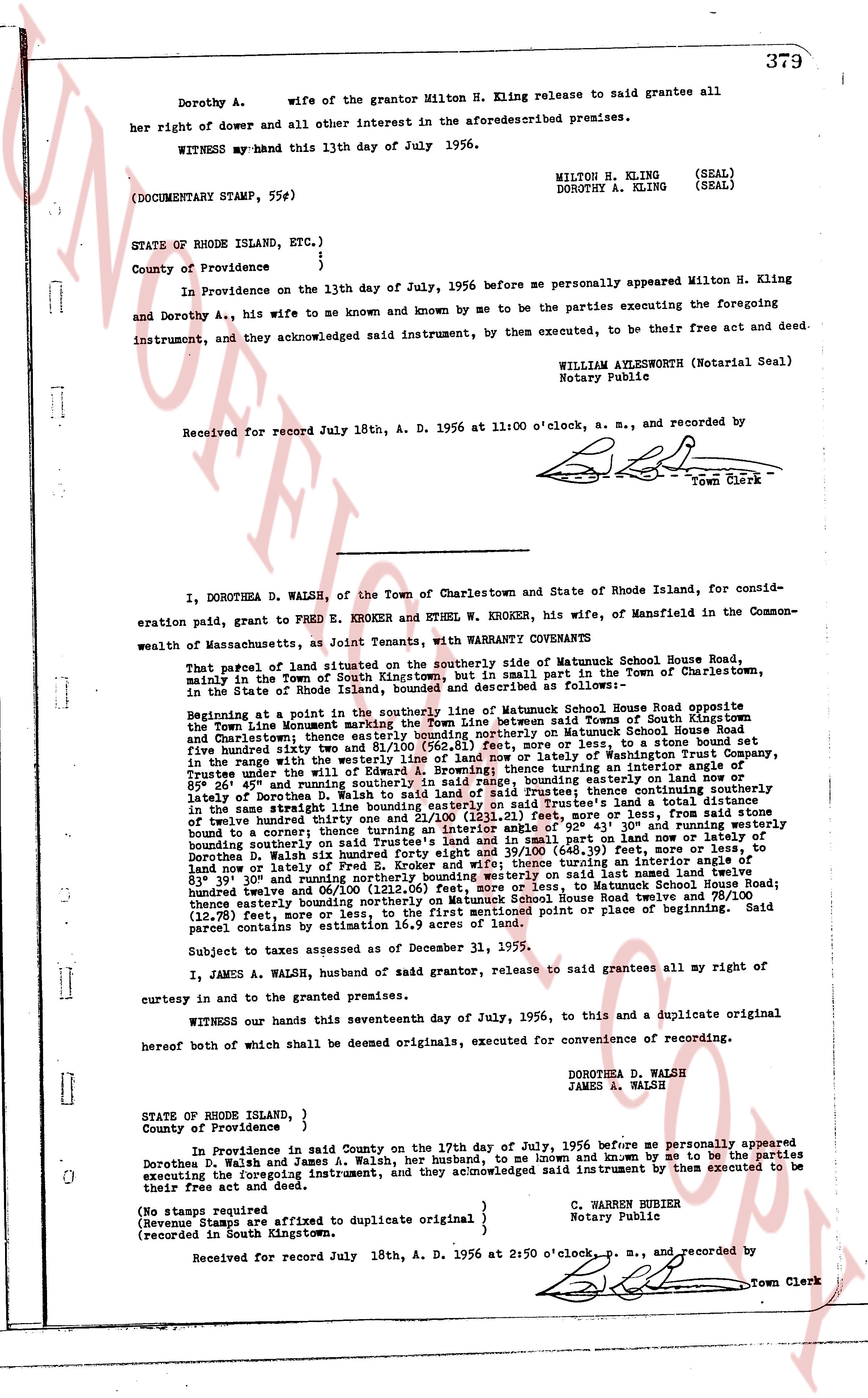
Dorothy A. wife of the grantor Milton H. Kling release to said grantee all
her right of dower and all other interest in the aforesaid described premises.
WITNESS my hand this 13th day of July 1956.
MILTON H. KLING (SEAL)
DOROTHY A. KLING (SEAL)
(DOCUMENTARY STAMP, 55¢#)
STATE OF RHODE ISLAND, ETC.)
County of Providence } ss.
In Providence on the 13th day of July, 1956 before me personally appeared Milton H. Kling
and Dorothy A., his wife to me known and known by me to be the parties executing the foregoing
instrument, and they acknowledged said instrument, by them executed, to be their free act and deed.
WILLIAM AYLESWORTH (Notarial Seal)
Notary Public
Received for record July 18th, A. D. 1956 at 11:00 o'clock, a. m., and recorded by
[signature]
Town Clerk
----
I, DOROTHEA D. WALSH, of the Town of Charlestown and State of Rhode Island, for consid-
eration paid, grant to FRED E. KROKER, and ETHEL W. KROKER, his wife, of Mansfield in the Common-
wealth of Massachusetts, as Joint Tenants, with WARRANTY COVENANTS
That parcel of land situated on the southerly side of Matumuck House Road,
mainly in the Town of South Kingstown, Rhode Island, part in the Town of Charlestown,
in the State of Rhode Island, as follows described and delineated as follows:
Beginning at a point in the southerly line of Matumuck House Road opposite
the Town Line monetary marking the Town line between said Towns of South Kingstown and
Charlestown; thence easterly along said southerly line of Matumuck House Road
five hundred thirty one feet and 81/100 (531.81) feet, more or less, to a stone bound set
in the range with the westerly line of a parcel of land belonging to Mansfield; thence turning an interior angle of
89° 26' in the range with the westerly line of said parcel, bounding easterly 411 feet, more or less, to
Truelove; thence under the westerly line of said parcel, bounding easterly 111 feet, more or less, to
the range with the westerly line of said parcel; thence continuing southerly
lately of interior 83° 31' and 40/100 (83.31) feet, more or less, to the range with the
in the same straight line bounding easterly on said Truelove's land a total distance of
twenty hundred thirty one feet and 11/100 (231.11) feet, more or less, to said stone
bound to a corner; thence turning an interior angle of 92° 43' 30" and running westerly
bounding northerly on said Truelove's land a total distance of 404 feet, more or less, to said
Dorothea D. Walsh six hundred forty eight feet and 39/100 (648.39) feet, more or less, to
leaving or turning an interior angle of 83° 31' and 40/100 (83.31) feet, more or less, to
83° 39' and running northerly bounding westerly on said last named land twelve
hundred thirty one and 81/100 (1231.81) feet, more or less, to Matumuck House Road;
thence northerly bounding northerly on Matumuck House Road twelve and 78/100
(12.78) feet, more or less, to the first mentioned point of place or beginning. Said
parcel being as stated in the deed in book 24, page 111.
Subject to taxes assessed as of December 31, 1955.
I, JAMES A. WALSH, husband of said grantor, release to said grantees all my right of
curtesy in and to the granted premises.
WITNESS our hands this seventeenth day of July, 1956, to this and a duplicate original
hereof both of which shall be deemed originals, executed for convenience of recording.
DOROTHEA D. WALSH
JAMES A. WALSH
STATE OF RHODE ISLAND, }
County of Providence } ss.
In Providence in said County on the 17th day of July, 1956 before me personally appeared
Dorothea D. Walsh and James A. Walsh, her husband, to me known and known by me to be the parties
executing the foregoing instrument, and they acknowledged said instrument by them executed to be
their free act and deed.
(No stamps required
(Revenue Stamps are affixed to duplicate original } C. WARREN HUBBER
(recorded in South Kingstown. Notary Public
Received for record July 18th, A. D. 1956 at 2:50 o'clock, p. m., and recorded by
[signature]
Town Clerk
The page as recorded