The instrument's own words
page 1 · read by Gemma vision
297
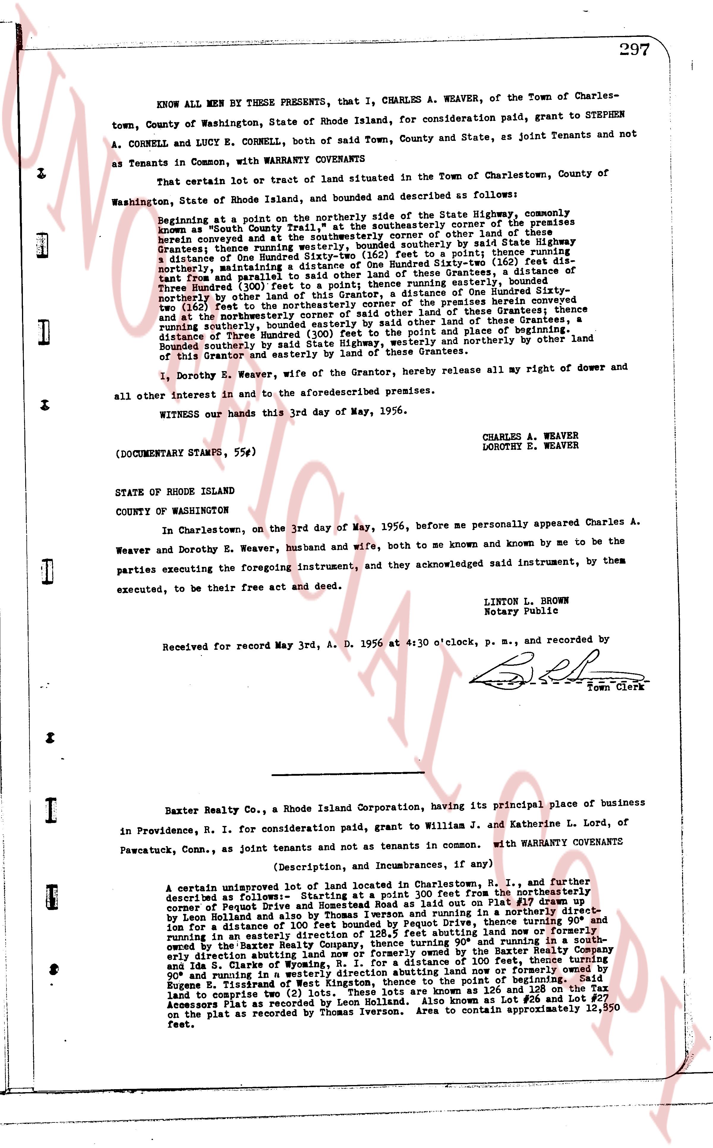
KNOW ALL MEN BY THESE PRESENTS, that I, CHARLES A. WEAVER, of the Town of Charlestown, County of Washington, State of Rhode Island, for consideration paid, grant to STEPHEN A. CORNELL and LUCY E. CORNELL, both of said Town, County and State, as Joint tenants and not as Tenants in Common, with WARRANTY COVENANTS
That certain Lot or tract of land situated in the Town of Charlestown, County of Washington, State of Rhode Island, land, and bounded and described as follows:
Beginning at a point on the northerly side of the State Highway, commonly known as "South County Trail" at the southeasterly corner of the premises herein conveyed and at the southeasterly corner of other land of these Grantees, bounded thence running westerly, bounded southerly by said State Highway a distance of One Hundred (100) feet to a pole, thence turning north northeasterly maintaining a distance of One Hundred Sixty-two (162) feet distant from and parallel to said State Highway, to a stone boundary, a distance of fifty feet from and parallel to said State Highway, thence running easterly, bounded northerly by other land of this Grantor, a distance of One Hundred Sixty-two Three Hundred (300) feet to the southeasterly corner of the premises herein conveyed and at the northeasterly corner of other land of these Grantees, thence running easterly and at the northeasterly corner of other land of these Grantees, a distance running northerly, bounded easterly by other land of these Grantees, a distance of Three Hundred (300) feet to the point and place of beginning, Bounded southerly, by said State Highway, bounded easterly and northerly by other land of this Grantor and easterly by land of these Grantees.
I, Dorothy E. Weaver, wife of the Grantor, hereby release all my right of dower and all other interest in and to the aforementioned premises.
hands this 3rd day of May, 1956.
CHARLES A. WEAVER
DOROTHY E. WEAVER
(DOCUMENTARY STAMPS, 55¢)
STATE OF RHODE ISLAND
COUNTY OF WASHINGTON
In Charlestown, on the 3rd day of May, 1956, before me personally appeared Charles A. Weaver and Dorothy E. Weaver, husband and wife, both to me known and known by me to be the parties executing the foregoing instrument, and they acknowledged said instrument, by them executed, to be their free act and deed.
LINTON L. BROWN
Notary Public
Received for record May 3rd A. D. 1956 at 4:30 o'clock, p. m., and recorded by
[Signature]
Town Clerk
----
Baxter Realty Co., a Rhode Island Corporation, having its principal place of business in Providence, R. I. for consideration paid, grant to William J. and Katherine L. Lord, of Pawcatuck, Conn., as joint tenants and not as tenants in common. with WARRANTY COVENANTS
(Description, and Incumbrances, if any)
A certain unimproved lot of land located in Charlestown, R. I., and further described as follows: Beginning at a point 100 feet from the northeasterly describer of Folger Street and Rhodehouse Road as laid out on Plat #19 drawn up by Leon Holland and also by Thomas Iverson and running in a southeasterly direction for a distance of 128.5 feet to a stone boundary, thence turning 90° and running in an easterly direction of 128.5 feet abutting land now and formerly owned by the Baxter Realty Company, thence turning 90° and running in a southerly direction abutting land now or formerly owned by the Baxter Realty Company a distance of 100 feet, thence turning 90° and in the State of Rhode Island, running in a westerly direction abutting land now or formerly owned by Eugene Trindade a distance of 128.5 feet to the point of beginning. The said land to comprise two (2) lots. These lots are known as 126 and 128 on the Tax Assessors Plat as recorded by Leon Holland. Also known as Lot 1 and Lot 2 as shown on the plat as recorded by Thomas Iverson. Area to contain approximately 12,550 feet.
The page as recorded