The instrument's own words
page 1 · read by Gemma vision
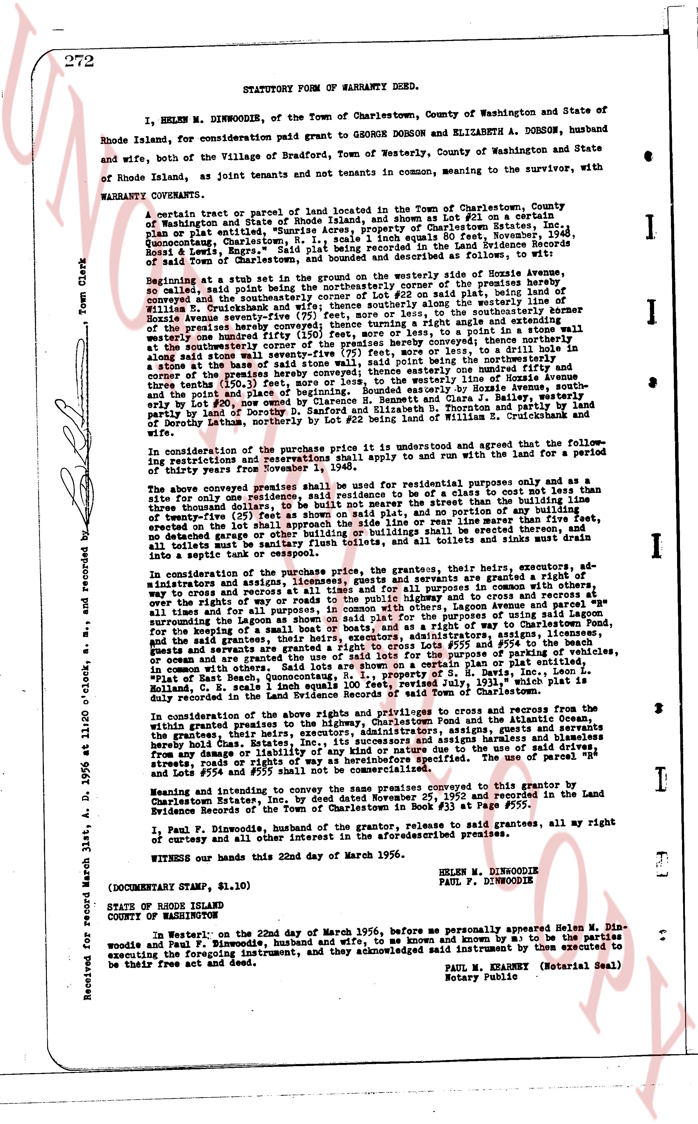
272 STATUTORY FORM OF WARRANTY DEED.
I, HELEN M. DINWOODIE, of the Town of Charlestown, County of Washington and State of Rhode Island, for consideration paid grant to GEORGE DOBSON and ELIZABETH A. DOBSON, husband and wife, both of the Village of Bradford, Town of Westerly, County of Washington and State of Rhode Island, as joint tenants and not tenants in common, meaning to the survivor, with WARRANTY COVENANTS.
A certain tract or parcel of land located in the Town of Charlestown, County of Washington and State of Rhode Island, and shown as lot #21 on a certain plan, dated Oct 23, 1936, entitled "Quannipowitt Acres, property of Charlestown Estates, Inc., Quonocutcong, Charlestown, R. I., scale 1 inch equals 50 feet, November, 1948, Sheet 1 page 1 of 4", said plan being recorded in the Land Evidence Records of said Town of Charlestown, and bounded and described as follows, to wit:
Beginning at a set stub in the bearing on the westerly side of Hosie Avenue, so called, said point being a corner of the premises hereby conveyed and also the southeasterly corner of Lot #22 on said plan, said point being the corner of the premises hereby conveyed and also the corner of the premises hereby conveyed by William E. Cruinkbank and wife, thence running along the northerly line of the Hosie Avenue sum eighty seven (87) feet, more or less, to the southeasterly corner of the premises hereby conveyed thence turning north forty one degrees twenty one minutes westerly one hundred twenty four (124) feet, more or less, to a point in a stone wall at the southeasterly corner of the premises hereby conveyed thence turning south eighty one degrees twenty one minutes east one hundred twenty four (124) feet, more or less, to drill a hole in base of the said stone wall, said point being the northerly corner of the premises hereby conveyed and also the northeasterly corner of Lot #22 on said plan, thence south twenty one degrees forty one minutes east one hundred fifty and three tenths (150.3) feet, more or less, to the westerly line of Hosie Avenue and thence north eighty one degrees twenty one minutes east eighty seven (87) feet, more or less, to point #21, now owned in part by Clarence B. Bennett and Clara J. Bailey, westerly party by land of Dorothy S. Danforth and husband, and easterly party by land of Dorothy S. Danforth and husband, and also the northerly corner of Lot #22 being land of William E. Cruinkbank and wife.
In consideration of the purchase price it is understood and agreed that the following restrictions and reservations shall apply to and run with and run for the land for a period of thirty years from November 1, 1956.
The above conveyed premises shall be used for residential purposes only and as a site for one single family residence or a site for a residence not to cost more than three thousand dollars, to be built not more than one hundred feet from the northerly line of Hosie Avenue, and not to be built on any part of said plat, and no portion of any building of exterior height more than twenty feet shall approach the side line or rear line more than five feet, no building shall be erected on the lot save as hereinabove provided, and all sanitary installations, all toilets must be sanitary flush toilets, and all toilets and sinks must drain into a septic tank or cesspool.
In consideration of the purchase price, the grantors, their heirs, executors, administrators, assigns, licensees, and guests, servants are granted a right of way to cross and recross a strip of land twenty feet in width running in general east and west direction, along the roads to the public highway and to cross and recross at all times and for all purposes, and on a strip of land twenty feet in width running in general north and south on said plat for the purposes of using said lagoon surrounding the pond on said plat for the purposes of using a boat or boats, and as a right of way to cross and recross the pond on said plat. The grantors, their heirs, executors, administrators, assigns, licensees, and guests and servants are granted a right to cross Lots #35 and #55 and #55a on said plat, for the purpose of parking of vehicles, or ocean or lake craft and to cross and recross the same for the purpose of parking of vehicles, in common with others. "Said lots are shown on a certain plan or plat entitled, "Plat of the Property of Charlestown Estates, Inc., E. H. Larrabee, and E. H. Larrabee and Holland, C. E. Scales 1 inch equals 100 feet, revised July, 1931," which plan is duly recorded in the Land Evidence Records of the Town of Charlestown.
In consideration of the above rights and privileges to cross and recross from the within granted premises to the highway, Charlestown Pond and the Atlantic Ocean, the grantors, their heirs, executors, administrators, assigns, licensees, and guests, servants hereby release from any liability, and its successors and assigns releases and harmless disables from any damage or liability of any kind whatsoever, arising from the use of said streets, roads, and ways as hereinbefore specified. The use of parcel "H" and Lots #554 and #555 shall not be commercialized.
Meaning and intending to convey the same premises conveyed to the grantor by Clarence B. Bennett and Clara J. Bailey, by deed dated Oct 23, 1952 and recorded in the Land Evidence Records of the Town of Charlestown in book #31 at page #555.
I, Paul F. Dinwoodie, husband of the grantor, release to said grantees, all my right of curtesy and of any other interest in the aforesaid premises.
WITNESS our hands this 22nd day of March 1956.
HELEN M. DINWOODIE
PAUL F. DINWOODIE
(DOCUMENTARY STAMP $1.10)
STATE OF RHODE ISLAND
COUNTY OF WASHINGTON
In Westerly on the 22nd day of March 1956, before me personally appeared Helen M. Dinwoodie and Paul F. Dinwoodie, husband and wife, to me known and by me known to be the parties executing the foregoing instrument, and acknowledged said instrument by them executed to be their free act and deed.
PAUL M. KEARNEY (Notarial Seal)
Notary Public
Received for record March 31st, A. D. 1956 at 11:20 o'clock, and recorded by [?]
The page as recorded