The instrument's own words
page 1 · read by Gemma vision
267
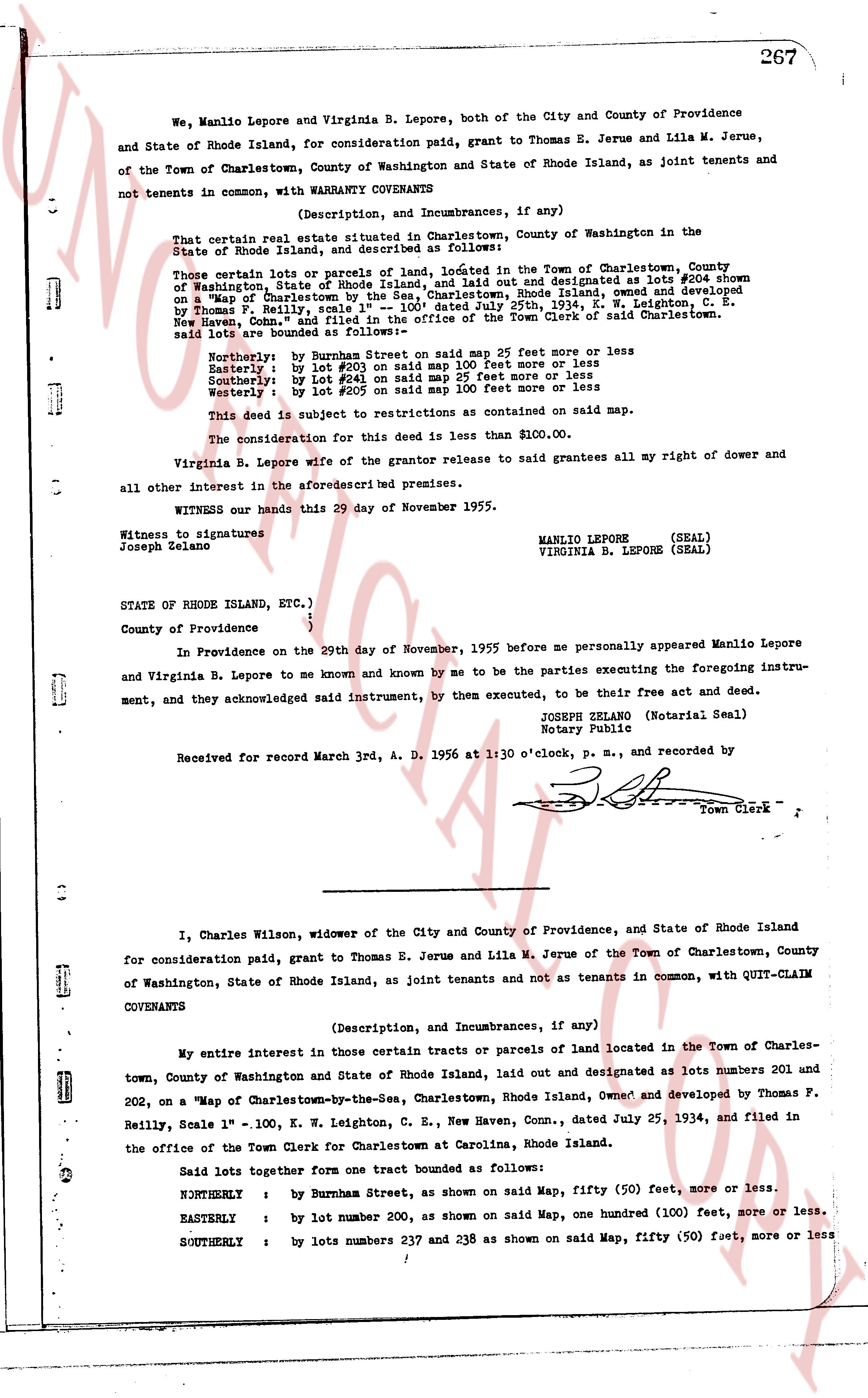
We, Manlio Lepore and Virginia B. Lepore, both of the City and County of Providence and State of Rhode Island, for consideration paid, grant to Thomas E. Jerue and Lila M. Jerue, of the Town of Charlestown, County of Washington and State of Rhode Island, as joint tenants and not tenants in common, with WARRANTY COVENANTS
(Description, and Incumbrances, if any)
That certain real estate situated in Charlestown, County of Washington in the State of Rhode Island, and described as follows:
Those certain lots or parcels of land, located in the Town of Charlestown, County of Washington, State of Rhode Island, laid out and designated as lots #204 shown on a "Map of Charlestown by the Sea, Charlestown, Rhode Island," owned and developed by Thomas Reilly, dated July 25, 1934, in W. Leighton C. E., New Haven, Conn., and filed in the office of the Town Clerk of said Charlestown. said lots are bounded as follows:
Northerly : by Burnham Street on said map 25 feet more or less
Easterly : by lot #203 on said map 100 feet more or less
Southerly : by lot #205 on said map 25 feet more or less
Westerly : by lot #205 on said map 100 feet more or less
This deed is subject to restrictions as contained on said map.
The consideration for this deed is less than $100.00.
Virginia B. Lepore wife of the grantor release to said grantees all my right of dower and all other interest in the aforesaid described premises.
WITNESS our hands this 29 day of November 1955.
MANLIO LEPORE (SEAL)
VIRGINIA B. LEPORE (SEAL)
Witness to signatures
Joseph Zelano
STATE OF RHODE ISLAND, ETC.)
County of Providence
In Providence on the 29th day of November, 1955 before me personally appeared Manlio Lepore and Virginia B. Lepore to me known and by me to be the parties executing the foregoing instrument, and they acknowledged said instrument, by them executed, to be their free act and deed.
JOSEPH ZELANO (Notarial Seal)
Notary Public
Received for record March 3rd, A. D. 1956 at 1:30 o'clock, P. M., and recorded by [?]
Town Clerk
----
I, Charles Wilson, widower of the City and County of Providence, and State of Rhode Island for consideration paid, grant to Thomas E. Jerue and Lila M. Jerue of the Town of Charlestown, County of Washington, State of Rhode Island, as joint tenants and not as tenants in common, with QUIT-CLAIM COVENANTS
(Description, and Incumbrances, if any)
My entire interest in those certain tracts or parcels of land located in the Town of Charlestown, County of Washington and State of Rhode Island, laid out and designated as lots numbers 201 and 202, on a "Map of Charlestown-by-the-Sea, Charlestown, Rhode Island, owned and developed by Thomas F. Reilly, Scale 1" = 100. K. W. Leighton, C. E., New Haven, Conn., dated July 25, 1934, and filed in the office of the Town Clerk for Charlestown at Carolina, Rhode Island.
Said lots together form one tract bounded as follows:
NORTHERLY : by Burnham Street, as shown on said Map, fifty (50) feet, more or less.
EASTERLY : by lot number 200, as shown on said Map, one hundred (100) feet, more or less.
SOUTHERLY : by lots numbers 237 and 238 as shown on said Map, fifty (50) feet, more or less
page 2 · read by Gemma vision
268
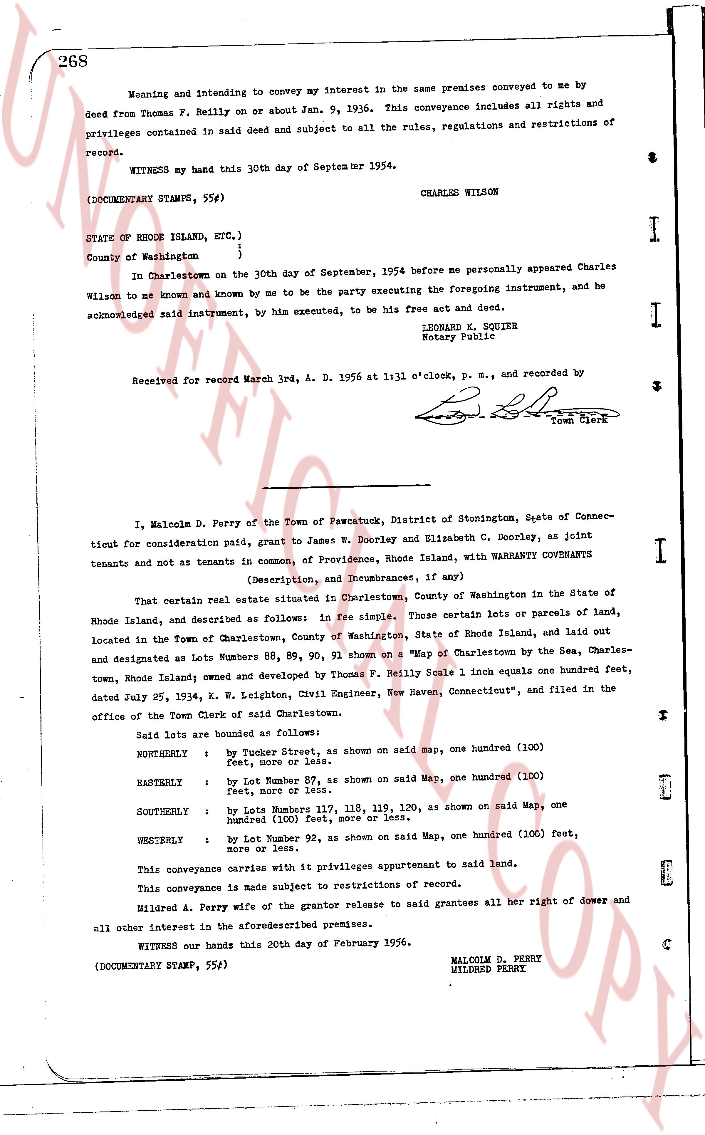
Meaning and intending to convey my interest in the same premises conveyed to me by
deed from Thomas F. Reilly on or about Jan. 9, 1936. This conveyance includes all rights and
privileges contained in said deed and subject to all the rules, regulations and restrictions of
record.
WITNESS my hand this 30th day of September 1954.
CHARLES WILSON
(DOCUMENTARY STAMPS, 55¢)
STATE OF RHODE ISLAND, ETC.)
County of Washington }
)
In Charlestown on the 30th day of September, 1954 before me personally appeared Charles
Wilson to me known and by known by me to be the party executing the foregoing instrument, and he
acknowledged said instrument, by his executed, to be his free act and deed.
LEONARD K. SQUIER
Notary Public
Received for record March 3rd, A. D. 1956 at 1:11 o'clock, p. m., and recorded by
[Signature]
Town Clerk
----
I, Malcolm D. Perry of the Town of Pawcostuck, District of Stonington, State of Connec-
ticut for consideration paid, grant to James W. Dooley and Elizabeth C. Dooley, as joint
tenants and not as tenants in common, of Providence, Rhode Island, with WARRANTY COVENANTS
(Description, and Incumbrances, if any)
That certain real estate situate in Charlestown, County of Washington in the State of
Rhode Island, and described as follows: in fee simple. Those certain lots or parcels of land,
located in the Town of Charlestown, County of Washington, State of Rhode Island, and laid out
and designated as Lots Numbers 88, 89, 90, 91 shown on a "Map of Charlestown by the Sea, Charles-
town, Rhode Island; owned and developed by Thomas F. Reilly Scale 1 inch equals one hundred feet,
dated July 25, 1934, K. W. Leighton, Civil Engineer, New Haven, Connecticut", and filed in the
office of the Town Clerk of said Charlestown.
Said lots are bounded as follows:
NORTHERLY : by Tucker Street, as shown on said map, one hundred (100)
feet, more or less.
EASTERLY : by Lot Number 87, as shown on said Map, one hundred (100)
feet, more or less.
SOUTHERLY : by Lots Numbers 117, 118, 119, 120, as shown on said Map, one
hundred (100) feet, more or less.
WESTERLY : by Lot Number 92, as shown on said Map, one hundred (100) feet,
more or less.
This conveyance carries with it privileges appurtenant to said land.
This conveyance is made subject to restrictions of record.
Mildred A. Perry a foreclosed of the grantor release to said grantees all her right of dower and
all other interest in the aforesaid premises.
WITNESS our hands this 20th day of February 1956.
MALCOLM D. PERRY
MILDRED PERRY
(DOCUMENTARY STAMP, 55¢)
The page as recorded