The instrument's own words
page 1 · read by Gemma vision
225
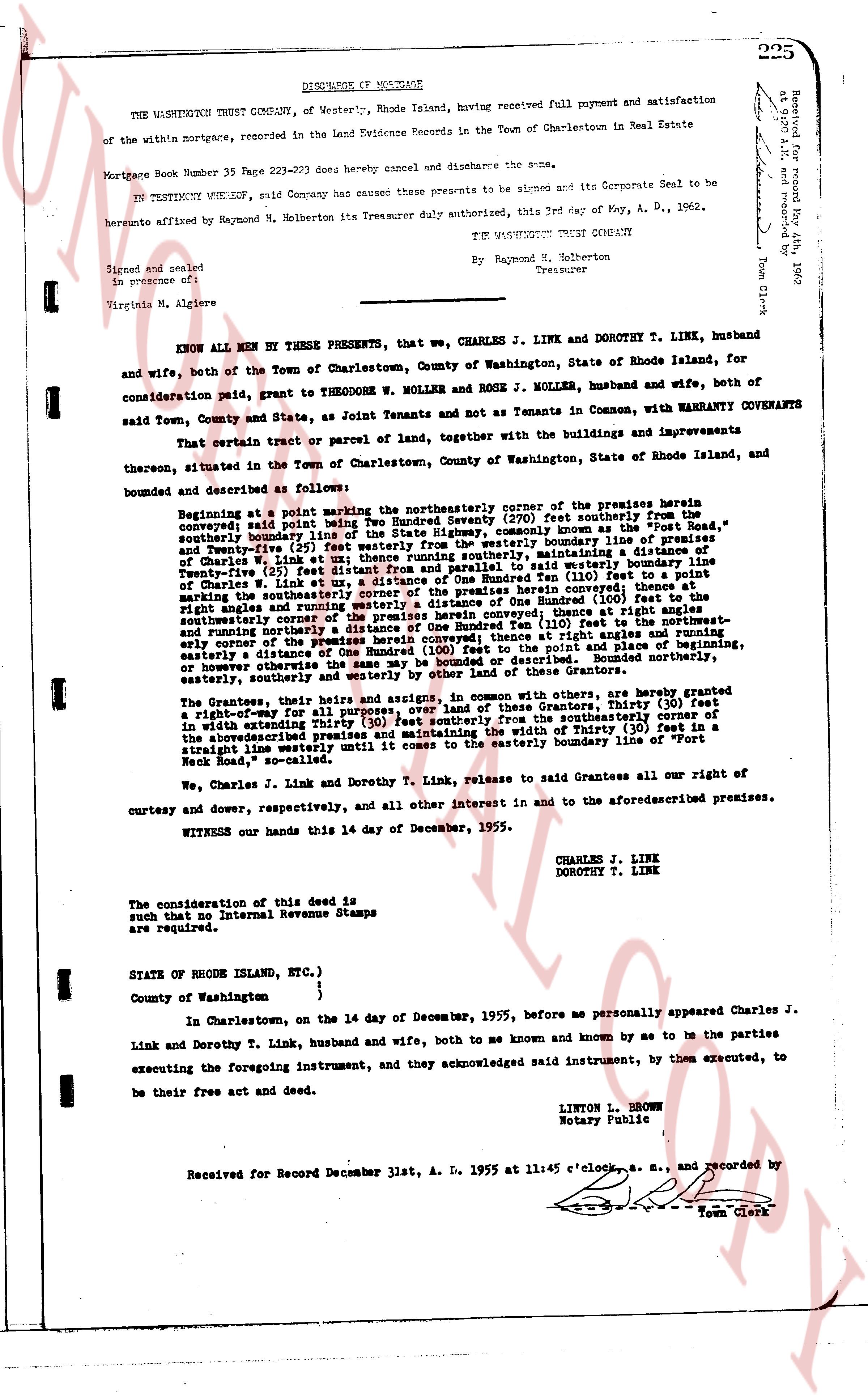
DISCHARGE OF MORTGAGE
THE WASHINGTON TRUST COMPANY, of Westerly, Rhode Island, having received full payment and satisfaction of the within mortgage, recorded in the Land Evidence Records in the Town of Charlestown in Real Estate
Mortgage Book Number 35 Page 223-225 does hereby cancel and discharge the same.
IN TESTIMONY WOf SIGN, said Company has caused the presents to be signed and its Corporate Seal to be hereunto affixed by Raymond M. Holberton its Treasurer duly authorized, this 3rd day of May, A. D. 1962.
THE WASHINGTON TRUST COMPANY
By Raymond M. Holberton
Treasurer
Signed and sealed
in presence of ot
Virginia M. Algiers
Recorded May 4, 1962 a.m. and recorded by
[signature]
Town Clerk
KNOW ALL MEN BY THESE PRESENTS, that we, CHARLES J. LINK and DOROTHY T. LINK, husband and wife, both of the Town of Charlestown, County of Washington, State of Rhode Island, for consideration paid, grant to THEODORE W. MOLLER and ROSE J. MOLLER, husband and wife, both of said Town, County and State, as Joint Tenants and mey as Tenants in Common, with WARRANTY COVENANTS that certain tract or parcel of land, together with the buildings and improvements thereon, situated in the Town of Charlestown, County of Washington, State of Rhode Island, and bounded and described as following:
Beginning at a point marking the northeasterly corner of the premises herein conveyed; said point being Two Hundred Seventy Seven (277) feet southerly from the boundary of the highway known as "The Old Post Road", commonly known as the "Post Road", southerly boundary, and Twenty Five (25) feet westerly from the westerly boundary line of premises of Charles W. Link et al; thence running southerly, maintaining a distance of Twenty Five (25) feet from and parallel to said westerly boundary line of premises of Charles W. Link et al, a distance of One Hundred Ten (110) feet to a point marking the southeasterly corner of the premises herein conveyed; thence at right angles and running westerly a distance of One Hundred Ten (110) feet to a point marking the southwesterly corner of the premises herein conveyed; thence at right angles and running northerly a distance of One Hundred Ten (110) feet to the point and place of beginning, or however otherwise the said premises may be described. Bounded northerly by the highway, easterly, southerly and westerly by other land of the Grantees.
The Grantees, their heirs and assigns, in common with others, are hereby granted a right-of-way for all purposes, over and across the land of the Grantors, Thirty (30) feet in width extending Thirty (30) feet southerly from the southeasterly corner of the south boundary line of the aforementioned premises and maintaining a width of Thirty (30) feet in a straight line westerly until it meets the easterly boundary line of "Fort Neck Road", so called.
We, Charles J. Link and Dorothy T. Link, Release to said Grantees all our right of curtesy and dowry, respectively, and all other interest in and to the aforementioned premises.
WITNESS our hands this 14 day of December, 1955.
CHARLES J. LINK
DOROTHY T. LINK
The consideration of this deed is $ [?] such that no Internal Revenue Stamps are required.
STATE OF RHODE ISLAND, ETC.)
County of Washington }
In Charlestown, on the 14 day of December, 1955, before me personally appeared Charles J. Link and Dorothy T. Link, husband and wife, both to me known and known by me to be the parties executing the foregoing instrument, and they acknowledged said instrument, by them executed, to be their free act and deed.
LINTON L. BROWN
Notary Public
Received for Record December 31st, A. D. 1955 at 11:45 o'clock a. m., and recorded by
[signature]
Town Clerk
The page as recorded