The instrument's own words
page 1 · read by Gemma vision
170
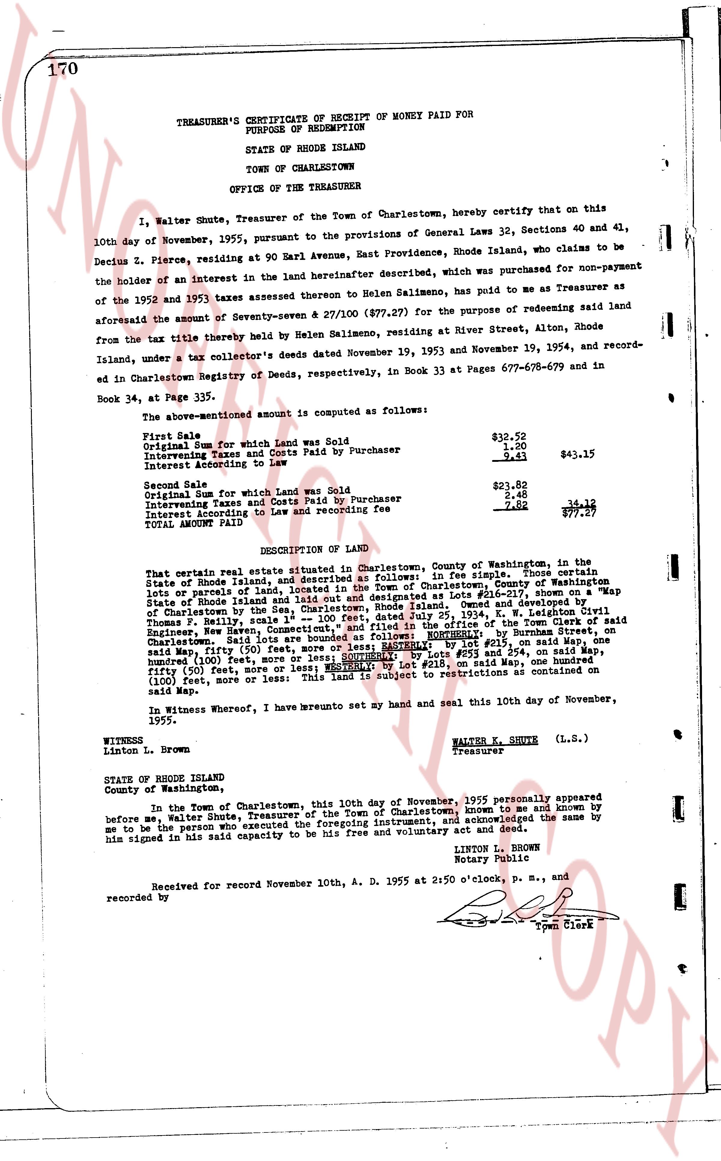
TREASURER'S CERTIFICATE OF RECEIPT OF MONEY PAID FOR
PURPOSE OF REDEMPTION
STATE OF RHODE ISLAND
TOWN OF CHARLESTOWN
OFFICE OF THE TREASURER
I, Walter Shute, Treasurer of the Town of Charlestown, hereby certify that on this 10th day of November, 1955, pursuant to the provisions of General Laws 32, Sections 40 and 41, Decius Z. Pierce, residing at 90 Earl Avenue, East Providence, Rhode Island, who claims to be the holder of an interest in the land hereinafter described, which was purchased for non-payment of the 1952 and 1953 taxes assessed thereon to Helen Salimeno, has paid to me as Treasurer as aforesaid the sum of Seventy-seven & 27/100 ($77.27) for the purpose of redeeming said land from the tax title thereby held by Helen Salimeno, residing at River Street, Alton, Rhode Island, under a tax collector's deeds dated November 19, 1953 and November 19, 1954, and recorded in Charlestown Registry of Deeds, respectively, in Book 33 at Pages 677-678-679 and in Book 34, at Page 335.
The above-mentioned amount is computed as follows:
First Sale $32.52
Original Sum for which Land was Sold 1.60
Intervening Taxes and Costs Paid by Purchaser 9.41 $43.13
Interest According to Law
Second Sale $32.82
Original Sum for which Land was Sold 2.48
Intervening Taxes and Costs Paid by Purchaser 34.18
Interest According to Law and recording fee 7.82 77.27
TOTAL AMOUNT PAID
DESCRIPTION OF LAND
That certain real estate situated in Charlestown, County of Washington, in the State of Rhode Island, and described as follows: A lot in fee simple, those certain lands or parcels of land, lying and being in the Town of Charlestown, County of Washington State of Rhode Island and laid out and designated as Lot #28-01 on a Map dated May 19, 1954, scale 1" = 100 feet, Dated July 25, 1954, by Leighton Civil Thomas F. Kelly, scale 1" = 100 feet, Dated July 25, 1954, owned and developed by Charlestown by the [?] 1" = 100 feet, Dated July 25, 1954, by W. N. Leighton Civil Engineer, New Haven, Conn. containing 0.15 acres, more or less, being part of the Town of Charlestown, said Lot 28-01 being bounded as follows: NORTHERNLY by Burness street, on Charlestown, said Lot 28-01; EASTERNLY by Lot #27, on said Map, and WESTERNLY by Lot #29, on said Map, and SOUTHERLY by Lots #53 and 254, on said Map, containing one hundred (100) feet, more or less; and SOUTHEASTLY by Lot #28, on said Map, containing fifty (50) feet, more or less and WESTERNLY by Lot #28, on said Map, containing one hundred (100) feet, more or less. This land is subject to restrictions as contained on said Map.
In Witness Whereof, I have brunt set my hand and seal this 10th day of November, 1955.
WITNESS WALTER E. SHUTE (L.S.)
Linton L. Brown Treasurer
STATE OF RHODE ISLAND
County of Washington,
In the Town of Charlestown, this 10th day of November, 1955 personally appeared before me, Walter Shute, Treasurer of the Town of Charlestown, known to me and known by me to be the person who executed the foregoing instrument, and acknowledged the same by him signed in his said capacity to be his free and voluntary act and deed.
LINTON L. BROWN
Notary Public
Received for record November 10th, A. D. 1955 at 2:50 o'clock, P. m., and
recorded by Town Clerk
The page as recorded