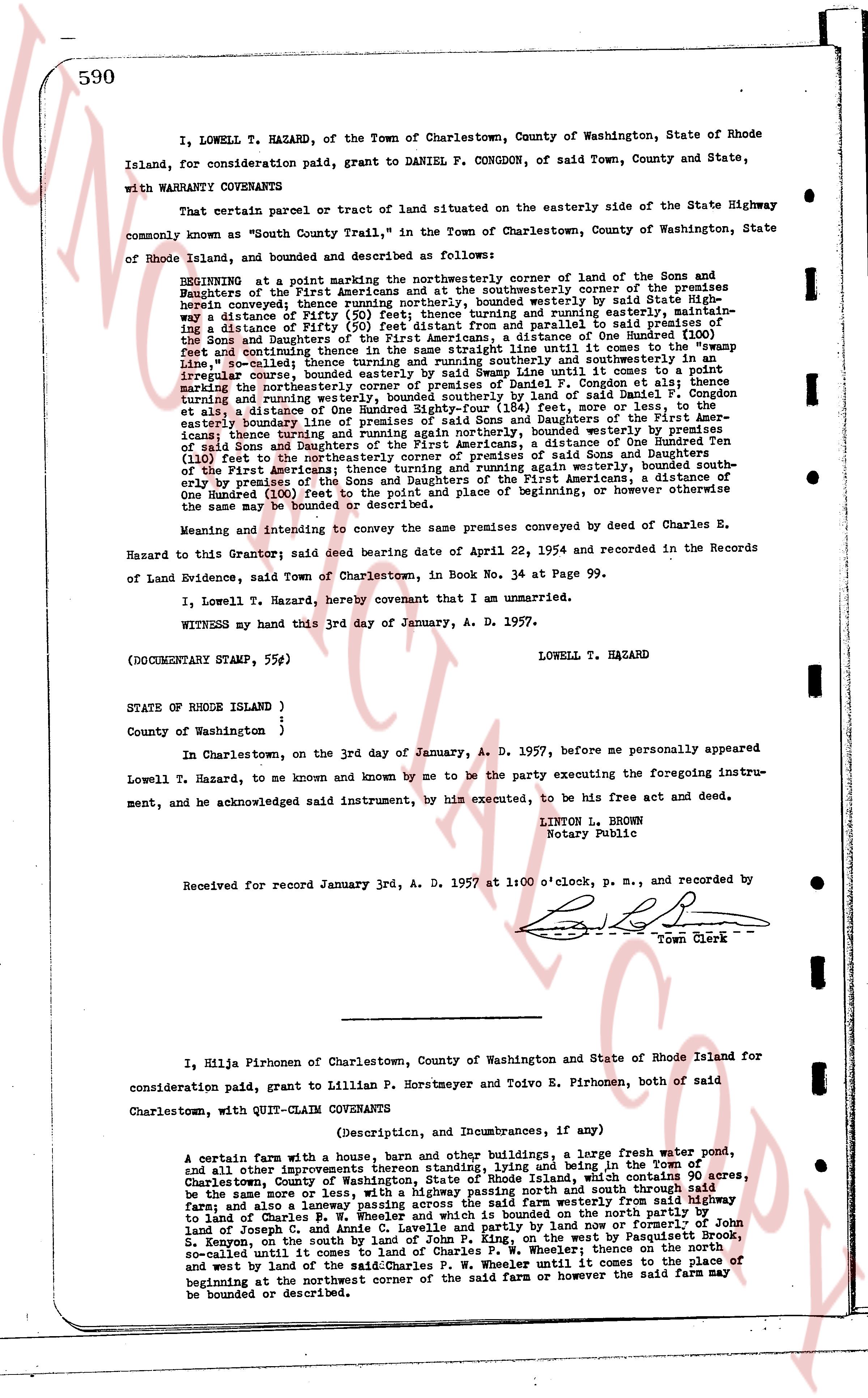
The instrument's own words
page 1
590
I, LOWELL T. HAZARD, of the Town of Charlestown, County of Washington, State of Rhode
Island, for consideration paid, grant to DANIEL F. CONGDON, of said Town, County and State,
with WARRANTY COVENANTS
That certain parcel or tract of land situated on the easterly side of the State Highway
commonly known as "South County Trail," in the Town of Charlestown, County of Washington, State
of Rhode Island, and bounded and described as follows:
BEGINNING at a point marking the northeasterly corner of land of the Sons and
Daughters of the First Americans and the southeasterly corner of the premises
herein conveyed thence running northerly, bounded westerly by said State Highway
a distance of Fifty (50) feet thence running easterly, bounded northerly by premises of
the Sons and Daughters of the First Americans from and parallel to said premises of
the Sons and Daughters of the First Americans, a distance of One Hundred Thirty
(130) feet, so called thence turning and running southerly and southeasterly in an
irregular course, bounded easterly by land of Daniel F. Congdon until it comes to a "swamp
line," so called thence turning and running westerly and southeasterly in an
irregular course, bounded easterly by land of Daniel F. Congdon until it comes to a point
marking the northwesterly corner of premises of Daniel F. Congdon et als; thence
turning and running westerly along the boundary line of said land of Daniel F.
Congdon et als, a distance of One Hundred Eighty-four (184) feet, more or less, to the
southeasterly corner of land of the Sons and Daughters of the First Americans;
thence turning and running again northerly, bounded westerly by premises of
the Sons and Daughters of the First Americans, a distance of One Hundred Twenty
(120) feet to the northeasterly corner of premises of Sons and Daughters
of the First Americans; thence turning and running westerly, bounded northerly by
said boundary line of the Sons and Daughters of the First Americans, a distance of
One Hundred (100) feet to the point and place of beginning, or however otherwise
the same may be bounded or described.
Meaning and intending to convey the same premises conveyed by deed of Charles E.
Hazard to this Grantor; said deed bearing date of April 22, 1954 and recorded in the Records
of Land Evidence, said Town of Charlestown, in Book No. 34 on Page 99.
I, Lowell T. Hazard, hereby covenant that I am unmarried.
WITNESS my hand this 3rd day of January, A. D. 1957.
LOWELL T. HAZARD
(DOCUMENTARY STAMP, 55¢)
STATE of RHODE ISLAND )
County of Washington )
In Charlestown, on the 3rd day of January, A. D. 1957, before me personally appeared
Lowell T. Hazard, to me known and by me to be the party executing the foregoing instru-
ment, and he acknowledged said instrument, by him executed, to be his free act and deed.
LINTON L. BROWN
Notary Public
Received for record January 3rd, A. D. 1957 at 1:00 o'clock, P. M., and recorded by
Town Clerk
I, Hilma Pirhonen of Charlestown, County of Washington and State of Rhode Island for
consideration paid, grant to Lillian P. Horstmeyer and Toivo E. Pirhonen, both of said
Charlestown, with QUIT-CLAIM COVENANTS
(Description, and Incumbrances, if any)
A certain farm with a house, barn and other buildings, a large fresh water pond,
and all other improvements thereon standing, lying and being in the Town of
Charlestown, County of Washington, State of Rhode Island, which comprises 90 acres,
the same more or less, with a highway passing north and south through said
farm; and also a laneway passing across the said farm westerly from the highway
to land of Charles R. Browning; the said farm is bounded on the north partly by
land of Joseph C, and Annie C. Lavelle and partly by land now or formerly of
John S.
Koppen, as the case may be; bounded on the east, in part, by Passaconnetic Brook,
so-called until it comes to land of Charles F. W. Wheeler; thence on the north
and west by land of the said Charles P. W. Wheeler until it comes to a line of
beginning at the northwest corner of the said farm or however the said farm may
be bounded or described.
The page as recorded