The instrument's own words
page 1 · read by Gemma vision
87
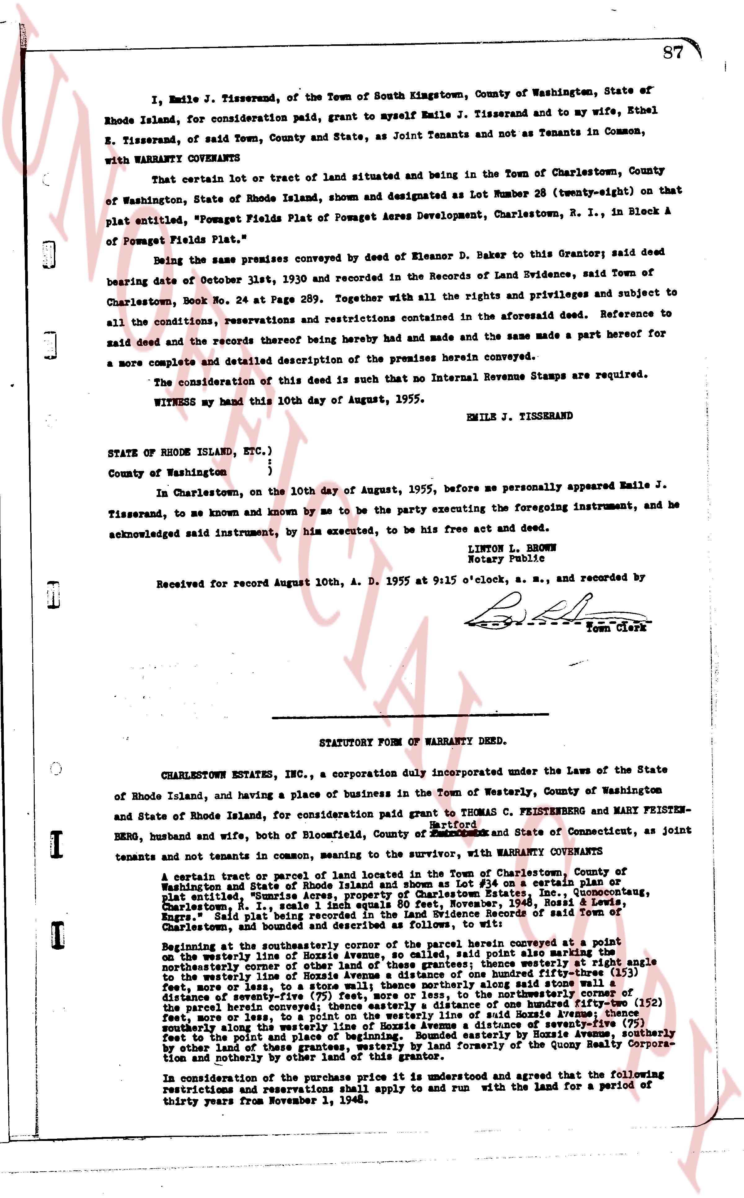
I, Emile J. Tisserand, of the Town of South Kingstown, County of Washington, State of Rhode Island, for consideration paid, grant to myself Emile J. Tisserand and to my wife, Ethel E. Tisserand, of said Town, County and State, as Joint Tenants and not as Tenants in Common, with WARRANTY COVENANTS
That certain lot or tract of land situated and being in the Town of Charlestown, County of Washington, State of Rhode Island, shown and designated as Lot Number 28 (twenty-eight) on that plat entitled, "Pomquet Fields Plat of Pomquet Acres Development, Charlestown, R. I., in Block A of Pomquet Fields Plat."
Being the same premises conveyed by deed of Eleanor D. Baker to this Grantor; said deed bearing date of October 13th, 1950 and recorded in the Records of Land Evidence, said Town of Charlestown, Book No. 24 at Page 289. Together with all the rights and privileges and subject to all the conditions, reservations and restrictions contained in the aforesaid deed. Reference to said deed and the records thereof being hereby had and made and the same a part made hereof for a more complete and detailed description of the premises herein conveyed.
The consideration of this deed is such that no Internal Revenue Stamps are required.
WITNESS my hand this 10th day of August, 1955.
EMILE J. TISSERAND
STATE OF RHODE ISLAND, ETC.)
)
County of Washington )
In Charlestown, on the 10th day of August, 1955, before me personally appeared Emile J. Tisserand, to me known and by me to be the party executing the foregoing instrument, and he acknowledged said instrument, by his executed, to be his free act and deed.
LINTON L. BROWN
Notary Public
Received for Record August 10th, A. D. 1955 at 9:15 o'clock, a. m., and recorded by [?] Town Clerk
----
STATUTORY FORM OF WARRANTY DEED.
CHARLESTOWN ESTATES, INC., a corporation duly incorporated under the Laws of the State of Rhode Island, and having a place of business in the Town of Westerly, County of Washington and State of Rhode Island, for consideration paid grant to Thomas C. Friesenberg and Mary Friesten-berg, husband and wife, both of Bloomfield, County of Hartford and State of Connecticut, as joint tenants and not tenants in common, meaning to the sever, with WARRANTY COVENANTS
That certain 1 tract or parcel of land located in the Town of Charlestown, County of Washington and State of Rhode Island, shown and designated as Lot # 56 on a certain plat entitled, "Square-Acre Lots in Pomquet Acres Development, Charlestown, R. I., measured, Nov. 1948, Rossel & Rossel, Engrs." Said plat being recorded in the Land Evidence Records of said Town of Charlestown and bounded and described as follows, to wit:
Beginning at the southeasterly corner of the parcel herein conveyed at a point on the westerly line of Hoxzie Avenue, as called, said point also being a corner of the northeasterly corner of the parcel herein conveyed. Thence westerly at right angle to the northeasterly line of Hoxzie Avenue a distance of one hundred fifty-three (153) feet, more or less, to the westerly line of Hoxzie Avenue a distance of one hundred fifty-three (153) feet, more or less, to the northeasterly corner of the parcel herein conveyed. Thence northerly along said westerly line of Hoxzie Avenue a distance of seventy-five (75) feet, more or less, to the northeasterly corner of the parcel herein conveyed. Thence easterly a distance of one hundred fifty-two (152) feet, more or less, to a point on the westerly line of said Hoxzie Avenue, thence southerly along said westerly line of Hoxzie Avenue a distance of seventy-five (75) feet to the point and place of beginning. Bounded easterly by Hoxzie Avenue, southerly by other land of based in the Town of Charlestown and formerly of the Quony Realty Corporation and northerly by other land of this grantor.
In consideration of the purchase price it is understood and agreed that the following restrictions and reservations shall apply to and run with the land for a period of thirty years from November 1, 1948.
The page as recorded