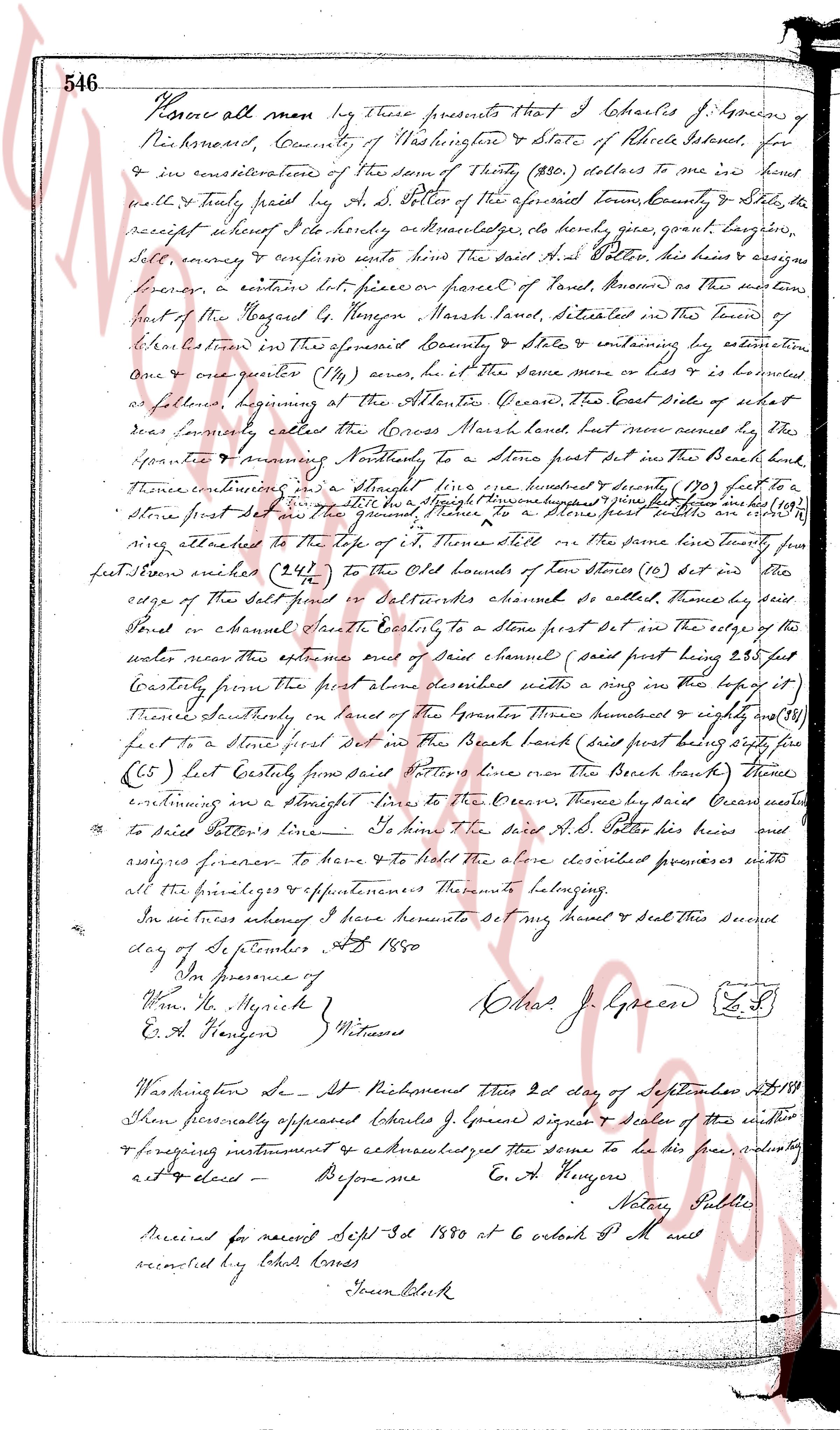
The instrument's own words
page 1
546
Know all men by these presents that I Charles J. Greene of
Richmond, County of Washington & State of Rhode Island, for
& in consideration of the sum of Thirty (30.) dollars to me in hand
well & truly paid by A. S. Potter of the aforesaid town, county & state, the
receipt whereof I hereby do hereby acknowledge, do hereby grant, bargain,
sell, convey & release unto the said A. S. Potter his heirs & assigns
forever, a certain lot piece or parcel of Land, known as the eastern
part of the Hoggetts & Hengen March land, situated in the town of
Richmond aforesaid in the State of Rhode Island by estimation
one & quarter (1 1/4) acres, or so of the same more or less & is bounded
as follows, beginning at the Atlantic Ocean the East side of what
was commonly called the Cross March land, but now named by the
opposite & surveying Northly to a stone first set in the Beach land
thence continuing in a straight line nw one hundred & twenty (120) feet to a
stone first set [illegible] a ring in the top & from that stone nw one hundred (100)
feet to a stone first set in the Beach land thence continuing in a straight li
ning attached to the top of it, thence still in the same line turning sw
one hundred & twenty (120) feet to the old Bounds of ten stones (10) set in the
edge of the salt marsh & saltworks channel so called, thence by said
shore or channel eastly to a stone first set in the edge of the
water near the entrance east side of said channel (said point being 225 ft
Easterly from the first stone above described with a ring in the top of it)
thence straightly on land of the opposite three hundred & eighty (380)
feet to a stone first set in the Beach land (said point being easterly
(65) feet Easterly from said Potter's line over the Beach land) thence
continuing on a straight line sw to the Ocean, thence by the Ocean westerly
to said Potter's line. To have & to hold the said A. S. Potter his heirs &
assigns forever. To have & to hold the above described premises with
all the privileges & appurtenances thereunto belonging.
In as witness whereof I have hereunto set my hand & seal this Second
day of September A.D. 1880.
In my presence of
Wm. the Hypritze &
C. A. Hengen Witnesses
Charles J. Greene (L.S)
Washington St. At Richmond This 2nd day of September A.D. 1880
then personally appeared Charles J. Greene signer & sealer of the within
foregoing instrument & acknowledged that the same to be his free & voluntary
act & deed.
Before me
C. A. Hengen Notary Public
Received for record Sept 3d 1880 at 10 o'clock P.M. and
recorded by Lebon Cross
Town Clerk
The page as recorded