The instrument's own words
page 1
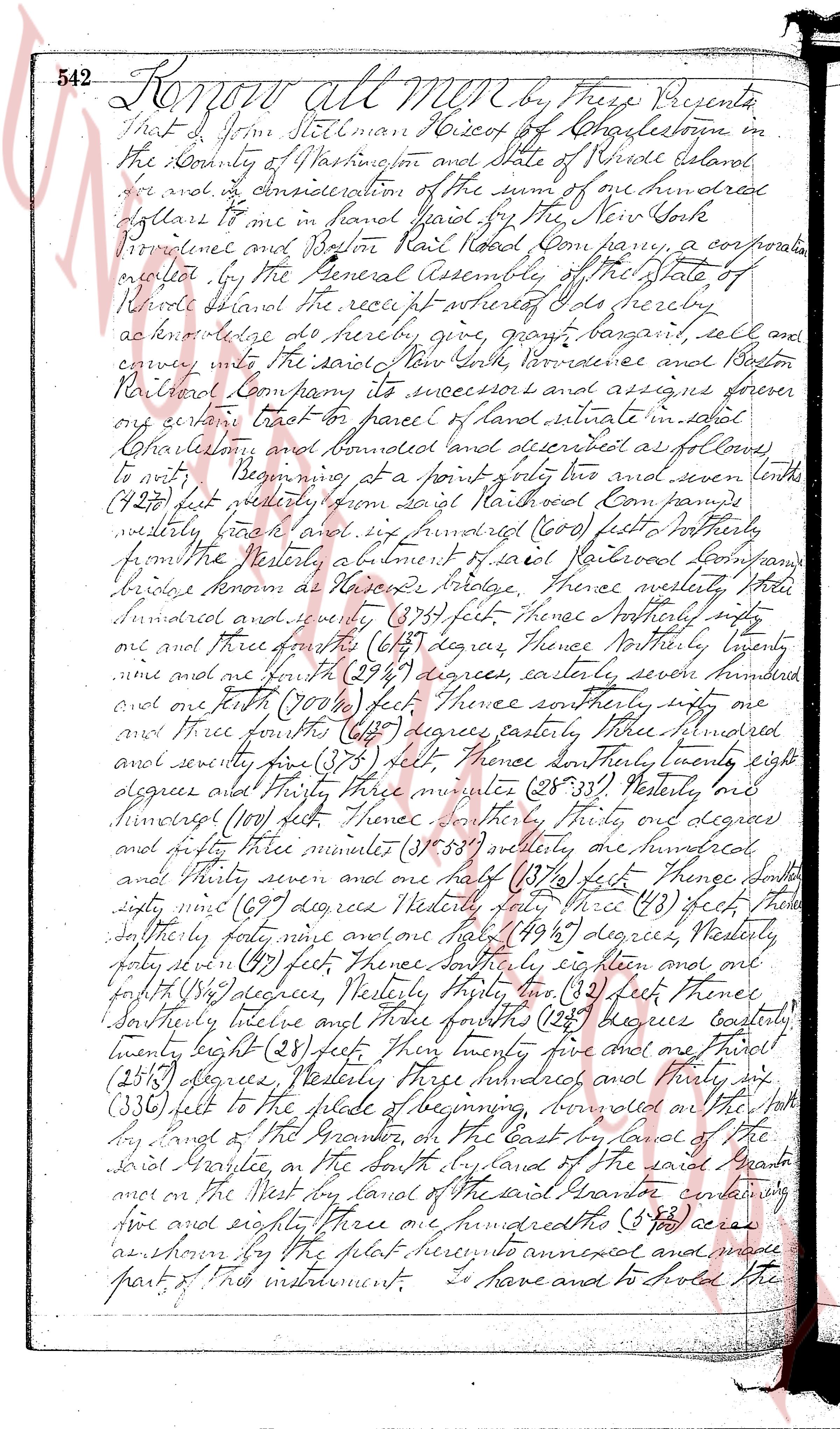
542 Know all men by these Presents
That I John Stillman Resident of Charlestowne in
the County of Washington and State of Rhode Island
do make and acknowledge the sum of one hundred
dollars to me in hand paid by the New York
Provincial and Boston Rail Road Company, a corporation
created by the General Assembly of the State of
Rhode Island the price received whereby I do hereby
acknowledge to do hereby give, grant, bargain, sell and
convey unto the said New York Providence and Boston
Railroad Company its successors and assigns forever
any certain tract of parcel of land situated in said
Charlestowne and bounded land described as follows
to wit Beginning at a point two and seven tenths
(2.70) feet westerly from diagonal Rail Road Company
westerly track and six hundred (600) feet southerly
from the westerly abutment of said Railroad Company
bridge known as Hiawatha bridge Thence westerly three
hundred and seventy seventy (370) feet Thence northerly sixty
one and three fourths (61 3/4) degrees Thence northerly seventy
nine and one fourth (79 1/4) degrees easterly seven hundred
and one fourth (700 1/4) feet Thence southerly sixty
one and three fourths (61 3/4) degrees easterly three hundred
and seventy six (376) feet Thence southerly twenty eight
degrees and thirty three minutes (28° 33') westerly one
hundred (100) feet Thence southerly thirty one degrees
and forty three minutes (31° 43') westerly one hundred
and thirty seven and one half (137 1/2) feet Thence south
sixty nine (69) degrees westerly three (3) feet Thence
southerly forty nine and one half (49 1/2) degrees westerly
forty seven (47) feet Thence southerly sixteen and one
fourth (16 1/4) degrees westerly thirty two (32) feet Thence
southerly twelve and three fourths (12 3/4) degrees easterly
twenty eight (28) feet Thence twenty five and one third
(25 1/3) degrees westerly three hundred and thirty six
(336) feet to the place of beginning bounded on the south
by land of the Grantor, on the East by land of the
said Grantee, on the South by land of the said Grantee
once on the West by land of the said Grantor containing
five and eighty three one hundredths (5.83) acres
as shown by the plat hereto annexed and made
part of this instrument I have and to hold the
page 2
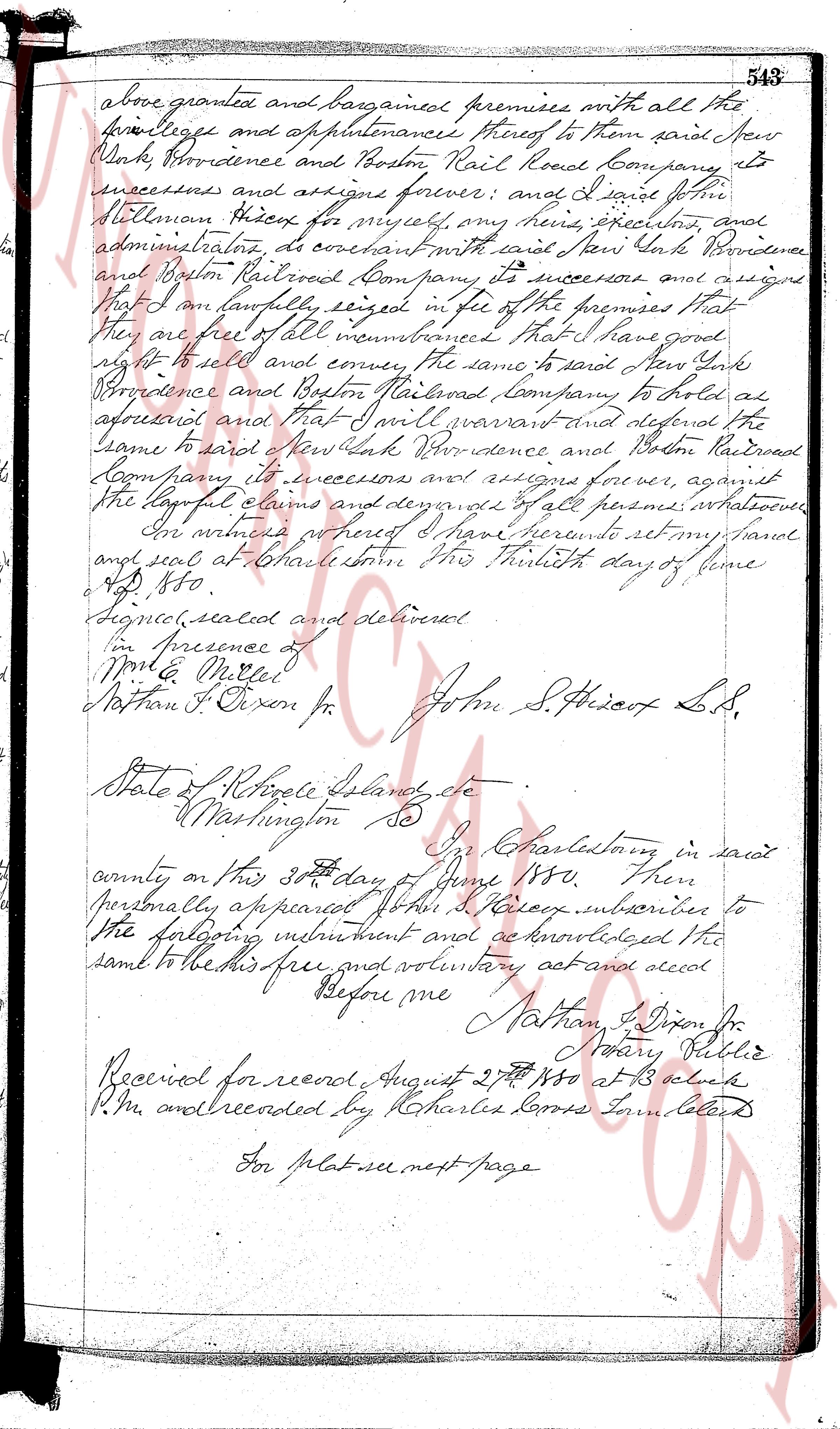
above granted and bargained premises with all the
privileges and appurtenances thereof to them said New
York, Providence and Boston Rail Road Company to
successors and assigns forever; and I said John
Kelsey do hereby for myself, my heirs, executors, and
administrators, do covenant with said New York Providence
and Boston Railroad Company its successors and assigns
that I am lawfully seized in fee of the premises that
they are free of all encumbrances that I have good
right to sell and convey the same to said New York
Providence and Boston Railroad Company to hold as
aforesaid and that I will warrant and defend the
same to said New York Providence and Boston Railroad
Company its successors and assigns forever, against
the lawful claims and demands of all persons whatsoever
In witness whereof I have hereunto set my hand
and seal at Charlestown this thirtieth day of June
1850
Signed, sealed and delivered
in presence of
Mont. Miller
Nathan P. Dixon Jr. John S. Kelsey L.S.
State of Rhode Island, etc.
Washington Ss
In Charlestown in said
county on this 30th day of June 1850 then
personally appeared John S. Kelsey subscriber to
the foregoing instrument and acknowledged the
same to be his free and voluntary act and deed
Before me Nathan P. Dixon Jr.
Notary Public
Received for record August 27th 1850 at 3 o'clock
P.M. and recorded by Charles Coons Town Clerk
For plat see next page
page 3
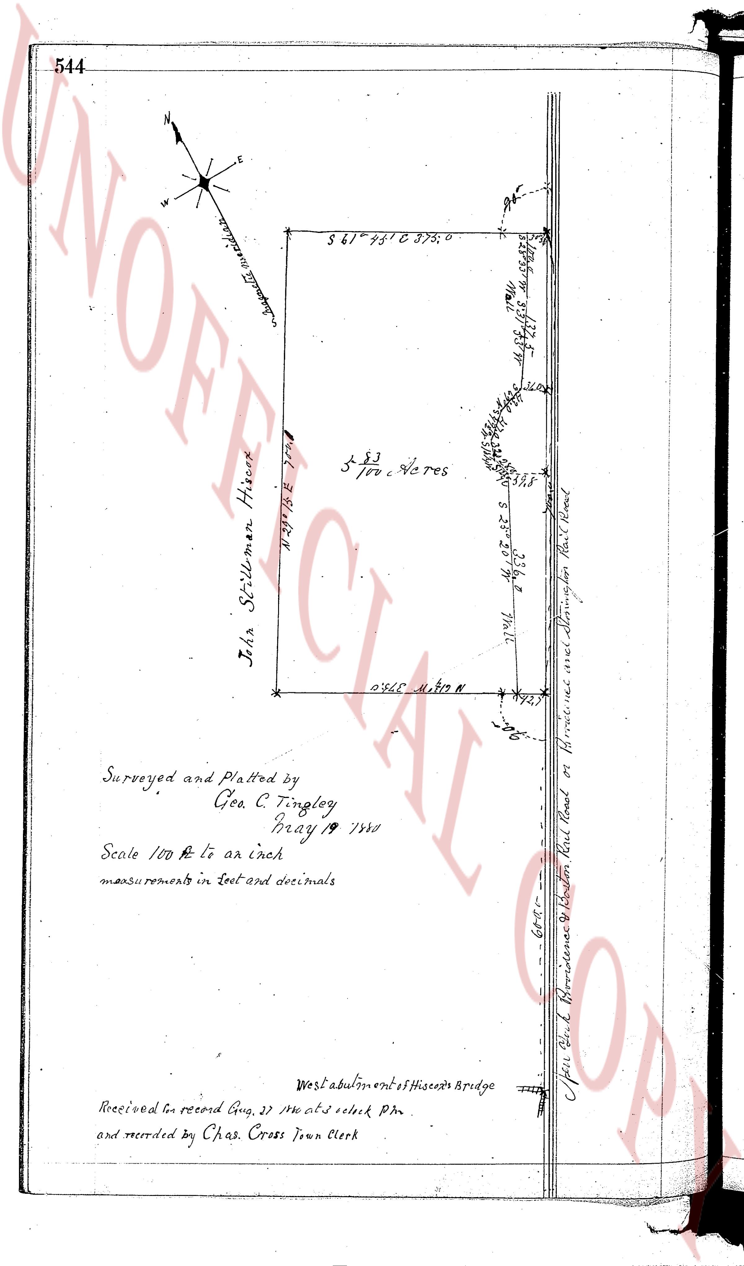
544
N
E
W
S
(Compass meridian)
S 61° 45' 30" E 375.0
N 28° 14' 30" W 300.0
John Stillman Hiscox
5 83/100 Acres
N 60° 02' 32" S 255.0
0° 36' 5" N 81.9 N
Surveyed and Platted by
Geo. C. Tingley
May 19 1880
Scale 100 ft to an inch
measurements in feet and decimals
West abutment of Hiscox's Bridge
Received for record Aug. 22 1880 at 3 o'clock P.M.
and recorded by Chas. Cross Town Clerk
N 28° 14' 30" W 355.8
77.11
77.46
Upper Gov. Providence & Boston Rail Road or Providence over Merrimacken Rail Road
608.0
The page as recorded