The instrument's own words
page 1 · read by Gemma vision
76
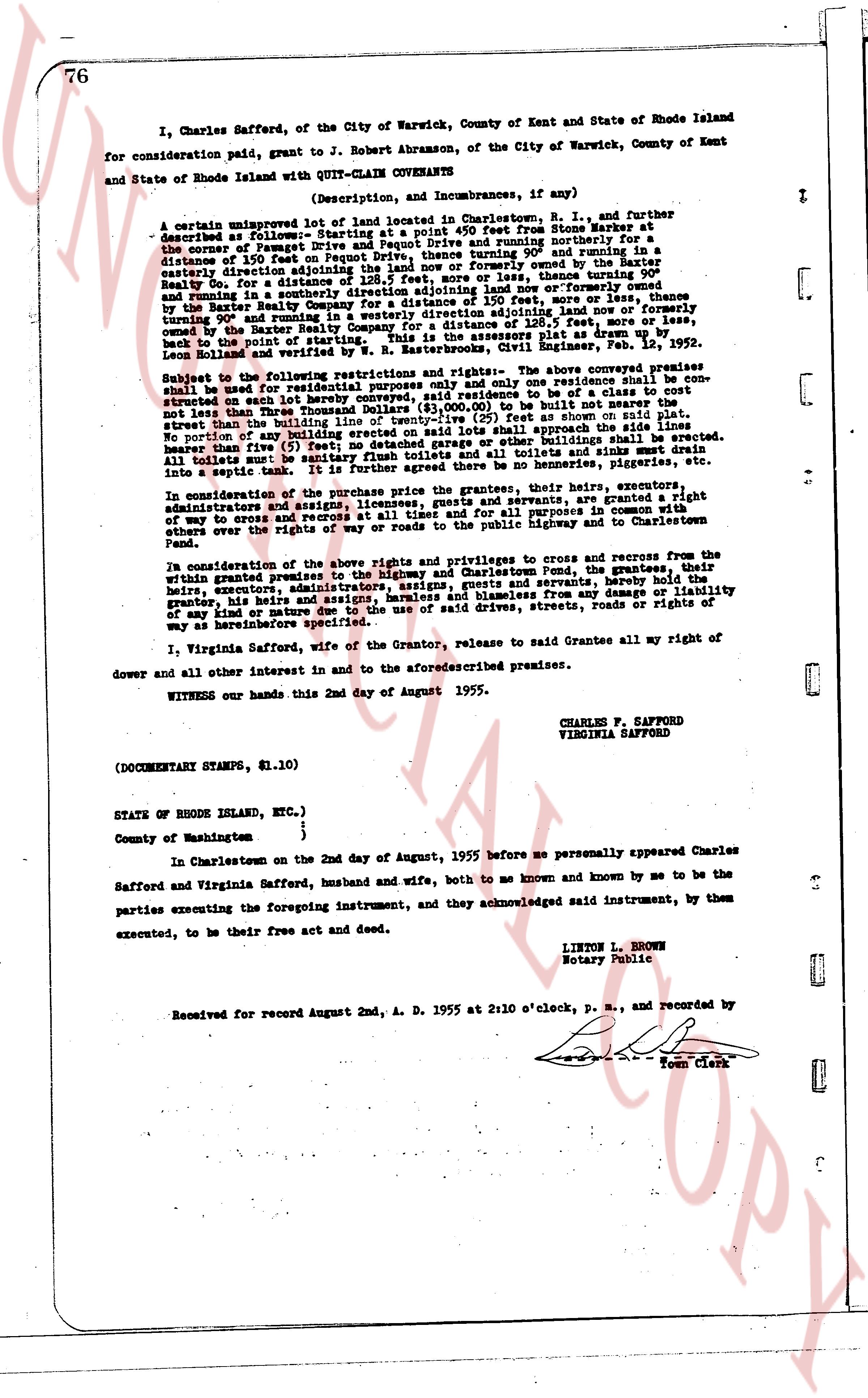
I, Charles Safford, of the City of Warwick, County of Kent and State of Rhode Island for consideration paid, grant to J. Robert Abramson, of the City of Warwick, County of Kent and State of Rhode Island with QUIT-CLAIM COVENANTS
(Description, and Incumbrances, if any)
A certain unimproved lot of land located in Charlestown, R. I., and further described as follows:- Starting at a point 50 feet West from Stone Wall corner at the corner of Pequot Drive and the land of the town and running northerly for a distance of 150 feet on Pequot Drive, thence turning 90° and running northerly for a distance of 128.5 feet, more or less, thence turning 90° easterly and running directly in a southerly direction for 150 feet, thence turning 90° easterly and running in a southerly direction for 128.5 feet, more or less, thence turning 90° and running in the easterly direction for a distance of 150 feet, more or less, thence turning 90° and running in the westerly direction for 128.5 feet, more or less, thence turning 90° and running in the westerly direction for 150 feet, more or less, back to the point of starting. This is the assessment of the Civil Engineer, Feb. 12, 1952. Lien bonds and mortgages are not known to the grantor.
Subject to the following restrictions and rights:- only one residence shall be erected on said land for residential purposes only and only one residence shall be built and not nearer than one hundred feet from the street. The value of the house to be of a class to cost not less than Three Thousand Dollars ($3,000.00) to be built not nearer than one hundred feet from the street than but not more than one hundred feet from the street on said plat. No sanitary building or outbuilding erected on said lot shall approach the side roads line either nearer than five (5) feet and no sanitary building or other buildings shall be erected nearer than five (5) feet to any sanitary privy toilets and all toilets and sinks must drain into a septic tank. It is further agreed there be no above ground privy privileges and no privy privileges.
In consideration of the purchase price the grantor, their heirs, executors, administrators, assigns and successors, their heirs, servants and grantees, are granted a right of way to cross and re-cross at all times and for all purposes in common with others over the right of way to the highway and Charlestown Pond.
In consideration of the above rights and privileges to cross and recross from the within granted premises to the Highway and Charlestown Pond, the grantees, their heirs, executors, administrators, assigns, successors their heirs, servants and grantees have warranty from any damage or liability of any kind or nature due to the use of said drives, streets, roads or rights of way as hereinbefore specified.
I, Virginia Safford, wife of the Grantor, release to said Grantee all my right of dower and all other interest in and to the aforesaid described premises.
WITNESS our hands this 2nd day of August 1955.
CHARLES F. SAFFORD
VIRGINIA SAFFORD
(DOCUMENTARY STAMPS, $1.10)
STATE OF RHODE ISLAND, ETC.)
)
) County of Washington }
In Charlestown on the 2nd day of August, 1955 before me personally appeared Charles Safford and Virginia Safford, husband and wife, both to me known and known by me to be the parties executing the foregoing instrument, and they acknowledged said instrument, by them executed, to be their free act and deed.
LINTON L. BROWN
Notary Public
Recorded for record August 2nd, A. D. 1955 at 2:10 o'clock, p. m., and recorded by
[Seal] Town Clerk
The page as recorded