The instrument's own words
page 1
519
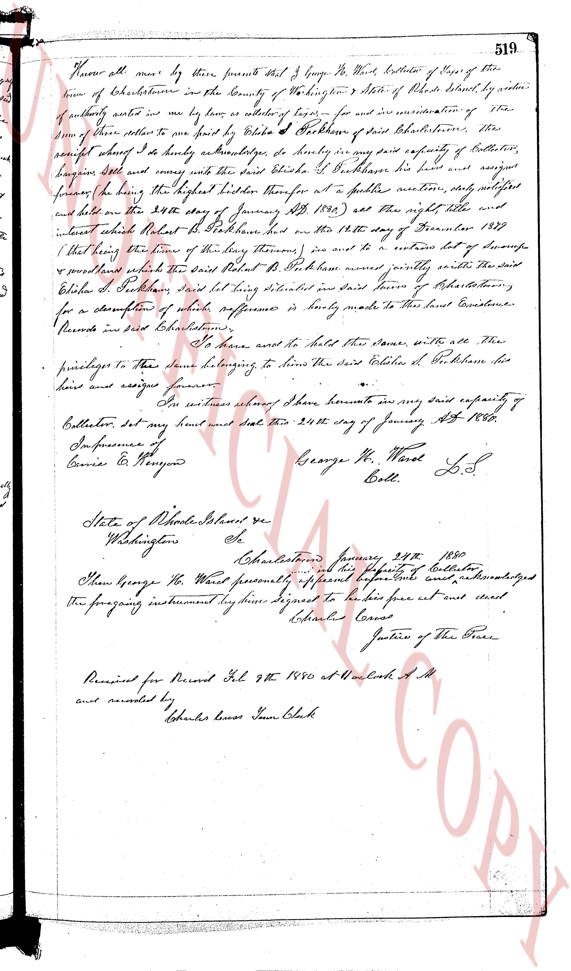
Know all men by these presents that I George W. Ward Collector of Taxes of the
town of Charlestown in the County of Washington & State of Rhode Island by virtue
of authority vested in me by law as collector of taxes for and in consideration of
some of those others to me paid by Ezra S. Peckham of said Charlestown, the
receipt whereof I do hereby acknowledge as formerly in my said capacity of Collector,
bargain sell and convey unto the said Ezra S. Peckham his heirs and assigns
forever the following tract of land being the highest bidder therefore at a publick auction, duly notified
and held on the 24th day of January AD 1880, and the right title with all
and appurtenances thereunto belonging on the 12th day of December 1879
(that being the time of my delivery thereof) and to an entire lot of stumps
& powderwood which the said Robert R. Peckham owned jointly with the Said
Ezra S. Peckham, said lot being situated in said town of Charlestown,
for a description of which preference is hereby reference is hereby made to the town Records
Records in said Charlestown.
To have and to hold the same, with all the
privileges to these same belonging to the said Ezra S. Peckham his
heirs and assigns forever.
In witness whereof I have hereunto in my said capacity of
Collector, set my hand and seal this 24th day of January AD 1880.
In presence of
Curtis E. & Pearson
George W. Ward L.S.
Coll.
State of Rhode Island sc
Washington ss
Charlestown January 24th 1880
Before me Deputy Clerk and his Deputy Clerk of Collector
I then George W. Ward personally appeared before me and acknowledged
the foregoing instrument by him signed to be his free act and deed
Charles Corves
Justice of the Peace
Received for Record Feb 9th 1880 at 11 o'clock A.M.
and recorded by
Charles Corves Town Clerk
page 2
71
At Jacksonville, in said County, on this 26 day of May, A. D. 1953, then personally
appeared the above named Frank C. Fish, to me known, and by me to be the party described
in who and executed the foregoing instrument, and he acknowledged the same to be his free act
and deed.
Before me,
HORTENSE CLARE CLARE ARROW (Notarial Seal)
Notary Public
My Comn. expires Nov. 12, 1955.
Received for record July 28th, A. D. 1955 at 9:05 o'clock, a. m., and recorded by
[Signature]
Town Clerk
STATUTORY FORM OF WARRANTY DEED
I, LILA CHAPO SOULE, of the Town of Charlestown, in the County of Washington and
State of Rhode Island, for consideration paid, grant to HENRY B. BURNETT and ALACIA B. BURNETT,
husband and wife, both, of 40 Waregan Drive, Warwick, in the County of Kent and State of Rhode
Island, and to the survivor of them as Joint Tenants and not as Tenants in Common, with WARRANTY
COVENANTS:
That certain tract or parcel of land situate being and at Quonochontouach Beach, so-called,
in the Town of Charlestown, County of Washington and State of Rhode Island, bounded and described
as follows:—
Commencing at a stone bound in the ground at the northeasterly corner of the
hereby conveyed tract of land, said point being the southerly corner of
land now or formerly of Robert Moquilviski and the northeasterly corner of Lot
"A" as shown on a plot untitled "Plat of Portion of Quonochontouach in Town of
Charlestown, R. I.," dated June 1, 1953, by Lila Chapo Soule by Sophia M. Domle, Surveyor
and on a plotted September 1947, Leon L. Bobild, Civil Engineer, Soule's plot
filed with the Land Evidence Records of Charlestown; thence running easterly, along Atlantic
ocean, to land of Chester Moore, and thence northerly by a stone bound in the ground,
running in a general northeasterly direction a distance of Sixty-nine and 66/100 (69.66) feet,
to land of Chester Moore, and thence running northerly by a stone bound in the ground,
hundred feet; thence running in a general southerly direction a distance of Four
Hundred eighty-four (484.00) feet, to a stone bound located easterly by said stone bound,
thence bounded easterly by said Charlestown Estates, Inc., land; thence running
southerly, to a drive way located at a point where high water line is shown on said plat; thence
in a general westerly direction a distance of One hundred ninety-five (195.00) feet, to
a drive way located at a point where high water line is shown on said plat; thence
turning and running in a general westerly direction to a drill hole in a stone bound set September 10, 1947 to
twenty and 07/100 (20.07) feet, said drill hole in a stone bound set September 10, 1947 to
replace bound destroyed by hurricanes of September 1938 and 1944; thence running
in the same straight line in a general northwesterly direction ninety-four and 31/100 (94.31) feet,
to the point and place of beginning, bounded westerly by land formerly of
Agnes M. and Florence E. Moore, and northerly by land of Henry B. Burnett.
Together with a right-of-way twenty (20) feet in width to the Grantees, their heirs
and assigns, licensees, guests,"servants and agents, to pass and repass, with vehicles and
on foot, in common with the public, from the high water mark on the Atlantic Ocean,
to the public highway, upon the same terms and conditions under which the same was
conveyed to the Grantor.
Being the same property and right-of-way conveyed to the within Grantor by 3 deeds
from Sophia M. Domle, one dated October 1, 1947 recorded in Book 30 page 267 of the
Book of land records of the Town of Charlestown and dated August 13, 1947, another
Book 30 page 268 of said Charlestown Land Evidence Records; and one dated July 23,
22nd, 1955 recording said Deed dated August 10, 1954, to be recorded herewith in said
Charlestown Land Evidence Records.
The within Grantor hereby reserves to herself, and to her heirs, assigns, licensees,
guests, servants and agents, to pass and repass, with vehicles and on foot, in common
with others over the public right-of-way located on the high water line on the premises
hereby conveyed, as now travelled, from other lands of the within Grantor lying generally nearby, to the public highway; said reservation and the within
conveyance is made subject to said reservation and also subject to the right acquired
by others to cross over said portion of said right-of-way located on the within conveyed
premises.
The page as recorded