The instrument's own words
page 1
475
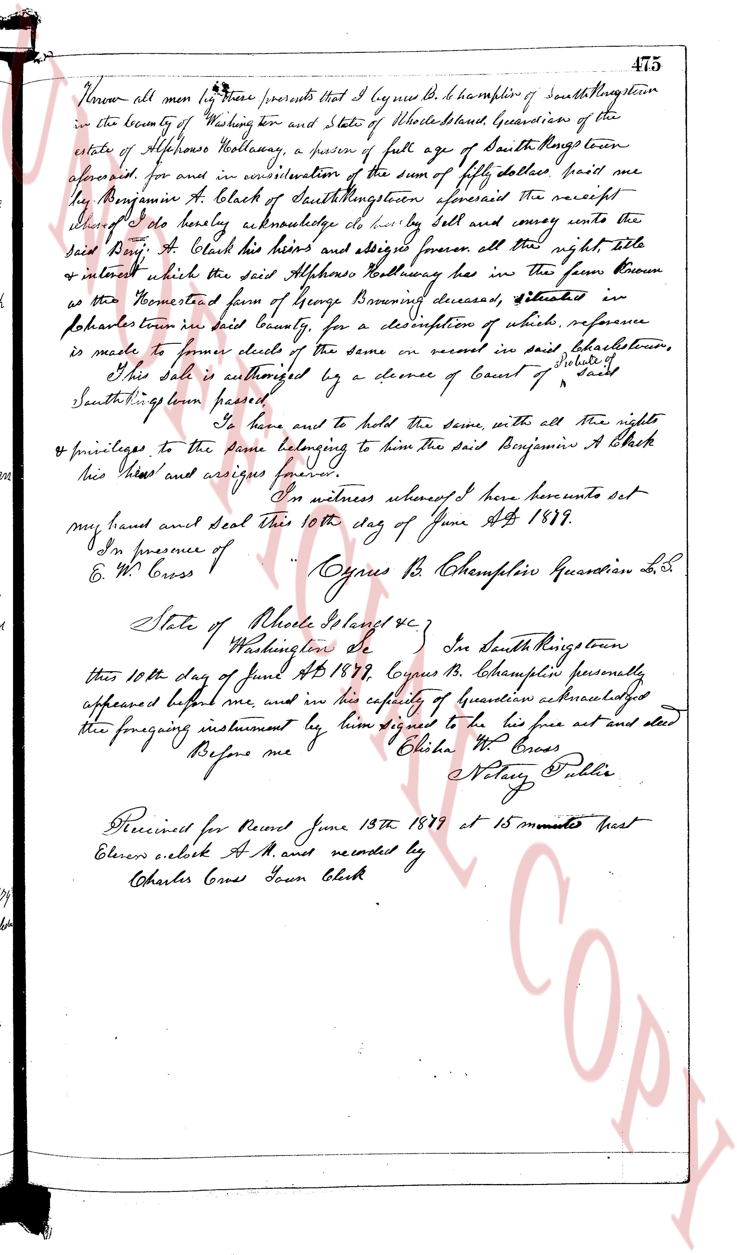
Known all men by these presents that I Cypres B. C. Champlin of South Kingstown
in the county of Washington and State of Rhode Island, Guardian of the
estate of Alphonsus Wortman, a person of full age of South Kingstown
aforesaid, for and in consideration of the sum of fifty dollars paid me
by Benjamin A. Black of South Kingstown aforesaid the receipt
hereof I do hereby acknowledge to be fully sell and convey unto the
said Benj. A. Black the heirs and assigns forever all the right title
& interest which the said Alphonsus Wortman has in the farm known
as the Homestead farm of George Bonney deceased, situated in
North Kingstown in said County, for a description of which reference
is made to former deeds of the same or record in said townstown,
the said sale is authorized by a decree of Court of State of
South Kingstown here passed
To have and to hold the same, with all the right
& privileges to the same belonging to him the said Benjamin A Black
his heirs and assigns forever.
In witness whereof I here presents set
my hand and seal this 10th day of June AD 1879.
In presence of Cypres B. C. Champlin Guardian L.S.
E & W Cross
State of Rhode Island &c
Washington ss
In South Kingstown
this 10th day of June AD 1879, Cypres B. C. Champlin personally
appeared before me, and in his capacity of Guardian acknowledged
the foregoing instrument by him signed to be his act and deed
Before me Charles W Cross
Notary Public
Received for Record June 13th 1879 at 15 minutes past
Eleven o'clock A.M. and recorded by
Charles Cross Town Clerk
page 2
42
northwesterly corner of the parcel herein conveyed; thence easterly a,
distance,of two hundred seventy-four (274) feet, more or less, to a point
on a stone wall running in a southeasterly direction, said point
marking the northeasterly corner of the parcel herein conveyed; thence
southerly along said stone wall a distance of forty (40) feet, more or
less to the southwesterly corner of the parcel herein conveyed; thence
westerly a distance of two hundred eighty-three and thirty-eight
hundredths (283.38) feet, more or less, to the place of beginning, said
last mentioned course forming an interior angle of ninety-one (91) degrees
and three (3) one quarter minutes at the corner of said Hoxie Avenue. Said
parcel of land is bounded westerly by Hoxie Avenue, northerly by other
land of this grantor, easterly by a stone wall and southerly partly by land
of Walter P. Thorp and partly by other land of this grantor by other land of this grantor.
In consideration of the purchase price it is understood and agreed that the
following restrictions and reservations shall apply to and run with the
land for a period of ten years from November 1, 1954.
The above conveyed premises shall be used for residential purposes only and
as a site for only one residence, said residence not to be of a cost not less
than three thousand dollars. No building shall be built nor neither Hoxie Avenue,
les so called, on the west than the building line of twenty-five (25) feet from
nor portion of any building shall be built nor approach the side lines
or rear line nearer than five feet, no detached garage or other building or
out building shall be built nor approach the side lines or rear line nearer
than ten feet, and all buildings shall be built rustic style and finished in
toleris, and all toilets and sinks must drain into a septic tank or cesspool.
No poison ivy may be permitted to grow on the premises.
In consideration of the purchase price the grantees, their heirs, executors,
administrators and assigns, are and shall be forever granted and conveyed all
rights of way and roads and ways at all times and for all purposes in common with
others, over the rights of way or roads or paths public highway and to and from the
used roads leading from the place of beginning, in common with others along
and parallel "MR" surrounding the Lagoon, as shown on said plat the use of the
used roads leading from the place of beginning, in common with others along
way to Charlestown Pond, and the said grantees, their heirs, executors, administrators,
trustees, assigns, and successors in interest are granted the right to throw their
lots #954# and #955# to the beach or ocean, and are granted the use of the
for the purpose of fishing, boating, swimming, and recreation with others. Said lots are
shown on a clear plan or plat entitled, "Plat of East Beach, Quonsetown R. I.,
property of C. E. Ruddell, and the entire tract I each conveyed is described
feet, revised July, 1931." which plat is duly recorded in the Land Evidence
Records of said Town of Westerly.
In consideration of the above rights of way and privileges to cross and recross from
the within granted premises to the highway, Charlestown Pond and the Atlantic
Ocean, the grantees, their heirs, executors, administrators, assigns, and successors in
interest, hereby bind themselves and their successors and assigns harmless and blameless
from any damage or liability of any kind whatsoever which may arise from the
use of divers, streets, roads, paths, and ways hereinbefore specified. The use of
parcel "MR" and Lots #954# and #955# shall not be commercialized.
WITNESS WHEREOF, the said corporation has caused these presents to be duly
signed by its President and attested by its Treasurer, and the corporate seal
seal to be hereunto affixed at Westerly, Rhode Island, this 8th day of November
1954.
CHARLESTOWN ESTATES, INC. (Corporate Seal)
Howard M. Thorp
President
Nelson H. Thorp
Treasurer
(DOCUMENTARY STAMP, 55¢)
STATE OF RHODE ISLAND
COUNTY OF WASHINGTON
In Westerly on this 8th day of November, 1954, before me personally appeared Howard
E. Thorp, to me known and known by me to be the President of said corporation, and Nelson H.
Thorp, to me known and known by me to be the Treasurer of said corporation, and they acknowledged
said instrument by them executed to be the free act and deed of said corporation and as well
individually.
ROGERS E. TRAINER (Notarial Seal)
Notary Public
Received for record June 29th, A. D. 1955 at 3:35 o'clock, p. m., and recorded by
Town Clerk
The page as recorded