The instrument's own words
page 1 · read by Gemma vision
25
|
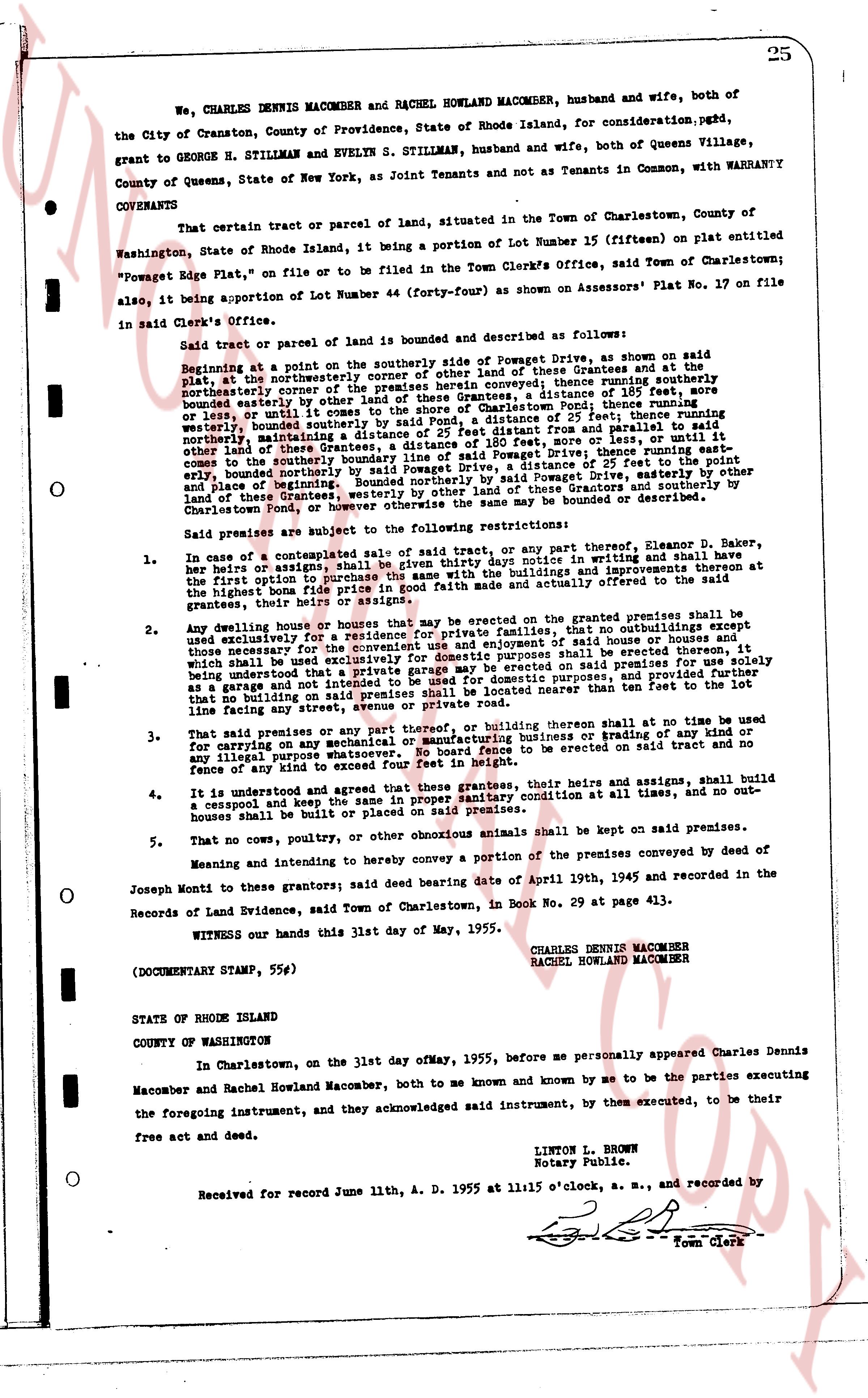
We, CHARLES DENNIS MACOMBER and RACHEL HOWLAND MACOMBER, husband and wife, both of the City of Cranston, County of Providence, State of Rhode Island, for consideration, paid, grant to GEORGE H. STILLMAN and EVELYN S. STILLMAN, husband and wife, both of Queens Village, County of Queens, State of New York, as Joint Tenants and not as Tenants in Common, with WARRANTY COVENANTS
That certain tract or parcel of land, situated in the Town of Charlestown, County of Washington, State of Rhode Island, being a portion of Lot Number 15 (fifteen) on plat entitled "Powegate Rps Plate", on file or to be filed in the Town Clerk's Office, said Town of Charlestown; also, being a portion of about Lot Number 44 (forty-four) as shown on Assessor's Plat No. 17 on file in said Clerk's Office.
Said tract or parcel of land is bounded and described as follows:
Beginning at a point on the southerly side of Powegate Dr, as shown on said plat, at the northeasterly corner of other land of these Grantees and at the plat, running northerly the cornerstone of the premises herein conveyed; thence running easterly a distance of 185 feet, more or less, until it comes to the shore of the seaside of Charlestown Pond; thence running southerly along the shore of said pond a distance of 105 feet; thence running westerly, bounded easterly by said pond, a distance of 25 feet from parallel and to parallel said other land of these Grantees, a distance of 25 feet; thence running north a distance of 25 feet, running northerly the cornerstone of the premises herein conveyed; thence running along the southerly side of Powegate Drive; thence running easterly, bounded northerly by said Powegate Drive, easterly by other land of these Grantees and westerly, bounded northerly by said Powegate Drive, easterly by other land of these Grantees, westerly by other land of these Grantees and northerly by the shore of Charlestown pond; the boundaries of the premises herein conveyed may be bounded or described.
Said premises are subject to the following restrictions:
1. In case of a subsequent sale of said tract or any part thereof, Clarence D. Baker, her heirs or assigns, shall be given first right of refusal in writing and shall have the first option to purchase the same with the buildings and improvements thereon at the highest bona fide price in good faith made and actually offered to the said grantees, their heirs or assigns.
2. Any dwelling house or houses that may be erected on the granted premises shall be used exclusively for the residence of private families, that no outbuildings except those necessary for the convenience of the occupants of said house shall be erected thereon, which shall be used exclusively for domestic purposes shall be erected thereon, and it being understood that a private garage may be erected for domestic purposes, and provided that no building on said premises shall be located nearer than ten feet to the line facing any street.
3. That no premises or any part thereof, or building thereon shall at any time be used for carrying on any mechanical or manufacturing business or trading of any kind or any illicit purpose; that no building shall be erected on said tract and no any fence or wall of any kind to exceed four feet in height.
4. It is understood and agreed that those grantees, their heirs and assigns, shall build a cesspool and the keep the said premises in a clean and sanitary condition at all times, and no out-houses shall be built or placed on said premises.
5. That no cows, poultry, or other obnoxious animals shall be kept on said premises.
Meaning and intending to hereby convey a portion of the premises conveyed by deed of Joseph Monti to these grantors; said deed bearing date of April 19th, 1945 and recorded in the Records of Land Evidence, said Town of Charlestown, in Book No. 29 at page 413.
WITNESS our hands this 31st day of May, 1955.
CHARLES DENNIS MACOMBER
RACHEL HOWLAND MACOMBER
(DOCUMENTARY STAMP, 55¢)
STATE OF RHODE ISLAND
COUNTY OF WASHINGTON
In Charlestown, on the 31st day of MAY, 1955, before me personally appeared Charles Dennis Macomber and Rachel Howland Macomber, both to me known and known by me to be the parties executing the foregoing instrument, and they acknowledged said instrument, by them executed, to be their free act and deed.
LINTON L. BROWN
Notary Public.
Received for record June 11th, A. D. 1955 at 11:05 o'clock, a. m., and recorded by
[Signature]
Town Clerk
The page as recorded