The instrument's own words
page 1 · read by Gemma vision
17
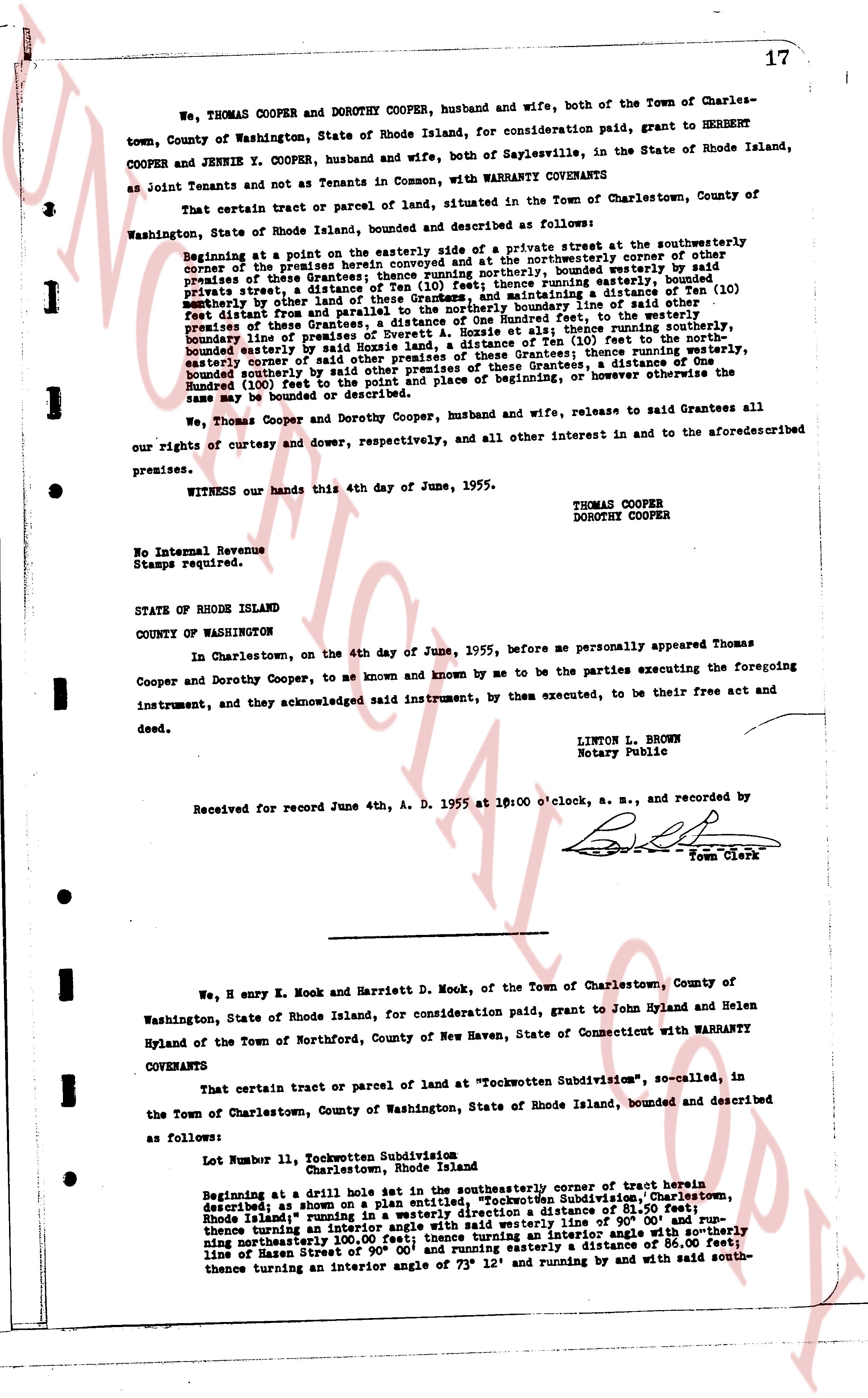
We, THOMAS COOPER and DOROTHY COOPER, husband and wife, both of the Town of Charlestown, County of Washington, State of Rhode Island, for consideration paid, grant to HERBERT COOPER and JENNIE Y. COOPER, husband and wife, both of Saylesvilles, in the State of Rhode Island, as Joint Tenants and not as Tenants in Common, with WARRANTY COVENANTS
That certain tract or parcel of land, situated in the Town of Charlestown, County of Washington, State of Rhode Island, bounded and described as follows:
Beginning at a point on the easterly side of a private street at the southwesterly corner of the premises herein granted, being a distance Ten (10) feet to the northeasterly corner of premises of these Grantees; thence running northerly, bounded easterly by premises of these Grantees, a distance Eighty (80) feet, running easterly, bounded northeasterly by premises of these Grantees, a distance One Hundred feet to the boundary line of said other premises of these Grantees, a distance of One Hundred feet, to the westerly boundary line of premises of these Grantees, a distance Ten (10) feet, then running southerly, boundary line of premises of these Grantees, a distance Ten (10) feet to the northeasterly corner of easterly corner of said other premises of these Grantees, thence running southerly, bounded northerly by premises of these Grantees, a distance of One Hundred feet, then running bounded northerly by premises of these Grantees, a distance of One Hundred feet to the point and place of beginning, or however otherwise the same may be bounded or described.
We, Thomas Cooper and Dorothy Cooper, husband and wife, release to said Grantees all our rights of curtesy and dower, respectively, and all other interest in and to the aforementioned premises.
WITNESS our hands this 4th day of June, 1955.
THOMAS COOPER
DOROTHY COOPER
No Internal Revenue Stamps required.
STATE OF RHODE ISLAND
COUNTY OF WASHINGTON
In Charlestown, on the 4th day of June, 1955, before me personally appeared Thomas Cooper and Dorothy Cooper, to me known and known by me to be the parties executing the foregoing instrument, and they acknowledged said instrument, by them executed, to be their free act and deed.
LINTON L. BROWN
Notary Public
Received for record June 4th, A. D. 1955 at 10:00 o'clock, A. M., and recorded by
[Signature]
Town Clerk
----
We, H enry E. Mook and Harriett D. Mook, of the Town of Charlestown, County of Washington, State of Rhode Island, for consideration paid, grant to John Hyland and Helen Hyland of the Town of Northford, County of New Haven, State of Connecticut with WARRANTY COVENANTS
That certain tract or parcel of land at "Tochwotten Subdivision", so-called, in the Town of Charlestown, County of Washington, State of Rhode Island, bounded and described as follows:
Lot Number 11, Tochwotten Subdivision
Charlestown, Rhode Island
Beginning at a drill hole set in the southwesterly corner of tract herein described as shown on a plan entitled, "Tochwotten Subdivision", Charlestown, Rhode Island" running in a westerly direction a distance of 81.50 feet; thence running thence turning an interior angle with said westerly line at 90° 00' and running northeasterly 100.00 feet; thence turning an interior angle with northerly line of Hasen Street of 90° 00' and running easterly a distance of 86.00 feet; thence turning an interior angle of 73° 12' and running by and with said south-
The page as recorded