The instrument's own words
page 1 · read by Gemma vision
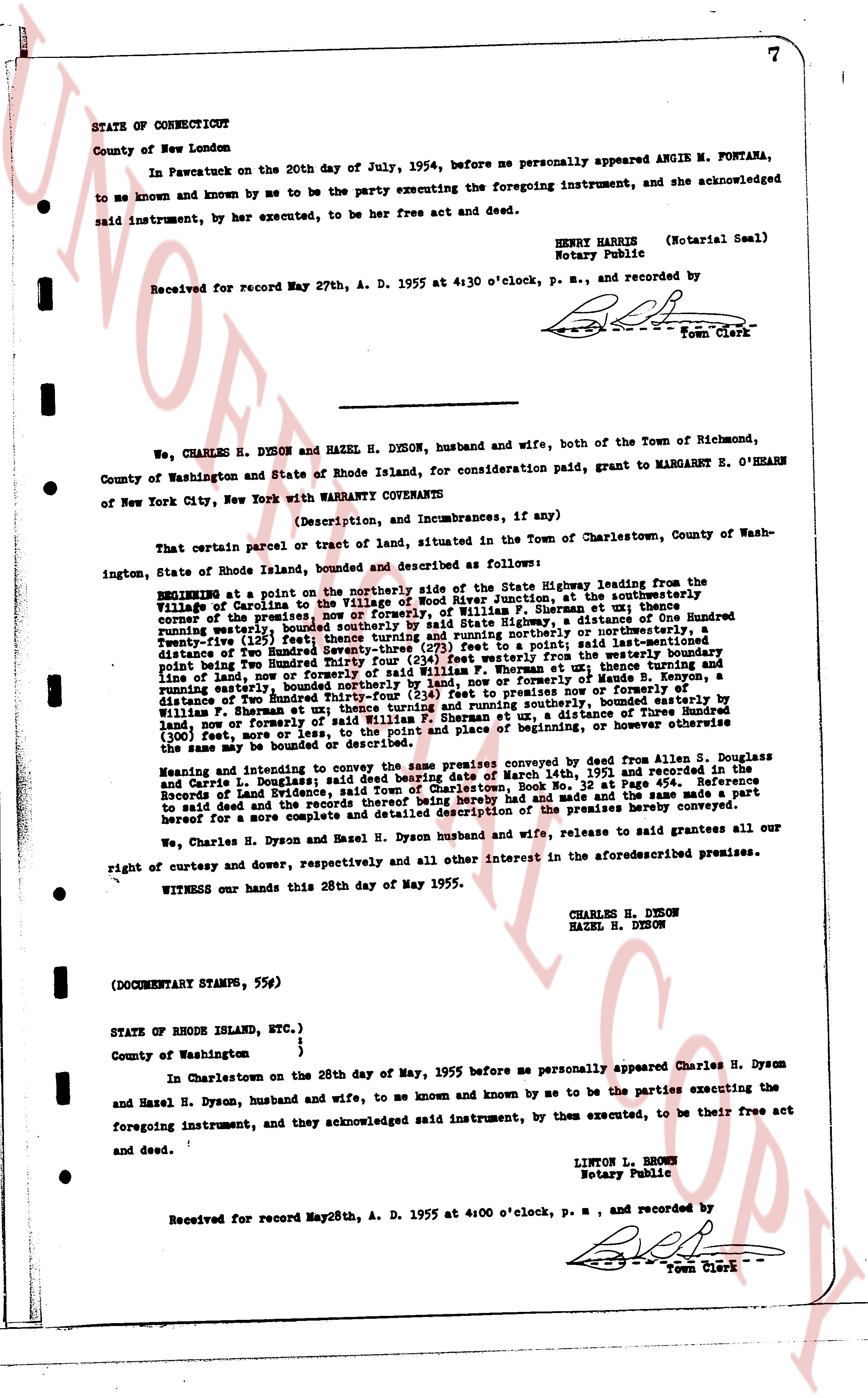
STATE OF CONNECTICUT
County of New London
In Pawcatuck on the 20th day of July, 1954, before me personally appeared ANGIE M. FONTANA, to me known and by me to be the party executing the foregoing instrument, and she acknowledged to me known and by me to be the party executing the foregoing instrument, and she acknowledged said instrument, to be her free act and deed.
HENRY HARRIS (Notarial Seal)
Notary Public
Received for record May 27th, A. D. 1955 at 4:30 o'clock, P. M., and recorded by
[Signature]
Town Clerk
----
We, CHARLES H. DYSON and HAZEL H. DYSON, husband and wife, both of the Town of Richmond, County of Washington and State of Rhode Island, for consideration paid, grant to MARGARET E. O'HEARN of New York City, New York with WARRANTY COVENANTS
(Description, and Incumbrances, if any)
That certain parcel or tract of land, situated in the Town of Charlestown, County of Washington, State of Rhode Island, bounded and described as follows:
BEGINNING at a point on the northerly side of the State Highway leading from the Village of Ninigret to the Village of Charlestown, at the southeasterly corner of the premises now or formerly of, William F. Sherman, at a point distance of One Hundred running westerly, bounded southerly by the land of William F. Sherman, a distance of One Hundred Twenty-one feet; then turning northerly and running northerly or northwesternly, a distance of Two Hundred Seventy-seven (277) feet to a point; said lot extending easterly a distance of Two Hundred Seventy-seven (277) feet to the westerly boundary, point being Two Hundred Seventy-seven (277) feet easterly from the westerly boundary, point first above mentioned, and running northerly or northwesternly, a distance of One Hundred feet, and line of land, now or formerly of said William F. Sherman or formerly of Maude B. Kenyon, a distance of Two Hundred Thirty-four (234) feet to premises now or formerly of Maude B. Kenyon, and running easterly, bounded northerly by the land of William F. Sherman, a distance of One Hundred Twenty-one feet; then turning southerly, bounded easterly by Williams, a distance of One Hundred feet, and southerly, bounded easterly by the land, now or formerly of said William F. Sherman et ux, a distance of Two Hundred Thirty-four (300) feet, now or formerly of said William F. Sherman et ux, place returning to the point of beginning the same lot may be bounded or described.
Meaning and intending to convey the same land conveyed by deed from Allen S. Douglas and Carrie L. Douglas signed and sealed in writing dated March 14th, 1951 and recorded in the Records of Land Evidence, said Town of Charlestown, Book No. 32 at page 113 and the same made a part to said deed and the records thereof be and reference made thereto and the same made a part hereof for a more complete and accurate said description of the premises hereby conveyed.
We, Charles H. Dyson and Hazel H. Dyson husband and wife, release to said grantees all our right of curtesy and dower, respectively and all other interest in the aforementioned premises.
WITNESS our hands this 28th day of May 1955.
CHARLES H. DYSON
HAZEL H. DYSON
(DOCUMENTARY STAMPS, 55¢)
STATE OF RHODE ISLAND, ETC.)
)
)
County of Washington
In Charlestown on the 28th day of May, 1955 before me personally appeared Charles H. Dyson and Hazel H. Dyson, husband and wife, to me known and known by me to be the parties executing the foregoing instrument, and they acknowledged said instrument, by them executed, to be their free act and deed.
LINTON L. BROWN
Notary Public
Received for record May 28th, A. D. 1955 at 4:00 o'clock, P. M., and recorded by
[Signature]
Town Clerk
The page as recorded