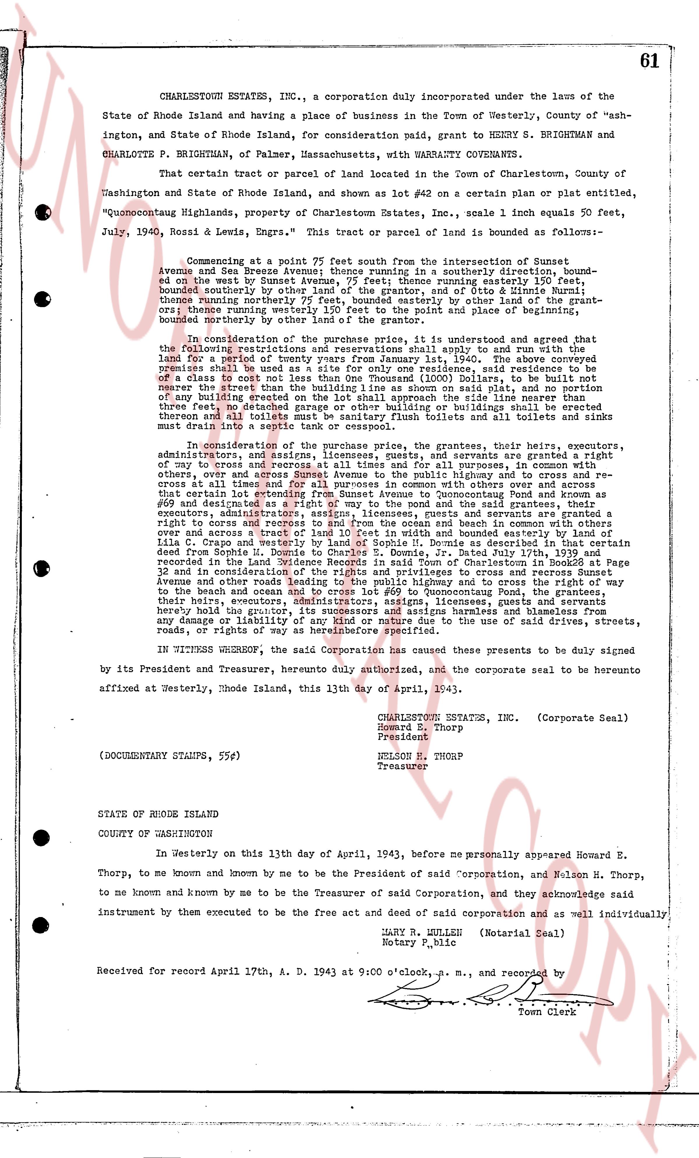
The instrument's own words
page 1 · read by Gemma vision
61
CHARLESTOWN ESTATES, INC., a corporation duly incorporated under the laws of the
State of Rhode Island and having a place of business in the Town of Westerly, County of "ash-
ington, State of Rhode Island, for consideration paid, grant to HENRY S. BRIGHTMAN and
CHARLOTTE P. BRIGHTMAN, of Palmer, Massachusetts, with WARRANTY COVENANTS.
That certain tract or parcel of land located in the Town of Charlestown, County of
Washington and State of Rhode Island, and shown as lot #42 on a certain plan or plat entitled,
"Quonocutong Highlands, property of Charlestown Estates, Inc.", scale 1 inch equals 50 feet,
July, 1940, Rossi & Lewis, Engrs." This tract or parcel of land is bounded as following:-
Commencing at a point 77 feet south from the intersection of Sunset
Avenue and Sea Breeze Avenue; thence running in a southerly direction, bounded south-
east by the west Sunset Avenue, 75 feet; and thence running easterly 150 feet, bounded
south east by the remainder of the grantor's land and of Otto G. Brightman; thence running
northerly westernly on northerly 75 feet, bounded easterly by other land of the grantor-
s; thence running westerly on northerly 150 feet, returning to the place of commencement
bounded northerly on northerly by other land of the Town.
In consideration of the purchase price, it is understood and agreed that shall run with the
land for a period of twenty years from January 1st, 1940. The above specified
property shall be used only for residential purposes, and no building shall be erected
of a class to cost not less than One Thousand (1000) Dollars, to be built not
manner than the third dimension of the building as shown on said plat, and no portion
of any building erected on the lot shall extend within twenty five feet of the line of
three feet, no detached garage or other building or buildings shall be erected
throughout and all toilets and bathrooms shall be equipped with bath tubs and all
must drain into a septic tank or cesspool.
In consideration of the purchase price, the grantees, their heirs, executors,
administrators, assigns, tenants, licensees and guests, are warranted a right
of way to cross and recross at all times and in all purposes, for whomsoever done,
over, across and through the land of the grantor, in a way 20 feet wide, and re-
cross and at all times, and for all purposes in common with others over and across
that way and certain lot identified as lot #41 on the aforementioned plan or plat
#69 and designated as a right of way to the pond and the said grantees, their
executors, administrators, assigns, tenants, licensees and guests, are warranted a
right to cross and recross to and from the ocean and beach in common with others
over and across the water lots and the land of the grantor, in a way 20 feet wide,
Lila C. Crapo and westerly by land of Sophia N. Domine as described in that certain
deed from Sophia N. Domine to Lila C. Crapo dated July 2nd, 1934 and recorded
recorded in the Land Evidence Records in said Town of Charlestown in Book 26 Page
32 and recorded in Book 28 Page 112 and privileges to cross and recross Sunset
Avenue and other roads leading to the beach, and to cross and recross the way
to the beach and ocean and to cross and recross lot #42 to Quonocutong Pond, the
grantees, their heirs, executors, administrators, assigns, tenants, licensees and guests,
hereby hold the grantor, its successors and assigns harmless and blameless from
any damage or liability arising out of or in connection with the use of said drives, streets,
roads, or rights of way as hereinbefore specified.
IN WITNESS WHEREOF, the said Corporation has caused these presents to be duly signed
by its President and Treasurer, hereby duly authorized, and the corporate seal to be hereunto
affixed at Westerly, Rhode Island, this 13th day of April, 1943.
CHARLESTOWN ESTATES, INC. (Corporate Seal)
Howard E. Thorp
President
Nelson H. Thorp
Treasurer
(DOCUMENTARY STAMPS, 55¢)
STATE OF RHODE ISLAND
COUNTY OF WASHINGTON
In Westerly on this 13th day of April, 1943, before me personally appeared Howard E.
Thorp, to me known and known by me to be the President of said Corporation, and Nelson H. Thorp,
to me known and known by me to be the Treasurer of said Corporation, and they acknowledge said
instrument by their execution to be the free act and deed of said corporation and as well individually.
MARY R. LULLEH (Notarial Seal)
Notary, p.lic
Received for record April 17th, A. D. 1943 at 9:00 o'clock, a. m., and recorded by
[Signature]
Town Clerk
The page as recorded