The instrument's own words
page 1 · read by Gemma vision
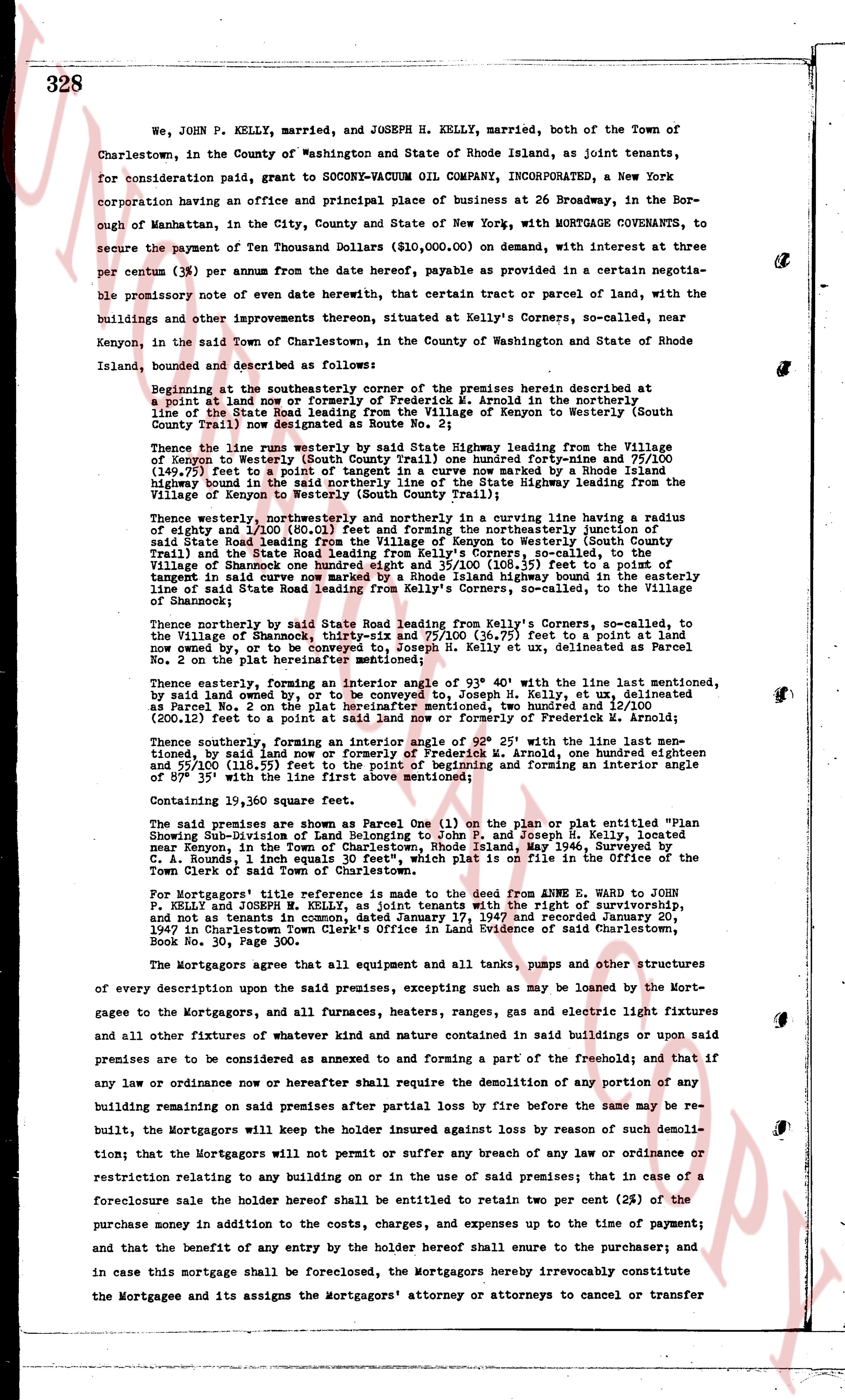
328
We, JOHN P. KELLY, married, and JOSEPH H. KELLY, married, both of the Town of Charlestown, in the County of Washington and State of Rhode Island, as joint tenants, for consideration paid, grant to SOCCONY-VACUUM OIL COMPANY, INCORPORATED, a New York corporation having an office and principal place of business at 26 Broadway, in the Borough of Manhattan, in the City, County and State of New York, with MORTGAGE COVENANTS, to secure the payment of Ten Thousand Dollars ($10,000.00) on demand, with interest at three per centum (3%) per annum from the date hereof, payable as provided in a certain negotiable promissory note of even date herewith, that certain tract or parcel of land, with the buildings and other improvements thereon situated, located at Kelly's Corners, so-called, near Kenyon, in the said Town of Charlestown, in the County of Washington and State of Rhode Island, bounded and described as follows:
Beginning at the southeasterly corner of the premises herein described at point A on the line between the lands of Frederick W. Arnold in the northerly line of the State Road leading from the Village of Kenyon to Westerly (South County Trail) now designated as Route 1;
Thence along the northerly line of said State Highway leading from the Village of Kenyon to Westerly (South County Trail) one hundred forty-nine and 75/100 (149.75) feet to a point of tangency in a curve now marked by a Rhode Island highway bound in the southeasterly line of the State highway leading from the Village of Kenyon to Westerly (South County Trail);
Thence westerly, northerly and northwesterly in the curving line having a radius of eighty and 1/100 (80.10) feet and an arc of one hundred twenty-four degrees in the northeasterly junction of said State Road leading from the Village of Kenyon to Westerly (South County Trail) and the State Road leading from Kelly's Corners, so-called, to the Village of Shannon of one hundred eight and 35/100 (108.35) feet to a point of tangency in said curve; then northwesterly in a straight line having a bearing of one line of said State Road leading from Kelly's Corners, so-called, to the Village of Shannon;
Thence northerly by said State Road leading from Kelly's Corners, so-called, to the Village of Shannon of thirty-six and 75/100 (36.75) feet to a point in a land now owned by, or to be conveyed to, Joseph H. Kelly et ux, delineated as Parcel No. 2 on the plat hereinafter mentioned;
Thence easterly, forming an interior angle of 93° 40' with the line last mentioned, by said land owned by, or to be conveyed to, Joseph H. Kelly, et ux, delineated as Parcel No. 2 on the plat hereinafter mentioned, one hundred two and 17/100 (102.17) (200.12) feet to a point in said land now or formerly of Frederick W. Arnold;
Thence southerly, forming an interior angle of 92° 25' with the line last mentioned, by said land now or formerly of Frederick W. Arnold, one hundred seven and 55/100 (107.55) feet to the point of beginning and forming an interior angle of 39° 35' with the line first above mentioned;
Containing 19,360 square feet.
The said premises are shown as Parcel One (1) on the plan or plat entitled "Plan Showing Sub-Division of Land Belonging to John P. and Joseph H. Kelly, located near Kenyon, in the Town of Charlestown, Rhode Island" dated May 1942, Surveyed by L. Honda, 1 inch equals 30 feet", which plat is on file in the Office of the Town Clerk of said Town of Charlestown.
For Mortgagees' title reference is made to the deed from ANNE E. WARD to JOHN P. KELLY and JOSEPH H. KELLY as joint tenants with the right of survivorship, and not as tenants in common, dated January 17, 1947 and recorded January 20, 1947 in Charlestown Town Clerk's Office in Land Evidence of said Charlestown, Book No. 30, Page 30.
The Mortgagors agree that all equipment and all tanks, pumps and other structures of every description upon the said premises, excepting such as may be loaned by the Mortgagees to the Mortgagors, and all furnaces, heaters, ranges, gas and electric light fixtures and all other fixtures of whatever kind and nature contained in said buildings or upon said premises are to be considered as annexed to and forming a part of the freehold; and that if any law or ordinance now or hereafter shall require the demolition of any portion or any building remaining on said premises after partial loss by fire before the same may be rebuilt, the Mortgagors will keep the holder insured against loss by reason of such demolition; that the Mortgagors will not permit or suffer any breach of any law or ordinance or restriction relating to any building on or in the use of said premises; that in case of a foreclosure sale the holder hereof shall be entitled to retain two per cent (2%) of the purchase money in addition to the costs, charges, and expenses up to the time of payment; and that the benefit of any entry by the holder hereof shall ensue to the purchaser; and in case this mortgage shall be foreclosed, the Mortgagors hereby irrevocably constitute the Mortgagee and its assigns the mortgagors' attorney or attorneys to cancel or transfer
The page as recorded