The instrument's own words
page 1
76
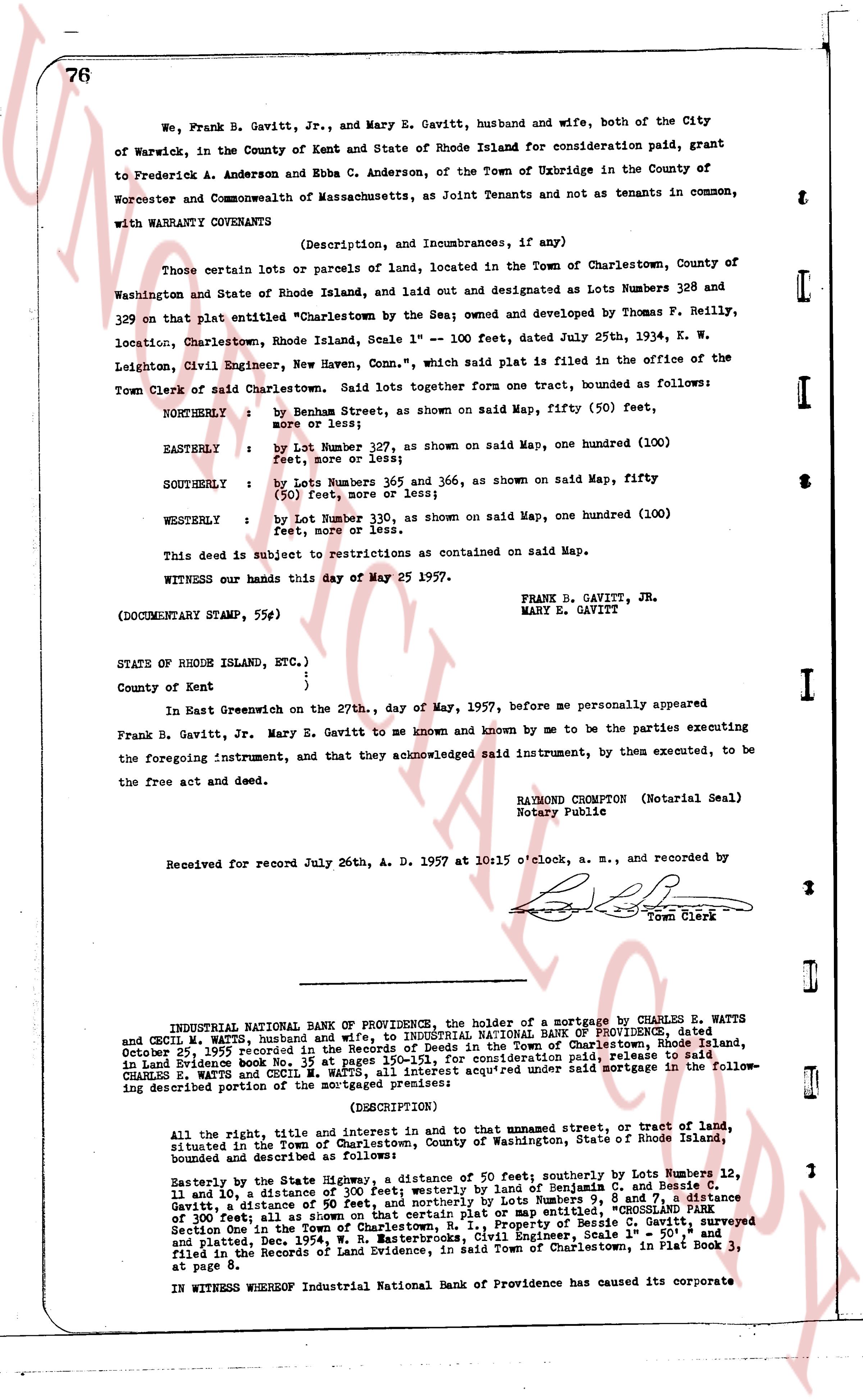
We, Frank B. Gavitt, Jr., and Mary E. Gavitt, husband and wife, both of the City
of Warwick, in the County of Kent and State of Rhode Island for consideration paid, grant
to Frederick A. Anderson and Ebba C. Anderson, of the Town of Uxbridge in the County of
Worcester and Commonwealth of Massachusetts, as Joint Tenants and not as tenants in common,
with WARRANTY COVENANTS
(Description, and Incumbrances, if any)
Those certain lots or parcels of land, located in the Town of Charlestown, County of
Washington and State of Rhode Island, and laid out and designated as Lots Numbers 128 and
329 on that plat entitled "Charlestown by the Sea"; owned and developed by Thomas P. Reilly,
location, Charlestown, Rhode Island, Scale 1" = 100 feet, dated July 25th, 1934, k. W.
Leighton, Civil Engineer, New Haven, Conn., which plan is filed in the office of the
Town Clerk of said Charlestown. Said lots together form one tract, bounded as follows:
NORTHERLY : by Benham Street, as shown on said Map, fifty (50) feet,
more or less;
EASTERLY : by Lot Number 127, as shown on said Map, one hundred (100)
feet, more or less;
SOUTHERLY : by Lots Numbers 365 and 366, as shown on said Map, fifty
(50) feet, more or less;
WESTERLY : by Lot Number 130, as shown on said Map, one hundred (100)
feet, more or less.
This deed is subject to restrictions as contained on said Map.
WITNESS our hands this day of May 25 1957.
FRANK B. GAVITT, JR.
MARY E. GAVITT
(DOCUMENTARY STAMP, 55¢)
STATE OF RHODE ISLAND, ETC., )
)
County of Kent )
In East Greenwich on the 27th, day of May, 1957, before me personally appeared
Frank B. Gavitt, Jr. Mary E. Gavitt to me known and known by me to be the parties executing
the foregoing instrument, and that they acknowledged said instrument, by them executed, to be
the free act and deed.
RAYMOND CROMPTON (Notarial Seal)
Notary Public
Received for record July 26th A. D. 1957 at 10h15 o'clock, a. m., and recorded by
Town Clerk
INDUSTRIAL NATIONAL BANK OF PROVIDENCE, the holder of a mortgage by CHARLES E. WATTS
and CECIL M. WATTS, husband and wife, to INDUSTRIAL NATIONAL BANK OF PROVIDENCE, dated
October 25, 1935 Recorded in the Land Evidence Records of the Town of Charlestown, Rhode Island,
in Land Evidence book No. 15 at pages 150-151, for consideration paid, release to said
CHARLES E. WATTS and CECIL M. WATTS, all interest acquired under said mortgage in the follow-
ing described portion of the mortgaged premises:
(DESCRIPTION)
All the right, title and interest in and to that unnamed street, or tract of land,
situated in the Town of Charlestown, County of Washington, State of Rhode Island,
bounded and described as follows:
Easterly by the State Highway, a distance of 50 feet, southerly by Lots Numbers 12,
11 and 10, a distance of 300 feet westerly by a line of Benjamin C. Anderson and Benja-
min Gavitt, a distance of 50 feet, and northerly by Lots Numbers 9, 8 and 7, a distance
of 300 feet, all as shown on a certain plat or map entitled, "CROSSLAND PARK"
and plotted, Two (2) lots, all scaled by Engineer's Scale, 1" = 50', surveyed
and filed in the Records of Land Evidence, in said Town of Charlestown, in Plat Book 3,
at page 8.
IN WITNESS WHEREOF Industrial National Bank of Providence has caused its corporate
The page as recorded