The instrument's own words
page 1
48
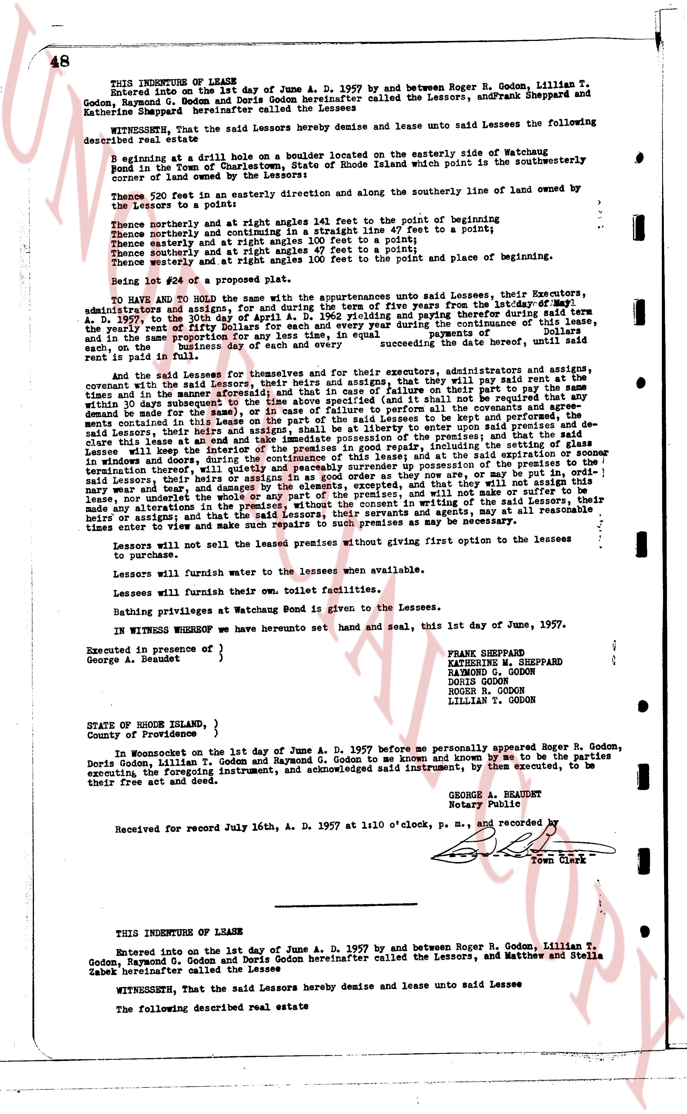
THIS INDENTURE OF LEASE
Entered into on the 1st day of June A. D. 1957 by and between Roger R. Godon, Lillian T.
Godon, Raymond G. Godon and Doris Godon hereinafter called the Lessors, and Frank Sheppard and
Katherine Sheppard hereinafter called the Lessees
WITNESSETH, That the said Lessors hereby demise and lease unto said Lessees the following
described real estate
Beginning at a railing drill hole on a boulder located on the easterly side of Watchaug
Pond in the Town of Charlestown, State of Rhode Island which point is the southwestern
corner of land owned by the Lessors on the eastern side
Thence 720 feet in an easterly direction and along the southerly line of land owned by
the Lessors to a point:
Thence northerly and at right angles 143 feet to the point of beginning
Thence northerly and continuing in a straight line 47 feet to a point;
Thence easterly and at right angles 100 feet to a point;
Thence southerly and at right angles 47 feet to a point;
Thence westerly and at right angles 100 feet to the point and place of beginning.
Being lot #24 of a proposed plat.
TO HAVE AND TO HOLD with the same appurtenances unto said Lessees, their Executors,
administrators and assigns, for and during the term of five years from the 1st day of May
A. D. 1957 and ending on the 30th day of April 1962, and paying therefore during said term
the yearly rent of fifty Dollars for each and every year during the continuance of this lease,
and in the same proportion if less than a year, payable in equal payments of
twenty five dollars of business each and every second succeeding the date hereof, until said
rent is paid in full
And the said Lessees for themselves and for their executors, administrators and assigns,
covenants with the said Lessors, that they and their heirs and assigns will pay the rent
due and in the same manner as aforesaid, and that they will not cut or remove any part of the
trees and in the same manner as aforesaid, and in case of failure to perform all the covenants
herein mentioned in the time specified (and that shall not be required that any
demand be made for the same), or in case of failure to perform all the covenants
herein mentioned in the time specified (and that shall not be required that any
said Lessors, their heirs and assigns, shall be at liberty to enter upon said premises to
clean, clear or cut any trees or brush as they may see fit, and that the said
Lessees will keep the interior of the premises in good repair, including the setting of glass
in all windows, and that the said Lessees will leave the premises in good order, or sooner
than termination thereof, will quietly and peaceably surrender up possession of the premises to
the said Lessors, their heirs and assigns, and that they will not commit any waste, nor
lease, nor underlet the premises, nor assign this lease, nor will they sell, nor will they
make any alterations in the premises, without the consent in writing of the said Lessors, their
heirs or assigns; and that the said Lessors, their heirs and assigns, may, at all reasonable
times to view and make such repairs to said premises as may be necessary.
Lessors will not sell the leased premises without giving first option to the lessees
to purchase.
Lessors will furnish water to the lessees when available.
Lessees will furnish their own toilet facilities.
Bathing privileges at Watchaug Pond is given to the Lessees.
IN WITNESS WHEREOF we have hereunto set hand and seal, this 1st day of June, 1957.
Executed in presence of )
George A. Beaudet ) FRANK SHEPPARD
KATHERINE M. SHEPPARD
RAYMOND G. GODON
DORIS GODON
ROGER R. GODON
LILLIAN T. GODON
STATE OF RHODE ISLAND, }
County of Providence, }
In Woonsocket on the 1st day of June A. D. 1957 before me personally appeared Roger R. Godon,
Doris Godon, Lillian T. Godon and Raymond G. Godon to me known and known by me to be the parties
executing the foregoing instrument, and acknowledged said instrument, by then executed, to be
their free act and deed.
GEORGE A. BEAUDET
Notary Public
Received for record July 16th, A. D. 1957 at 1:10 o'clock, p. m., and recorded by
[Seal]
Town Clerk
THIS INDENTURE OF LEASE
Entered into on the 1st day of June A. D. 1957 by and between Roger R. Godon, Lillian T.
Godon, Raymond G. Godon and Doris Godon hereinafter called the Lessors, and Matthew and Stella
Sabek hereinafter called the Lessees
WITNESSETH, That the said Lessors hereby demise and lease unto said Lessees
The following described real estate
The page as recorded