The instrument's own words
page 1
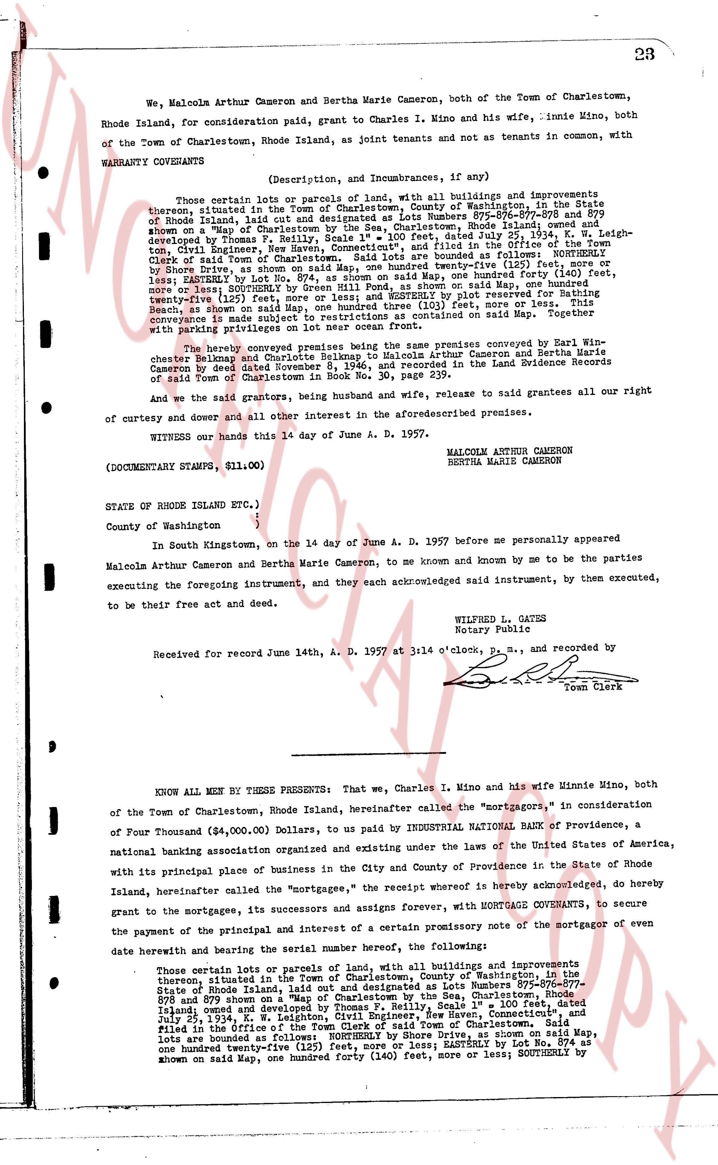
We, Malcolm Arthur Cameron and Bertha Marie Cameron, both of the Town of Charlestown,
both of the Town of Charlestown, Rhode Island, as joint tenants and not as tenants in common, with
Town of the Town of Charlestown, Rhode Island, as joint tenants and not as tenants in common, with
WARRANTY COVENANTS
(Description, and Incumbrances, if any)
Those certain lots or parcels of land, with all buildings and improvements
thereon, situated in the Town of Charlestown, County of Washington, in the State
of Rhode Island, laid out and designated as Lots Numbers 875-876-877-878 and 879
known on a "Map of Charlestown by the Sea, Charlestown, Rhode Island," dated
July 25, 1934, and developed by Thomas P. Reilly, Scale 1" = 100 feet, K. W. Leigh-
ton, Civil Engineer, New Haven, Connecticut," and filed in the Office of the
Town Clerk of Town of Charlestown, Rhode Island, and bounded as follows: NORTHLY
by Shore Drive, as shown on said Map, one hundred twenty-five (125) feet, more or
less; EASTERLY by Lot Number 874, as shown on said Map, one hundred forty (140) feet,
more or less; SOUTHERLY by Green Hill Road, as shown on said Map, one hundred
twenty-five (125) feet; WESTERLY by Lot Number 880, as shown by plot reserved by Thomas
Reilly, as shown on said Map, one hundred three (103) feet, more or less. This
conveyance is made subject to restrictions contained on said Map. Together with
parking privileges.
The hereby conveyed premises being the same premises conveyed by Earl Win-
chester Belknap and Charlotte Belknap to Malcolm Arthur Cameron and Bertha Marie
Cameron by deed dated November 11, 1943, recorded September 21, 1943 in the Land Evidence Records
of said Town of Charlestown in Book No. 30, page 239.
And we the said grantors, being husband and wife, release to said grantees all our right
of curtesy and dower and all other interest in the aforementioned described premises.
WITNESS our hands this 14 day of June A. D. 1957.
(DOCUMENTARY STAMPS, $11.00)
MALCOLM ARTHUR CAMERON
BERTHA MARIE CAMERON
STATE OF RHODE ISLAND ETC.)
County of Washington )
In South Kingstown, on the 14 day of June A. D. 1957 before me personally appeared
Malcolm Arthur Cameron and Bertha Marie Cameron, to me known and by me to be the parties
executing the foregoing instrument, and they each acknowledged said instrument, by them executed,
to be their free act and deed.
WILFRED L. GATES
Notary Public
Received for record June 14th, A. D. 1957 at 3:14 o'clock P.M., and recorded by
Town Clerk
KNOW ALL MEN BY THESE PRESENTS: That we, Charles I. Mino and his wife Minnie Mino, both
of the Town of Charlestown, Rhode Island hereinafter called the "mortgagors," in consideration
of Four Thousand ($4,000.00) Dollars, to us paid by INDUSTRIAL NATIONAL BANK of providence, a
national banking association organized and existing under the laws of the United States of America,
with its principal place of business in the City and County of Providence in the State of Rhode
Island, hereinafter called the "mortgagee," the receipt whereof is hereby acknowledged, do hereby
grant to the mortgage, its successors and assigns forever, with MORTGAGE COVENANTS, to secure
the payment of the principal and interest of a certain promissory note of the mortgagor of even
date herewith and bearing the serial number hereof, the following:
Those certain lots or parcels of land, with all buildings and improvements
thereon, situated in the Town of Charlestown, County of Washington, in the State
of Rhode Island, laid out and designated as Lots Numbers 875-876-
877-878 and 879 and shown on a "Map of Charlestown by the Sea, Charlestown, Rhode
Island; owned and developed by Thomas P. Reilly, Scale 1" = 100 feet, dated
July 25, 1934, and filed in the Office of the Town Clerk of said Town of Charlestown. Said
lots are bounded as follows: NORTHLY by Shore Drive, as shown on said Map,
one hundred twenty-five (125) feet, more or less; EASTERLY by Lot No. 874 as
known on said Map, one hundred forty (140) feet, more or less; SOUTHERLY by
The page as recorded