The instrument's own words
page 1
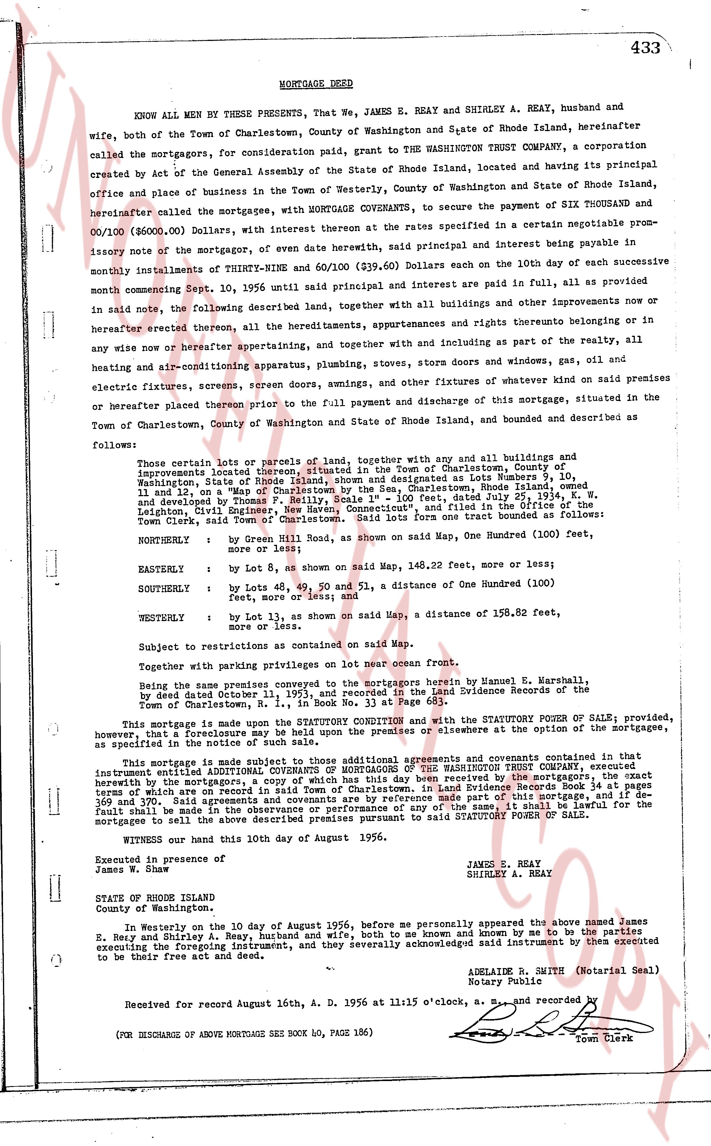
MORTGAGE DEED 433
KNOW ALL MEN BY THESE PRESENTS, That We, JAMES E. REAY, JAMES E. REAY, and SHIRLEY A. REAY, husband and
wife, both of the Town of Charlestown, County of Washington and State of Rhode Island, hereinafter
called the mortgagors, for consideration paid, grant to THE WASHINGTON TRUST COMPANY, a corporation
created by Act of the General Assembly of the State of Rhode Island, located and having its principal
office and place of business in the Town of Westerly, County of Washington and State of Rhode Island,
hereinafter called the mortgagee, with MORTGAGE COVENANTS, to secure the payment of SIX THOUSAND
nor/100 ($6,000.00) Dollars, with interest thereon at the rates specified in a certain negotiable prom-
issory note of the mortgagors, of even date herewith, said principal and interest being payable in
monthly installments of THIRTY-NINE and 60/100 ($39.60) Dollars each on the 10th day of each successive
month commencing Sept. 10, 1956, until said principal and interest are paid in full, in all as provided
in said note, the following described land, together with all buildings and other improvements now or
hereafter erected thereon, all the hereditaments, appurtenances and rights thereunto belonging or in
any wise now or hereafter appertaining, and together with and including as part of the realty, all
heating and air-conditioning apparatus, plumbing, stoves, doors and windows, gas, oil and
electric fixtures, screens, screen doors, swings, and other of whatever kind or whateer skin of praised premises
or hereafter placed thereon prior to the full payment and discharge of this mortgage, situated in the
Town of Charlestown, County of Washington and State of Rhode Island, bounded and described as
follows:
Those certain lots or parcels of land, together with any and all buildings and
improvements located thereon, situated in the Town of Charlestown, County of
Washington, State of Rhode Island, shown as designated as Lots Number 10,
11 and 12 on a "Map of the Sea-Shore Lots, Rhode Island", owned
and developed by Thomas P. Reilly, Scale 1" = 100 feet, dated July 25, 1954, K. W.
Leighton, Civil Engineer Exhibit "A", and recorded and filed in the Office of the
Town Clerk, said Town of Charlestown. Said lots form one tract bounded as follows:
NORTHERLY : by Green Hill Road, as shown on said Map, One Hundred (100) feet,
more or less;
EASTERLY : by Lot 8, as shown on said Map, 148.22 feet, more or less;
SOUTHERLY : by Lots 48, 49, 50 and 51, a distance of One Hundred (100)
feet, more or less; and
WESTERLY : by Lot 13, as shown on said Map, a distance of 158.82 feet,
more or less.
Subject to restrictions as contained on said Map.
Together with paving privileges with the mortgagors herein by Emmanuel H. Marshall,
being the dame premises conveyed to the mortgagors herein by Emmanuel H. Marshall,
by deed dated December 11, 1955, recorded in the Land Evidence Records of the
Town of Charlestown, R. I., in Book No. 33 at Page 683.
This mortgage is made upon the STATUTORY CONDITION and with the STATUTORY POWER OF SALE; provided,
however, that a foreclosure may be held upon the premises or elsewhere at the option of the mortgagee,
as specified in the statute of frauds.
This mortgage is made subject to those additional covenants and agreements contained in said instrument
entitled ADDITIONAL COVENANTS OF MORTGAGORS OF THE WASHINGTON TRUST COMPANY, executed
concurrently with the mortgage, by the mortgagors, and delivered by the mortgagors, the exact
terms of which are on record in said Town of Charlestown in Land Evidence Records Book 34 at pages
353 and following. Said premises are insured for the sum of $5,000.00 and in the event that a
default shall be made in the observance or performance of any of the same, it shall be lawful for the
mortgagees to sell the above described premises pursuant to said STATUTORY POWER OF SALE.
WITNESS our hand this 10th day of August 1956.
JAMES E. REAY
SHIRLEY A. REAY
Executed in presence of
James H.
STATE OF RHODE ISLAND
County of Washington.
In Westerly on the 10 day of August 1956, before me personally appeared the above named James
E. Reay and Shirley A. Reay, husband and wife, both to me known and known by me to be the parties
executing the foregoing instrument, and they severally acknowledged said instrument by them executed
to be their free act and deed.
ADELAIDE E. WHITE (Notarial Seal)
Notary Public
Received for record August 16th, A. D. 1956 at 11:15 o'clock, a. m., and recorded by
Town Clerk
(FOR DISCHARGE OF ABOVE MORTGAGE SEE BOOK 40, PAGE 186)
The page as recorded