The instrument's own words
page 1 · read by Gemma vision
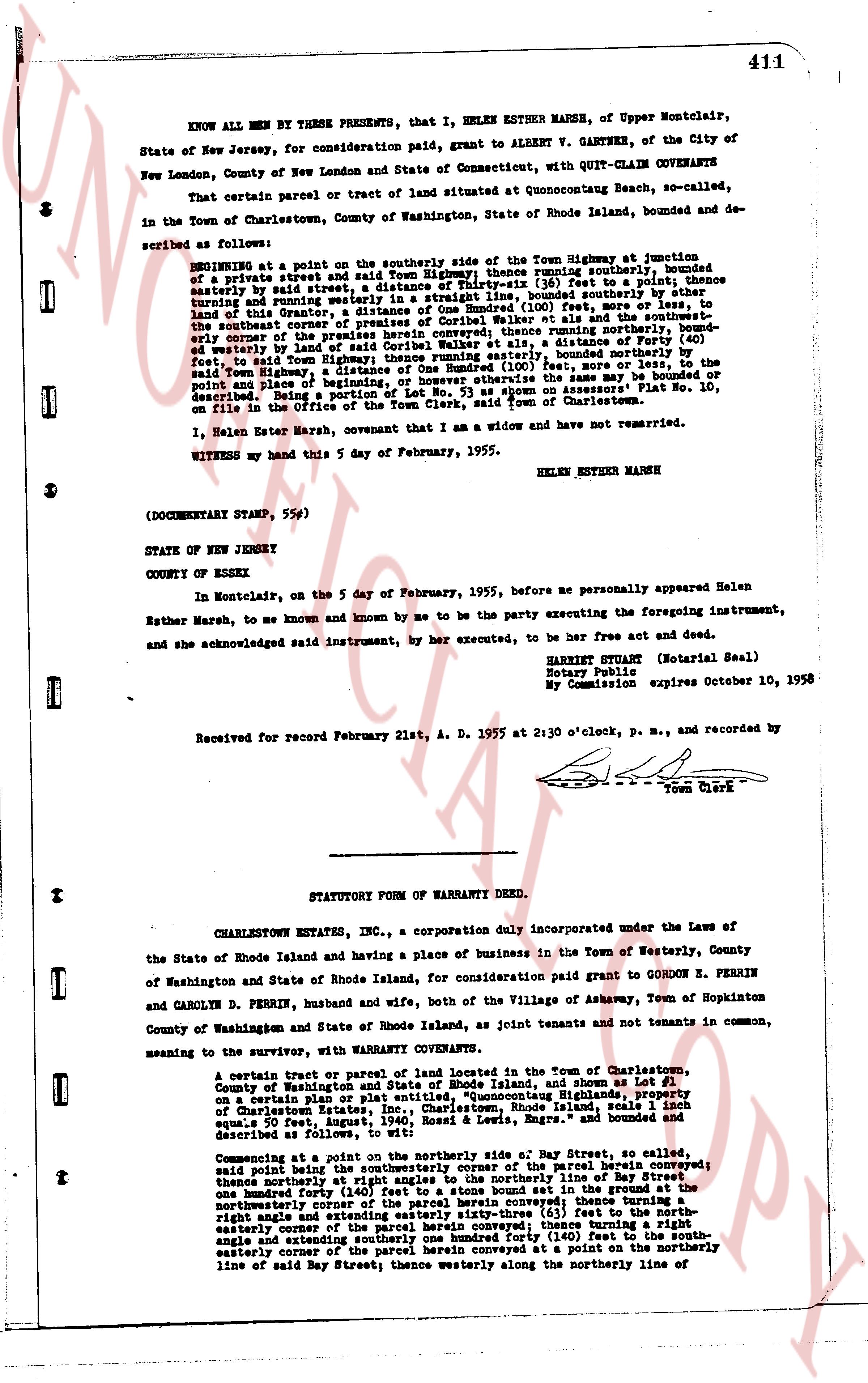
411
KNOW ALL MEN BY THESE PRESENTS, that I, HELEN ESTHER MARSH, of Upper Montclair, State of New Jersey, for consideration paid, grant to ALBERT V. GARTNER, of the City of New London, County of New London and State of Connecticut, with QUIT-CLAIM COVENANTS
That certain parcel or tract of land situated at Quonnocutcong Beach, so-called, in the Town of Charlestown, County of Washington, State of Rhode Island, bounded and described as follows:
BEGINNING at a point on the southerly side of the Town Highway at junction of a private street and said Town Highway, thence running easterly, bounded northerly bounded and said street a distance of one hundred fifty (150) feet to a point; thence easterly turning and running westerly in a straight line, bounded southerly by other land of this Grantor, a distance of one hundred (100) feet, more or less, to the southeast corner of the premises herein conveyed, thence running northerly bounded westerly by the land of Grantor, a distance of one hundred (100) feet, more or less, to the northeast corner of the premises herein conveyed, thence running westerly, a distance of forty (40) feet, to said Town Highway; thence running easterly, bounded northerly bounded northerly by said Town Highway, a distance of one hundred (100) feet, more or less, to the point and place of beginning, or however otherwise the same may be bounded or described being a portion of a lot shown on Assessor's Plat No. 10, on file in the Office of the Town Clerk, said town of Charlestown.
I, Helen Esther Marsh, covenant that I am a widow and have not remarried.
WITNESS my hand this 5 day of February, 1955.
HELEN ESTHER MARSH
(DOCUMENTARY STAMP, 55¢)
STATE OF NEW JERSEY
COUNTY OF ESSEX
In Montclair, on the 5 day of February, 1955, before me personally appeared Helen Esther Marsh, to me known and by me to know and by me to be the party executing the foregoing instrument, and she acknowledged said instrument, by her executed, to be her free act and deed.
HARRIET STUART (Notarial Seal)
Notary Public
My Commission expires October 10, 1958
Received for record February 21st, A. D. 1955 at 2:30 o'clock, p. m., and recorded by
[Signature]
Town Clerk
----
STATUTORY FORM OF WARRANTY DEED.
CHARLESTOWN ESTATES INC., a corporation duly incorporated under the Laws of the State of Rhode Island and having a place of business in the Town of Westerly, County of Washington and State of Rhode Island, for consideration paid grant to GORDON E. PERRIN and CAROLYN D. PERRIN, husband and wife, both of the Village of Ashaway, Town of Hopkinton County of Washington and State of Rhode Island, as joint tenants and not tenants in common, meaning the same, with WARRANTY COVENANTS.
A certain tract or parcel of land located in the Town of Charlestown, County of Washington and State of Rhode Island, and shown as Lot 1 on a certain Plan or plat entitled "Quonnocutcong Highlands, property of Charlestown Estates, Inc., Charlestown, Rhode Island, scale 1 inch equals 20 feet, August, 1940, Rosad & Lewis, Engrs." and bounded and described as follows:
Commencing at a point on the northerly side, of Bay Street, so called, said point being the southeasterly corner of the parcel herein conveyed; beginning said point being the southeasterly corner of the northerly line of Bay Street one hundred forty (140) feet to a stone bound set in the ground at the northeasterly corner of the premises herein conveyed thence extending easterly sixty-three (63) feet to the northeast corner of the premises herein conveyed, thence turning a right angle and extending southerly one hundred forty (140) feet to the southeast angle and extending southerly one hundred forty (140) feet to the southeast cornerly corner of the parcel herein conveyed at a point on the southeasterly line of said Bay Street; thence westerly along the northerly line of
page 2 · read by Gemma vision
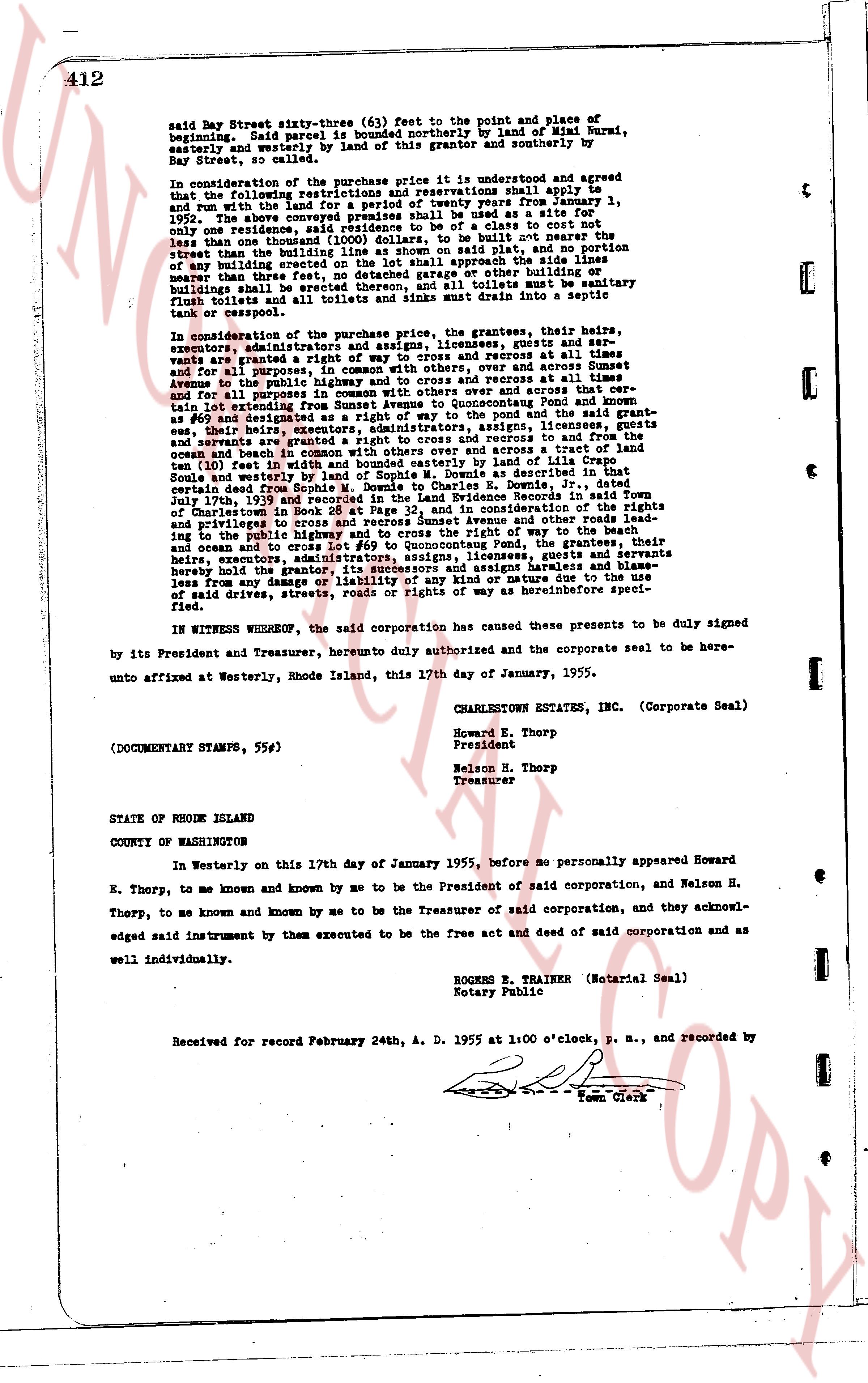
412
said Bay Street sixte-three (63) feet to the point and place of beginning. Said parcel is bounded northerly by land of Mimi Nurai, easterly and westerly by land of this grantor and southerly by Bay Street, so called.
In consideration of the purchase price it is understood and agreed that all the following restrictions and reservations shall apply to and run with the land for a period of twenty years from January 1, 1955, the above described lot shall be used as a site for only one residence, said residence to be of a class to cost not less than one thousand dollars ($1,000.00) to be built on or near the street than the building line as seen on shom on plat said, and no portion of any building shall extend beyond the side lines or shall approach the side lines nearer than three feet, no detached garage or other building or buildings shall be erected thereon, and all toilets must be sanitary flush toilets and all tubs and sinks must drain into a septic tank or cesspool.
In consideration of the purchase price, the grantees, their heirs, executors, administrators and assigns, licensees, grantees and users shall have a grant of right of way, in common with others, over and across Sunset Avenue for the purpose of ingress and egress at all times and for all purposes, and to exercise the right of way over and across the rights of avenue the public highway and to cross the roads and access to all rights of way and for purposes of ingress and egress over and across a certain lot extending from Sunset Avenue to Quonocut Pond and known as lot #4 on said plat, together with the right, and the said grant-ees, their heirs, executors, administrators assigns, licensees, grantees and users shall have a grant of right of way, in common with others, over and across a tract of land ten (10) feet in width and whose course is parallel by land of the late Sophie Dome, southerly boundary of Sophie M. Dome as described in that certain deed from Sophie M. Dome to Dorris L. Dome, Bk 27, pg 138 dated July 13th 1938 and recorded in the Evidence records in Town said of Charlestown in Book 20 at Page 32, and in consideration of the rights of way over and across Sunset Avenue and other roads leading to the public highway and to cross the right of way to the beach and over and across the tract of land bordering Quonocut Pond, the grantees their heirs, executors, administrators assigns, licensees, grantees and servants hereby covenant and agree to indemnify and save harmless and hold blameless from any damage or liability of any kind or nature due to the use of said drives, streets, roads or rights of way as hereinbefore specified.
IN WITNESS WHEREOF, the said corporation has caused these presents to be duly signed by its President and Treasurer, herunto duly authorised and the corporate seal to be hereunto affixed at Westerly, Rhode Island, this 17th day of January, 1955.
CHARLESTOWN ESTATES, INC. (Corporate Seal)
Howard E. Thorp
President
Nelson H. Thorp
Treasurer
(DOCUMENTARY STAMPS, 55¢)
STATE OF RHODE ISLAND
COUNTY OF WASHINGTON
In Westerly on this 17th day of January 1955, before me personally appeared Howard E. Thorp, to me known and known by me to be the President of said corporation, and Nelson H. Thorp, to me known and known by me to be the Treasurer of said corporation, and they acknowledged said instrument by them executed to be the free act and deed of said corporation as and well individually.
ROBERTS E. TRAINER (Notarial Seal)
Notary Public
Received for record February 24th, A. D. 1955 at 1:00 o'clock, p. m., and recorded by
[?] Town Clerk
The page as recorded