The instrument's own words
page 1 · read by Gemma vision
385
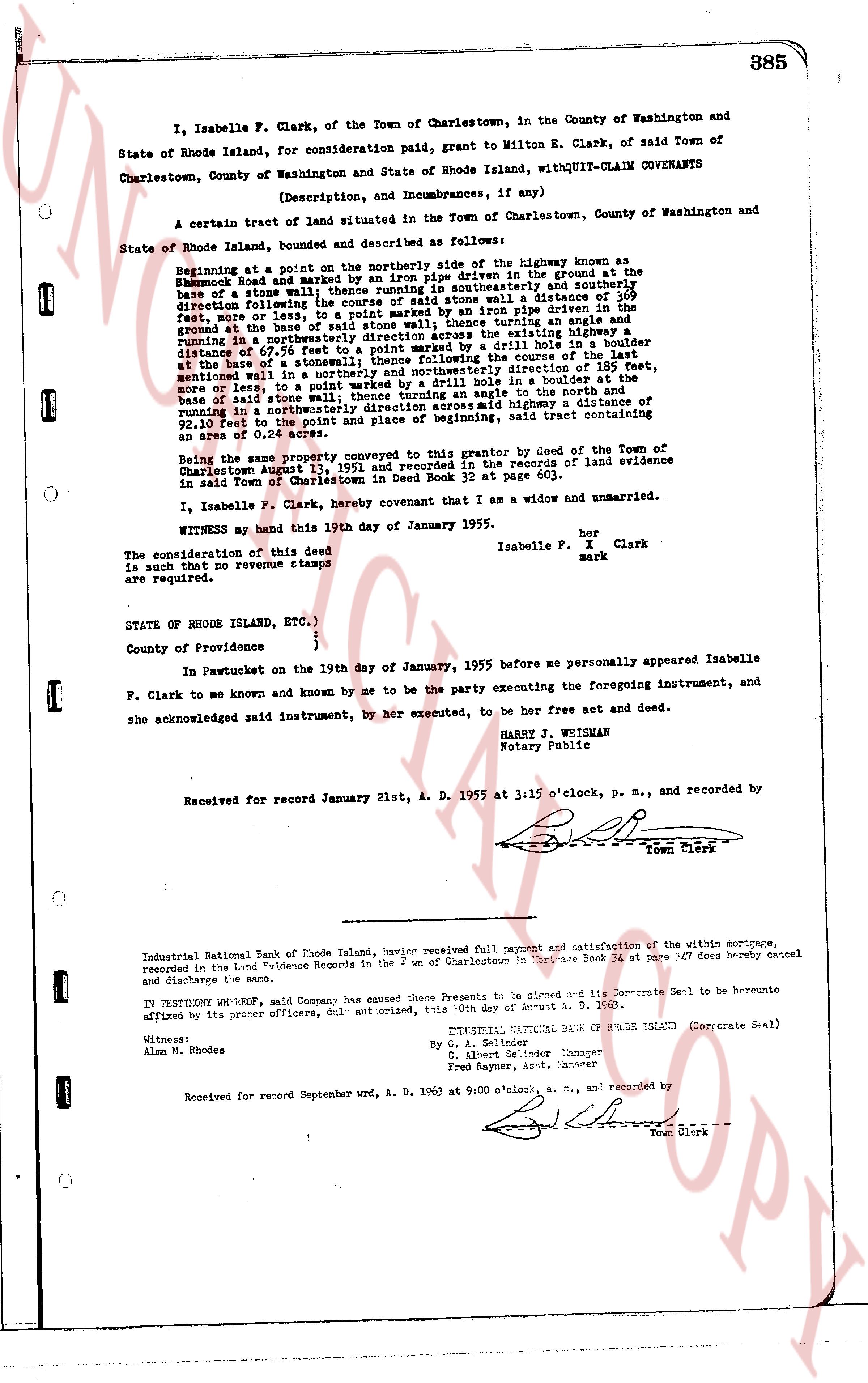
I, Isabelle F. Clark, of the Town of Charlestown, in the County of Washington and State of Rhode Island, for consideration paid, grant to Milton E. Clark, of said Town of Charlestown, County of Washington and State of Rhode Island, withQUIT-CLAIM COVENANTS
(Description, and Incumbrances, if any)
A certain tract of land situated in the Town of Charlestown, County of Washington and State of Rhode Island, bounded and described as follows:
Beginning at a point on the northerly side of the highway known as
Charlestown Road and marked by an iron pipe driven in the ground at the
base of a stone wall; thence running a course southwesterly and southerly
directing the line along the base of said stone wall a distance of 369
feet, more or less, to a point marked by an iron pipe driven in the
ground, the base of a stone wall; thence turning an angle and
running in a northwesterly direction across the extend highway a
distance of 20.7 feet, to a point marked by a drill hole in a boulder
at the base of a stonewall; thence following the course of the last
sentinel wall in a northerly and northwesterly direction of 169 feet,
more or less, to a point marked by a drill hole in a stone wall
base of the said stone wall; thence turning an angle and running
north in a northwesterly direction across said highway a distance of
92.10 feet to the point and place of beginning, said tract containing
an area of 0.65 acres.
Being the same property conveyed to this grantor by deed of the Town of
Charlestown August 13, 1921 and recorded in the records of land evidence
in said Town of Charlestown in Land Book 52 at page 603.
I, Isabelle F. Clark, hereby covenant that I am a widow and unmarried.
WITNESS my hand this 19th day of January 1955.
Isabelle F. I Clark
mark
The consideration of this deed
is such as to require no revenue stamps
are required.
STATE OF RHODE ISLAND, ETC.)
)
)
County of Providence {
In Pawtucket on the 19th day of January, 1955 before me personally appeared Isabelle
F. Clark to me known and known by me to be the party executing the foregoing instrument, and
she acknowledged said instrument, by her executed, to be her free act and deed.
HARRY J. WEIGHMAN
Notary Public
Received for record January 21st, A. D. 1955 at 3:15 o'clock, p. m., and recorded by
[Signature]
Town Clerk
----
Industrial National Bank of Rhode Island, having received full payment and satisfaction of the within mortgage,
recorded in the Land Evidence Records in the Town of Charlestown in Book 34 at page 347 does hereby cancel
and discharge the same.
IN TESTIMONY WHEREOF, said Company has caused these Presents to be signed and its Corporate Seal to be hereunto
affixed by its proper officers, duly authorized, this 30th day of August A. D. 1963.
(Corporate Seal)
INDUSTRIAL NATIONAL BANK OF RHODE ISLAND
By C. A. Seider
C. Albert P. Under Manager
and Rayner, Asst. Manager
Witness:
Alm n. Rhodes
Received for record September wrd, A. D. 1963 at 9:00 o'clock, a. m., and recorded by
[Signature]
Town Clerk
The page as recorded