The instrument's own words
page 1 · read by Gemma vision
383
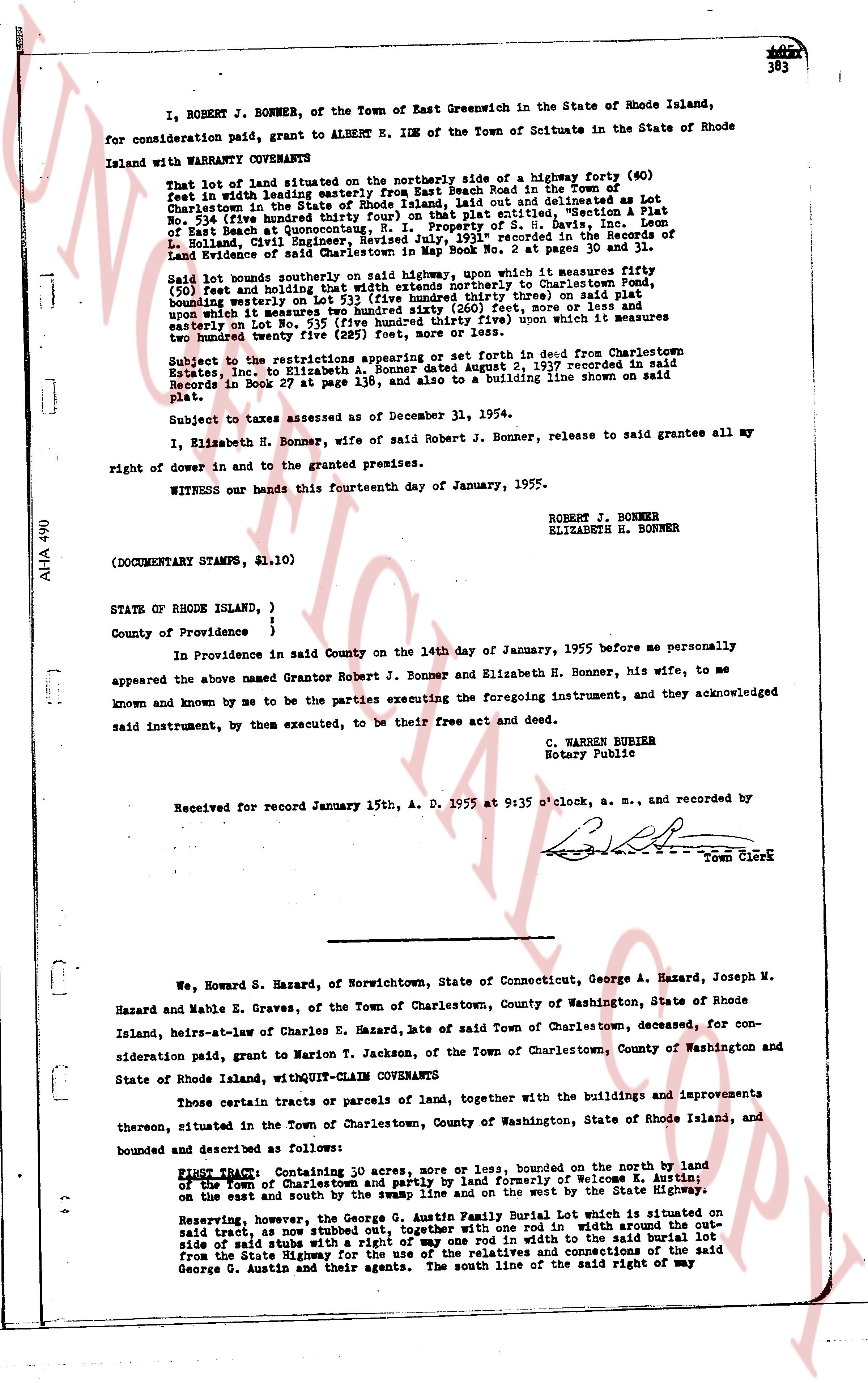
I, ROBERT J. BONNER, of the Town of East Greenwich in the State of Rhode Island, for consideration paid, grant to ALBERT E. IDE of the Town of Scituate in the State of Rhode Island with WARRANTY COVENANTS
That lot of land situated on the northerly side of a highway forty (40) feet in width with leading easterly from East Beach Road in the Town of Charlestown in the State of Rhode Island, and more or less denominated as Lot 53 (five hundred thirty three) square feet on that plat entitled "Section A Plat of East Beach at Quonochonticut, N. RI. Property of S. H. Davis, inc. Lease term 1936, Build Right Exp. 1965" recorded in the Records of Land Evidence of said Charlestown in Book No 29 at pages 30 and 31.
Said lot bounds southerly on said highway, upon which it measures fifty (50) feet and bounding westerly on Lot 52, bounding northerly to Charlestown Road, bounding easterly on Lot 53 (five hundred thirty three) on said plat upon which it measures two hundred sigma [?] feet, more or less and bounding easterly on Lot No. 54 (five hundred thirty five) upon which it measures two hundred twenty five (225) feet, more or less.
Subject to the restrictions appearing or set forth in deed from Charlestown Estates, Inc. to Elizabeth H. Bonner dated August 2, 1937 recorded in said Records in Book 27 at page 139, and also to a building line shown on said plat.
Subject to taxes assessed as of December 31, 1954.
I, Elizabeth H. Bonner, wife of said Robert J. Bonner, release to grantee all my right of dower in and to the granted premises.
WITNESS our hands this fourteenth day of January, 1955.
ROBERT J. BONNER
ELIZABETH H. BONNER
(DOCUMENT STAMPS, $1.10)
STATE OF RHODE ISLAND, )
County of Providence }
In Providence in said County on the 14th day of January, 1955 before me personally appeared the above named Grantor Robert J. Bonner and Elizabeth H. Bonner, his wife, to me known and known by me to be the parties executing the foregoing instrument, and they acknowledged said instrument, by them executed, to be their free act and deed.
C. WARREN BURIER
Notary Public
Received for record January 15th, A. D. 1955 at 9:35 o'clock, a. m., and recorded by [Signature] Town Clerk
----
We, Howard S. Hazard, of Norwichtown, State of Connecticut, George A. Hazard, Joseph M. Hazard and Mabel E. Graves, of the Town of Charlestown, County of Washington, State of Rhode Island, heirs-at-law of Charles E. Hazard, late of said Town of Charlestown, deceased, for consideration paid, grant to Marion T. Jackson, of the Town of Charlestown, County of Washington and State of Rhode Island, with QUIT-CLAIM COVENANTS
Those certain tracts or parcels of land, together with the buildings and improvements thereon, situated in the Town of Charlestown, County of Washington, State of Rhode Island, and bounded and described as follows:
FIRST TRACT Containing 10 acres, more or less, bounded on the north by land of the Town of Charlestown and partly by land formerly of Welcome K. Austin; on the east and south by the swamp line and on the west by the State Highway.
Reserving, however, the George G. Austin Family Burial Lot which is situated on said tract, as now stubbed out by stakes, a rectangle 20 rod in width across the side of said stub with a right of way one rod in width to the said burial lot from the State Highway for the use of the relatives and connections of the said George G. Austin and their agents. The south line of the said right of way
The page as recorded