The instrument's own words
page 1 · read by Gemma vision
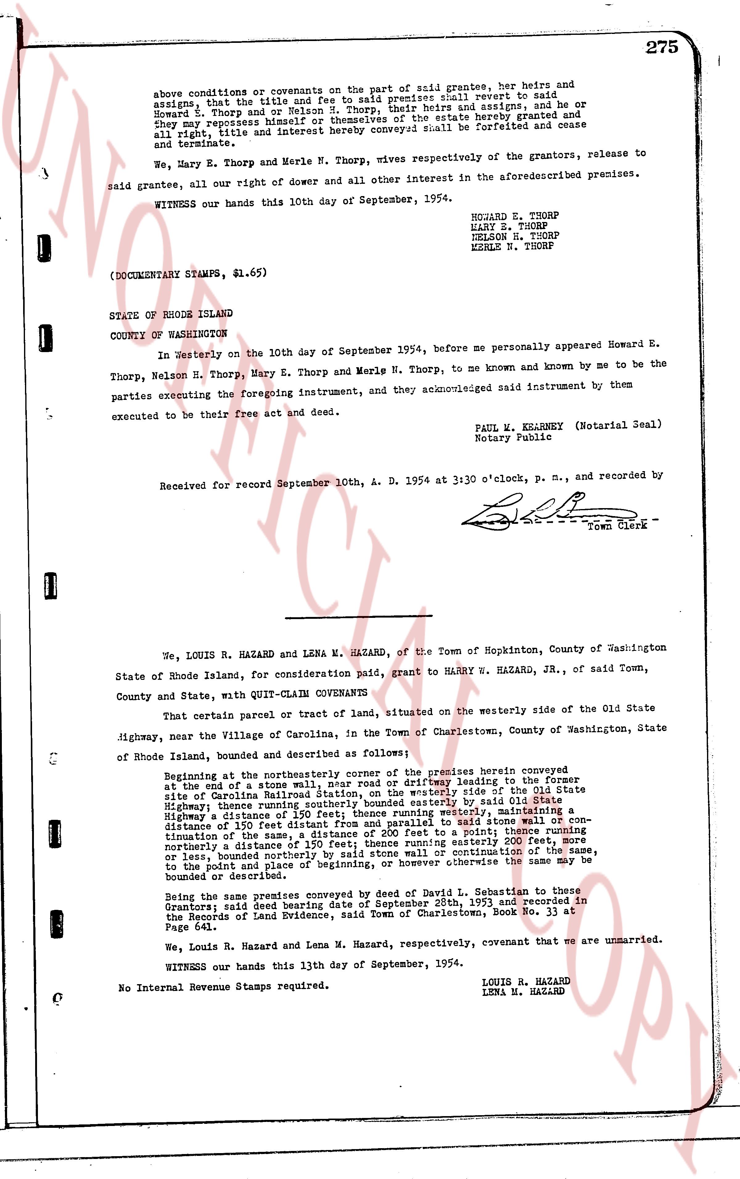
275
above conditions or covenants on the part of said grantees, their heirs and assigns, that the title and right thereunto, said premises shall revert to said Howard E. Thorp, L. Thorp, and or Nelson S. Thorp, their heirs and assigns, and that he or they may repossess himself or themselves of the estate hereby granted and that all right, title and interest hereby conveyed shall be forfeited and cease and terminate.
We, Mary E. Thorp and Merle N. Thorp, wives respectively of the grantors, release to said grantees, all our right of dower and all other interest in the aforementioned premises.
WITNESS our hands this 10th day of September, 1954.
HOWARD E. THORP
HARY E. THORP
NELSON H. THORP
MERLE N. THORP
(DOCUMENTARY STAMPS, $1.65)
STATE OF RHODE ISLAND
COUNTY OF WASHINGTON
In Westerly on the 10th day of September 1954, before me personally appeared Howard E. Thorp, Nelson E. Thorp, Mary E. Thorp and Merle N. Thorp, to me known and known by me to be the parties executing the foregoing instrument, and they acknowledged said instrument by them executed to be their free act and deed.
PAUL M. KEARNEY (Notarial Seal)
Notary Public
Received for record September 10th, A. D. 1954 at 3:30 o'clock, p. m., and recorded by
[Signature]
Town Clerk
----
We, LOUIS R. HAZARD and LENA M. HAZARD, of the Town of Hopkinton, County of Washington State of Rhode Island, for consideration paid, grant to HENRY W. HAZARD, JR., of said Town, County and State, with QUIT-CLAIM COVENANTS
That certain parcel of tract or land, situated on the westerly side of the Old State Highway, near the Village of Carolina, in the Town of Charlestown, County of Washington, State of Rhode Island, bounded and described as follows:
Beginning at the northeasterly corner of the premises herein conveyed, at the toe of a stone wall, and running southerly in the driveway leading to the former site of Carolina National Station, on the westerly side of the Old State Highway, thence southerly in the stone wall, as marked by said Old State Highway a distance of 190 feet; thence running westerly, maintaining a distance of 150 feet from said highway, to a stone wall or continuation of the same, a distance of 200 feet to a point; thence running southerly in the continuation of the same, a distance of 200 feet to a point; thence running northerly a distance of 150 feet, to a stone wall or continuation westerly 200 feet thereunto, or less, bounded northerly by said stone wall or continuation of the same, to the point and place of beginning, or however otherwise the same may be bounded or described.
Being the same premises conveyed by deed of David L. Sebastian to these Grantors; said deed bearing date of September 28th, 1953 and recorded in the Records of Land Evidence, said Town of Charlestown, Book No. 33 at Page 641.
We, Louis R. Hazard and Lena M. Hazard, respectively, covenant that we are unmarried.
WITNESS our hands this 13th day of September, 1954.
LOUIS R. HAZARD
LENA M. HAZARD
No Internal Revenue Stamps required.
page 2 · read by Gemma vision
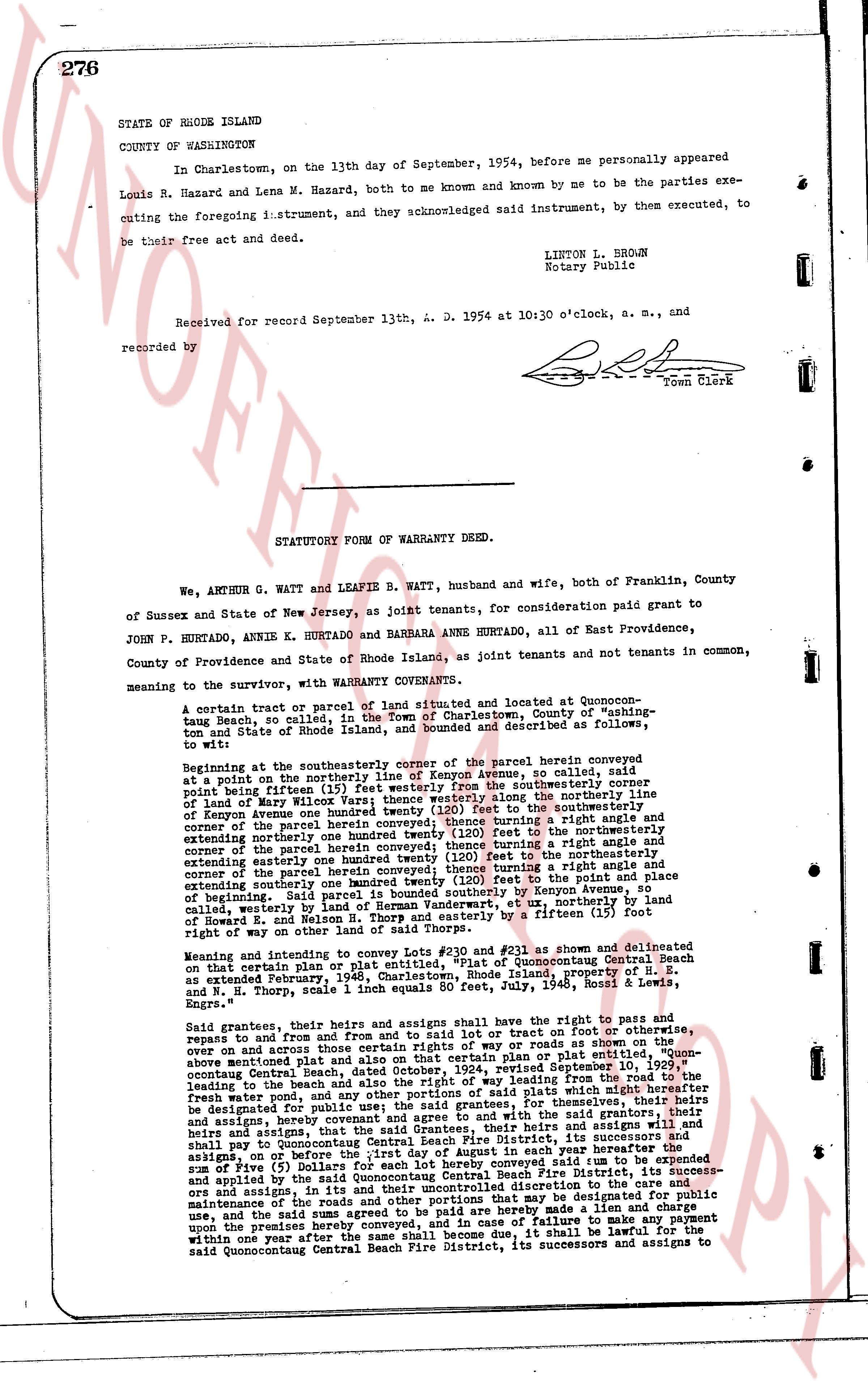
276
STATE OF RHODE ISLAND
COUNTY OF WASHINGTON
In Charlestown, on the 13th day of September, 1954, before me personally appeared Louis R. Hazard and Lena M. Hazard, both to me known and known by me to be the parties executing the foregoing instrument, and they acknowledged said instrument, by them executed, to be their free act and deed.
LINTON L. BROWN
Notary Public
Received for record September 13th, A. D. 1954 at 10:30 o'clock, a. m., and recorded by [Signature] Town Clerk
----
STATUTORY FORM OF WARRANTY DEED.
We, ANTHONY G. WATT and LEAFIE B. WATT, husband and wife, both of Franklin, County of Sussex and State of New Jersey, as joint tenants, for consideration paid grant to JOHN P. HURTADO, ANNIE K. HURTADO and BARBARA ANNE HURTADO, all of East Providence, County of Providence and State of Rhode Island, as joint tenants and not tenants in common, meaning to the survivor, with WARRANTY CONVEYANCE.
A certain tract or parcel of land situated and delineated at Quonocuton-
Tannis Beach, so called, in the Town of Charlestown, County of "ashing-
ton and State of Rhode Island, and bounded and described as follows,
to wit:
Beginning at the southeasterly corner of the parcel herein conveyed, commencing
at a point on the northerly line of Kenyon Avenue, we called, said
point being fifteen (15) feet east of the southeasterly corner
of land of Mary Wilcox Viers; thence westerly along the northerly line
of Kenyon Avenue the distance of 100 feet to the northeasterly
corner of the parcel herein conveyed; thence turning a right angle and
extending northerly the distance of 100 feet to the northeasterly
corner of the parcel herein conveyed; thence turning a right angle and
extending easterly one hundred (100) feet to the northeasterly
corner of the parcel herein conveyed; thence turning a right angle and
extending southerly one hundred twenty one (121) feet to the line of
beginning said line running parallel and southerly by Kenyon Avenue, so
called, westerly by land of Herman Vandermaten et al., easterly by the land
of Edward B. Wilson and southerly partly by a fifteen (15) foot
right of way on other land of said Thorp.
Meaning and intending to convey and lots No #230 and #231 as shown and delineated
on that certain plan or plat made for said lot at Quonocutong Central Beach
as extended February, 1948, Charlestown, Rhode Island, property of H. E.
and N. Thorp, scale 1 inch equals 50 feet, July, 1948, signed "H. E. &
Engrs."
Said grantees, their heirs and assigns shall have the right to repair and paths and
repass to and from the highway and to erect sheds to lay track or root on other footage, or
over on and across other than those certain rights of way or roads as mentioned
above the mentioned plat and also on that certain plan or plat entitled "Quonocuton
Central Beach, made and filed in the town records revised September 10, 1929," the
leading to the beach and also the right of way leading to the beach which might hereafter
be designated for public use, the said grantees, for themselves, their heirs and assigns,
and by reference to and from the plan or plat above mentioned, the said grantees, their
heirs and assigns, that the said Grantees, their heirs and assigns will assign and
shall pay to Quonocutong Central Beach Fire District, its successors and assigns,
on or before the first day of August in each year thereafter the
sum of Five ($) Dollars to the said Quonocutong Central Beach Fire District, to be expended
and applied by the said Quonocutong Central Beach Fire District, its successors and
assigns, in its discretion for the care, maintenance and supervision of the roads and
maintenance of the Common and other portions that may be designated for public
use, and the said sums agreed to be paid are hereby agreed to be a lien and encumbrance
upon the premises herein conveyed, and in case of failure to make any payment
within one year after the same shall become due, it shall be lawful for the
said Quonocutong Central Beach Fire District, its successors and assigns to seize
The page as recorded