The instrument's own words
page 1 · read by Gemma vision
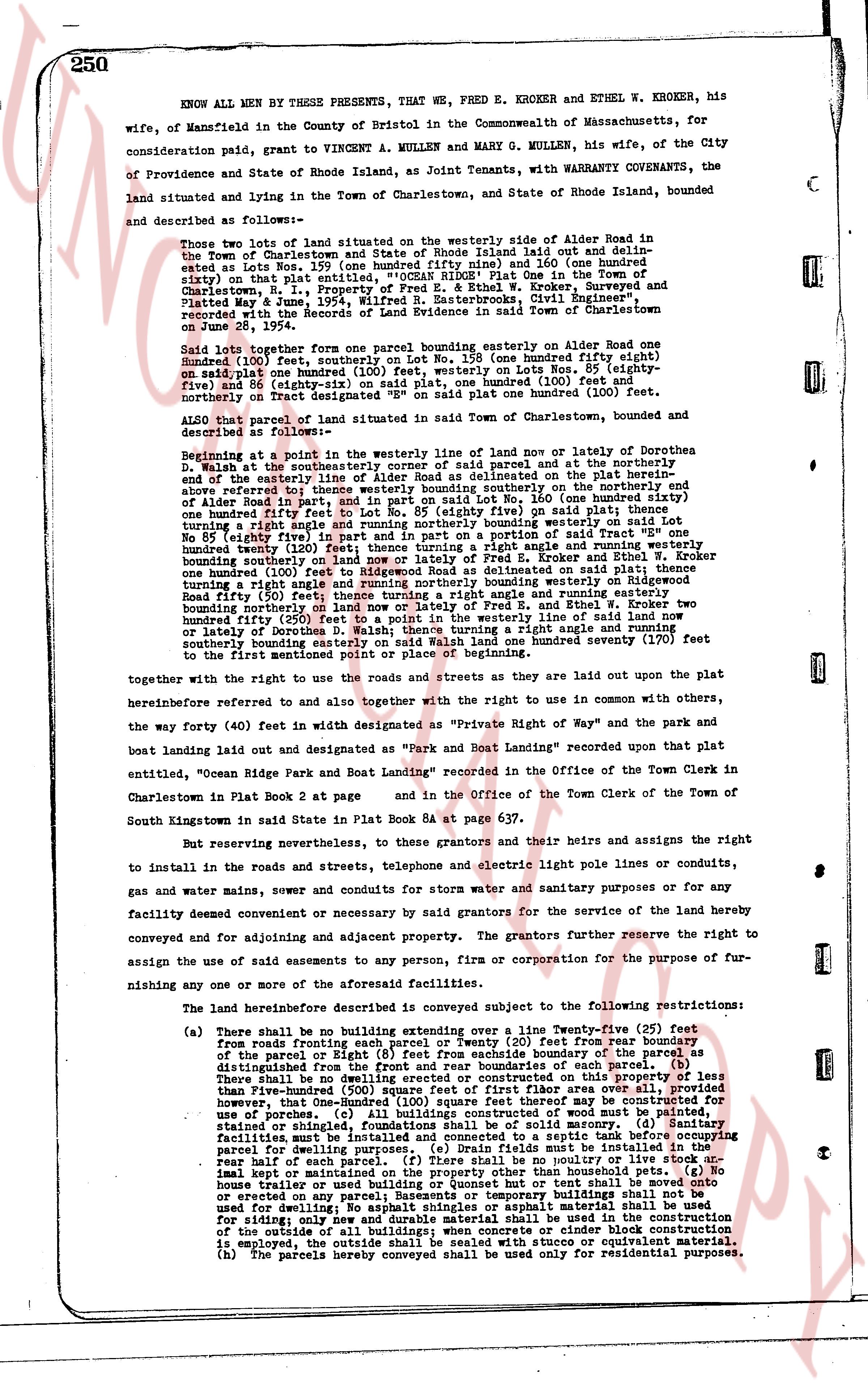
250
KNOW ALL MEN BY THESE PRESENTS, that WE, FRED E. KROKER and ETHEL W. KROKER, his wife, of Mansfield in the County of Bristol in the Commonwealth of Massachusetts, for consideration paid, grant to VINCENT A. MULLEN and Mary G. MULLEN, his wife, of the City of Providence and State of Rhode Island as Joint Tenants, with WARRANTY COVENANTS, the land situated and lying in the Town of Charlestown, and State of Rhode Island, bounded and described as follows:—
Those two lots of land situated on the wide westerly side of Alder Road in the Town of Charlestown and State of Rhode Island laid out and designated as Lot No. 58 (fifty eight) and Lot No. 59 (fifty nine) and Lot 160 (one hundred and sixty) on that plat entitled, "OCEAN RIDGE Plot One in the Town of Charlestown, R. I.," Property of the Estate of Paul V. Rhodes, surveyed and platted May 4, 1936, by "George R. Easterbrooks, Civil Engineer", recorded with the Records of the Land Evidence in said Town of Charlestown on June 21, 1936.
Said lots together form one parcel bounding easterly on Alder Road one Hundred (100) feet, southerly on Lot No. 158 (one hundred fifty eight) ninety five (95) and eighty six (86) on said plat, westerly on Lots No. 159 (one hundred fifty nine) and 86 (eighty six) on said plat, one Hundred (100) feet and northerly on Tract Designated as "SP 8" on said plat one Hundred (100) feet.
ALSO a parcel of land situated in said Town of Charlestown and described as follows:—
Beginning at a point in the westerly line of surname of land now or lately of Northerna D. Walsh at the southeasterly corner of said parcel and at the northerly end of the easterly line of Alder Road as delineated on the plat herein before mentioned and thence southerly bounding on the southerly end of the above referred to one hundred fifty feet to Lot No. 160 (one hundred sixty) one hundred fifty feet to Lot No. 85 (eighty five) on said plat; thence turning a right angle westerly one hundred feet and in part and in portion on a said Tract "SP 8" one hundred eighty (180) feet and thence turning a right angle northerly one hundred feet bounding southerly on land now or lately of Fred E. Kroker and Ethel W. Kroker one hundred twenty (120) feet and thence turning a right angle easterly on said plat one hundred (100) feet and thence turning a right angle and rounding northerly bounding westerly on Rhode Island Road fifty (50) feet; thence turning a right angle easterly on land now or lately of Fred E. and Ethel W. Kroker two hundred fifty (250) feet to a point in the westerly line of said land now or lately of portion of a surname of land; thence turning a right angle and rounding southerly southerly bounding easterly on said Walsh land one hundred seventy (170) feet and thence westerly on Alder Road one hundred (100) feet to the point of beginning.
together with the right to use the roads and streets as they are laid out upon the plat hereinbefore referred to and also together with the right to use in common with others, the way forty (40) feet in width designated as "Private Right of Way" and the park and boat landing laid out and designated as "Park and Boat Landing" recorded upon that plat entitled, "Ocean Ridge Plot and Boat Landing" recorded in the Office of the Town Clerk in Charlestown in Plat Book 2 at page and in the Office of the Town Clerk of the Town of South Kingstown in said State in Plat Book 5A at page 637.
But in reserving nevertheless, to these grantors and their heirs and assigns the right to install in the roads and streets, telephone and electric light pole lines or conduits, gas and water mains, sewer and conduits for storm water and sanitary purposes or for any facility deemed convenient or necessary by said grantors for the service of the land hereby conveyed and for adjoining and adjacent property. The grantors further reserve the right to assign the use of said easements to any person, firm or corporation for the purpose of furnishing any one of the above or for related facilities.
The land hereinbefore described is conveyed subject to the following restrictions:
(a) There shall be no building extended over a line Twenty-five (25) feet from roads fronting each parcel or Twenty (20) feet from rear boundary of the parcel or Right of Way and no building shall extend beyond the boundary as distinguished from the front and rear boundaries of each parcel. (b) There shall be no building erected or placed on the property without a basement of less than Five-hundred (500) square feet of first floor area over all, provided however, that One-Hundred (100) square feet thereof may be above the ground for use of a porch. (c) The exterior of any building of wood must be painted, stained or shingled, foundations shall be of solid masonry. (d) Sanitary facilities must be of the most approved type. (e) No laundry or oil tank shall be kept or maintained on the property other than household pets. (g) No house or other building shall be used as a garage or tent shall be erected or erected on any parcel; Basements or temporary buildings shall not be used for dwelling purposes. (f) All exterior material shall be used for siding; only new and durable material shall be used in the construction of the outside of all buildings; when concrete or cinder block construction is employed, the outside shall be finished with a stucco or equivalent material. (h) The parcels hereby conveyed shall be used only for residential purposes.
page 2 · read by Gemma vision
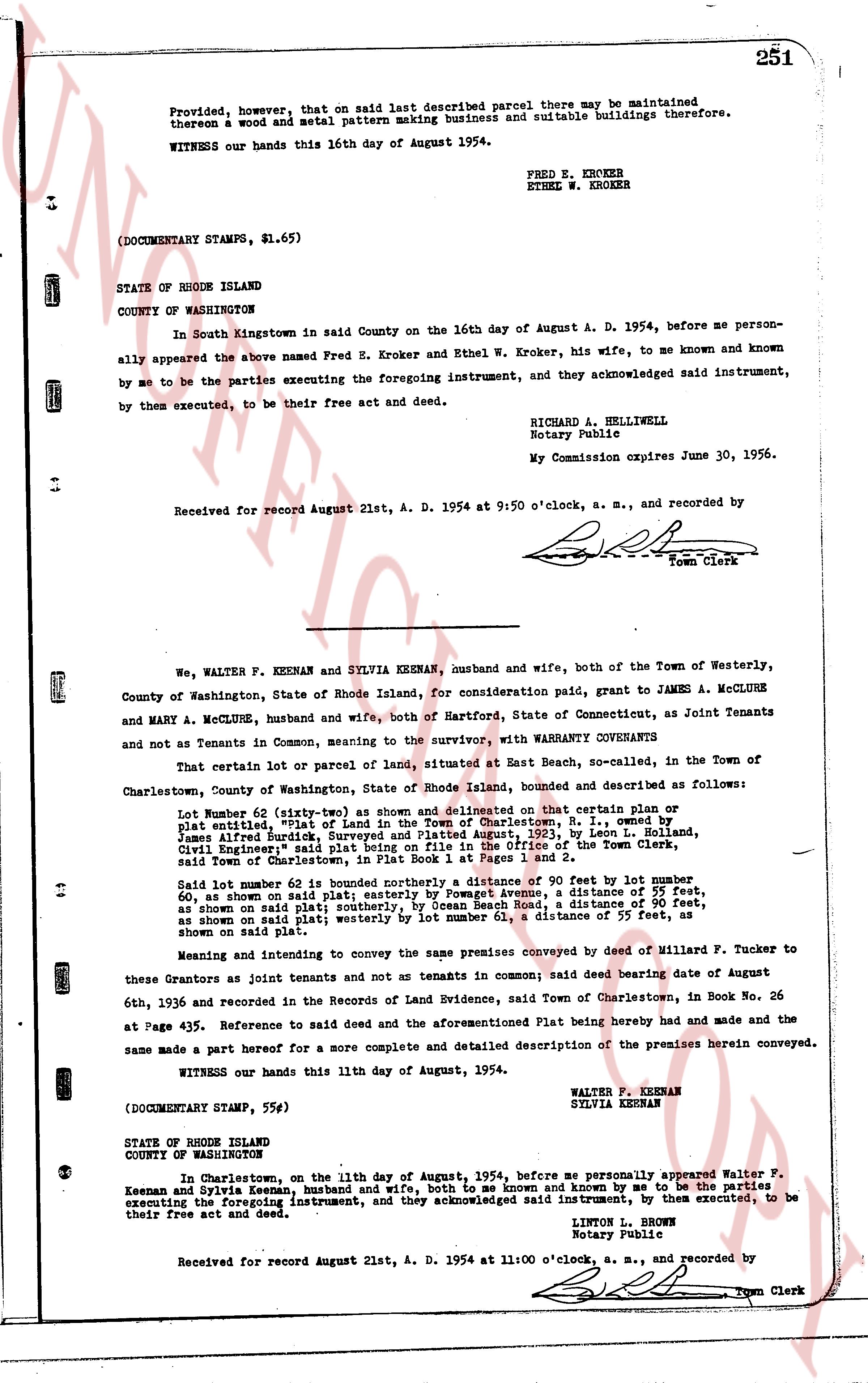
Provided, however, that on that said last described parcel there may be maintained
thereon a wood and metal pattern making business and suitable buildings therefore.
WITNESS our hands this 16th day of August 1954.
FRED E. KROKER
ETHEL W. KROKER
(DOCUMENTARY STAMPS, $1.65)
STATE OF RHODE ISLAND
COUNTY OF WASHINGTON
In South Kingstown in said County on the 16th day of August A. D. 1954, before me person-
ally appeared the above named Fred E. Kroker and Ethel W. Kroker, his wife, to me known and known
by me to be the parties executing the foregoing instrument, and they acknowledged said instrument,
by them executed, to be their free act and deed.
RICHARD A. HELLIWELL
Notary Public
My Commission expires June 30, 1956.
Received for record August 21st, A. D. 1954 at 9:50 o'clock, a. m., and recorded by
[Signature]
Town Clerk
----
We, WALTER F. KEENAN and SYLVIA KEENAN, husband and wife, both of the Town of Westerly,
County of Washington, State of Rhode Island, for consideration paid, grant to JAMES A. MCCLURE
and MARY A. MCCLURE, husband and wife, both of Hartford, State of Connecticut, as Joint Tenants
and not as Tenants in Common, meaning to the survivor, with WARRANTY CONVEYANTS
That certain lot or parcel of land, situated at East Beach, so-called, in the Town of
Charlestown, County of Washington, State of Rhode Island, bounded and described as follows:
Lot Number 62 (sixty-two) as shown and delineated on that certain plan or
cp entitled "Plat of Land in the Town of Charlestown, R. I." drawn by
James Alfred Russell surveying engineer in August, 1932, by Leon L. Holland,
Civil Engineer", said plat being on file in the Office of the Town Clerk,
said Town of Charlestown, in Plat Book 1 at Pages 1 and 2.
Said lot number 62 is bounded northerly a distance of 90 feet by lot number
60, as shown on said plat, easterly by the beach or shore, a distance of 55 feet,
as shown on said plat, southerly, by Ocean Beach Road, a distance of 90 feet,
as shown on said plat, westerly by lot number 63, a distance of 55 feet, as
shown on said plat.
Meaning and intending to convey the same premises conveyed by deed of Millard F. Tucker to
these Grantors as joint tenants and not as tenants in common said deed bearing date of August 6th,
1936 and recorded in the Records of Land Evidence, said Town of Charlestown, in Book No. 26
at Page 435. Reference to said deed and the aforementioned Plat being hereby made and had and the
same made a part hereof for a more complete and detailed description of the premises herein conveyed.
WITNESS our hands this 11th day of August, 1954.
WALTER F. KEENAN
SYLVIA KEENAN
(DOCUMENTARY STAMP, 55¢)
STATE OF RHODE ISLAND
COUNTY OF WASHINGTON
In Charlestown, on the 11th day of August, 1954, before me personally appeared Walter F.
Keenan and Sylvia Keenan, husband and wife, both to me as known and known by me to be the parties
executing the foregoing instrument, and they acknowledged said instrument, to be executed, to be
their free act and deed.
LINTON L. BROWN
Notary Public
Received for record August 21st, A. D. 1954 at 11:00 o'clock, a. m., and recorded by
[Signature]
Town Clerk
The page as recorded