The instrument's own words
page 1 · read by Gemma vision
244
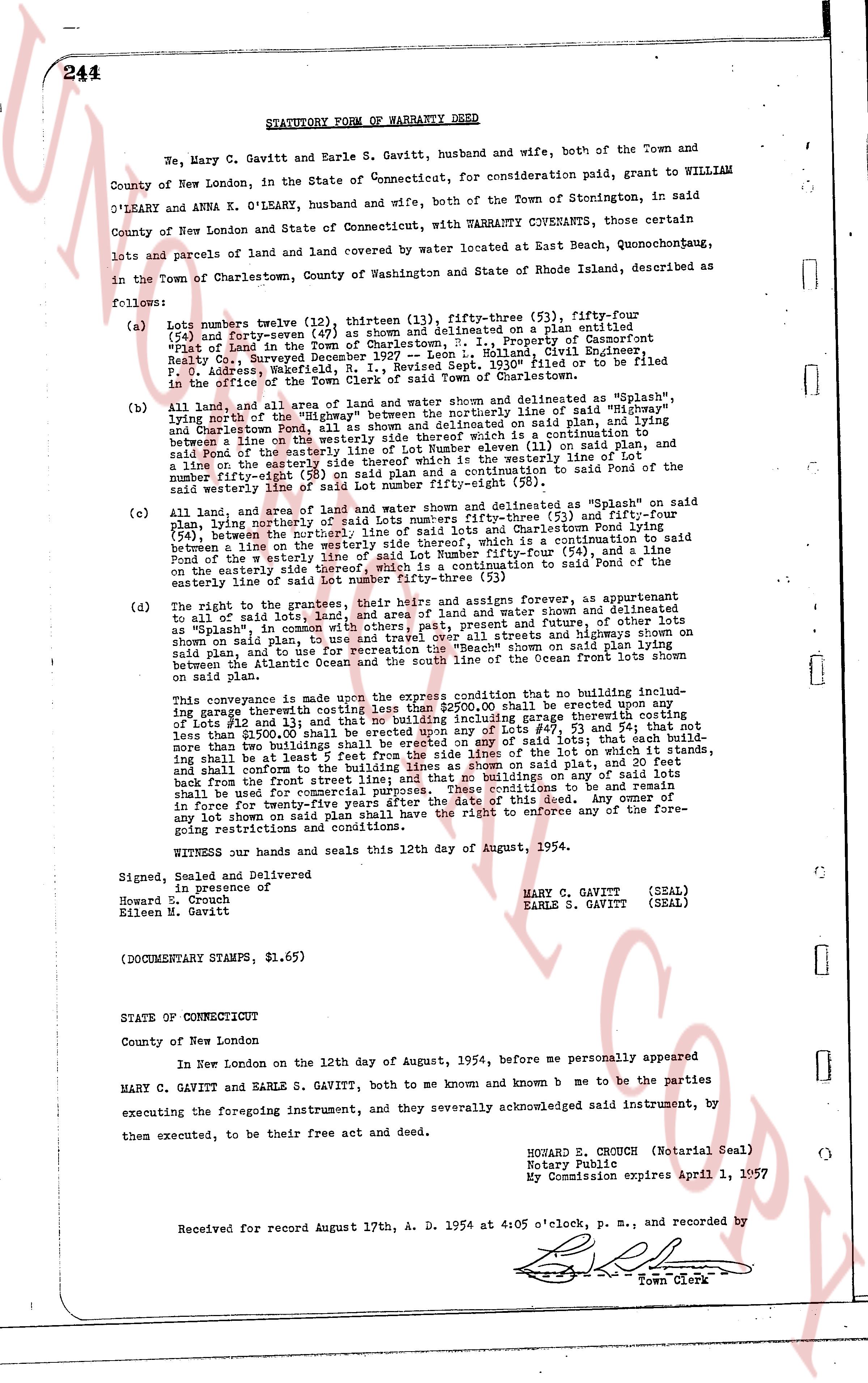
STATUTORY FORM OF WARRANTY DEED
We, Mary C. Gavitt and Earle S. Gavitt, husband and wife, both of the Town and County of New London, in the State of Connecticut, for consideration paid, grant to WILLIAM OLEARY and ANNA K. OLEARY, husband and wife, both of the Town of Stonington, in said County of New London and State of Connecticut, with WARRANTY COVENANTS, those certain lots and parcels of land and land covered by water locate at East Beach, Quonochontochong, in the Town of Charlestown, County of Washington and State of Rhode Island, described as follows:
(a) Lots numbers twelve (12), thirteen (13), fifty-three (53), fifty-four (54) and fifty-seven (57) as shown and delineated on a plan entitled "Plot of Land in the Town of Charlestown, R. I." in Property of Casimirot Field, Really Conv. Surveyed December 1927, by A. Casimirot Field, Civil Engineer, P.O. Address, Westerly, R.I. Revised Sept. 1930* filed or to be filed in the office of the Town Clerk of said Town of Charlestown.
(b) All land, and all area of land and water shown and delineated as "Splash" lying south of the westerly line of Lot number eleven (11) and the line of "High Bridge" and Charlestown Pond, all as shown and delineated on said plan, and lying between a line on the easterly side of Lot number eleven (11) which is a continuation to said Pond of the easterly line of the westerly boundary line of Lot number eleven (11) on said plan, and a line on the easterly side of Lot number twelve (12) the westerly line of Lot number fifty-eight (58) on said plan and a continuation to said Pond of the said westerly line of said Lot number fifty-eight (58).
(c) All land, and all area of land and water shown and delineated as "Splash" on said plan, lying northerly, westerly and southerly of lots numbers fifty-three (53) and fifty-four (54) plan, lying northerly, westerly and southerly, line of said lots and Charlestown Pond lying between a line on the easterly side of Lot number fifty-two (52) which is a continuation to said Pond of the w easterly line of said Lot number Fifty-four (54), and a line on the westerly side of Lot number fifty-seven (57) a continuation to said Pond of the easterly side line of said Lot number fifty-three (53) there-by.
(d) The right to the grantees, their heirs and assigns forever and appurtenant, as appurtenances to all said lots, all land, and all area of land and water shown and delineated as "Splash", in common with others, past, present and future, of egress and ingress to said plan, and the right to use the "Beach" shown on said plan lying between the Atlantic Ocean and the south line of the Ocean front Lots shown on said plan.
This conveyance is made upon the express condition that no building including garage therwith costing less than $2500.00 shall be erected upon any of lots fifty-three (53) and fifty-four (54) and no building including garage therwith costing less than $2500.00 shall be erected upon any of Lots 57, 53 and 54, but that each building shall cost not less than $2500.00 to be erected on said lots; that each building shall be at least 5 feet from the side lines of the lot on which it stands, and shall conform to the building lines shown on said plan, and shall be set back 50 feet back from the front street line; and that no buildings on any of said lots shall be used for commercial purposes or for concessions to be run, and this shall be in force for twenty-five years after the date of this deed. Any owner of any lot shown on said plan shall have the right to enforce any of the foregoing restrictions and conditions.
WITNESS our hands and seals this 12th day of August, 1954.
Signed, Sealed and Delivered
in presence of
Howard E. Crouch
Eileen M. Gavitt
MARY C. GAVITT (SEAL)
EARLE S. GAVITT (SEAL)
(DOCUMENTARY STAMPS, $1.65)
STATE OF CONNECTICUT
County of New London
In New London on the 12th day of August, 1954, before me personally appeared
MARY C. GAVITT and EARLE S. GAVITT, both to me known and known b me to be the parties executing the foregoing instrument, and they severally acknowledged said instrument by, them executed, to be their free and deed act.
HOWARD E. CROUCH (Notarial Seal)
Notary Public
My Commission expires April 1, 1957
Received for record August 17th, A. D. 1954 at 4:05 o'clock, p. m., and recorded by
[Signature]
Town Clerk
The page as recorded