The instrument's own words
page 1 · read by Gemma vision
204
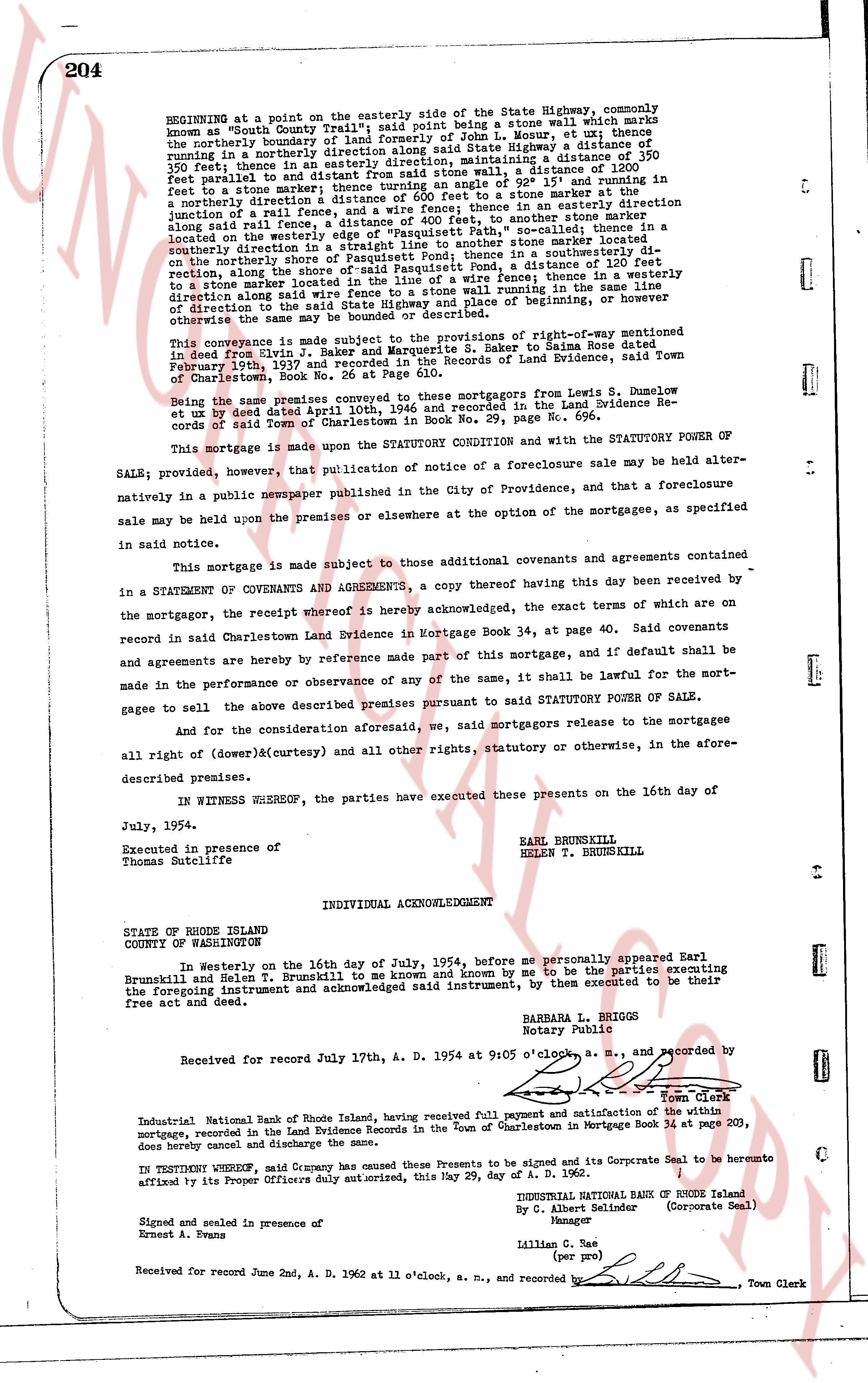
BEGINNING at a point on the easterly side of the State Highway, commonly known as "South County Trail" said point being a stone wall which marks the northerly boundary of lot 10, plat 2, Town of Charlestown, or ut thence southerly a short distance along said State Highway a distance of 150 feet; thence in an easterly direction, maintaining a distance of 1200 feet parallel to said State Highway to a stone wall; thence in a northerly direction to a stone marker; then turning an angle of 92° 15' and running in a northerly direction a short distance to a stone wall; thence in a northerly direction to a rail fence, and a wire fence; thence in an easterly direction along said rail fence, a distance of 100 feet, to another stone marker located on the northerly boundary of "Pasquisset Path," so-called, thence in a southerly direction the shortest line between said stone marker located on the northerly boundary of the shore of Pasquisset Pond, thence in a southwesterly direction, along the shore of said Pasquisset Pond, a distance of 130 feet to a stone wall; thence along said stone wall to a fence; thence in a westerly direction along said wire fence to a stone wall running in the same direction as the State Highway; and thence northerly along said boundary or however otherwise the same may be bounded or described.
This conveyance is made subject to the provisions of the rights-of-way mentioned in deed dated Feb 2, 1911 from George W. Baker, to S. Saker a dime Raise dated February 10th, 1937 and recorded in the Records of Land Evidence, said Town of Charlestown, Book No. 26 at Page 61.
Being the same premises conveyed, these mortgagors from Lewis S. Dumelow et ux by deed dated April 12, 1944, 1946 and recorded in the Land Evidence Records of said Town of Charlestown in Book No. 29, page No. 696.
This mortgage is made upon the STATUTORY CONDITION and with the STATUTORY POWER OF SALE; provided, however, that publication of notice of a foreclosure sale may be held alternatively in a public newspaper published in the City of Providence, and that a foreclosure sale may be held upon the premises or elsewhere at the option of the mortgagees, as specified in said notice.
This mortgage is made subject to those additional covenants and agreements contained in a STATEMENT OF COVENANTS AND AGREEMENT, a copy thereof having this day been received by the mortgagor, the receipt whereof is hereby acknowledged, the exact terms of which are on record in said Charlestown Land Evidence in Mortgage Book 34, at page 40. Said covenants and agreements are hereby by reference made part of this mortgage, and if default shall be made in the performance or observance of any of the same, it shall be lawful for the mortgagee to sell the above described premises pursuant to said STATUTORY POWER OF SALE.
And for the consideration aforesaid, we, said mortgagors release to the mortgagees all right of (dower)&(curtesy) and all other rights, statutory or otherwise, in the aforesaid described premises.
IN WITNESS WHEREOF, the parties have executed these presents on the 16th day of July, 1954.
Executed in presence of
Thomas Sutcliffe
EARL BRUNSKILL
HELEN T. BRUNSKILL
INDIVIDUAL ACKNOWLEDGMENT
STATE OF RHODE ISLAND
COUNTY OF WASHINGTON
In Westerly on the 16th day of July, 1954, before me personally appeared Earl Brunskill and Helen T. Brunskill to me known and known by me to be the parties executing the foregoing instrument and acknowledged said instrument, by their recorded to be their free act and deed.
BARBARA L. HODGES
Notary Public
Received for record July 17th, A. D. 1954 at 9:05 o'clock a. m., and recorded by
Town Clerk
Industrial National Bank of Rhode Island, having received full payment and satisfaction of the within mortgage, recorded in the Land Evidence Records in the Town of Charlestown in Mortgage Book 34 at page 203, does hereby cancel and discharge the same.
IN TESTIMONY WHEREOF, said Company has caused these Presents to be signed and its Corporate Seal to be hereunto affixed by its Proper Officers duly authorized, this May 29, day of A. D. 1962.
INDUSTRIAL NATIONAL BANK OF RHODE ISLAND
By C. Albert Selinder (Corporate Seal)
Manager
Signed and sealed in presence of
Ernest E. Avans
Lillian C. (per pro)
Received for record June 2nd, A. D. 1962 at 11 o'clock, a. m., and recorded by
Town Clerk
The page as recorded