The instrument's own words
page 1 · read by Gemma vision
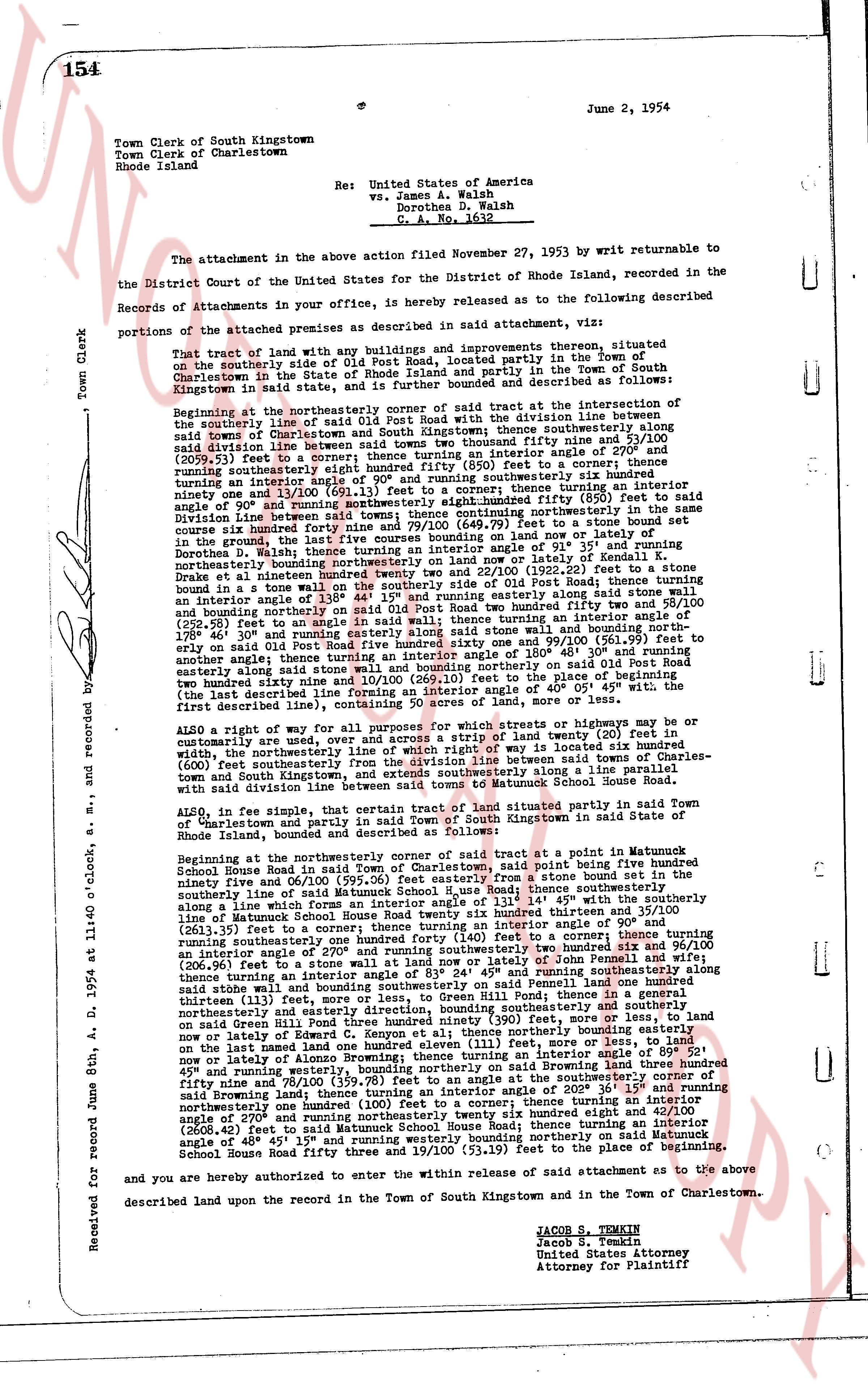
154 June 2, 1954
Town Clerk of South Kingstown
Town Clerk of Charlestown
Rhode Island Re: United States of America
vs. James A. Walsh
Dorothea D. Walsh
C. A. No. 1632
The attachment in the above action filed November 27, 1953 viết by returnable to the
the District Court of the United States for the District of Rhode Island, recorded in the
Records of attachments in your office, is hereby released as to the following described
portions of the attached premises as described in said attachment, viz:
That tract of land with any buildings and improvements thereon, situated
on the southerly side of Old Post Road, located partly in the Town of
Charlestown, County of Washington, and partly in the Town of South
Kingstown in said state, and is further bounded and described as follows:
Beginning at the northwesterly corner of said tract at the intersection of the
southerly line of said Old Post Road and the division line between the Town of
South Kingstown and the Town of Charlestown thence southeasterly along said
division line between said town between two thousand five hundred fifty and 27/100
(2550.27) feet to a corner; thence turning an interior angle of 27° 0' and
(2550.27) feet to a corner; thence turning an interior angle of 115° 30' and running
southeasterly eight hundred eighty first (881) feet to a corner; thence turning an interior
angle of 115° 30' and running southwesterly six hundred sixty nine and 11/100
ninety one and 11/100 (669.11) feet to a corner; thence turning an interior angle
of 115° 30' and running northwesterly eight hundred fifty (850) feet to said
Division Line between said towns; thence continuing northerly in the same course
to the intersection of said Division Line and a stone wall; and thence along said stone
wall in the ground, the last five courses bounding on land now or lately of
Dorothea D. Walsh, northwesterly to the intersection of said stone wall and the
boundary line bounding northerly on the land now or lately of Kenneth S.
Blake in an interior angle of 117° 30' and (507.50) feet to a corner; thence turning
an interior angle of 158° 44' 15" and running southwesterly along said stone
wall and boundary line bounding southerly on land now or lately of
an interior angle of 158° 44' 15" and running southwesterly along said stone
wall and boundary line bounding southerly on land now or lately of
two hundred fifty two and 88/100 (252.88) feet to a corner; thence turning an interior
angle of 158° 44' 15" and running northwesterly along said wall, and bounding north
erly on said Old Post Road five hundred sixty one and 99/100 (561.99) feet to
another angle of 158° 44' 15" and running northwesterly along said stone
wall and boundary line extending wall and boundary northerly on said Old Post Road
Human and boundary line bounding northerly on said Old Post Road
(the last described line forming an interior angle of 40° 05' 45" with the,
the last described line forming, containing 50 acres of land, more or less.
ALSO a right of way for all purposes for which streets or highways may be or
be used, forty feet wide, across a strip of land twenty (20) feet to the
northwest, with the centerline of which line is located six hundred eighty
(680) feet southeasterly of the division line between said towns of Charles-
town and South Kingstown, extending along said road, line parallel to said
road, and extending from said road to the Matunuck School House Road.
ALSO, in fee simple, that certain tract of land situated partly in said Town
of Charlestown and partly in said Town of South Kingstown in said State of
Rhode Island, and further bounded and described as follows:
Beginning at the northwesterly corner of said tract at a point in Matunuck
School House Road in said Town of Charlestown, said point being five hundred
ninety five and 10/100 (595.10) feet from a stone wall and boundary line
southeasterly line of said Matunuck School House Road; thence southeasterly
along a line which forms an interior angle of 117° 30' and 117.4/100 (117.4) feet
southeasterly line of said road; thence east sixty two hundred thirty five and 37/100
(6235.37) feet to a corner; thence turning a southwesterly angle of 117° 30' and
running southwesterly one hundred forty (140) feet to a corner; thence turning
(2613.35) feet to a corner; thence turning an interior angle of 27° 0' and
(200.91) feet to a corner; thence turning an interior angle of 27° 0' and
an interior angle of 270° and running southeasterly 117.4/100 (117.4) feet to the
intersection of said stone wall and boundary line of John Pennell and wife;
thence turning an interior angle of 83° 27' 45" and running southeasterly along
said boundary line of John Pennell and wife five hundred twenty one and
thirteen (113) feet, more or less, to the stone wall, Green Hill Pond; thence in a
general westerly direction along said stone wall and boundary line bounding
on said Green Hill Pond one hundred ninety three (193) feet, more or less, to
land now or lately of the United States, thence northerly bounding on
on the land now or lately one hundred eleven (111) feet, more or less, to
land now or lately of James A. Walsh in an interior angle of 117° 30' and
45° and running northerly on said boundary on said Brownland three hundred
ninety seven and 70/100 (397.70) feet to an angle of 202° 36' 15" and running
northeasterly one hundred (100) feet to a corner; thence turning an interior
angle of 117° 30' and running northwesterly three hundred eight and 42/100
(2608.42) feet to said Matunuck School House Road; thence turning an interior
angle of 117° 30' and running northwesterly along said road northerly on Matunuck
School House Road fifty three and 19/100 (53.19) feet to the place of beginning.
and are you hereby entered to the within release of said attachment as to the above
described land upon the record in the Town of South Kingstown and in the Town of Charlestown.
JACOB S. TEMKIN
Jacob S. Temkin
United States Attorney
Attorney for Plaintiff
Received for record June 8th A. D. 1954 at 11:40 o'clock, and s. and recorded by me.
The page as recorded