The instrument's own words
page 1 · read by Gemma vision
152
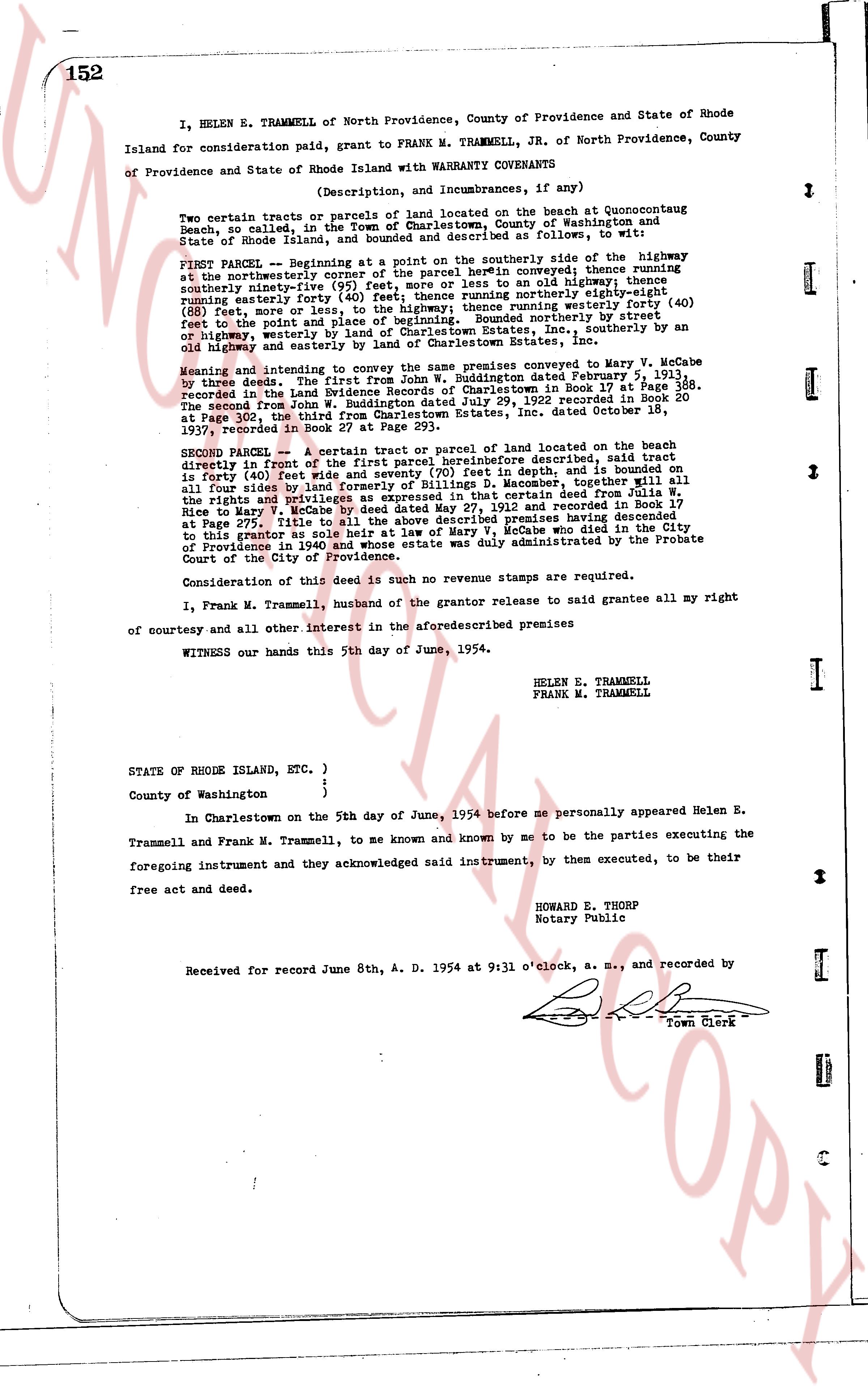
I, HELEN E. TRAMMELL of North Providence, County of Providence and State of Rhode Island for consideration paid, grant to FRANK M. TRAMMELL, JR. of North Providence, County of Providence and State of Rhode Island with WARRANTY COVENANTS as follows:
(Description, and Incumbrances, if any)
Two certain parcels or tracts of parcels of land located on the beach at Quonsetucong Beach, so called, in the Town of Charlestown, County of Washington and State of Rhode Island, and more fully described as follows, to wit:
FIRST PARCEL -- Beginning at a point on the southerly side of the highway at the northeasterly corner of the facet of the parcel herein conveyed; thence running southerly ninety-five (95) feet more or less to a point on an old highway; thence running easterly forty (40) feet; thence running northerly forty-eight (48) feet more or less to a point on said highway; thence running westerly forty (40) feet to the point and place of beginning. Bounded rounded by northerly street or highway, westerly by land of [?] [?], easterly, by southerly on an old highway and easterly by land of Charlestown Estates, Inc.
Meaning and intending to convey the same premises conveyed to Mary V. McCabe by three deeds. The first from John W. Buddington dated February 5, 1913, recorded in the Land Evidence Records of Charlestown, in Book 17 at Page 588. The second from John W. Buddington dated July 29, 1922 recorded in Book 20 at Page 195, third from John W. Buddington and his heirs, dated November 15, 1937, recorded in Book 27 at Page 293.
SECOND PARCEL -- A certain tract or parcel of land located on the beach directly in front of the first parcel hereinbefore described, said tract is forty (40) feet wide and seventy (70) feet in depth, it bounded on the north by all four sides by land of Frank M. Trammell, together with all the rights and privileges as expressed in that certain deed from Julia W. Rice to Mary V. McCabe dated July 29, 1922 and recorded in Book 17 at Page 275, title to all the above described premises having descended to this grantor as sole heir at law of Mary V. McCabe who died in the City of Providence in 1940 and whose estate was duly administered by the Probate Court of the City of Providence.
Consideration of this deed is such no revenue stamps are required.
I, Frank M. Trammell, husband of the grantor release to said grantee all my right of courtesy and all other interest in the aforesaid premises
WITNESS our hands this 5th day of June, 1954.
HELEN E. TRAMMELL
FRANK M. TRAMMELL
STATE OF RHODE ISLAND, ETC.)
)
County of Washington }
In Charlestown on the 5th day of June, 1954 before me personally appeared Helen E. Trammell and Frank M. Trammell, to me known and known by me to be the parties executing the foregoing instrument and they acknowledged said instrument, by them executed, to be their free act and deed.
HOWARD E. THORP
Notary Public
Received for record June 8th, A. D. 1954 at 9:31 o'clock, a. m., and recorded by
[Signature] Town Clerk
The page as recorded