The instrument's own words
page 1 · read by Gemma vision
115
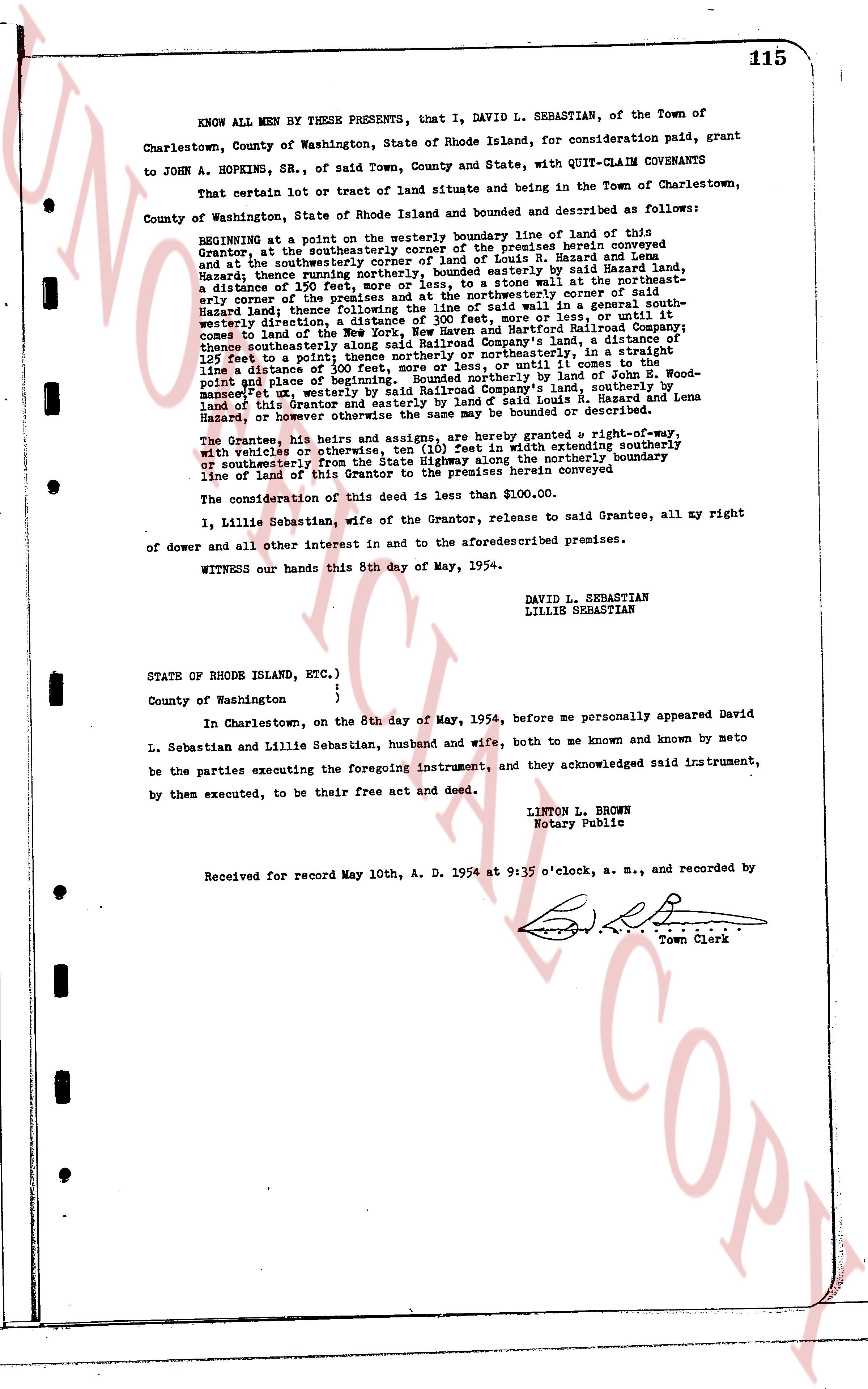
KNOW ALL MEN BY THESE PRESENTS, that I, DAVID L. SEBASTIAN, of the Town of Charlestown, County of Washington, State of Rhode Island, for consideration paid, grant to JOHN A. HOPKINS, SR., of said Town, County and State, with QUIT-CLAIM COVENANTS
That certain lot or tract of land situate and being in the Town of Charlestown, County of Washington, State of Rhode Island and bounded and described as follows:
BEGINNING at a point on the westerly boundary line of a stone wall at the northeasterly corner of the southeasterly corner of the premises herein conveyed and at the southeasterly corner of the premises of Louis R. Hazard and Lena Hazard and thence running northerly, bounded easterly by said Hazard land, a distance of 125 feet to a point; thence running easterly to the northeasterly corner of the premises and at the northeasterly corner of said Hazard land, thence following said stone wall in a general north easterly direction, a distance of 150 feet to a point; said wall in a general north westerly direction, a distance of 300 feet, more or less, or until it comes to the line of the New England Telephone and Telegraph Mutual Insurance Company comes to the land of the New England Telephone and Telegraph Mutual Insurance Company along said Railroad Company's land, a distance of 125 feet to a point; thence northerly, bounded northeasterly, in a straight line a distance of 300 feet, more or less, or until it comes to the line of a distance of 300 feet of beginning, Bounded northerly by land of Wood-point and place of beginning, Bounded northerly by land of John Wood-point and bounded easterly by land of grantor's land, southerly by land of this Grantor and easterly by land of said Louis R. Hazard and Lena Hazard or however otherwise the same be bounded or described.
The Grantee, his heirs and assigns, are hereby granted a right-of-way, with vehicles or otherwise, in a 20 foot wide path with extending southerly southerly from the premises to State highway along the northerly boundary line of land of this Grantor to the premises herein conveyed
The consideration of this deed is less than $100.00.
I, Lillie Sebastian, wife of the Grantor, release to said Grantee, all my right of dower and all other interest in and to the aforesaid described premises.
WITNESS our hands this 8th day of May, 1954.
DAVID L. SEBASTIAN
LILLIE SEBASTIAN
STATE OF RHODE ISLAND, ETC.)
County of Washington {
}
In Charlestown, on the 8th day of May, 1954, before me personally appeared David L. Sebastian and Lillie Sebastian, husband and wife, both to me known and known by me to be the parties executing the foregoing instrument, and they acknowledged said instrument, by them executed, to be their free act and deed.
LINTON L. BROWN
Notary Public
Received for record May 10th, A. D. 1954 at 9:35 o'clock, a. m., and recorded by
[Signature]
Town Clerk
The page as recorded