The instrument's own words
page 1 · read by Gemma vision
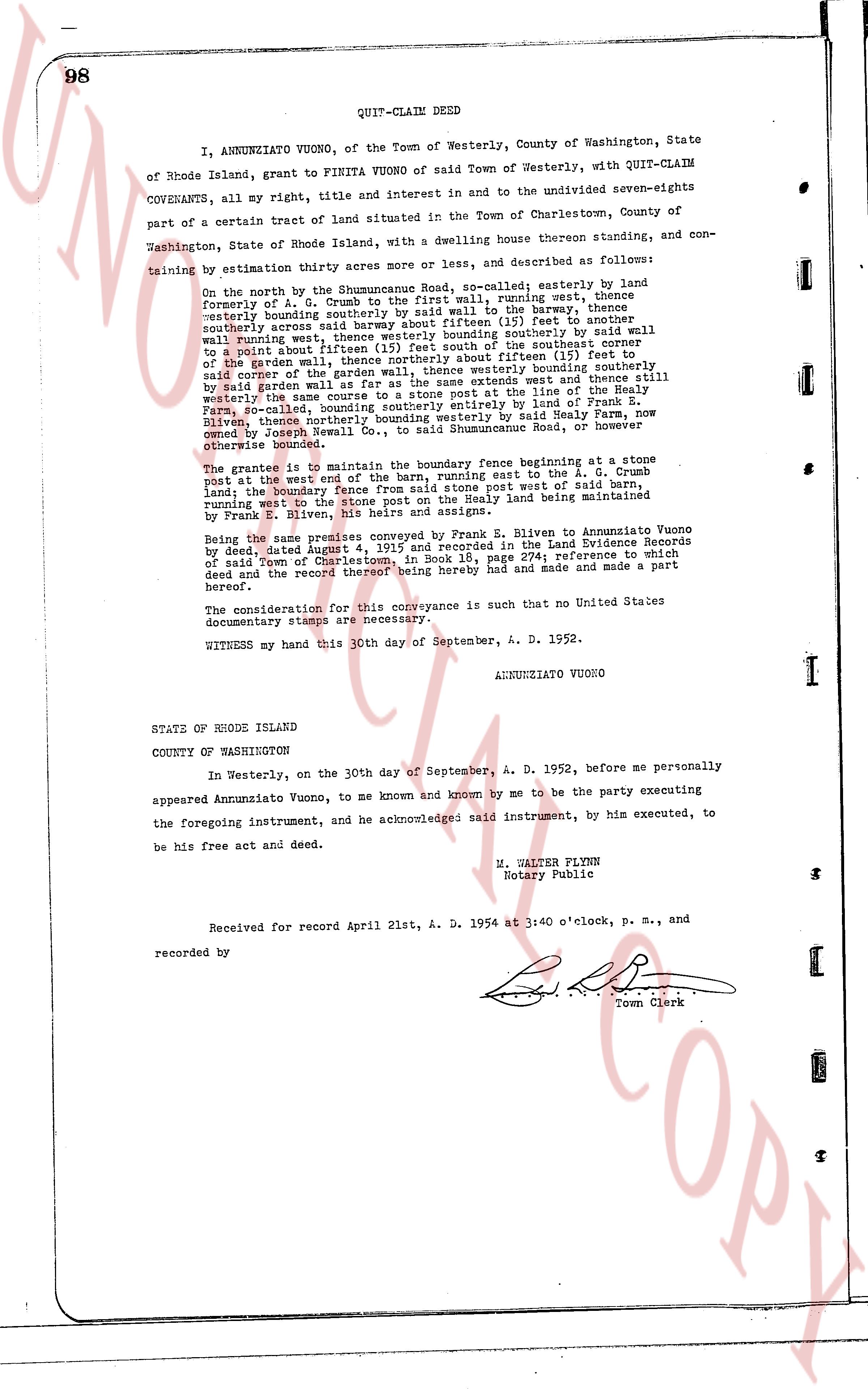
98 QUIT-CLAIM DEED
I, ANNUNZIATO VUONO, of the Town of Westerly, County of Washington, State
of Rhode Island, grant to FINITA VUONO of said Town of Westerly, with QUIT-CLAIM
COVENANTS, all my right, title and interest in and to the undivided seven-eighths
part of a certain tract of land situated in the Town of Charlestown, County of
Washington, State of Rhode Island, with a dwelling house thereon standing, and con-
taining by estimation thirty acres more or less, and described as follows:
On the north by the Shummuncuke Road, so-called; easterly by land
formerly of A. D. Crumb to the first wall, running west, thence
westerly bounding southerly by said wall, to the barn; thence westerly
bounding northerly across said land to a stone post (fifteen ft) thence to another
westerly bounding northerly across said land to the south of the southeast corner
of the garden wall, thence westerly bounding southerly by said wall
to a point about fifteen feet from the south of the southeast corner
of the garden wall, thence northerly about fifteen (15) feet, thence
westerly bounding northerly across said land bounding southerly
by said garden wall as far as the same extends west and thence still
westerly across the remainder of said tract at the line of the Healy
Farm, so-called, bounding southerly entirely by land of Frank E.
Eliven, thence northwardly across said land westerly by said Healy Farm, now
owned by Joseph Newell Co., to said Shummuncuke Road, or however
otherwise bounded.
The grantee is to maintain the boundary fence beginning at a stone
post at the west end of the barn, running east to the A. D. Crumb
land; the boundary fence from A. D. Crumb a stone post west part of said barn
land; the boundary fence from E. Eliven a stone post west part of the Healy land
running west to the Stone wall on the east the Healy land being maintained
by Frank E. Eliven, his heirs and assigns.
Being the same premises conveyed by Frank E. Eliven to Annunziato Vuono
by deed dated August 4, 1924, and recorded in the Land Evidence Records
of said Town of Charlestown, in Book 18, page 274; reference to which
deed and the record thereof being hereby had and made a part
hereof.
The consideration for this conveyance is such that no United States
documentary stamps are necessary.
WITNESS my hand this 30th day of September, A. D. 1952.
ANNUNZIATO VUONO
STATE OF RHODE ISLAND
COUNTY OF WASHINGTON
In Westerly, on the 30th day of September, A. D. 1952, before me personally
appeared Annunziato Vuono, to me known and known by me to be the party executing
the foregoing instrument, and he acknowledged said instrument, by his executed, to
be his free act and deed.
M. WALTER FLYNN
Notary Public
Received for record April 21st, A. D. 1954 at 3:40 o'clock, P. M., and
recorded by
[Signature]
Town Clerk
The page as recorded