The instrument's own words
page 1 · read by Gemma vision
73
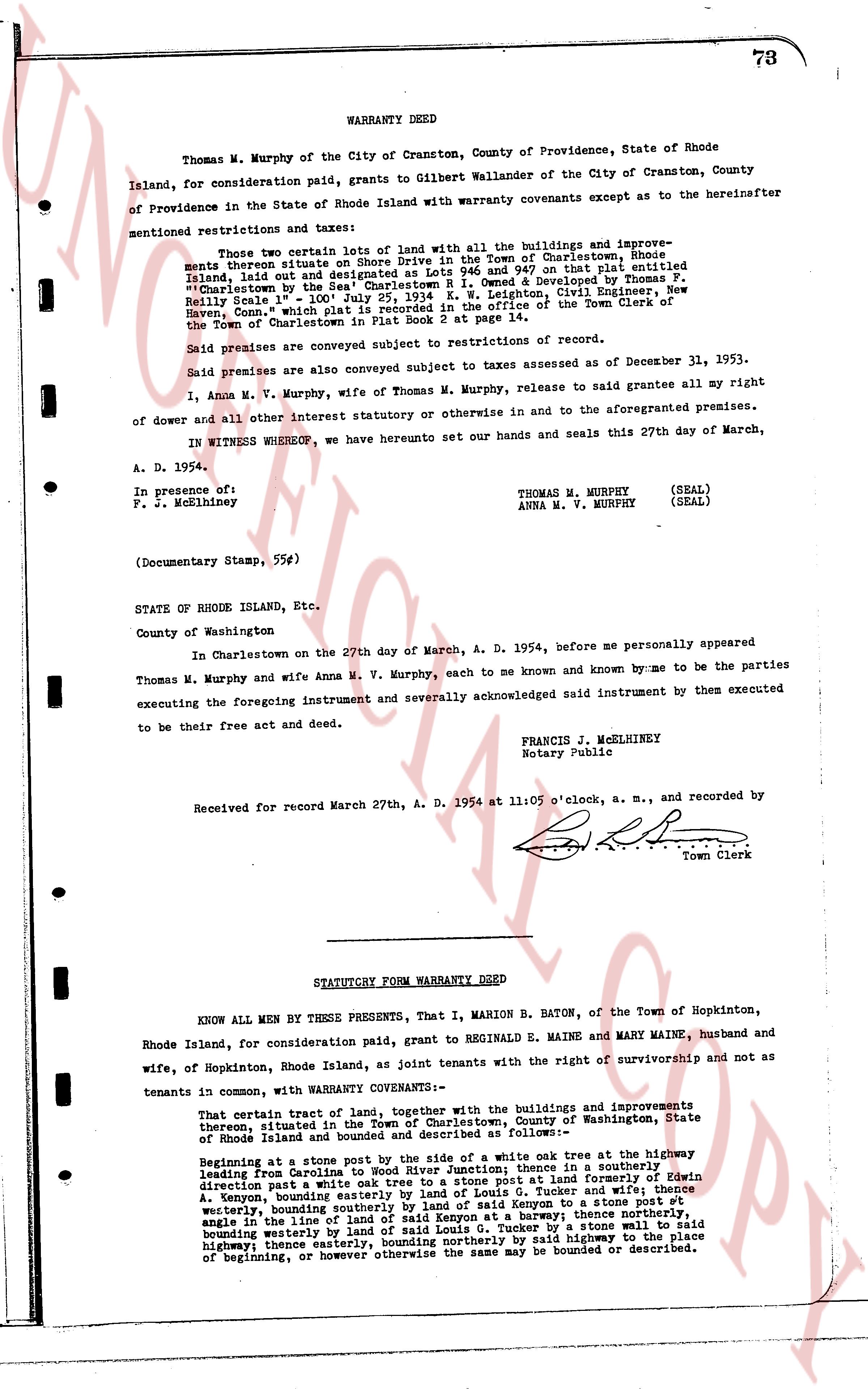
WARRANTY DEED
Thomas M. Murphy of the City of Cranston, County of Providence, State of Rhode Island, for consideration paid, grants to Gilbert Wallander of the City of Cranston, County of Providence in the State of Rhode Island with warranty covenants except as to the hereinafter mentioned restrictions and taxes:
That two 1/2 lots of land with all the buildings and improvements thereon situate on Shore Drive in the Town of Charlestown, Rhode Island, and designated as lots 11 and 12 and/or by a map entitled "Island, laid out by the said Charlestown R. I. owned & developed by Thomas F. Reilly Seal No. 1" July 25, 1934 K. W. Leighton, Civil Engineer, New Haven, Conn." which plat is recorded in the office of the Town Clerk of the Town of Charlestown in Plat Book 2 at page 14.
Said premises are conveyed subject to restrictions of record.
Said premises are also conveyed subject to taxes assessed as of December 31, 1953.
I, Anna M. V. Murphy, wife of Thomas M. Murphy, release to said grantee all my right of dower and all other interest statutory or otherwise in and to the aforementioned premises.
IN WITNESS WHEREOF, we have hereunto set our hands and seals this 27th day of March, A. D. 1954.
In presence of:
F. J. McElhiney
THOMAS M. MURPHY (SEAL)
ANNA M. V. MURPHY (SEAL)
(Documentary Stamp, 55¢)
STATE OF RHODE ISLAND, Etc.
County of Washington
In Charlestown on the 27th day of March, A. D. 1954, before me personally appeared Thomas M. Murphy and wife Anna M. V. Murphy, each to me known and known by me to be the parties executing the foregoing instrument and severally acknowledged said instrument by them executed to be their free act and deed.
FRANCIS J. McELHINEY
Notary Public
Received for record March 27th, A. D. 1954 at 11:05 o'clock, a. m., and recorded by
[Signature]
Town Clerk
----
STATUTORY FORM WARRANTY DEED
KNOW ALL MEN BY THESE PRESENTS, That I, MARION B. BATON, of the Town of Hopkinton, Rhode Island, for consideration paid, grant to REGINALD E. MAINE and MARY MAINE, husband and wife, of Hopkinton, Rhode Island as joint tenants with the right of survivorship and not as tenants in common, with WARRANTY COVENANTS:
That certain tract of land, together with the buildings and improvements thereon situated in the Town of Charlestown, County of Washington, State of Rhode Island and bounded and described as follows:—
Beginning at a stone post by the side of the white oak tree at the highway leading from Warwick St. to the South Section; thence in a southerly direction past a white oak tree to a stone post at land formerly of Edwin A. Kenyon, bounding easterly by land of said Kenyon & Tucker and wife, stone wall, bounding southerly by land of said Kenyon at a stone post vt westerly, bounding westerly by land of said Kenyon at a barway; thence northerly to an angle in the line of land of said Kenyon at a barway; thence northerly to a stone wall, bounding easterly by land of said Kenyon & Tucker by a stone wall to said highway; thence easterly, bounding northerly by said highway to the place of beginning, or however otherwise the same may be bounded or described.
The page as recorded