The instrument's own words
page 1 · read by Gemma vision
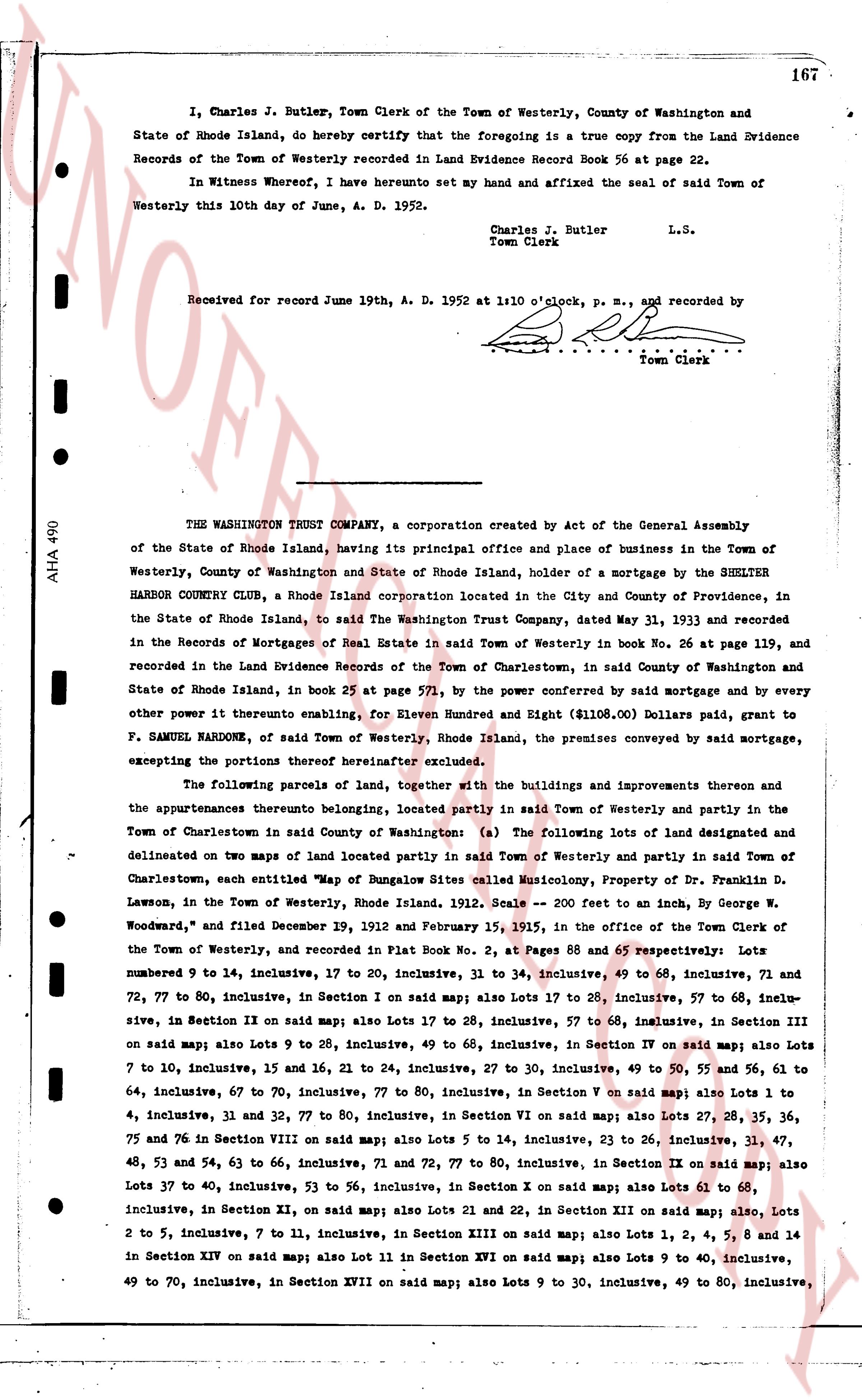
167
I, Charles J. Butler, Town Clerk of the Town of Westerly, County of Washington and State of Rhode Island, do hereby certify that the foregoing is a true copy from the Land Evidence Records of the Town of Westerly recorded in Land Evidence Record Book 56 at page 22.
In Witness whereof, I have hereunto set my hand and affixed the seal of said Town of Westerly this 10th day of June, A. D. 1952.
Charles J. Butler
Town Clerk L.S.
Received for record June 19th, A. D. 1952 at 1:10 o'clock, p. m., and recorded by
[signature]
Town Clerk
----
THE WASHINGTON TRUST COMPANY, a corporation created by Act of the General Assembly of the State of Rhode Island, having its principal office and place of business in the Town of Westerly, County of Washington and State of Rhode Island, holder of a mortgage by the SHELTER HARBOR COUNTRY CLUB, a Rhode Island corporation located in the City and County of Providence, in the State of Rhode Island, to said The Washington Trust Company, dated May 31, 1933 and recorded in the Records of Mortgages of Real Estate in said Town of Westerly in book No. 26 at page 139, and recorded in the Land Evidence Records of the Town of Charlestown, said County of Washington and State of Rhode Island, in book 25 at page 571, by the power conferred by said mortgage and by every other power it thereunto enabling, for Eleven Hundred and Eight ($1108.00) Dollars paid, grant to F. SAMUEL HARDNOW, of said Town of Westerly, Rhode Island, the premises conveyed by said mortgage, excepting the portions therefrom hereinafter excluded.
The following parcels of land, together with the buildings and improvements thereon and the appurtenances thereto belongng, located partly in said Town of Westerly and partly in the Town of Charlestown in said County of Washington (a) The following lots of land designated and delineated on two maps of land located partly in said Town of Westerly and partly in said Town of Charlestown, each entitled "Map of Bungalow Sites called Musicology, Property of Dr. Franklin D. Lawson, in the Town of Westerly, Rhode Island, 1912. Scale 200 feet to an inch, by George W. Woodward," and filed December 19, 1912 and February 15, 1915, in the office of the Town Clerk of the Town of Westerly, and recorded in Plat Book No. 2, at Pages 68 and 65 respectively: Lots numbered 9 to 14, inclusive, 17 to 20, inclusive, 31 to 34, inclusive, 49 to 68, inclusive, 71 and 72, 77 to 80, inclusive, in Section I on said map; also Lots 17 to 28, inclusive, 57 to 68, inclusive, 72 to 77, 80 inclusive, in Section IX on said map; also Lots 17 to 28, inclusive, 57 to 68, inclusive, in Section III on said map; also Lots 9 to 28, inclusive, 49 to 68, inclusive, in Section IV on said map; also Lots 7 to 10, inclusive, 15 and 16, 21 to 24, inclusive, 27 to 30, inclusive, 49 to 50, 55 and 56, 61 to 64, inclusive, 67 to 70, inclusive, 77 to 80, inclusive, in Section V on said map; also Lots 1 to 7, inclusive, 31 and 32, 77 to 80, inclusive, in Section VI on said map; also Lots 27, 28, 35, 36, 78 and 76 in Section VIII on said map; also Lots 5 to 14, inclusive, 23 to 26, inclusive, 31, 47, 48, 53 and 54, 63 to 66, inclusive, 71 and 72, 77 to 80, inclusive, in Section IX on said map; also Lots 37 to 40, inclusive, 53 to 56, inclusive, in Section X on said map; also Lots 61 to 68, inclusive, in Section XI, on said map; also Lots 21 and 22, in Section XII on said map; also, Lots 2 to 5, inclusive, 7 to 11, inclusive, in Section XIII on said map; also Lots 1, 2, 4, 5, 8 and 14 in Section XIV on said map; also Lot 11 in Section XVI on said map; also Lots 9 to 40, inclusive, 49 to 70, inclusive, in Section XVII on said map; also Lots 9 to 30, inclusive, 49 to 80, inclusive,
page 2 · read by Gemma vision
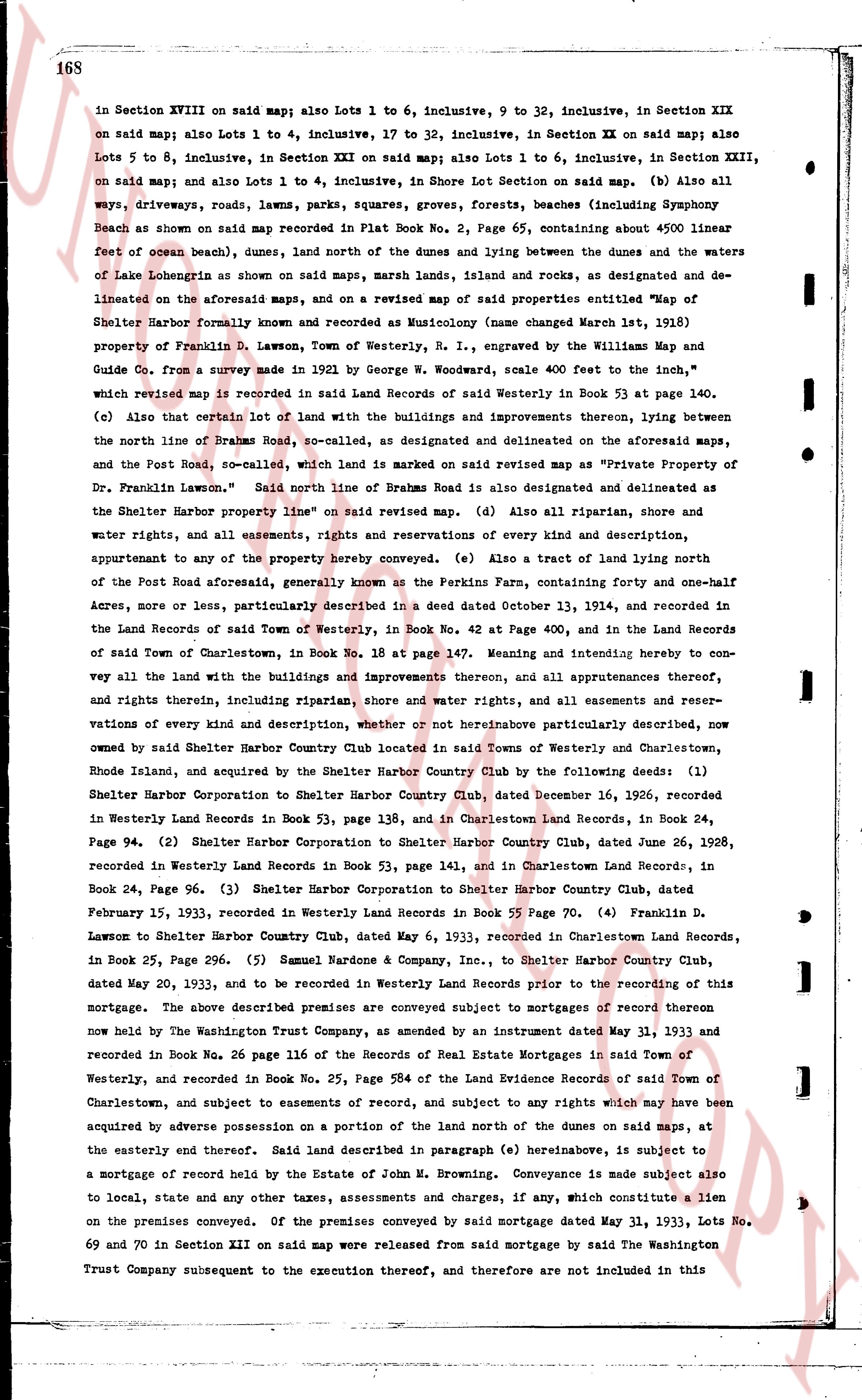
168
in Section XVIII on said map; also Lots 1 to 6, inclusive, 9 to 32, inclusive, in Section XIX on said map; also Lots 1 to 4, inclusive, 17 to 38, inclusive, in Section XX on said map; also Lots 5 to 8, inclusive, in Section XXI on said map; also Lots 1 to 6, inclusive, in Section XXIII, on said map; and also Lots 1 to 4, inclusive, in Shore Lot Section on said map. (b) Also all ways, driveways, roads, lawns, parks, squares, groves, forests, beaches (including Symphony Beach as shown on said map recorded in Plat Book No. 2, Page 65, containing about 4500 linear feet of ocean beach), dunes, land north of the dunes and buying between the dunes and the waters of Lake Lobengrin as shown on said maps, marsh lands, islands and rocks, as designated and delineated on the aforesaid maps, and on a revised map of said properties entitled "Map of Shelter Harbor Formerly known as and recorded as Musicology (name changed March 1st, 1938) property of Franklin D. Lawson, town of Westerly, R. I., engraved by the Williams Map and Guide Co., from a survey made in 1924 by George W. Woodcock, scale 400 feet to the inch," which revised map is recorded in said Land Records of said Westerly in Book 53 at page 140. (c) Also certain that lot of land with the buildings and improvements thereon, lying between the north line of Brahms Road, so-called, as designated and delineated on the aforesaid maps, and the Post Road, so-called, which land is marked on said revised map as "Private Property of Dr. Franklin Lawson." Said north line of Brahmas Road is also designated and delineated as the Shelter Harbor property line on said revised map. (d) Also all riparian, shore and water rights, and all easements, rights and reservations of every kind and description, appurtenant to any of the property hereby conveyed. (e) Also a tract of land lying north of the Post Road aforesaid, generally known as the Perkins Farm, containing forty and one-half acres, more or less, particularly described in a deed dated October 13, 1914, and recorded in the Land Records of said Town of Westerly, in Book No. 42 at Page 400, and in the Land Records of said Town of Charlestown, in Book No. 18 at page 147. Meaning and intending hereby to convey all the land with the buildings and improvements thereon, and all appurtenances thereto, and rights therein, including riparian, shore and water rights, and all easements and reservations of every kind and description, whether or not hereinabove particularly described, now owned by said Shelter Harbor Country Club located in said Towns of Westerly and Charlestown, Rhode Island, and acquired by the Shelter Harbor Country Club by the following deeds: (1) Shelter Harbor Corporation to Shelter Harbor Country Club, dated December 16, 1926, recorded in Westerly Land Records in Book 53, page 138, and in Charlestown Land Records, in Book 24, Page 94. (2) Shelter Harbor Corporation to Shelter Harbor Country Club, dated June 26, 1928, recorded in Westerly Land Records in Book 53, page 141, and in Charlestown Land Records, in Book 24, Page 94. (3) Shelter Harbor Corporation to Shelter Harbor Country Club, dated February 15, 1933, recorded in Westerly Land Records in Book 55 Page 70. (4) Franklin D. Lawson to Shelter Harbor Country Club, dated May 6, 1933, recorded in Charlestown Land Records, in Book 25, Page 296. (5) Samuel Handley & Company, Inc., to Shelter Harbor Country Club, dated May 20, 1933, and to be recorded in Westerly Land Records prior to the recording of this mortgage. The above described premises are conveyed subject to mortgages of record thereon now held by The Washington Trust Company, as amended by an instrument dated May 31, 1933 and recorded in Book No. 26 page 116 of the Records of Real Estate Mortgages in said Town of Westerly, and recorded in Book No. 25, Page 584 of the Land Evidence Records of said Town of Charlestown, and subject to easements of record, and subject to any rights which may have been acquired by adverse possession on a portion of the land north of the dunes on said maps, at the easterly end thereof. Said land described in paragraph (e) hereinabove, is subject to a mortgage of record held by the Estate of John M. Browning. Conveyance is made subject also to local, state and any other taxes, assessments and charges, if any, which constitute a lien on the premises conveyed. Of the premises conveyed by said mortgage dated May 31, 1933, Lots No. 69 and 70 in Section XII on said map were released from said mortgage by said The Washington Trust Company subsequent to the execution thereof, and therefore are not included in this
page 3 · read by Gemma vision
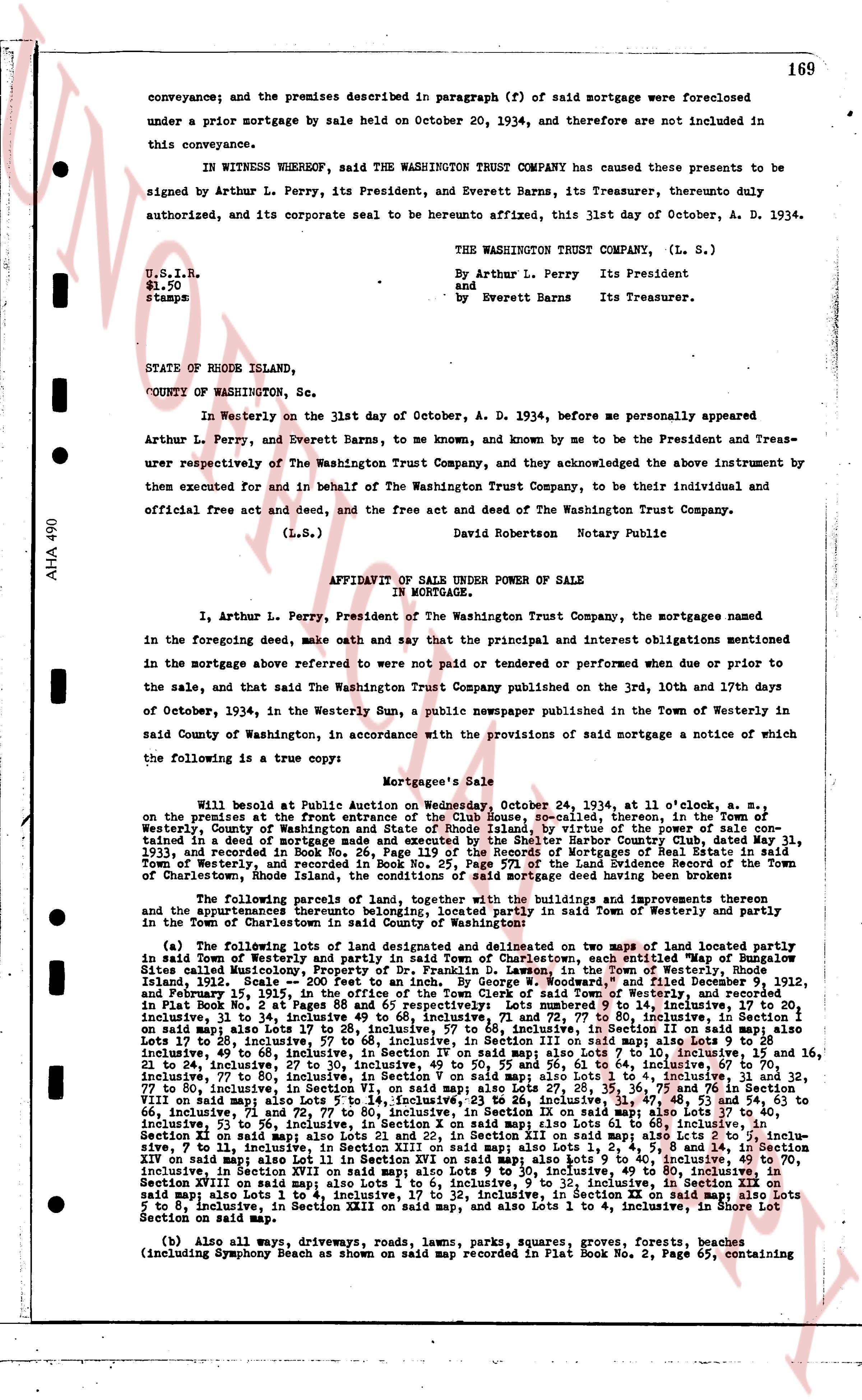
169
conveyance; and the premises described in paragraph (f) of said mortgage were foreclosed under a prior mortgage by sale held on October 20, 1934, and therefore are not included in this conveyance.
IN WITNESS WHEREOF, said THE WASHINGTON TRUST COMPANY has caused these presents to be signed by Arthur L. Perry, its President, and Everett Barns, its Treasurer, durently duly authorized, and its corporate seal to be hereunto affixed, this 31st day of October, A. D. 1934.
THE WASHINGTON TRUST COMPANY, (L. S.)
By Arthur L. Perry Its President
and by Everett Barns Its Treasurer.
U.S.I.R.
$1.50
stamps
STATE OF RHODE ISLAND,
COUNTY OF Washington, Sc.
In Westerly on the 31st day of October, A. D. 1934, before me personally appeared Arthur L. Perry, and Everett Barns, to me known, and known by me to be the President and Treasurer respectively of The Washington Trust Company, and they acknowledged the above instrument by them executed for and in behalf of The Washington Trust Company, to be their individual and official free act and deed, and the free act and deed of The Washington Trust Company.
(L.S.) David Robertson Notary Public
AFFIDAVIT OF SALE UNDER POWER OF SALE
IN MORTGAGE.
I, Arthur L. Perry, President of The Washington Trust Company, the mortgagee named in the foregoing deed, make oath and say that the principal and interest obligations mentioned in the mortgage above referred to were not paid or tendered or performed when due or prior to the sale, and that said The Washington Trust Company published on the 3rd, 10th and 17th days of October, 1934, in the Westerly Sun, a public newspaper published in the Town of Westerly in said County of Washington, in accordance with the provisions of said mortgage a notice of which the following is a true copy:
Mortgagee's Sale
Will be sold at Public Auction on Wednesday, October 24, 1934, at 11 o'clock, a. m., on the premises at the front entrance of the Club House, specified, therein, in the Town of Westerly, County of Washington, State of Rhode Island, by virtue of a power of sale contained in a deed of mortgage made and executed in said State and County, dated May 31, 1933, and recorded in Book No. 26, Page 119 of the Records of Mortgages of Real Estate in said Town of Westerly, and further described in a deed recorded in the Land Evidence Records of the Town of Charlestown, Rhode Island, the conditions of said mortgage deed having been broken:
The following parcels of land, together with the buildings and improvements thereon thereunto and the appurtenances thereto belonging, situated in said Town of Westerly and partly in the Town of Charlestown, said County of Washington:
(a) The following lots of land designated and delineated on map of Town of Westerly partly situated in said Town of Westerly, partly in the Town of Charlestown, both said Town being in County of Washington, Sites called Mourning Cove, Property of Dr. Franklin D. Lawson, in the Town of Westerly, Rhode Island, 1912. Scale 200 feet to an Inch. By George W. Modestine, filed December 9, 1912, and February 1, 1913. The parcels of land are described as follows: The parcels of land described in Plat Book No. 2 at Pages 88 and 65 respectively: Lots number 9 inclusive, to 14 inclusive, to 27 inclusive, 30 and 31, 34 to 38 inclusive, 40 to 45 inclusive, 47 to 51 inclusive, 53 to 56 inclusive, on said map Lots 12 to 26 inclusive, 57 to 68 inclusive, Section II on said map; also Lots 1 to 10 inclusive, 49 to 58 inclusive, Section III on said map; also Lots 1 to 14 inclusive, 15 to 21 inclusive, 49 to 58 inclusive, Section IV on said map; also Lots 1 to 10 inclusive, 15 inclusive, 21 to 28 inclusive, 49 to 58 inclusive, Section V on said map; also Lots 1 to 10 inclusive, 15 to 21 inclusive, 77 to 80 inclusive, in Section V on said map also Lots 1 to 4 inclusive, 31 to 32, 77 to 80 inclusive, in Section VI on said map; also Lots 1 to 10 inclusive, 15 to 21 inclusive, 77 to 80 inclusive, in Section VII on said map; also Lots 5 to 14 inclusive, 23 to 26 inclusive, 31 to 36 inclusive, 47 to 48, 53 to 54 and 63 to 66 inclusive, in Section VIII on said map; also Lots 1 to 10 inclusive, 15 to 21 inclusive, 77 to 80 inclusive, in Section VIII on said map; also Lots 1 to 14 inclusive, 23 to 26 inclusive, 31 to 36 inclusive, 47 to 48, 53 to 54 and 63 to 66 inclusive, in Section IX on said map; also Lots 1 to 60 inclusive, in Section X on said map; also Lots 1 to 14 inclusive, 23 to 26 inclusive, 31 to 36 inclusive, 47 to 48, 53 to 54 inclusive, 53 to 56 inclusive, in Section X on said map; also Lots 1 to 60 inclusive, in Section XI, inclusive, 53 to 56 inclusive, in Section XII on said map; also Lots 1 to 14 inclusive, 23 to 26 inclusive, 7 to 11 inclusive, in Section XIII on said map also Lots 1, 2, 4, 5, 8 and 14, in Section XIV on said map also Lot 11 in Section XV on said map also Lots 1 to 9 inclusive, 49 to 70 inclusive, in Section XVI on said map also Lots 1 to 14 inclusive, 23 to 26 inclusive, 31 to 36 inclusive, in Section XVIII on said map also Lots 1 to 6 inclusive, 9 to 12 inclusive, in Section XIX on said map also Lots 1 to 14 inclusive, 23 to 26 inclusive, 31 to 36 inclusive, 47 to 48, 53 to 54 inclusive, Lots 5 to 8 inclusive, in Section XXIII on said map, and also Lots 1 to 4 inclusive, in Shore Lot Section on said map.
(b) Also all ways, driveways, roads, lawns, parks, squares, groves, forests, beaches (including Symphony Beach as shown on said map recorded in Plat Book No. 2, Page 65, containing
page 4 · read by Gemma vision
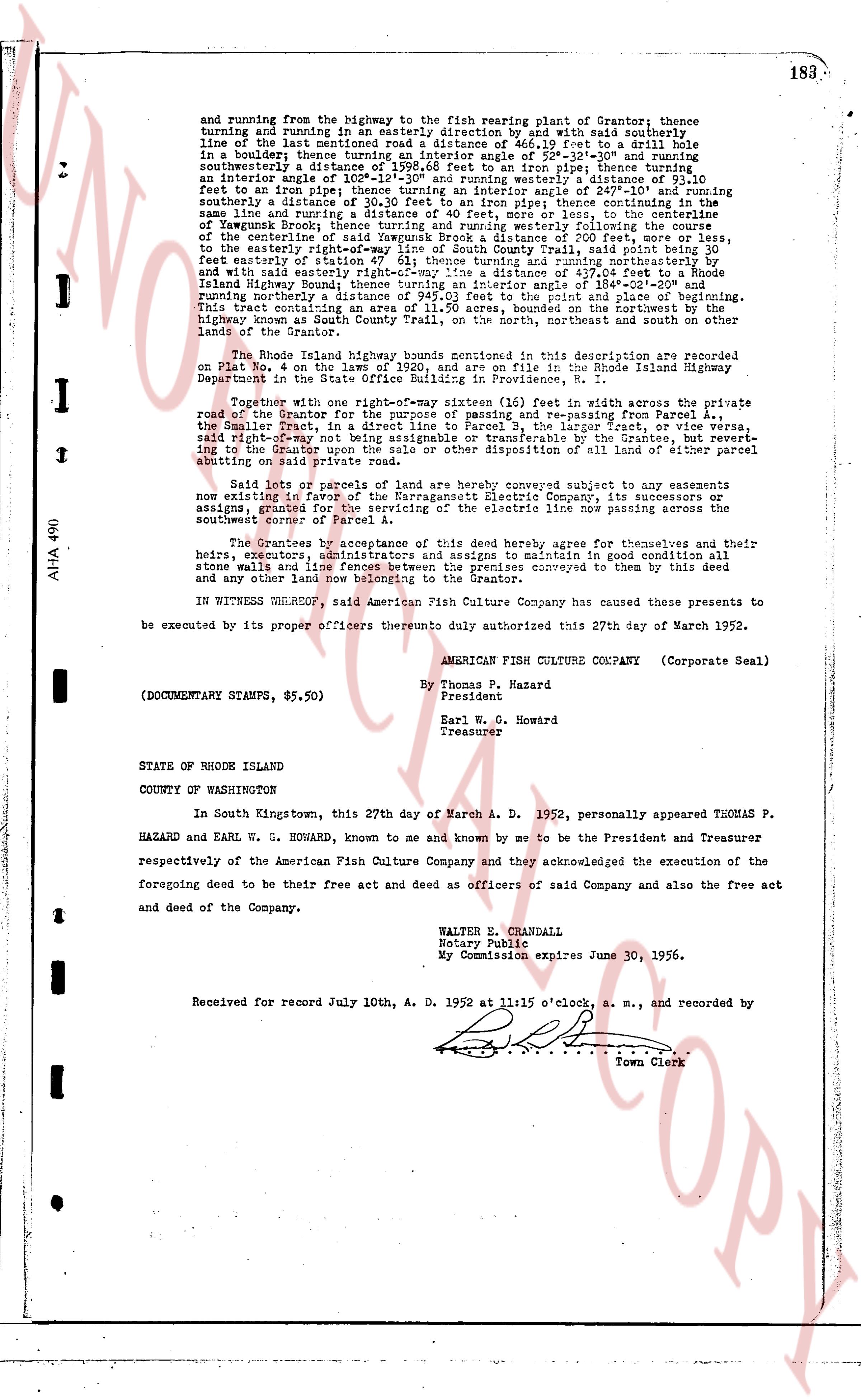
and running from the highway to the fish rearing plant of Grantor; thence turning and running in an easterly direction and by and with said southerly line of the last mentioned road a distance of 466.19 feet to a drill hole in a boulder thence showing during an interior angle of 126.31° and running southeasterly a distance of 1598.68 feet to an iron pipe; thence turning a interior angle of 131.11° and running easterly a distance of 431.11 feet to an iron pipe; thence turning an interior angle of 247.10° and running southerly a distance of 431.11 feet to an iron pipe; thence turning an interior angle of 131.11° and running southeasterly a distance of 1598.68 feet to an iron pipe; thence running by the same line and turning a distance of 40 feet, more or less, to the centerline of Yawgoog Brook; thence turning and running westerly following the course of the centerline of said brook a distance of 40 feet, more or less, and thence to the easterly right-of-way line of South County Trail, said point being 30 feet easterly of the centerline of said trail; thence turning an interior angle of 148.11° and with said easterly right-of-way line a distance of 437.04 feet to a Rhode Island highway known as South County Trail; thence turning an interior angle of 148.11° running northerly a distance of 945.03 feet to the point and place of beginning. This tract consisting of 11.11 acres, more or less, bounded on the North and East by the highway known as South County Trail, on the North, northeast and south on the other lands of the Grantor.
The Rhode Island highway bounds mentioned in this description are recorded on Plat No. 4 on the leaves 190 and 192, and are on file in the Rhode Island Highway Department in the city of Providence, State of Rhode Island.
Reserve with one right-of-way sixteen (16) feet in width across the private road of the Grantor for the purpose of passing and re-passing from Parcel A, the Smaller Tract, in a direct line to Parcel B, the Larger Tract, or vice versa, said right-of-way to be used by the Grantee and by the Company, but without extending to the Grantor upon the sale or other disposition of all lands of either parcel obtaining said private road.
Said lots or parcels of land here above conveyed subject to any easements now existing in favor of the Narragansett Electric Company, its successors or assigns, especially the right for the location of a power line now passing across the southwest corner of Parcel A.
The Grantees by acceptance of this deed here agree for themselves and their heirs, executors, administrators and assigns to maintain in good condition all stone walls and line fences between the premises conveyed to them by this deed and any other land now belonging to the Grantor.
IN WITNESS WHEREOF, said American Fish Culture Company has caused these presents to be executed by its proper officers thereto duly authorized this 27th day of March 1952.
AMERICAN FISH CULTURE COMPANY (Corporate Seal)
By Thomas P. Hazard
President
Earl W. G. Howard
Treasurer
(DOCUMENTARY STAMPS, $5.50)
STATE OF RHODE ISLAND
COUNTY OF WASHINGTON
In South Kingstown, this 27th day of March A. D. 1952, personally appeared THOMAS P. HAZARD and EARL W. G. HOWARD, known to me and known by me to be the President and Treasurer respectively of the American Fish Culture Company and they acknowledged the execution of the foregoing deed to be their free act and deed as officers of said Company and also the free act and deed of the Company.
WALTER E. CHANDALL
Notary Publicle
My Commission expires June 30, 1956.
Received for record July 10th, A. D. 1952 at 11:15 o'clock, a. m., and recorded by
[Signature]
Town Clerk
The page as recorded