The instrument's own words
page 2 · read by Gemma vision
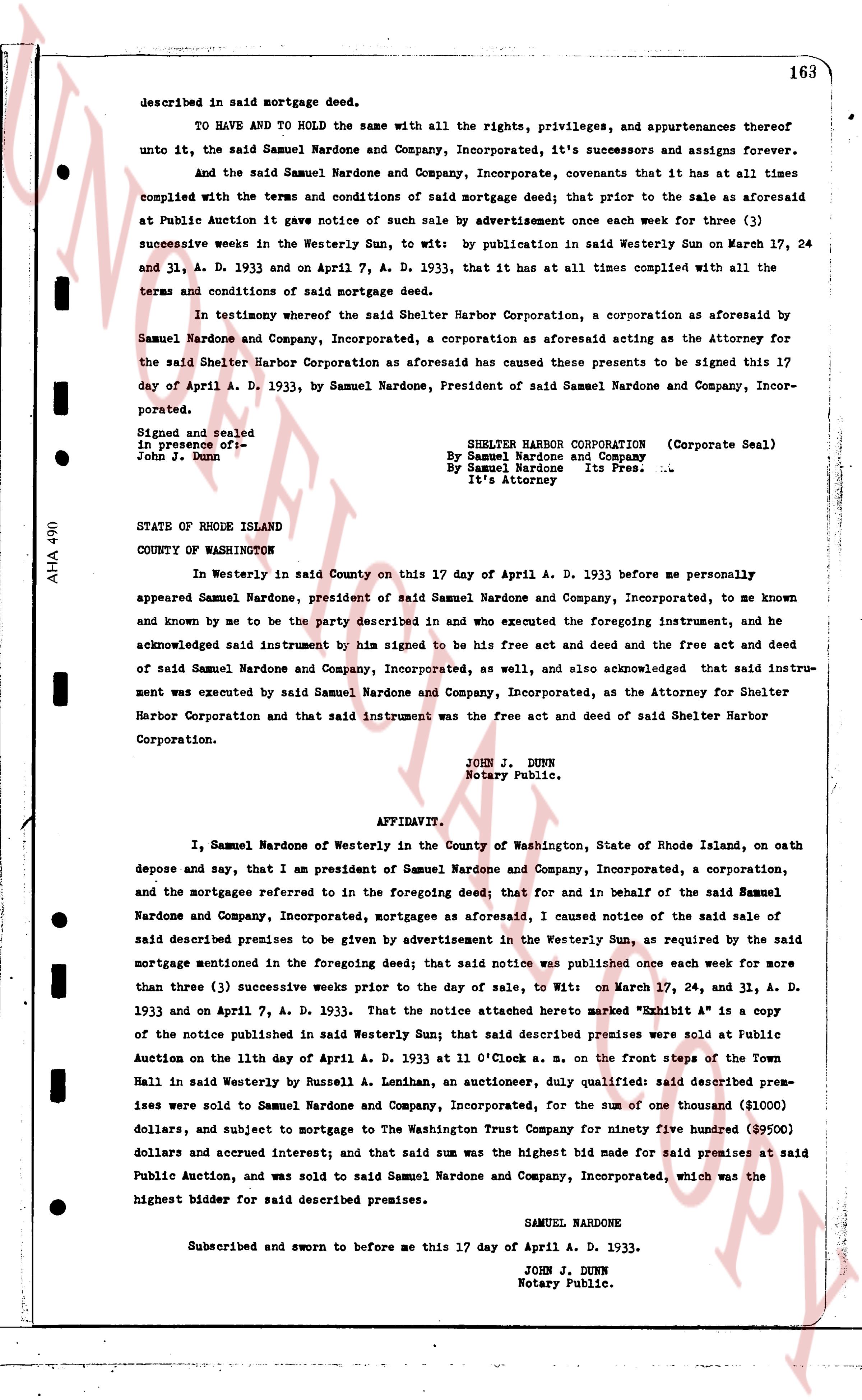
163
described in said mortgage deed.
TO HAVE AND TO HOLD the same with all the rights, privileges, and appurtenances thereof unto it, the said Samuel Nardone and Company, Incorporated, its successors and assigns forever.
And the said Samuel Nardone and Company, Incorporated, covenants that it has at all times complied with the terms and conditions of said mortgage deed; that prior to the sale as aforesaid at Public Auction it gave notice of such sale by advertisement once each week for three (3) successive weeks in the Westerly Sun, to wit: by publication in said Westerly Sun on March 17, 24 and 31, A. D. 1933 and on April 7, A. D. 1933, that it has at all times complied with all the terms and conditions of said mortgage deed.
In testimony whereof the said Shelter Harbor Corporation, a corporation as aforesaid by Samuel Nardone and Company, Incorporated, a corporation as aforesaid acting as the Attorney for the said Shelter Harbor Corporation as aforesaid has caused the presents to be signed this 17 day of April A. D. 1933, by Samuel Nardone, President of said Samuel Nardone and Company, Incorporated.
Signed and sealed
in presence of:
John J. Dunn
SHELTER HARBOR CORPORATION (Corporate Seal)
By Samuel Nardone and Company
By Samuel Nardone Its Pres. \_\_\_\_\_\_\_\_\_\_\_\_\_\_\_\_\_\_\_\_\_\_\_\_\_\_\_\_\_\_\_\_\_\_\_\_\_\_\_\_\_\_\_\_\_\_\_\_\_\_\_\_\_\_\_\_\_\_\_\_\_\_\_\_\_\_\_\_\_\_\_\_\_\_\_\_\_\_\_\_\_\_\_\_\_\_\_\_\_\_\_\_\_\_\_\_\_\_\_\_\_\_\_\_\_\_\_\_\_\_\_\_\_\_\_\_\_\_\_\_\_\_\_\_\_\_\_\_\_\_\_\_\_\_\_\_\_\_\_\_\_\_\_\_\_\_\_\_\_\_\_\_\_\_\_\_\_\_\_\_\_\_\_\_\_\_\_\_\_\_\_\_\_\_\_\_\_\_\_\_\_\_\_\_\_\_\_\_\_\_\_\_\_\_\_\_\_\_\_\_\_\_\_\_\_\_\_\_\_\_\_\_\_\_\_\_\_\_\_\_\_\_\_\_\_\_\_\_\_\_\_\_\_\_\_\_\_\_\_\_\_\_\_\_\_\_\_\_\_\_\_\_\_\_\_\_\_\_\_\_\_\_\_\_\_\_\_\_\_\_\_\_\_\_\_\_\_\_\_\_\_\_\_\_\_\_\_\_\_\_\_\_\_\_\_\_\_\_\_\_\_\_\_\_\_\_\_\_\_\_\_\_\_\_\_\_\_\_\_\_\_\_\_\_\_\_\_\_\_\_\_\_\_\_\_\_\_\_\_\_\_\_\_\_\_\_\_\_\_\_\_\_\_\_\_\_\_\_\_\_\_\_\_\_\_\_\_\_\_\_\_\_\_\_\_\_\_\_\_\_\_\_\_\_\_\_\_\_\_\_\_\_\_\_\_\_\_\_\_\_\_\_\_\_\_\_\_\_\_\_\_\_\_\_\_\_\_\_\_\_\_\_\_\_\_\_\_\_\_\_\_\_\_\_\_\_\_\_\_\_\_\_\_\_\_\_\_\_\_\_\_\_\_\_\_\_\_\_\_\_\_\_\_\_\_\_\_\_\_\_\_\_\_\_\_\_\_\_\_\_\_\_\_\_\_\_\_\_\_\_\_\_\_\_\_\_\_\_\_\_\_\_\_\_\_\_\_\_\_\_\_\_\_\_\_\_\_\_\_\_\_\_\_\_\_\_\_\_\_\_\_\_\_\_\_\_\_\_\_\_\_\_\_\_\_\_\_\_\_\_\_\_\_\_\_\_\_\_\_\_\_\_\_\_\_\_\_\_\_\_\_\_\_\_\_\_\_\_\_\_\_\_\_\_\_\_\_\_\_\_\_\_\_\_\_\_\_\_\_\_\_\_\_\_\_\_\_\_\_\_\_\_\_\_\_\_\_\_\_\_\_\_\_\_\_\_\_\_\_\_\_\_\_\_\_\_\_\_\_\_\_\_\_\_\_\_\_\_\_\_\_\_\_\_\_\_\_\_\_\_\_\_\_\_\_\_\_\_\_\_\_\_\_\_\_\_\_\_\_\_\_\_\_\_\_\_\_\_\_\_\_\_\_\_\_\_\_\_\_\_\_\_\_\_\_\_\_\_\_\_\_\_\_\_\_\_\_\_\_\_\_\_\_\_\_\_\_\_\_\_\_\_\_\_\_\_\_\_\_\_\_\_\_\_\_\_\_\_\_\_\_\_\_\_\_\_\_\_\_\_\_\_\_\_\_\_\_\_\_\_\_\_\_\_\_\_\_\_\_\_\_\_\_\_\_\_\_\_\_\_\_\_\_\_\_\_\_\_\_\_\_\_\_\_\_\_\_\_\_\_\_\_\_\_\_\_\_\_\_\_\_\_\_\_\_\_\_\_\_\_\_\_\_\_\_\_\_\_\_\_\_\_\_\_\_\_\_\_\_\_\_\_\_\_\_\_\_\_\_\_\_\_\_\_\_\_\_\_\_\_\_\_\_\_\_\_\_\_\_\_\_\_\_\_\_\_\_\_\_\_\_\_\_\_\_\_\_\_\_\_\_\_\_\_\_\_\_\_\_\_\_\_\_\_\_\_\_\_\_\_\_\_\_\_\_\_\_\_\_\_\_\_\_\_\_\_\_\_\_\_\_\_\_\_\_\_\_\_\_\_\_\_\_\_\_\_\_\_\_\_\_\_\_\_\_\_\_\_\_\_\_\_\_\_\_\_\_\_\_\_\_\_\_\_\_\_\_\_\_\_\_\_\_\_\_\_\_\_\_\_\_\_\_\_\_\_\_\_\_\_\_\_\_\_\_\_\_\_\_\_\_\_\_\_\_\_\_\_\_\_\_\_\_\_\_\_\_\_\_\_\_\_\_\_\_\_\_\_\_\_\_\_\_\_\_\_\_\_\_\_\_\_\_\_\_\_\_\_\_\_\_\_\_\_\_\_\_\_\_\_\_\_\_\_\_\_\_\_\_\_\_\_\_\_\_\_\_\_\_\_\_\_\_\_\_\_\_\_\_\_\_\_\_\_\_\_\_\_\_\_\_\_\_\_\_\_\_\_\_\_\_\_\_\_\_\_\_\_\_\_\_\_\_\_\_\_\_\_\_\_\_\_\_\_\_\_\_\_\_\_\_\_\_\_\_\_\_\_\_\_\_\_\_\_\_\_\_\_\_\_\_\_\_\_\_\_\_\_\_\_\_\_\_\_\_\_\_\_\_\_\_\_\_\_\_\_\_\_\_\_\_\_\_\_\_\_\_\_\_\_\_\_\_\_\_\_\_\_\_\_\_\_\_\_\_\_\_\_\_\_\_\_\_\_\_\_\_\_\_\_\_\_\_\_\_\_\_\_\_\_\_\_\_\_\_\_\_\_\_\_\_\_\_\_\_\_\_\_\_\_\_\_\_\_\_\_\_\_\_\_\_\_\_\_\_\_\_\_\_\_\_\_\_\_\_\_\_\_\_\_\_\_\_\_\_\_\_\_\_\_\_\_\_\_\_\_\_\_\_\_\_\_\_\_\_\_\_\_\_\_\_\_\_\_\_\_\_\_\_\_\_\_\_\_\_\_\_\_\_\_\_\_\_\_\_\_\_\_\_\_\_\_\_\_\_\_\_\_\_\_\_\_\_\_\_\_\_\_\_\_\_\_\_\_\_\_\_\_\_\_\_\_\_\_\_\_\_\_\_\_\_\_\_\_\_\_\_\_\_\_\_\_\_\_\_\_\_\_\_\_\_\_\_\_\_\_\_\_\_\_\_\_\_\_\_\_\_\_\_\_\_\_\_\_\_\_\_\_\_\_\_\_\_\_\_\_\_\_\_\_\_\_\_\_\_\_\_\_\_\_\_\_\_\_\_\_\_\_\_\_\_\_\_\_\_\_\_\_\_\_\_\_\_\_\_\_\_\_\_\_\_\_\_\_\_\_\_\_\_\_\_\_\_\_\_\_\_\_\_\_\_\_\_\_\_\_\_\_\_\_\_\_\_\_\_\_\_\_\_\_\_\_\_\_\_\_\_\_\_\_\_\_\_\_\_\_\_\_\_\_\_\_\_\_\_\_\_\_\_\_\_\_\_\_\_\_\_\_\_\_\_\_\_\_\_\_\_\_\_\_\_\_\_\_\_\_\_\_\_\_\_\_\_\_\_\_\_\_\_\_\_\_\_\_\_\_\_\_\_\_\_\_\_\_\_\_\_\_\_\_\_\_\_\_\_\_\_\_\_\_\_\_\_\_\_\_\_\_\_\_\_\_\_\_\_\_\_\_\_\_\_\_\_\_\_\_\_\_\_\_\_\_\_\_\_\_\_\_\_\_\_\_\_\_\_\_\_\_\_\_\_\_\_\_\_\_\_\_\_\_\_\_\_\_\_\_\_\_\_\_\_\_\_\_\_\_\_\_\_\_\_\_\_\_\_\_\_\_\_\_\_\_\_\_\_\_\_\_\_\_\_\_\_\_\_\_\_\_\_\_\_\_\_\_\_\_\_\_\_\_\_\_\_\_\_\_\_\_\_\_\_\_\_\_\_\_\_\_\_\_\_\_\_\_\_\_\_\_\_\_\_\_\_\_\_\_\_\_\_\_\_\_\_\_\_\_\_\_\_\_\_\_\_\_\_\_\_\_\_\_\_\_\_\_\_\_\_\_\_\_\_\_\_\_\_\_\_\_\_\_\_\_\_\_\_\_\_\_\_\_\_\_\_\_\_\_\_\_\_\_\_\_\_\_\_\_\_\_\_\_\_\_\_\_\_\_\_\_\_\_\_\_\_\_\_\_\_\_\_\_\_\_\_\_\_\_\_\_\_\_\_\_\_\_\_\_\_\_\_\_\_\_\_\_\_\_\_\_\_\_\_\_\_\_\_\_\_\_\_\_\_\_\_\_\_\_\_\_\_\_\_\_\_\_\_\_\_\_\_\_\_\_\_\_\_\_\_\_\_\_\_\_\_\_\_\_\_\_\_\_\_\_\_\_\_\_\_\_\_\_\_\_\_\_\_\_\_\_\_\_\_\_\_\_\_\_\_\_\_\_\_\_\_\_\_\_\_\_\_\_\_\_\_\_\_\_\_\_\_\_\_\_\_\_\_\_\_\_\_\_\_\_\_\_\_\_\_\_\_\_\_\_\_\_\_\_\_\_\_\_\_\_\_\_\_\_\_\_\_\_\_\_\_\_\_\_\_\_\_\_\_\_\_\_\_\_\_\_\_\_\_\_\_\_\_\_\_\_\_\_\_\_\_\_\_\_\_\_\_\_\_\_\_\_\_\_\_\_\_\_\_\_\_\_\_\_\_\_\_\_\_\_\_\_\_\_\_\_\_\_\_\_\_\_\_\_\_\_\_\_\_\_\_\_\_\_\_\_\_\_\_\_\_\_\_\_\_\_\_\_\_\_\_\_\_\_\_\_\_\_\_\_\_\_\_\_\_\_\_\_\_\_\_\_\_\_\_\_\_\_\_\_\_\_\_\_\_\_\_\_\_\_\_\_\_\_\_\_\_\_\_\_\_\_\_\_\_\_\_\_\_\_\_\_\_\_\_\_\_\_\_\_\_\_\_\_\_\_\_\_\_\_\_\_\_\_\_\_\_\_\_\_\_\_\_\_\_\_\_\_\_\_\_\_\_\_\_\_\_\_\_\_\_\_\_\_\_\_\_\_\_\_\_\_\_\_\_\_\_\_\_\_\_\_\_\_\_\_\_\_\_\_\_\_\_\_\_\_\_\_\_\_\_\_\_\_\_\_\_\_\_\_\_\_\_\_\_\_\_\_\_\_\_\_\_\_\_\_\_\_\_\_\_\_\_\_\_\_\_\_\_\_\_\_\_\_\_\_\_\_\_\_\_\_\_\_\_\_\_\_\_\_\_\_\_\_\_\_\_\_\_\_\_\_\_\_\_\_\_\_\_\_\_\_\_\_\_\_\_\_\_\_\_\_\_\_\_\_\_\_\_\_\_\_\_\_\_\_\_\_\_\_\_\_\_\_\_\_\_\_\_\_\_\_\_\_\_\_\_\_\_\_\_\_\_\_\_\_\_\_\_\_\_\_\_\_\_\_\_\_\_\_\_\_\_\_\_\_\_\_\_\_\_\_\_\_\_\_\_\_\_\_\_\_\_\_\_\_\_\_\_\_\_\_\_\_\_\_\_\_\_\_\_\_\_\_\_\_\_\_\_\_\_\_\_\_\_\_\_\_\_\_\_\_\_\_\_\_\_\_\_\_\_\_\_\_\_\_\_\_\_\_\_\_\_\_\_\_\_\_\_\_\_\_\_\_\_\_\_\_\_\_\_\_\_\_\_\_\_\_\_\_\_\_\_\_\_\_\_\_\_\_\_\_\_\_\_\_\_\_\_\_\_\_\_\_\_\_\_\_\_\_\_\_\_\_\_\_\_\_\_\_\_\_\_\_\_\_\_\_\_\_\_\_\_\_\_\_\_\_\_\_\_\_\_\_\_\_\_\_\_\_\_\_\_\_\_\_\_\_\_\_\_\_\_\_\_\_\_\_\_\_\_\_\_\_\_\_\_\_\_\_\_\_\_\_\_\_\_\_\_\_\_\
page 3 · read by Gemma vision
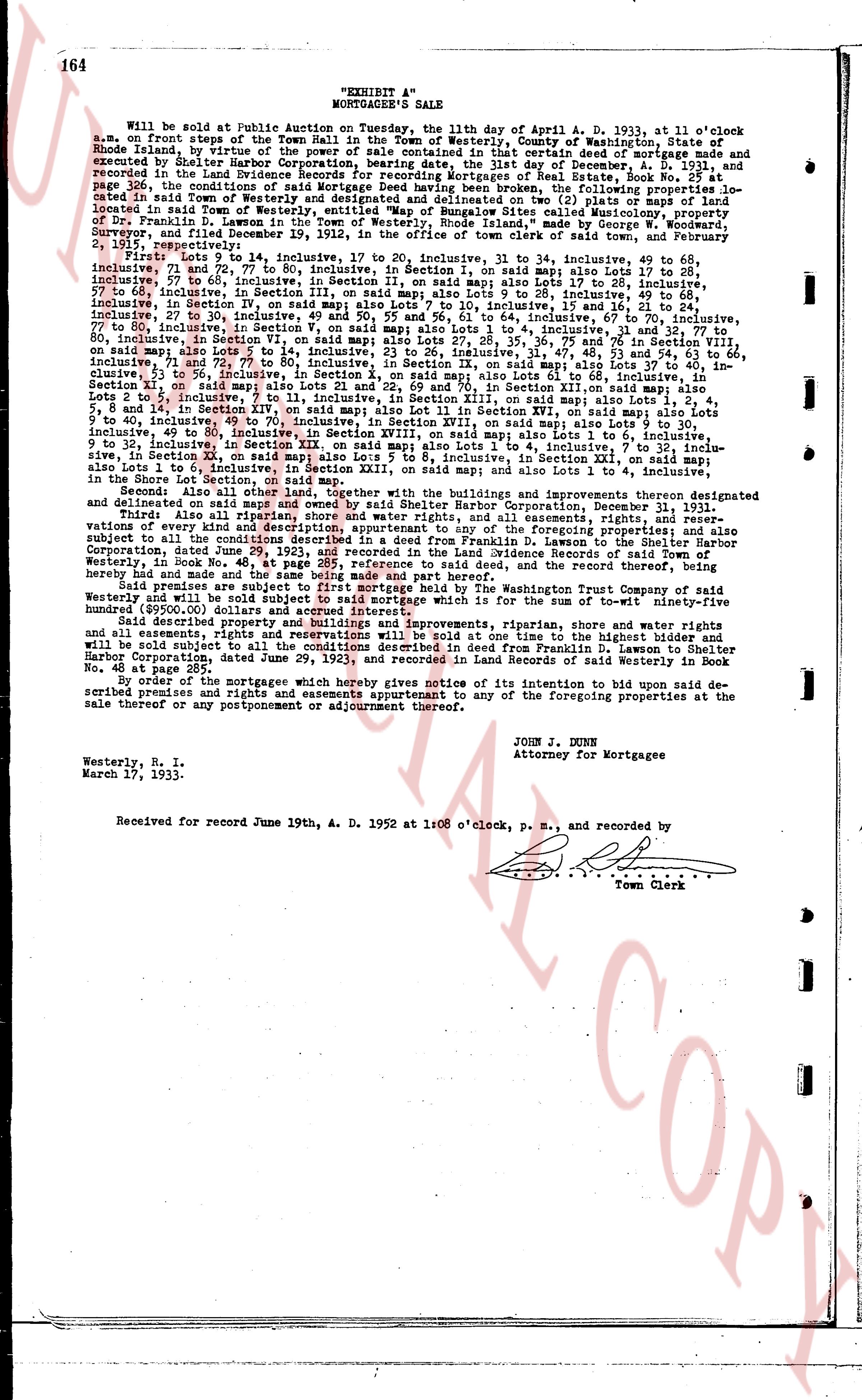
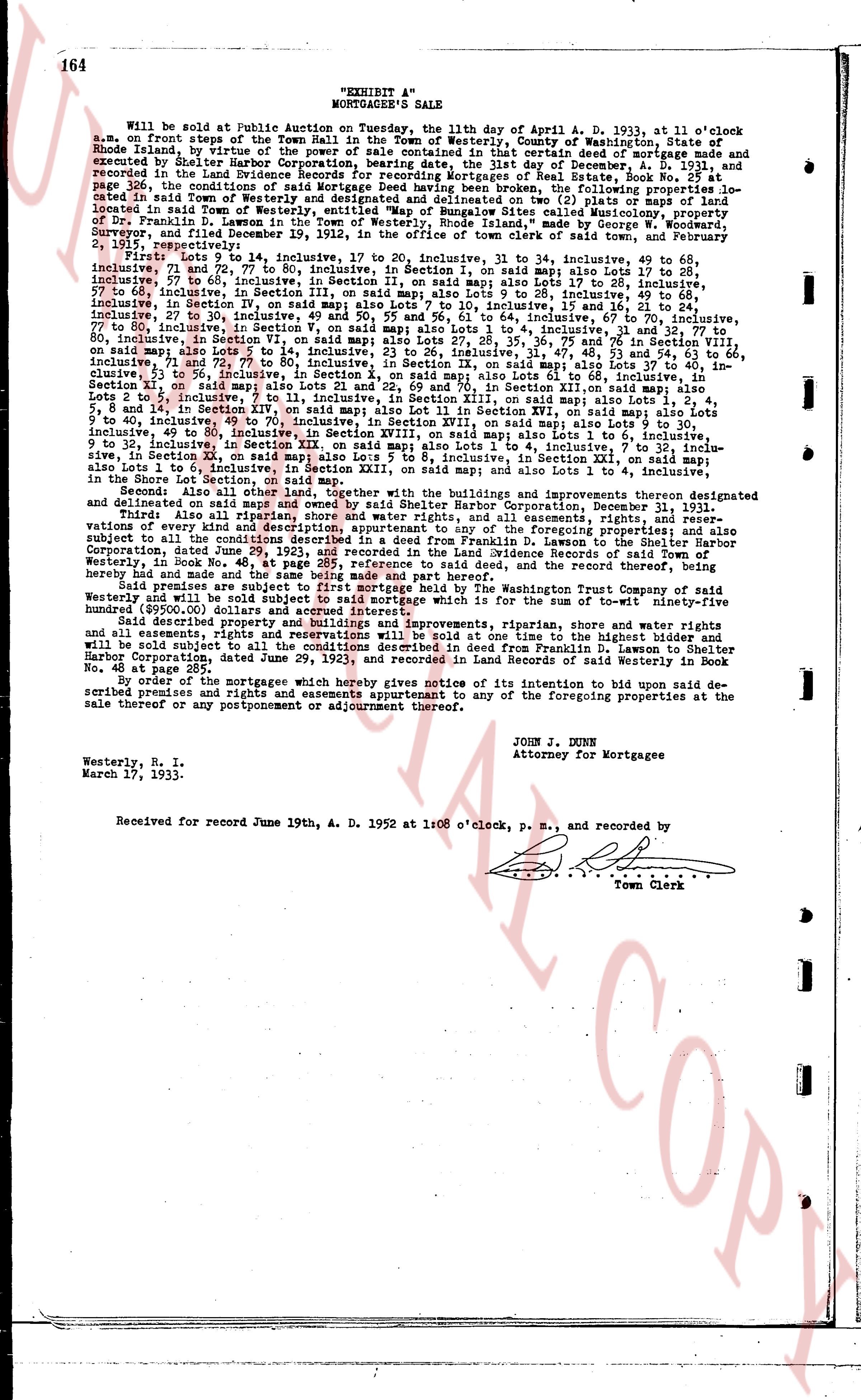
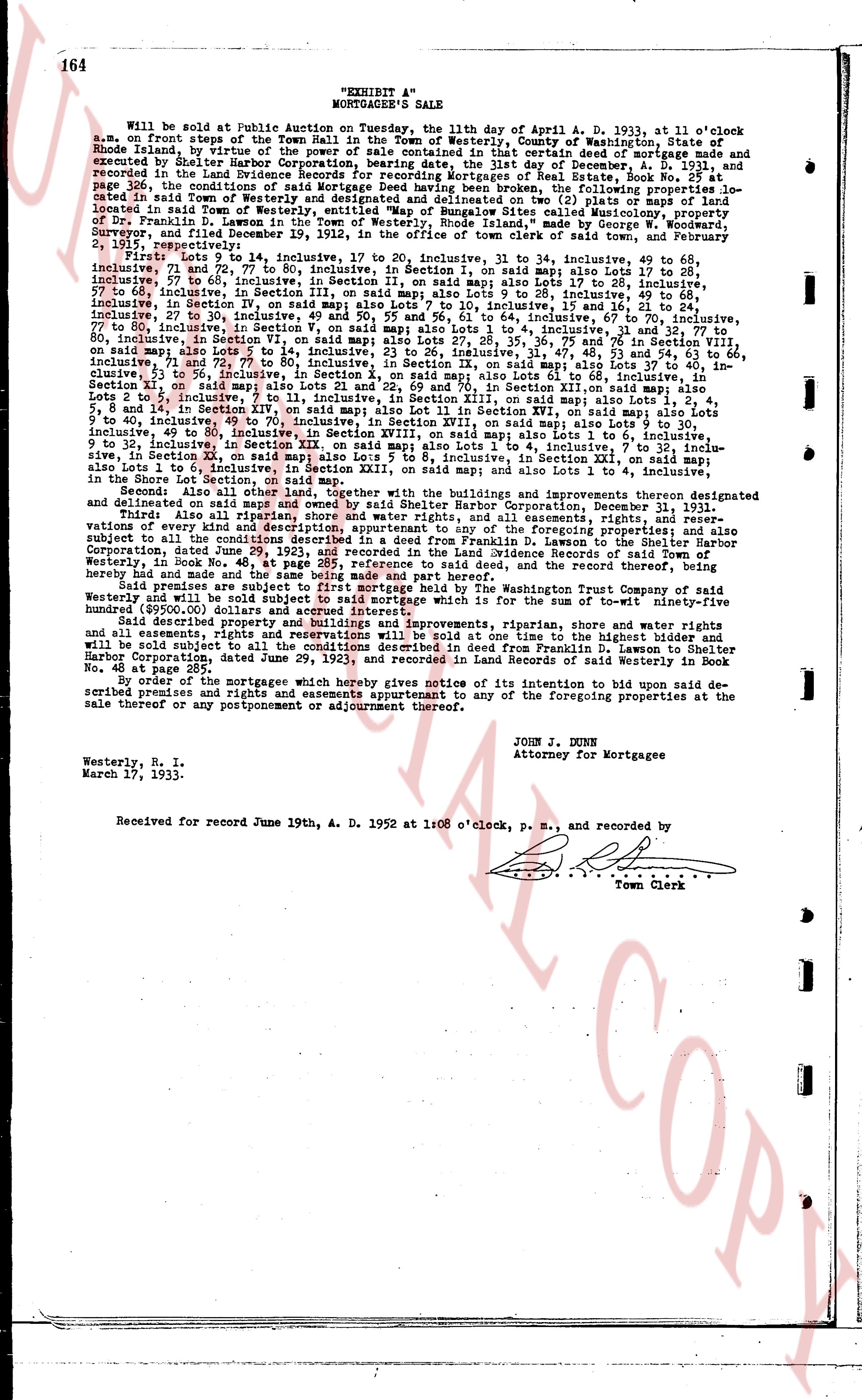
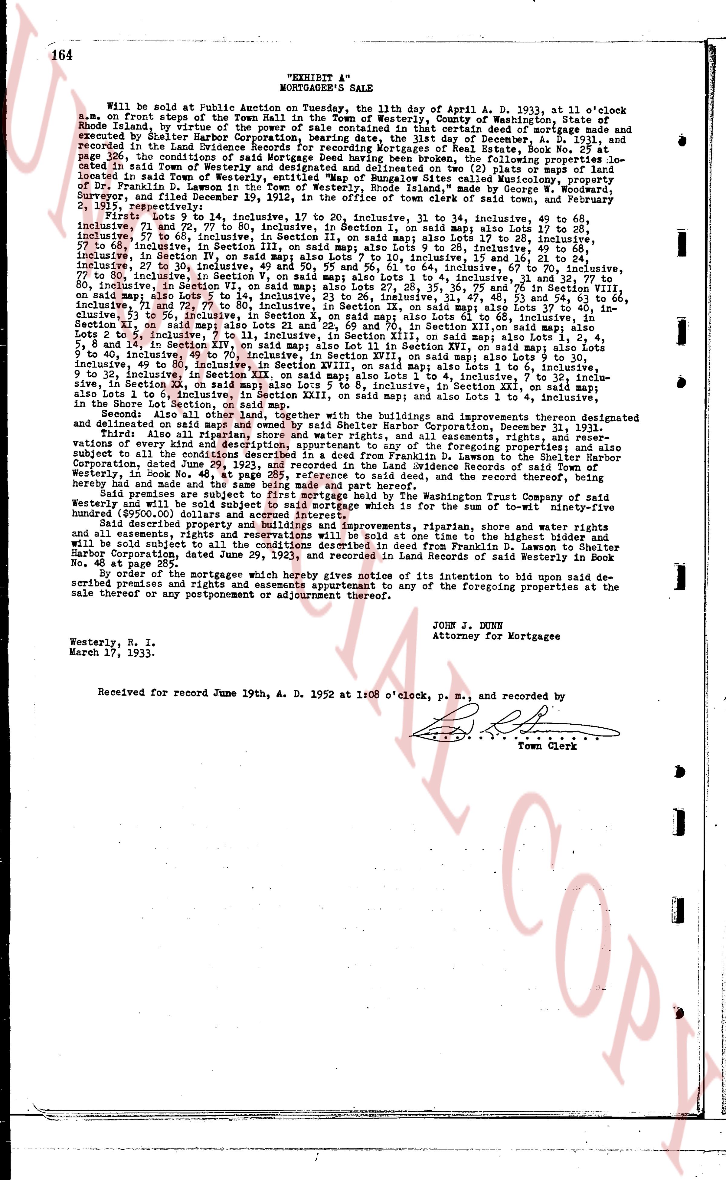
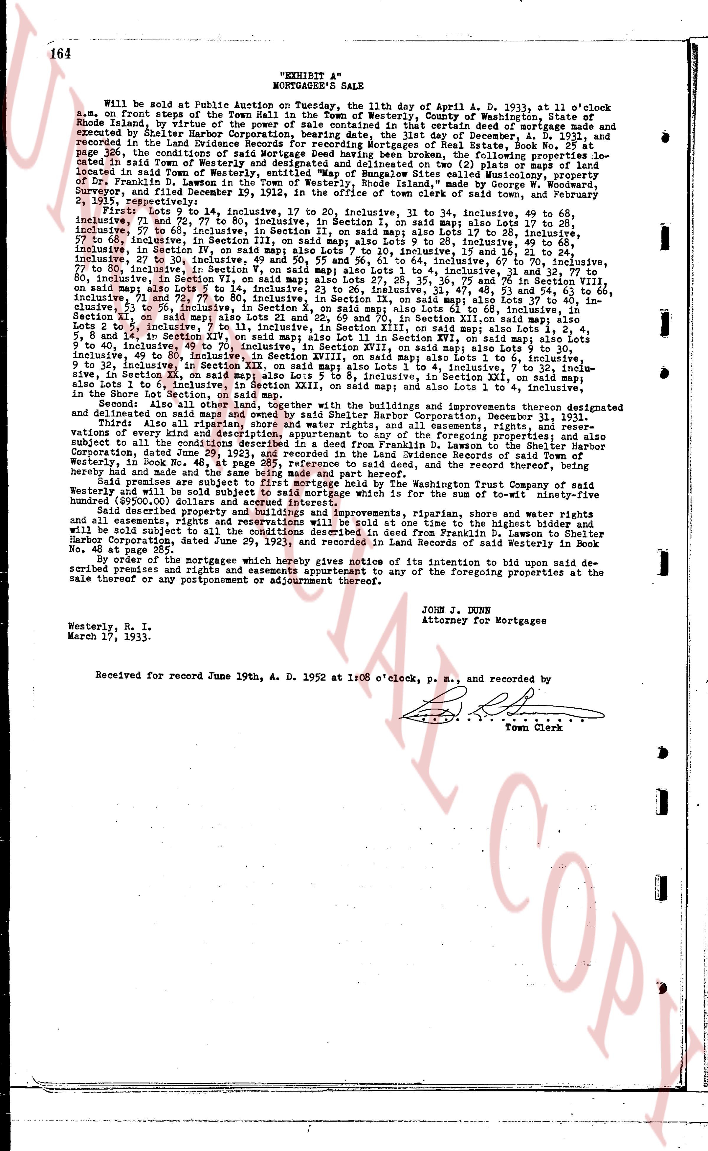
164
"EXHIBIT A"
MORTGAGEE'S SALE
Will be sold at Public auction on Tuesday, the 11th day of April A. D. 1933, at 11 o'clock a.m. on the front steps of the town hall in the town of Westerly, county of Washington, state of Rhode Island, by virtue of the power of sale contained in certain deed of mortgage made and executed by Shelter Harbor Corporation, borrowing party, dated the 1st day of December, A. D. 1931, and recorded in the land evidence records of the town of Westerly, in book 246, page 326, the conditions of said Mortgage Deed having been broken, the following properties located in said town of Westerly, being all of the land and buildings (or lots) shown on map (or maps) located in said town of Westerly, entitled "Map of Bungalow Sites called Misquamic property, located in town of Westerly", in section "A" of said map, as made by George H. Snyder, Surveyor, and filed December 19, 1912, in the office of the town clerk of said town, and primarily described as follows:
First Lots 9 to 14, inclusive, to 17 to 20, inclusive, to 31 to 34, inclusive, 49 to 68, inclusive, 74 to 81, inclusive, to 84 to 91, inclusive, to 94 to 101, inclusive, to 104 to 112, inclusive, 57 to 66, inclusive, in Section I, on said map; also Lots 1 to 27, inclusive, to 31 to 35, inclusive, to 41 to 45, inclusive, to 51 to 55, inclusive, Lot 76 to 81, inclusive, 57 to 66, inclusive, in Section III, on said map; also Lots 9 to 15, inclusive, 28 to 49, inclusive, 66 to 75, inclusive, in Section IV, on said map; also Lots 1 to 10, inclusive, to 14 to 20, inclusive, 27 to 30, inclusive, 49 and 50, 55 and 56, 61 to 64, inclusive, 67 to 70, inclusive, 77 to 80, inclusive, in Section V, on said map; also Lots 1 to 10, inclusive, to 14 to 20, inclusive, 27 to 30, inclusive, 77 to 80, inclusive, in Section VI, on said map; also Lots 27, 28, 35, 36, 75 and 76 in Section VII, on said map; also Lots 1 to 10, inclusive, to 14 to 20, inclusive, 27 to 30, inclusive, 61 to 64, inclusive, 71 and 72, 77 to 80, inclusive, in Section IX, on said map; also Lots 37 to 40, inclusive, Lots 1 to 10, inclusive, to 14 to 20, inclusive, 27 to 30, inclusive, 61 to 64, inclusive, 67 to 70, inclusive, Section XI, on said map; also Lots 21 and 22, and 69 and 70, in Section XII, on said map; also Lots 4 to 9, inclusive, 14 to 20, inclusive, 27 to 30, inclusive, 61 to 64, inclusive, 67 to 70, inclusive, 9 to 14, inclusive, 49 to 80, inclusive, in Section XIII, on said map; also Lots 1 to 4, inclusive, 5 to 8 and 14, in Section XIV, on said map; also Lot 11 in Section XVI, on said map; also Lots 1 to 6, inclusive, 9 to 14, inclusive, 49 to 80, inclusive, in Section XVII, on said map; also Lots 1 to 6, inclusive, 9 to 14, inclusive, 49 to 80, inclusive, in Section XVIII, on said map; also Lots 1 to 6, inclusive, 9 to 14, inclusive, 49 to 80, inclusive, in Section XX, inclusive, 7 to 10, inclusive, in Section XXI, on said map; also Lots 5 to 8, inclusive, in Section XXII, on said map; also Lots 1 to 4, inclusive, in the Shore Lot Section, on said map; also Lot 1 in Section XXIII, on said map; and also Lots 1 to 4, inclusive, in the Shore Lot Section, on said map.
Second Also all other land, together with the buildings and improvements thereon designated and delineated on said map, not hereinabove described, in the foregoing properties located in said town of Westerly.
Third Also all riparian, shore and water rights, and all easements, rights, rights and reservations, easements, rights and reservations, appurtenant to the foregoing properties located in said town of Westerly, in book No. 48, at page 285, reference to said deed, and the record thereof, being previously recorded in the land evidence records of the town of Westerly.
Said premises are subject to first mortgage held by The Washington Trust Company of said Westerly, in book No. 48, at page 285, for the sum which is for the sum of to-wit ninety-five hundred ($9500.00) dollars and accrued interest.
The said land, buildings, improvements, riparian, shore and water rights, and all easements, rights and reservations will be sold at one time to the highest bidder and will be conveyed subject to the conditions described in deed from Franklin D. Lawson to Shelter Harbor Corporation, dated June 29, 1923, and recorded in the land evidence records of said town of Westerly in book No. 48, at page 285.
By order of the mortgagees which hereby gives notice of its intention to bid upon said described premises and rights and easements appurtenant to any of the foregoing properties at the sale thereof or any postponement or adjournment thereof.
JOHN J. MUNN
Attorney for Mortgagee
Westerly, R. I.
March 17, 1933.
Received for record June 19th, A. D. 1952 at 1:08 o'clock, p. m., and recorded by
[Seal]
Town Clerk
page 4 · read by Gemma vision
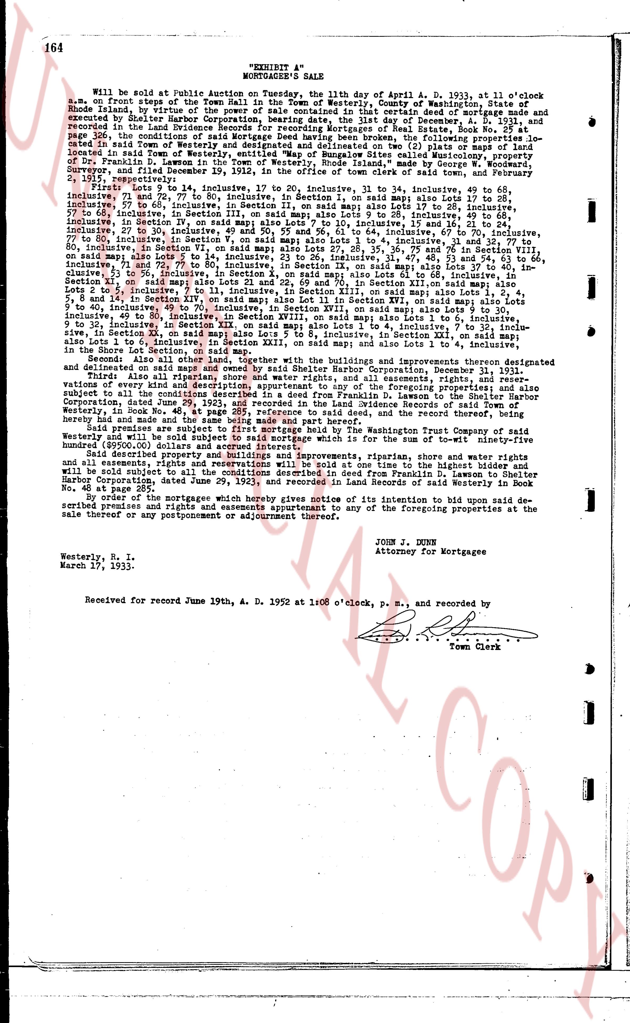
164
"EXHIBIT A"
MORTGAGEE'S SALE
Will be sold at Public auction on Tuesday, the 11th day of April A. D. 1933, at 11 o'clock a.m. on the front steps of the town hall in the town of Westerly, county of Washington, state of Rhode Island, by virtue of the power of sale contained in certain deed of mortgage made and executed by Shelter Harbor Corporation, bearing date the first day of December, A. D. 1931, and recorded in the land evidence records of the town of Westerly, in book 254, page 326, the conditions of said Mortgage Deed having been broken, the following properties located in said town and state, being more particularly described in said mortgage, in book 254, page 326, the town's index gives the parties as: grantor(s) SULLIVAN LEO J; grantee(s) WILLIAMS HARRIOT ELIZABETH; instrument type DEED. located in said Town of Westerly, entitled "Map of Bungalow Sites called Misquamic property," approved by the town of Westerly, and recorded in the office of the town clerk of said town, by George S. Surveyor, and filed December 19, 1912, in the office of the town clerk of said town, and February 2, 1913, in the registry of land evidence of said town:
First Lots 9 to 14, inclusive, to 17 to 20, inclusive, to 31 to 34, inclusive, 49 to 68, inclusive, 74 to 81, inclusive, to 84 to 91, inclusive, in Section I, on said map; also Lots 1 to 28, inclusive, 57 to 66, inclusive, in Section I, on said map; also Lots 1 to 27, inclusive, 31 to 35, inclusive, 57 to 66, inclusive, in Section III, on said map; also Lots 9 to 28, inclusive, 49 to 68, inclusive, 74 to 81, inclusive, to 84 to 91, inclusive, in Section III, on said map; also Lots 1 to 64, inclusive, 27 to 30, inclusive, in Section IV, on said map; also Lots 50 and 55, 56 to 61, inclusive, 64 to 67, inclusive, 70 to 70, inclusive, 77 to 80, inclusive, in Section V, on said map; also Lots 1 to 28, inclusive, 31 to 35, inclusive, 57 to 60, inclusive, 71 to 72, 77 to 80, inclusive, in Section VI, on said map; also Lots 27, 28, 35, 36, 75 to 76 in Section VII, on said map; also Lots 1 to 28, inclusive, 31 to 35, inclusive, 57 to 60, inclusive, 71 to 72, 77 to 80, inclusive, in Section IX, on said map; also Lots 37 to 40, inclusive, 41 to 44, inclusive, 45 to 48, inclusive, 49 to 52, inclusive, in Section IX, on said map; also Lots 1 to 28, inclusive, 71 to 72, 77 to 80, inclusive, in Section X, on said map; also Lots 21 and 22, and 69 to 70, in Section XI, on said map; also Lots 4 to 5, 8 to 14, inclusive, in Section XII, on said map; also Lots 1 to 28, inclusive, 31 to 35, inclusive, 57 to 60, inclusive, 49 to 80, inclusive, in Section XIII, on said map; also Lot 11 in Section XVI, on said map; also Lots 1 to 6, inclusive, 9 to 14, inclusive, in Section XVII, on said map; also Lots 1 to 28, inclusive, 31 to 35, inclusive, 57 to 60, inclusive, 49 to 80, inclusive, in Section XVIII, on said map; also Lots 1 to 6, inclusive, 9 to 14, inclusive, in Section XIX, on said map; also Lots 1 to 28, inclusive, 31 to 35, inclusive, 57 to 10, inclusive, in Section XX, on said map; also Lots 5 to 8, inclusive, in Section XXI, on said map; also Lots 1 to 4, inclusive, in Section XXII, on said map; also Lot 1 in Section XXIII, on said map; and also Lots 1 to 4, inclusive, in the Shore Lot Section, on said map.
Second Also all other lands, together with the buildings and improvements thereon designated and delineated on said map, not hereinabove described, in the foregoing properties located in said town.
Third Also all riparian, shore and water rights, and all easements, rights, and reservations, and all delegates and appurtenances thereunto belonging, in the foregoing properties located in said town, subject to all the conditions described in a deed from Franklin D. Lawson to the Shelter Harbor Corporation, recorded in the land evidence records of the town of Westerly, in book No. 48, at page 285, reference to said deed, and the record thereof, being hereby reserved.
Said premises are subject to first mortgage held by The Washington Trust Company of said Westerly, in book 254, page 326, of said records, and to all easements, rights, and reservations, and all easements, rights, and reservations which is for the sum of to-wit ninety-five hundred ($9500.00) dollars and accrued interest.
Third Also all riparian, shore and water rights, and all easements, rights, and reservations, and all delegates and appurtenances thereunto belonging, in the properties described in deed from Franklin D. Lawson to Shelter Harbor Corporation, dated June 29, 1923, and recorded in the land evidence records of said town of Westerly in Book No. 48, page 285.
By order of the mortgagees which hereby gives notice of its intention to bid upon said described premises and rights and easements appurtenant to any of the foregoing properties at the sale thereof or any postponement or adjournment thereof.
JOHN J. MUNN
Attorney for Mortgagee
Westerly, R. I.
March 17, 1933.
Received for record June 19th, A. D. 1952 at 1:08 o'clock, p. m., and recorded by
Town Clerk
page 5 · read by Gemma vision
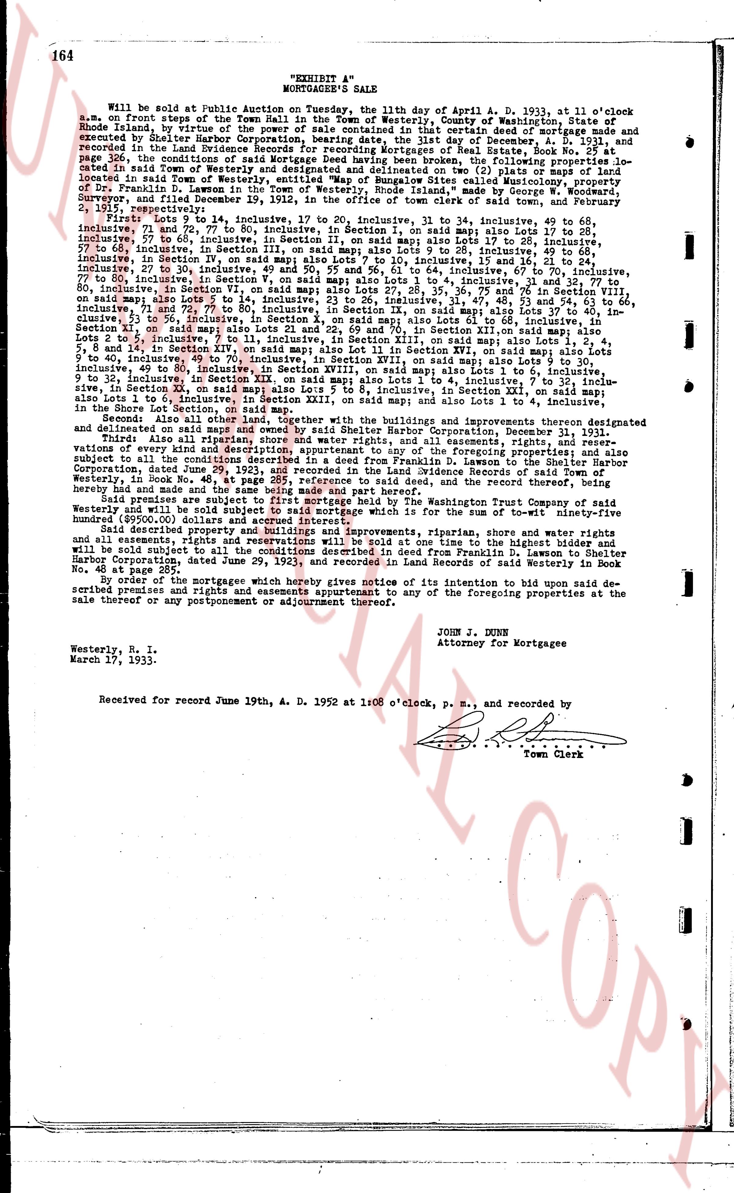
164
"EXHIBIT A"
MORTGAGEE'S SALE
Will be sold at Public auction on Tuesday, the 11th day of April A. D. 1933, at 11 o'clock a.m. on the front steps of the town hall in the town of Westerly, county of Washington, state of Rhode Island, by virtue of the power of sale contained in certain deed of mortgage made and executed by Shelter Harbor Corporation, bearing date the 1st day of December, A. D. 1931, and recorded in the land evidence records of the town of Westerly, in book 254, page 326, the conditions of said Mortgage Deed having been broken, the following properties located in said town of Westerly, being the properties described in said mortgage, in book 254, page 326, the conditions of said Mortgage Deed having been broken, the following properties located in said town of Westerly, entitled "Map of Bungalow Sites called Misquamic property", approved by the Town of Westerly, and recorded in the office of the town clerk by George S. Snyder, Surveyor, and filed December 19, 1932, in the office of the town clerk of said town, and February 2, 1933, in the office of the register of deeds of the county of Washington:
First Lots 9 to 14, inclusive, to 17 to 20, inclusive, to 31 to 34, inclusive, 49 to 68, inclusive, 75 to 81, inclusive, to 84 to 91, inclusive, in Section I, on said map; also Lots 1 to 28, inclusive, 57 to 68, inclusive, in Section I, on said map; also Lots 1 to 27, inclusive, 31 to 35, inclusive, 57 to 68, inclusive, in Section III, on said map; also Lots 9 to 28, inclusive, 49 to 68, inclusive, 75 to 81, inclusive, to 84 to 91, inclusive, in Section III, on said map; also Lots 1 to 28, inclusive, 27 to 30, inclusive, 39 to 40, inclusive, 49 and 50, 55 and 56, 61 to 64, inclusive, 67 to 70, inclusive, 77 to 80, inclusive, in Section V, on said map; also Lots 1 to 28, inclusive, 31 to 35, inclusive, 57 to 60, inclusive, 71 and 72, 77 to 80, inclusive, in Section V, on said map; also Lots 27, 28, 35, 36, 75 and 76 in Section VIII; also Lots 1 to 28, inclusive, 31 to 35, inclusive, 57 to 60, inclusive, 61 to 64, inclusive, 67 to 70, inclusive, 71 and 72, 77 to 80, inclusive, in Section IX, on said map; also Lots 37 to 40, inclusive, Lots 4 to 8, inclusive, 11 to 14, inclusive, 17 to 20, inclusive, 31 to 34, inclusive, 49 to 68, inclusive, 75 to 81, inclusive, to 84 to 91, inclusive, in Section XI, on said map; also Lots 21 and 22, and 69 and 70, in Section XII, on said map; also Lots 4 to 8, inclusive, 11 to 14, inclusive, 17 to 20, inclusive, 31 to 34, inclusive, 49 to 68, inclusive, 75 to 81, inclusive, 49 to 80, inclusive, in Section XIV, on said map; also Lot 11 in Section XVI, on said map; also Lots 1 to 6, inclusive, 9 to 14, inclusive, 17 to 20, inclusive, 31 to 34, inclusive, 49 to 68, inclusive, 75 to 81, inclusive, 49 to 80, inclusive, in Section XVIII, on said map; also Lots 1 to 6, inclusive, 9 to 14, inclusive, 17 to 20, inclusive, 31 to 34, inclusive, 49 to 68, inclusive, 5 to 10, inclusive, in Section XI, on said map; also Lot 5 to 8, inclusive, in Section XII, on said map; also Lots 1 to 4, inclusive, Lots 1 to 4, inclusive, in Section XIII, on said map; also Lots 1 to 4, inclusive, in Section XV, on said map; also Lots 1 to 4, inclusive, in Section XVII, on said map; also Lots 1 to 4, inclusive, in the Shore Lot Section, on said map.
Second All other lots and land, together with the buildings and improvements thereon designated and delineated on said map, not described in the first above description.
Third Also all riparian, shoreline, and water rights, and all easements, rights, and reservations, deliminated and delineated on said map, appertaining to the foregoing properties.
Said premises are subject to first mortgage held by The Washington Trust Company of said Westerly, in book 248, page 111, and to a second mortgage, in book 254, page 326, and to a deed from Franklin D. Lawson to the Shelter Harbor Corporation, bearing date June 29, 1923, and recorded in the land evidence records of said town of Westerly, in Book No. 48, at page 285, reference to said deed, and the record thereof, being hereby reserved.
Said premises are to be sold as a whole, in one lot, which is for the sum of to-wit ninety-five hundred ($9500.00) dollars and accrued interest.
The properties will be sold together with all riparian, shoreline, and water rights, and all easements, rights, and reservations as described in deed from Franklin D. Lawson to Shelter Harbor Corporation, dated June 29, 1923, and recorded in the land evidence records of said town of Westerly in Book No. 48, page 285.
By order of the mortgagees which hereby gives notice of its intention to bid upon said described premises and rights and easements appurtenant to any of the foregoing properties at the sale thereof or any postponement or adjournment thereof.
JOHN J. MUNN
Attorney for Mortgagee
Westerly, R. I.
March 17, 1933.
Received for record June 19th, A. D. 1952 at 1:08 o'clock, p. m., and recorded by
Town Clerk
page 6 · read by Gemma vision
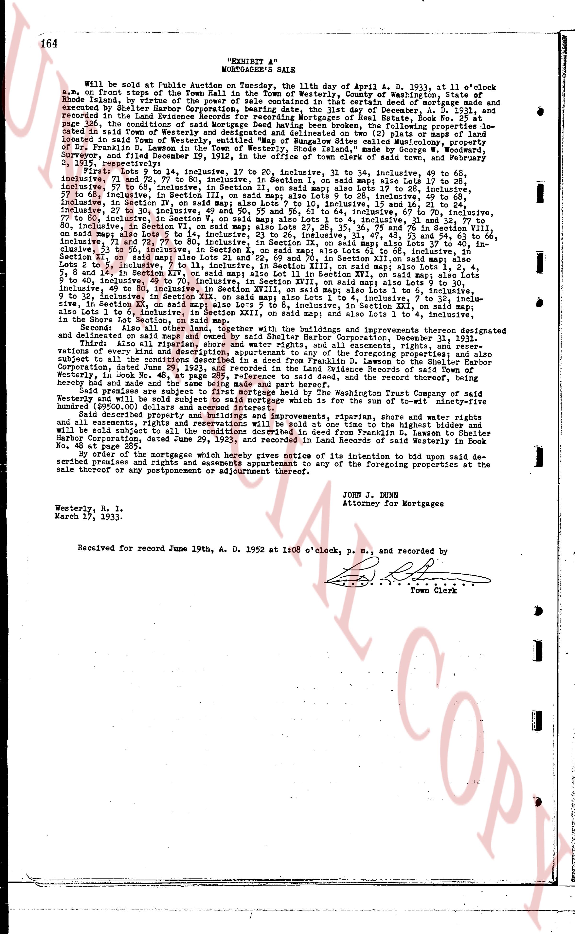
164
"EXHIBIT A"
MORTGAGEE'S SALE
Will be sold at Public auction on Tuesday, the 11th day of April A. D. 1933, at 11 o'clock a.m. on the front steps of the town hall in the town of Westerly, county of Washington, state of Rhode Island, by virtue of the power of sale contained in certain deed of mortgage made and executed by Shelter Harbor Corporation, borrowing party, dated the 1st day of December, A. D. 1931, and recorded in the land evidence records of the town of Westerly, in book 242, page 326, the conditions of said Mortgage Deed having been broken, the following properties located in said town of Westerly, being all the land in said town, as shown on (6) plats or maps, located in said town of Westerly, entitled "Map of Bungalow Sites called Misquamic property", located in said town, in accordance with a survey made by George H. Snyder, Surveyor, and filed December 19, 1932, in the office of the town clerk of said town, and February 2, 1933, in the office of the register of deeds, to wit:
First Lots 9 to 14, inclusive, to 17 to 20, inclusive, to 31 to 34, inclusive, to 49 to 68, inclusive, to 74 to 81, inclusive, in Section I, on said map; also Lots 1 to 27, inclusive, to 28 to 35, inclusive, to 57 to 68, inclusive, in Section I, on said map; also Lots 1 to 27, inclusive, to 28 to 35, inclusive, to 57 to 68, inclusive, in Section III, on said map; also Lots 9 to 28, inclusive, to 49 to 68, inclusive, to 74 to 81, inclusive, in Section III, on said map; also Lots 1 to 27, inclusive, to 28 to 35, inclusive, to 57 to 68, inclusive, in Section V, on said map; also Lots 9 to 28, inclusive, to 49 to 68, inclusive, to 74 to 81, inclusive, to 27 to 30, inclusive, to 49 and 50, and 55 and 56, lot 61 to 64, inclusive, to 67 to 70, inclusive, to 77 to 81, inclusive, in Section V, on said map; also Lots 1 to 27, inclusive, to 28 to 35, inclusive, to 57 to 80, inclusive, in Section VI, on said map; also Lots 27 to 28, 35, 36, 75 to 76 in Section VIII; also Lots 1 to 27, inclusive, to 28 to 35, inclusive, to 57 to 68, inclusive, to 74 to 81, inclusive, to 71 and 72, 77 to 80, inclusive, in Section IX, on said map; also Lots 37 to 40, inclusive, to 41 to 44, inclusive, to 45 to 48, inclusive, to 49 to 52, inclusive, to 53 to 56, inclusive, to 61 to 64, inclusive, to 71 and 72, 77 to 80, inclusive, in Section X, on said map; also Lots 21 and 22, and 69 and 70, in Section XI, on said map; also Lots 4 to 5, Lots 8 and 9, and 10 to 14, inclusive, in Section XII, on said map; also Lots 1 to 4, inclusive, to 5 to 8, inclusive, to 9 to 14, inclusive, in Section XIII, on said map; also Lot 11 in Section XVI, on said map; also Lots 1 to 6, inclusive, to 7 to 10, inclusive, to 11 to 14, inclusive, in Section XVII, on said map; also Lots 1 to 27, inclusive, to 28 to 35, inclusive, to 49 to 80, inclusive, in Section XVIII, on said map; also Lots 1 to 6, inclusive, to 7 to 10, inclusive, to 11 to 14, inclusive, in Section XIX, on said map; also Lots 1 to 6, inclusive, to 7 to 10, inclusive, to 11 to 14, inclusive, to 15 to 18, inclusive, to 7 to 10, inclusive, in Section XX, on said map; also Lot 5 to 8, inclusive, in Section XXI, on said map; also Lots 1 to 4, inclusive, to 5 to 8, inclusive, to 9 to 14, inclusive, in Section XXII, on said map; also Lots 1 to 4, inclusive, in the Shore Lot Section, on said map; also Lots 1 to 4, inclusive, in Section XXIII, on said map; and also Lots 1 to 4, inclusive, in the Shore Lot Section, on said map.
Second Also all other lands, together with the buildings and improvements thereon designated and delineated on said maps, and the descriptions contained in said maps.
Third Also all riparian, shore and water rights, and all easements, rights, and reservations, appurtenant to the foregoing properties at the time of their acquisition, and all the foregoing properties subject to all the conditions described in a deed from Franklin D. Lawson to the Shelter Harbor Corporation, recorded in the land evidence records of the town of Westerly, in book No. 48, at page 285, reference to said deed, and the record thereof, being partly repeated in the descriptions contained in said maps.
Said premises are subject to first mortgage held by The Washington Trust Company of said Westerly, in the sum of twenty-five thousand dollars, and subject to all the rights, privileges, and all easements, rights, and reservations which is for the sum of to-wit ninety-five hundred ($9500.00) dollars and accrued interest.
The said lands, together with the buildings and improvements thereon, shore and water rights, and all easements, rights, and reservations will be sold at one time to the highest bidder and will be conveyed subject to the rights, privileges, and conditions described in deed from Franklin D. Lawson to Shelter Harbor Corporation, dated June 29, 1923, and recorded in the land evidence records of said Westerly in book No. 48, page 285.
By order of the mortgagees which hereby gives notice of its intention to bid upon said described premises and rights and easements appurtenant to any of the foregoing properties at the sale thereof or any postponement or adjournment thereof.
JOHN J. MUNN
Attorney for Mortgagee
Westerly, R. I.
March 17, 1933.
Received for record June 19th, A. D. 1952 at 1:08 o'clock, p. m., and recorded by
Town Clerk
page 7 · read by Gemma vision
164
"EXHIBIT A"
MORTGAGEE'S SALE
Will be sold at Public auction on Tuesday, the 11th day of April A. D. 1933, at 11 o'clock a.m. on the front steps of the town hall in the town of Westerly, county of Washington, state of Rhode Island, by virtue of the power of sale contained in certain deed of mortgage made and executed by Shelter Harbor Corporation, bearing date the 1st day of December, A. D. 1911, and recorded in the land evidence records of the town of Westerly, in book 242, page 326, the conditions of said Mortgage Deed having been broken, the following properties located in said town of Westerly, being all of the land and buildings (or lots) shown on a map page 326, the conditions of said Mortgage Deed having been broken, the following properties located in said town of Westerly, entitled "Map of Bungalow Sites called Misquamic property", and located in said Town, are hereby offered for sale by said Mortgagee, as described in a survey made by George [?] Surveyor, and filed December 19, 1912, in the office of the town clerk of said town, and February 2, 1913.
First Lots 9 to 14, inclusive, to 17 to 20, inclusive, to 31 to 34, inclusive, 49 to 68, inclusive, 74 to 80, inclusive, to 84 to 90, inclusive, to 101 to 108, inclusive, to 112 to 118, inclusive, 57 to 68, inclusive, in Section I, on said map; also Lots 1 to 27, inclusive, to 31 to 35, inclusive, to 41 to 45, inclusive, to 51 to 55, inclusive, Lot 76 to 81, inclusive, 57 to 68, inclusive, in Section III, on said map; also Lots 9 to 15, inclusive, 28 to 49, inclusive, 66 to 73, inclusive, in Section IV, on said map; also Lots 1 to 10, inclusive, to 14 to 20, inclusive, 27 to 30, inclusive, 49 and 50, 55 and 56, 61 to 64, inclusive, 67 to 70, inclusive, 77 to 80, inclusive, in Section V, on said map; also Lots 1 to 10, inclusive, to 13 to 17, inclusive, 27 to 30, inclusive, 77 to 80, inclusive, in Section VI, on said map; also Lots 27, 28, 35, 36, 75 and 76 in Section VII, on said map; also Lots 1 to 10, inclusive, to 13 to 17, inclusive, 27 to 30, inclusive, 61 to 64, inclusive, 71 and 72, 77 to 80, inclusive, in Section IX, on said map; also Lots 37 to 40, inclusive, Lots 1 to 4, inclusive, to 5 to 8, inclusive, to 9 to 12, inclusive, to 13 to 16, inclusive, to 17 to 20, inclusive, in Section X, on said map; also Lots 21 and 22, and 69 and 70, in Section XI, on said map; also Lots 4 to 5, 8 and 14, in Section XII, on said map; also Lots 1 to 4, inclusive, to 5 to 8, inclusive, to 9 to 12, inclusive, 49 to 80, inclusive, in Section XIII, on said map; also Lot 11 in Section XVI, on said map; also Lots 1 to 6, inclusive, 9 to 12, inclusive, in Section XVII, on said map; also Lots 1 to 4, inclusive, to 5 to 8, inclusive, to 9 to 12, inclusive, 49 to 80, inclusive, in Section XVIII, on said map; also Lots 1 to 6, inclusive, 9 to 12, inclusive, in Section XIX, on said map; also Lots 1 to 4, inclusive, to 5 to 8, inclusive, to 9 to 12, inclusive, 49 to 80, inclusive, in Section XX, inclusive, to Section XXI, on said map; also Lots 1 to 8, inclusive, in Section XXII, on said map; also Lots 1 to 4, inclusive, to 5 to 8, inclusive, to 9 to 12, inclusive, in Section XXIII, on said map; also Lots 1 to 4, inclusive, to 5 to 8, inclusive, to 9 to 12, inclusive, in Section XXIV, on said map; and also Lots 1 to 4, inclusive, in the Shore Lot Section, on said map.
Second Also all other lands, together with the buildings and improvements thereon designated and delineated on said map, not otherwise described in the foregoing description.
Third Also all riparian, shore and water rights, and all easements, rights, and reservations, appurtenant to the foregoing properties at the time of the execution of the mortgage, and also subject to all the conditions described in a deed from Franklin D. Lawson to the Shelter Harbor Corporation, recorded in the land evidence records of the town of Westerly, in book 242, page 326, subject to all the conditions described in a deed from Franklin D. Lawson to Shelter Harbor Corporation, recorded in the land evidence records of said town of Westerly, in Book No. 48, at page 285, reference to said deed, and the record thereof, being partly described in the foregoing description.
Said premises are subject to first mortgage held by The Washington Trust Company of said Westerly, in the sum of twenty-five thousand dollars, which is for the sum of to-wit ninety-five hundred ($9500.00) dollars and accrued interest.
The properties, together with all the buildings and improvements thereon, and all the riparian, shore and water rights, and all easements, rights, and reservations described in deed from Franklin D. Lawson to Shelter Harbor Corporation, dated June 29, 1923, and recorded in the land evidence records of said town of Westerly in Book No. 111, page 237.
By order of the mortgagees which hereby gives notice of its intention to bid upon said described premises and rights and easements appurtenant to any of the foregoing properties at the sale thereof or any postponement or adjournment thereof.
JOHN J. MUNN
Attorney for Mortgagee
Westerly, R. I.
March 17, 1933.
Received for record June 19th, A. D. 1952 at 1:08 o'clock, p. m., and recorded by
Town Clerk
page 8 · read by Gemma vision
164
"EXHIBIT A"
MORTGAGEE'S SALE
Will be sold at Public Auction on Tuesday, the 11th day of April A. D. 1933, at 11 o'clock a.m. on the front steps of the town hall in the town of Westerly, county of Washington, state of Rhode Island, by virtue of the power of sale contained in certain deed of mortgage made and executed by Shelter Harbor Corporation, bearing date the 1st day of December, A. D. 1931, and recorded in the land evidence records of the town of Westerly, in book 284, page 326, the conditions of said Mortgage Deed having been broken, the following properties located in said town of Westerly, being all of the land and buildings (or lots) shown on map 1, page 326, located in said town of Westerly, entitled "Map of Bungalow Sites called Misquamic property", in District No. 1, section I, as shown on said map, and as more fully described by deed made by George S. Surveyor, and filed December 19, 1912, in the office of the town clerk of said town, and February 2, 1913:
First Lots 9 to 14, inclusive, to 17 to 20, inclusive, to 31 to 34, inclusive, 49 to 68, inclusive, 74 to 80, inclusive, in Section I, on said map; also Lots 1 to 20, inclusive, to 24 to 28, inclusive, 57 to 68, inclusive, in Section I, on said map; also Lots 1 to 27, inclusive, to 31 to 34, inclusive, 49 to 68, inclusive, 74 to 80, inclusive, in Section III, on said map; also Lots 9 to 20, inclusive, 24 to 28, inclusive, 57 to 68, inclusive, in Section III, on said map; also Lots 9 to 20, inclusive, 24 to 28, inclusive, 57 to 68, inclusive, in Section V, on said map; also Lots 9 to 20, inclusive, 24 to 28, inclusive, 57 to 68, inclusive, in Section VII, on said map; also Lots 1 to 64, inclusive, 27 to 30, inclusive, 39 to 40, inclusive, 49 and 50, 55 and 56, 61 to 64, inclusive, 67 to 70, inclusive, 77 to 80, inclusive, in Section VIII, on said map; also Lots 1 to 64, inclusive, 27 to 30, inclusive, 39 to 40, inclusive, 49 and 50, 55 and 56, 61 to 64, inclusive, 67 to 70, inclusive, 77 to 80, inclusive, in Section VI, on said map; also Lots 27, 28, 35, 36, 75 and 76 in Section VIII, on said map; also Lots 27, 28, 35, 36, 75 and 76 in Section VI, on said map; also Lots 37 to 40, inclusive, 71 and 72, 77 to 80, inclusive, in Section IX, on said map; also Lots 37 to 40, inclusive, 71 and 72, 77 to 80, inclusive, in Section X, on said map; also Lots 1 to 4, inclusive, 71 and 72, 77 to 80, inclusive, in Section IX, on said map; also Lots 37 to 40, inclusive, 71 and 72, 77 to 80, inclusive, in Section X, on said map; also Lots 1 to 4, inclusive, 5 to 8, 14 and 15, in Section XIV, on said map; also Lot 11 in Section XVI, on said map; also Lots 1 to 6, inclusive, 9 to 12, inclusive, 14 to 18, inclusive, in Section XV, on said map; also Lots 1 to 6, inclusive, 9 to 12, inclusive, 14 to 18, inclusive, 49 to 80, inclusive, in Section XVIII, on said map; also Lots 1 to 6, inclusive, 9 to 12, inclusive, 14 to 18, inclusive, 49 to 80, inclusive, in Section XX, on said map; also Lots 1 to 4, inclusive, 5 to 8, inclusive, 14 to 18, inclusive, 49 to 80, inclusive, in Section XX, on said map; also Lots 1 to 4, inclusive, 5 to 8, inclusive, in Section XI, on said map; also Lot 5 to 8, inclusive, in Section XII, on said map; also Lots 1 to 4, inclusive, 5 to 8, inclusive, in Section XIII, on said map; also Lots 1 to 4, inclusive, 5 to 8, inclusive, in Section XV, on said map; also Lots 1 to 4, inclusive, 5 to 8, inclusive, in Section XVI, on said map; also Lots 1 to 4, inclusive, 5 to 8, inclusive, in Section XVII, on said map; also Lots 1 to 4, inclusive, 5 to 8, inclusive, in the Shore Lot Section, on said map.
Second Also all other land, together with the buildings and improvements thereon designated and delineated on said map, not otherwise described in this Description, in District No. 1, Section I.
Third Also all riparian, shoreline, and water rights, and all easements, rights, and reservations, all easements, rights, and reservations appurtenant to the foregoing properties located in said town of Westerly, subject to all the conditions described in a deed from Franklin D. Lawson to the Shelter Harbor Corporation, recorded in the land evidence records of the town of Westerly, in book No. 48, at page 285, reference to said deed, and the record thereof, being hereby reserved.
Said premises are subject to first mortgage held by The Washington Trust Company of said Westerly, in book 284, page 326, and to all easements, rights, and reservations, and to all easements, rights, and reservations contained in deed from Franklin D. Lawson to Shelter Harbor Corporation, dated June 29, 1923, and recorded in the land evidence records of said town of Westerly in Book No. 48, page 285.
By order of the mortgagees which hereby gives notice of its intention to bid upon said described premises and rights and easements appurtenant to any of the foregoing properties at the sale thereof or any postponement or adjournment thereof.
JOHN J. MUNN
Attorney for Mortgagee
Westerly, R. I.
March 17, 1933.
Received for record June 19th, A. D. 1952 at 1:08 o'clock, p. m., and recorded by
Town Clerk
page 9 · read by Gemma vision
164
"EXHIBIT A"
MORTGAGEE'S SALE
Will be sold at Public auction on Tuesday, the 11th day of April A. D. 1933, at 11 o'clock a.m. on the front steps of the town hall in the town of Westerly, county of Washington, state of Rhode Island, by virtue of the power of sale contained in certain deed of mortgage made and executed by Shelter Harbor Corporation, bearing date the 1st day of December, A. D. 1931, and recorded in the land evidence records of the town of Westerly, in book 254, page 326, the conditions of said Mortgage Deed having been broken, the following properties located in said town of Westerly, being the land and premises described in (6) plots on a map annexed to page 326, the conditions of said Mortgage Deed having been broken, the following properties located in said town of Westerly, entitled "Map of Bungalow Sites called Misquamic property, plot of land in Section IV", as the same appears on said map made by George H. Snyder, Surveyor, and filed December 19, 1932, in the office of the town clerk of said town, and February 2, 1933.
First Lots 9 to 14, inclusive, in Section 10, 20 inclusive, in Section 31 to 34, inclusive, 49 to 68, inclusive, in Section 32, Lots 1 to 18, inclusive, in Section 1, on said map; also Lots 17 to 28, inclusive, 57 to 68, inclusive, in Section 33, on said map; also Lots 1 to 27, inclusive, in Section 34, on said map; also Lots 1 to 28, inclusive, 57 to 68, inclusive, in Section III, on said map; also Lots 9 to 28, inclusive, 49 to 68, inclusive, in Section III, on said map; also Lots 1 to 28, inclusive, 57 to 68, inclusive, in Section IV, on said map; also Lots 1 to 28, inclusive, 27 to 30, inclusive, in Section IV, on said map; also Lots 9 to 64, inclusive, 67 to 70, inclusive, 77 to 80, inclusive, in Section V, on said map; also Lots 1 to 28, inclusive, 57 to 68, inclusive, 77 to 80, inclusive, in Section VI, on said map; also Lots 27, 28, 35, 36, 75 and 76 in Section VII, on said map; also Lots 1 to 28, inclusive, 57 to 68, inclusive, 77 to 80, inclusive, in Section VIII, on said map; also Lots 1 to 28, inclusive, 61 to 72, inclusive, 77 to 80, inclusive, in Section IX, on said map; also Lots 27, 28, 35, 36, 75 and 76 in Section VIII, on said map; also Lots 1 to 28, inclusive, 57 to 68, inclusive, 77 to 80, inclusive, in Section X, on said map; also Lots 37 to 40, inclusive, 71 and 72, 77 to 80, inclusive, in Section IX, on said map; also Lots 1 to 28, inclusive, 61 to 72, inclusive, 77 to 80, inclusive, in Section X, on said map; also Lots 21 and 22, and 69 and 70, in Section XII, on said map; also Lots 4, 5, 8 and 14, in Section XIV, on said map; also Lot 11 in Section XVI, on said map; also Lots 1 to 6, inclusive, 9 to 14, inclusive, in Section XVII, on said map; also Lots 1 to 28, inclusive, 57 to 68, inclusive, 49 to 80, inclusive, in Section XVIII, on said map; also Lots 1 to 6, inclusive, 9 to 14, inclusive, in Section XIX, on said map; also Lots 1 to 28, inclusive, 6 to 12, inclusive, 7 to 10, inclusive, in Section XI, on said map; also Lot 5 to 8, inclusive, in Section XII, on said map; also Lots 1 to 4, inclusive, in Section XIII, on said map; also Lot 1 in Section XIII, on said map; and also Lots 1 to 4, inclusive, in the Shore Lot Section, on said map.
Second Also all other land, together with the buildings and improvements thereon designated and delineated on said map, not otherwise described in the foregoing description, in Section IV.
Third Also all riparian, shoreline, and water rights, and all easements, rights, and reservations, all easements, rights, and reservations, and all the foregoing properties together with all the buildings and improvements thereon, subject to all the conditions described in deed from Franklin D. Lawson to the Shelter Harbor Corporation, recorded in the land evidence records of the town of Westerly, in book No. 48, at page 285, reference to said deed, and the record thereof, being hereby reserved.
Said premises are subject to first mortgage held by The Washington Trust Company of said Westerly, in book No. 254, page 326, and to all easements, rights, and reservations, and all easements, rights, and reservations, and all the foregoing properties together with all the buildings and improvements thereon, which is for the sum of to-wit ninety-five hundred ($9500.00) dollars and accrued interest.
The said land, buildings, improvements, riparian, shoreline, and water rights, and all easements, rights, and reservations will be sold at one time to the highest bidder and will be conveyed subject to the conditions described in deed from Franklin D. Lawson to Shelter Harbor Corporation, dated June 29, 1923, and recorded in the land evidence records of said Westerly in Book No. 48, page 285.
By order of the mortgagees which hereby gives notice of its intention to bid upon said described premises and rights and easements appurtenant to any of the foregoing properties at the sale thereof or any postponement or adjournment thereof.
JOHN J. MUNN
Attorney for Mortgagee
Westerly, R. I.
March 17, 1933.
Received for record June 19th, A. D. 1952 at 1:08 o'clock, p. m., and recorded by
Town Clerk
page 10 · read by Gemma vision
164
"EXHIBIT A"
MORTGAGEE'S SALE
Will be sold at Public auction on Tuesday, the 11th day of April A. D. 1933, at 11 o'clock a.m. on the front steps of the town hall in the town of Westerly, county of Washington, state of Rhode Island, by virtue of the power of sale contained in certain deed of mortgage made and executed by Shelter Harbor Corporation, bearing date the first day of December, A. D. 1931, and recorded in the land evidence records of the town of Westerly, in book 254, page 326, the conditions of said Mortgage Deed having been broken, the following properties located in said town of Westerly, being the properties described in said mortgage, in book 254, page 326, located in said town of Westerly, entitled "Map of Bungalow Sites called Misquamic property," in town of Westerly, as more fully described in deed made by George W. Snyder, Surveyor, and filed December 19, 1912, in the office of the town clerk of said town, and February 2, 1913:
First Lots 9 to 14, inclusive, to 17 to 20, inclusive, to 31 to 34, inclusive, 49 to 68, inclusive, 74 to 81, inclusive, to 84 to 91, inclusive, in Section I, on said map; also Lots 1 to 28, inclusive, 57 to 66, inclusive, in Section III, on said map; also Lots 9 to 28, inclusive, 49 to 68, inclusive, 57 to 66, inclusive, in Section III, on said map; also Lots 9 to 28, inclusive, 49 to 68, inclusive, in Section III, on said map; also Lots 1 to 28, inclusive, 49 to 68, inclusive, in Section I, on said map; also Lots 1 to 28, inclusive, 57 to 66, inclusive, in Section III, on said map; also Lots 9 to 28, inclusive, 49 to 68, inclusive, in Section III, on said map; also Lots 1 to 28, inclusive, 49 to 68, inclusive, in Section III, on said map; also Lots 1 to 28, inclusive, 49 to 68, inclusive, 57 to 66, inclusive, in Section III, on said map; also Lots 1 to 28, inclusive, 27 to 30, inclusive, in Section III, on said map; also Lots 9 to 60, inclusive, 64 to 66, inclusive, 67 to 70, inclusive, 77 to 80, inclusive, in Section V, on said map; also Lots 1 to 28, inclusive, 49 to 68, inclusive, 57 to 66, inclusive, 27 to 30, inclusive, in Section VII, on said map; also Lots 27, 28, 35, 36, 75 to 76 in Section VIII; also Lots 1 to 28, inclusive, 49 to 68, inclusive, 57 to 66, inclusive, 27 to 30, inclusive, 67 to 80, inclusive, in Section VI, on said map; also Lots 27, 28, 35, 36, 75 to 76 in Section VIII; also Lots 1 to 28, inclusive, 49 to 68, inclusive, 57 to 66, inclusive, 27 to 30, inclusive, 67 to 80, inclusive, in Section VI, on said map; also Lots 37 to 40, inclusive, 71 to 72, 77 to 80, inclusive, in Section IX, on said map; also Lots 37 to 40, inclusive, 71 to 72, 77 to 80, inclusive, in Section IX, on said map; also Lots 21 and 22, 69 and 70, in Section XII, on said map; also Lots 4, 5, 8 and 14, in Section XIV, on said map; also Lot 11 in Section XVI, on said map; also Lots 1 to 6, inclusive, 9 to 12, inclusive, in Section XVII, on said map; also Lots 1 to 6, inclusive, 9 to 12, inclusive, 49 to 80, inclusive, in Section XVIII, on said map; also Lots 1 to 6, inclusive, 9 to 12, inclusive, 49 to 80, inclusive, in Section XVIII, on said map; also Lots 1 to 6, inclusive, 9 to 12, inclusive, 49 to 80, inclusive, in Section XVIII, on said map; also Lots 5 to 8, inclusive, in Section XI, on said map; also Lots 5 to 8, inclusive, in Section XI, on said map; also Lots 7 to 10, inclusive, in Section XI, on said map; also Lots 5 to 8, inclusive, in Section XI, on said map; also Lots 1 to 4, inclusive, in the Shore Lot Section, on said map; also Lots 1 to 4, inclusive, in Section XXII, on said map; and also Lots 1 to 4, inclusive, in the Shore Lot Section, on said map.
Second Also all other land, together with the buildings and improvements thereon designated and delineated on said map, not otherwise described in this Description, in the town of Westerly.
Third Also all riparian, shoreline, and water rights, and all easements, rights, and reservations, delgates and appurtenances thereunto belonging, and appertaining to the foregoing properties located in Westerly, in book No. 48, page 285, reference to said deed, and the record thereof, being preserved in the land evidence records of the town of Westerly.
Said premises are subject to first mortgage held by The Washington Trust Company of said Westerly, in book No. 48, page 285, reference to said deed, and the record thereof, being preserved in the land evidence records of the town of Westerly.
All the above described properties, together with all the buildings and improvements thereon, and all easements, rights, and reservations will be sold at one time to the highest bidder and will be conveyed subject to the conditions described in deed from Franklin D. Lawson to Shelter Harbor Corporation, dated June 29, 1923, and recorded in the land evidence records of said town of Westerly in book No. 48, page 285.
By order of the mortgagees which hereby gives notice of its intention to bid upon said described premises and rights and easements appurtenant to any of the foregoing properties at the sale thereof or any postponement or adjournment thereof.
JOHN J. MUNN
Attorney for Mortgagee
Westerly, R. I.
March 17, 1933.
Received for record June 19th, A. D. 1952 at 1:08 o'clock, p. m., and recorded by
Town Clerk
page 11 · read by Gemma vision
164
"EXHIBIT A"
MORTGAGEE'S SALE
Will be sold at Public auction on Tuesday, the 11th day of April A. D. 1933, at 11 o'clock a.m. on the front steps of the town hall in the town of Westerly, county of Washington, state of Rhode Island, by virtue of the power of sale contained in certain deed of mortgage made and executed by Shelter Harbor Corporation, borrowing party, dated the 1st day of December, A. D. 1931, and recorded in the land evidence records of the town of Westerly, in book 242, page 326, the conditions of said Mortgage Deed having been broken, the following properties located in said town of Westerly, being all of the parcels of land, together with the buildings thereon, located in said Town of Westerly, entitled with "Map Boundary of Gulles Coves settlement property, Map of the Town of Westerly", as the same appears on a certain map made by George W. Snyder, Surveyor, and filed December 19, 1912, in the office of the town clerk of said town, and February 2, 1931:
First Lots 9 to 14, inclusive, to 17 to 20, inclusive, to 31 to 34, inclusive, 49 to 68, inclusive, 74 to 81, inclusive, and 84 to 91, inclusive, in Section I, on said map; also Lots 1 to 28, inclusive, 57 to 66, inclusive, in Section II, on said map; also Lots 1 to 27, inclusive, 31 to 35, inclusive, 57 to 66, inclusive, in Section III, on said map; also Lots 9 to 28, inclusive, 49 to 66, inclusive, 74 to 81, inclusive, and 84 to 91, inclusive, in Section IV, on said map; also Lots 1 to 27, inclusive, 27 to 30, inclusive, 39, 40 and 50, 55 and 56, 61 to 64, inclusive, 67 to 70, inclusive, 77 to 80, inclusive, in Section V, on said map; also Lots 1 to 27, inclusive, 31 to 35, inclusive, 57 to 60, inclusive, 71 to 80, inclusive, in Section VI, on said map; also Lots 27, 28, 35, 36, 75 and 76 in Section VII, also Lots 1 to 27, inclusive, 31 to 35, inclusive, 57 to 60, inclusive, 61 to 64, inclusive, 67 to 70, inclusive, 71 and 72, 77 to 80, inclusive, in Section IX, on said map; also Lots 37 to 40, inclusive, Lots 4 to 14, inclusive, 17 to 20, inclusive, 31 to 34, inclusive, 49 to 68, inclusive, 74 to 81, inclusive, 84 to 91, inclusive, in Section X, on said map; also Lots 21 and 22, and 69 and 70, in Section XI, on said map; also Lot 4, Lots 5 to 14, inclusive, 17 to 20, inclusive, 31 to 34, inclusive, 49 to 68, inclusive, 74 to 81, inclusive, 84 to 91, inclusive, in Section XII, on said map; also Lots 1 to 27, inclusive, 31 to 35, inclusive, 49 to 80, inclusive, in Section XVIII, on said map; also Lots 1 to 6, inclusive, 9 to 14, inclusive, 17 to 20, inclusive, 31 to 34, inclusive, 49 to 68, inclusive, 74 to 81, inclusive, 84 to 91, inclusive, in Section XI, on said map; also Lot 5 to 8, inclusive, in Section XII, on said map; also Lot 11 in Section XVI, on said map; also Lots 1 to 6, inclusive, 9 to 14, inclusive, 17 to 20, inclusive, 31 to 34, inclusive, 49 to 68, inclusive, 74 to 81, inclusive, 84 to 91, inclusive, in Section XIV, on said map; also Lot 11 in Section XVI, on said map; also Lots 1 to 6, inclusive, 9 to 14, inclusive, 17 to 20, inclusive, 31 to 34, inclusive, 49 to 68, inclusive, 74 to 81, inclusive, 84 to 91, inclusive, in Section XV, on said map; also Lots 1 to 27, inclusive, 31 to 35, inclusive, 49 to 80, inclusive, in Section XVIII, on said map; also Lots 1 to 6, inclusive, 9 to 14, inclusive, 17 to 20, inclusive, 31 to 34, inclusive, 49 to 68, inclusive, 74 to 81, inclusive, 84 to 91, inclusive, in Section XX, on said map; also Lots 5 to 8, inclusive, in Section XXI, on said map; also Lots 1 to 4, inclusive, in the Shore Lot Section, on said map; also Lots 1 to 4, inclusive, in Section XXIII, on said map; and also Lots 1 to 4, inclusive, in the Shore Lot Section, on said map.
Second Also all other lands, together with the buildings and improvements thereon designated and delineated on said map, not specifically described in the foregoing description.
Third Also all riparian, shoreline, and water rights, and all easements, rights, and reservations, appurtenant to the foregoing properties.
Said properties are subject to a certain deed from Franklin D. Lawson to the Shelter Harbor Corporation, recorded in the land evidence records of the town of Westerly, in book 234, page 150, subject to all the conditions described in a deed from Franklin D. Lawson to the Shelter Harbor Corporation, recorded in the land evidence records of the town of Westerly, in Book No. 48, at page 285, reference to said deed, and the record thereof, being partly described in the foregoing description.
Said premises are subject to first mortgage held by The Washington Trust Company of said Westerly, in the original sum of twenty-five thousand dollars which is for the sum of to-wit ninety-five hundred ($9500.00) dollars and accrued interest.
The said properties, together with all the buildings and improvements thereon, and subject to all easements, rights, and reservations will be sold at one time to the highest bidder and will be conveyed subject to the conditions described in deed from Franklin D. Lawson to Shelter Harbor Corporation, dated June 29, 1923, and recorded in the land evidence records of said Westerly in Book No. 234, page 150.
By order of the mortgagees which hereby gives notice of its intention to bid upon said described premises and rights and easements appurtenant to any of the foregoing properties at the sale thereof or any postponement or adjournment thereof.
JOHN J. MUNN
Attorney for Mortgagee
Westerly, R. I.
March 17, 1933.
Received for record June 19th, A. D. 1952 at 1:08 o'clock, p. m., and recorded by
Town Clerk
The page as recorded