The instrument's own words
page 1 · read by Gemma vision
3
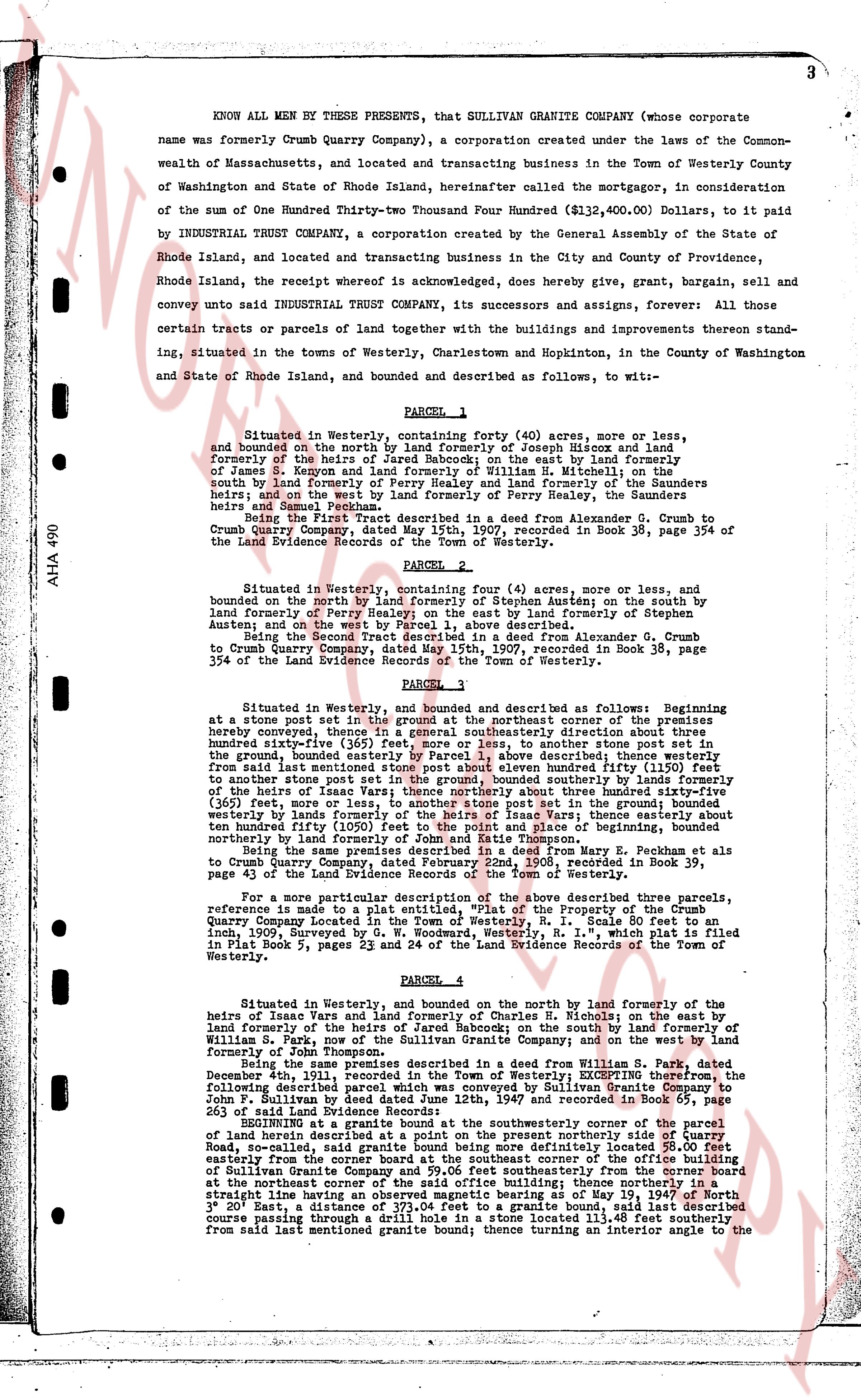
KNOW ALL MEN BY THESE PRESENTS, that SULLIVAN GRANITE COMPANY (whose corporate
name was formerly Crumb Quarry Company), a corporation created under the laws of the Common-
wealth of Massachusetts, and located and transacting business in the Town of Westerly County
of Washington and State of Rhode Island, hereinafter called the mortgagor, in consideration of
the sum of One Hundred Twenty-two Thousand Four Hundred ($122,400.00), Dollars, to it paid
by INDUSTRIAL TRUST COMPANY, a corporation created by the General Assembly of the State of
Rhode Island, and located and transacting business in the City and County of Providence,
Rhode Island, the receipt whereof is acknowledged, does hereby give, grant, bargain, sell and
convey unto said INDUSTRIAL TRUST COMPANY, its successors and assigns, forever, All those
certain tracts or parcels of land together with the buildings and improvements thereon stand-
ing, situated in the Towns of Westerly, Charlestown and Hopkinton, in the County of Washington
and State of Rhode Island, and bounded and described as follows, to wit:—
PARCEL 1
Situated in Westerly, being bounded northerly forty (40) acres, more or less, and
bounded on the north by land formerly of Joseph Hiscox and land
formerly of the heirs of Jared Babcock; on the east by land formerly
of James S. Keygon and land formerly of William H. Mitchell on the
south by land formerly of the heirs of Perry Healey and land formerly of the Baunders
heirs and Samuel Peckham; and on the west by land formerly of Perry Healey, the Baunders
heirs and Samuel Peckham.
Being the First Tract described in a deed from Alexander G. Crumb to
Crumb Quarry Company, dated May 15th, 1907, recorded in Book 38, page 354 of
The Land Evidence Records of the Town of Westerly.
PARCEL 2
Situated in Westerly, being bounded four (4) acres, more or less, and
bounded on the north by land formerly of Stephen Austin; on the south by
land formerly of Perry Healey; on the east by land formerly of Stephen
Austin; and on the west by land as above described.
Being the Second Tract described in a deed from Alexander G. Crumb
to Crumb Quarry Company, dated May 15th, 1907, recorded in Book 38, page
354 of the Land Evidence Records of the Town of Westerly.
PARCEL 3
Situated in Westerly, and bounded and described as follows: Beginning at
a stone post set in the ground at the northeast corner of the premises
hereby conveyed, thence in a northeasterly direction about one hundred
sixty-five (165) feet, more or less, to another stone post set in the
ground, thence bounded on the northeast by the boundary described
from said last mentioned stone post above mentioned until fifty (50)
feet to another stone post set in the ground bounded northerly by the
heirs of Isaac Vance; thence starting southeasterly about three hundred sixty-five (365)
feet, more or less, to another stone post set in the ground bounded
westerly by land formerly of Isaac Vance; thence westward three hundred
ten hundred fifty (1050) feet to the point and place of beginning, bounded
northerly by land formerly of Isaac Vance.
Being the same premises described in a deed from Mary E. Peckham et als
to Crumb Quarry Company, dated June 15th, 1905, recorded in Book 39,
page 43 of The Land Evidence Records of the Town of Westerly.
For a more particular description of the above described Three parcels
reference is made to a plat map dated June 15th, 1905, entitled "Property of the Crumb
Quarry Company located in the Town of Westerly, R. I. Scale 80 feet to an
inch, Surveyed by the Engineering Dept. of R. I.", which plat is filed and
in Plat Book 5, pages 23 and 24 of the Land Evidence Records of the Town of Westerly.
PARCEL 4
Situated in Westerly, and bounded on the north by land formerly of the
heirs of Isaac Vance and land formerly of Charles S. Nichols; on the east by land
formerly of James S. Keygon and of Jared Babcock; on the south by land
formerly of James S. Keygon and of the Sullivan Granite Company; and on the west by land
formerly of John Thompson.
Being the same premises described in a deed from William S. D. Park, dated
December 4th, 1911, recorded in the Town of Westerly; excepting from the
following described parcel of land conveyed to the Sullivan Granite Company by
John P. Sullivan by deed dated June 12th, 1948 and recorded in Book 65, page
265 of said Land Evidence Records of the Town of Westerly:—
BEGINNING at a granite bound at the southwesternmost corner of the parcel
of land now owned by the Sullivan Granite Company northerly along the boundary
Road, so-called, said granite bound being more definitely located 58.00 feet
easterly from the corner bound at the southeast corner of the office building
of Sullivan Granite Company; thence southeasterly from the corner bound
at the northeast corner of the said office building; thence northerly in a
straight line of bearing North 35° 00' East as may be on the ground, then
3° 20' East, a distance of 373.04 feet to a granite bound, said last described
course passing through a round hole in a stone wall 13.32 feet before the
from said last mentioned granite bound; thence turning an interior angle to the
The page as recorded