The instrument's own words
page 1 · read by Gemma vision
465
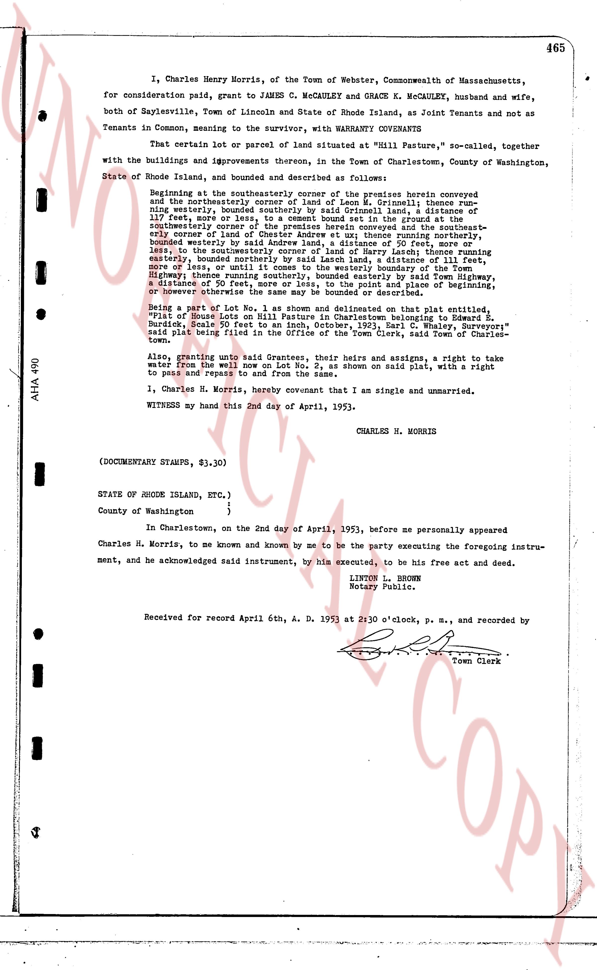
I, Charles Henry Morris, of the Town of Webster, Commonwealth of Massachusetts, for consideration paid paid, grant to JAMES C. MCCAULEY and GRACE K. MCCAULEY, husband and wife, and both of Saylesville, Town of Lincoln and State of Rhode Island, as Joint Tenants and not as Tenants in Common, meaning to the survivor, with WARRANTY COVENANTS
That certain lot or parcel of land situated at "Hill Pasture," so called, together with the buildings and improvements thereon, in the Town of Charlestown, County of Washington, State of Rhode Island, and bounded and described as follows:
Beginning at the southeasterly corner of the premises herein conveyed and on the northerly corner of the lot of Leo L. Grinnell; thence run generally northwesterly, bounded westerly by said Grinnell land, a distance of 117 feet, more or less, to a cement set in the ground at the southeasterly corner of the lot of Leo L. Grinnell as conveyed and the southeasterly corner of land of Chester Andrew et ux; thence running northerly, bounded westerly by said Chester Andrew land, a distance of 50 feet more or less, to the southeasterly corner of land of Henry Larch; thence running easterly, bounded northerly by said Henry Larch land, a distance of 50 feet, more or less, to the southeasterly corner of said Larch land; thence running southerly, bounded easterly by said Larch land, a distance of 50 feet, more or less, until it comes to the westerly boundary of the Town highway, Highest home route; thence running easterly by said Town highway, a distance of 50 feet, more or less, until to the point and place of beginning, or however otherwise the same may be bounded or described.
Being a part of Lot No. 11 as shown on a map entitled, "Plot of House Lots No. 11 on Hill Pasture in Charlestown belonging to Edward E. Bardell, Scale 50 feet to an inch, October, 1921, Carl W. Haley, Surveyor" said plat being filed with the records of the Town Clerk, said Town of Charlestown.
Also, granting unto said Grantees, their heirs and assigns, a right to take water from the well on Lot No. 2, as shown on said plat, with a right to pass and repass to and from the same.
I, Charles H. Morris, hereby covenant that I am single and unmarried.
WITNESS my hand this 2nd day of April, 1953.
CHARLES H. MORRIS
(DOCUMENTARY STAMPS, $3,30)
STATE OF RHODE ISLAND, ETC. )
)
County of Washington )
In Charlestown, on the 2nd day of April, 1953, before me personally appeared Charles H. Morris, to me known and known by me to be the party executing the foregoing instrument, and he acknowledged said instrument, by him executed, to be his free act and deed.
LINTON L. BROWN
Notary Public.
Received for record April 6th, A. D. 1953 at 2:30 o'clock, p. m., and recorded by [?] Town Clerk
The page as recorded