The instrument's own words
page 1 · read by Gemma vision
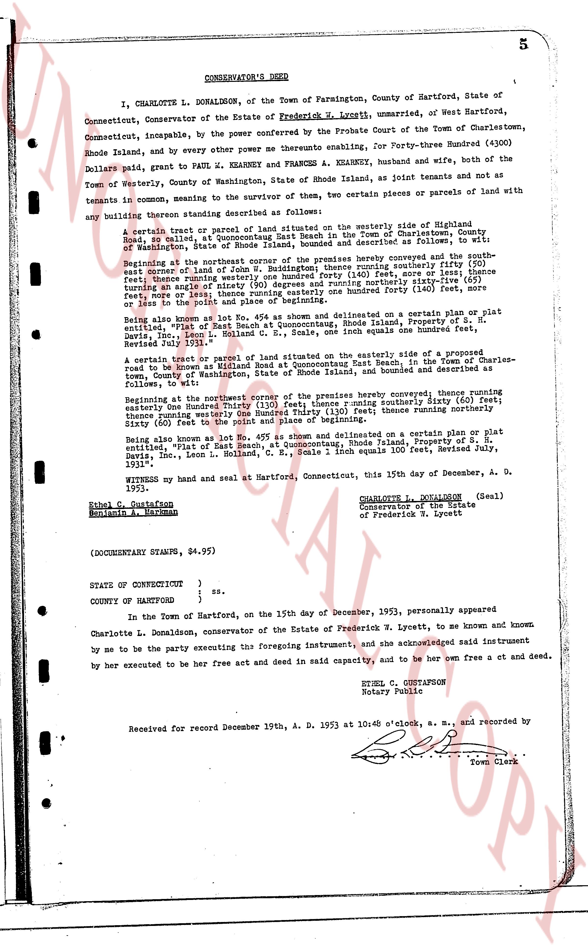
CONSERVATOR'S DEED
I, CHARLOTTE L. DONALDSON, of the Town of Farmington, County of Hartford, State of Connecticut, Conservator of the Estate of Frederick W. Lycett, unmarried, of West Hartford, Connecticut, Incapable, by the power conferred by the Probate Court of the Town of Charlestown, Rhode Island, and by every other power me thereunto enabling, for Forty-three Hundred (4300) Dollars paid, grant to PAUL M. KEARNEY and FRANCES A. KEARNEY, husband and wife, both of the Town of Westerly, County of Washington, State of Rhode Island, as joint tenants and not as tenants in common, meaning to the survivor of them, two certain pieces or parcels of land with any building thereon standing described as following:
A certain tract or parcel of land situated on the westerly side of Highland Road, in called, at the Quonsetpoint Beach in the Town of Charlestown, County of Washington, State of Rhode Island, bounded and described as following and more fully, to wit:
Beginning at the northeast corner of the premises hereby conveyed running southerly the south east corner of land of Joseph S. H. Davies, then running southerly fifty (50) feet; thence running westerly one hundred forty (140) feet, more or less; and thence running northerly fifty (50) feet; then running northerly sixty (60) feet; turning an angle north westerly one hundred forty (140) feet, more or less; then running an angle north easterly one hundred forty (140) feet, more or less to the point of its place beginning.
Being also known as lot No. 45a as shown and delineated on a certain plan or plat entitled, "Plot of East Side Beach at Quonsetcountaq, Rhode Island, Property of S. H. Davies, Inc., Leon L. Holland, C. E., Scale 1 inch equals one hundred feet, Revised July 1931."
A certain tract or parcel of land situated on the easterly side of the road known as Highland road to be known as Midland Road at Quonsetcountaq Beach East in the Town of Charlestown, County of Washington, State of Rhode Island, bounded and described as following, to wit:
Beginning at the north west Corner of the premises hereby conveyed; thence running easterly One hundred Thirty (130) feet; there running southerly Sixty (60) feet; thence running northerly one hundred Thirty (130) feet; thence running northerly Sixty (60) feet to the point and place of beginning.
Being also known as lot No. 45a as shown and delineated on a certain plan or plat entitled, "Plot of East Side Beach at Quonsetcountaq, Rhode Island, Property of S. H. Davies, Inc., Leon L. Holland, C. E., Scale 1 inch equals 100 feet, Revised July, 1931."
WITNESS my hand and seal at Hartford, Connecticut, this 15th day of December, A. D. 1953.
CHARLOTTE L. DONALDSON (Seal)
Conservator of the Estate
of Frederick W. Lycett
Ethel C. Gustafson
Benjamin A. Barkman
(DOCUMENTARY STAMPS, $4.95)
STATE OF CONNECTICUT } ss.
}
COUNTY OF HARTFORD }
In the Town of Hartford, on the 15th day of December, 1953, personally appeared Charlotte L. Donaldson, conservator of the Estate of Frederick W. Lycett, to me known and known by me to be the party executing the foregoing instrument, and she acknowledged said instrument by her executed to be her free act and deed in said capacity, and to be her own free act ct and deed.
ETHEL C. GUSTAFSON
Notary Public
Received for record December 19th, A. D. 1953 at 10:45 o'clock, a. m., and recorded by [Seal]
Town Clerk
The page as recorded