The instrument's own words
page 1 · read by Gemma vision
687
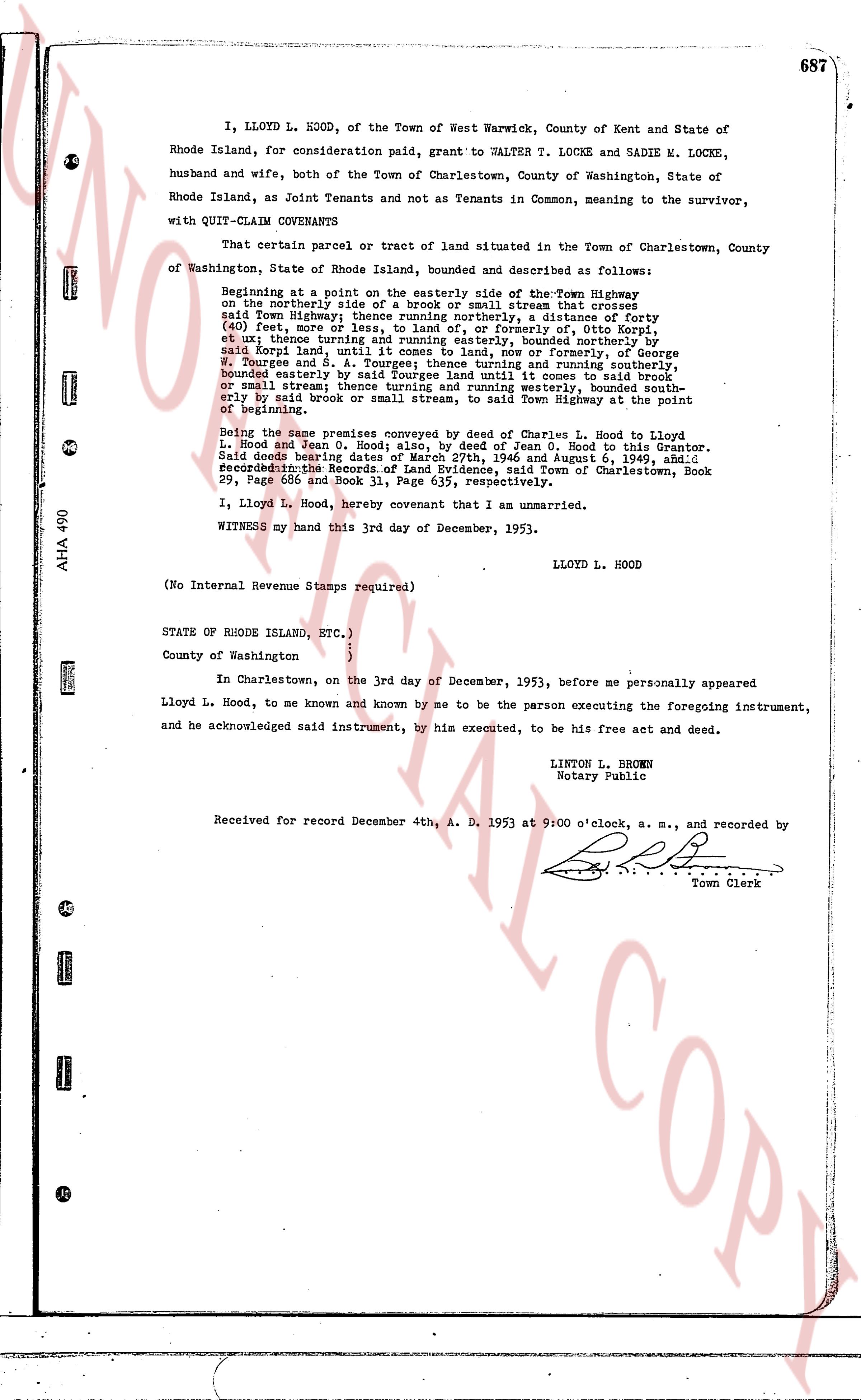
I, LLOYD L. HOOD, of the Town of West Warwick, County of Kent and State of Rhode Island, for consideration paid, grant to WALTER T. LOCKE and SADIE M. LOCKE, husband and wife, both of the Town of Charlestown, County of Washington, State of Rhode Island, as Joint Tenants and not as Tenants in Common, meaning to the survivor, with QUIT-CLAIM COVENANTS
That certain parcel of tract of land situated in the Town of Charlestown, County of Washington, State of Rhode Island, bounded and described as follows:
Beginning at a point on the easterly side of the Town Highway moving on the northerly side of a brook or small stream that crosses said Town Highway; thence running northerly, a distance of forty (40) feet more or less, to a line, now or formerly of the Old Kent, et ux; thence turning easterly and running easterly, bounded northerly by said Kent land, until a point, now or formerly, bounded northerly by W. Tourgee and S. A. Tourgee; thence turning and running southerly, bounded easterly by said Tourgee land, until I come to said brook or small stream and turning and running westerly, bounded south- erly by said brook or small stream, to said Town Highway at the point of beginning.
Being the same parcel conveyed by deed of Charles L. Hood to Lloyd L. Hood and Dean O. Hood; size 2.12 acres; and deed of Jean L. Hood to this Grantor. Said deeds bearing dates of March 27th, 1946 and August 6, 1948, and recorded in the Records of Land Evidence, said Town of Charlestown, Book 29, Page 66 and Book 31, Page 105, respectively.
I, Lloyd L. Hood, hereby covenant that I am unmarried.
WITNESS my hand this 3rd day of December, 1953.
LLOYD L. HOOD
(No Internal Revenue Stamps required)
STATE OF RHODE ISLAND, ETC. )
County of Washington ) ss.
In Charlestown, on the 3rd day of December, 1953, before me personally appeared Lloyd L. Hood, to me known and known by me to be the person executing the foregoing instrument, and he acknowledged said instrument, by his executed, to be his free act and deed.
LINTON L. BROWN
Notary Public
Received for record December 4th, A. D. 1953 at 9:00 o'clock, a. m., and recorded by [Signature]
Town Clerk
The page as recorded