The instrument's own words
page 1 · read by Gemma vision
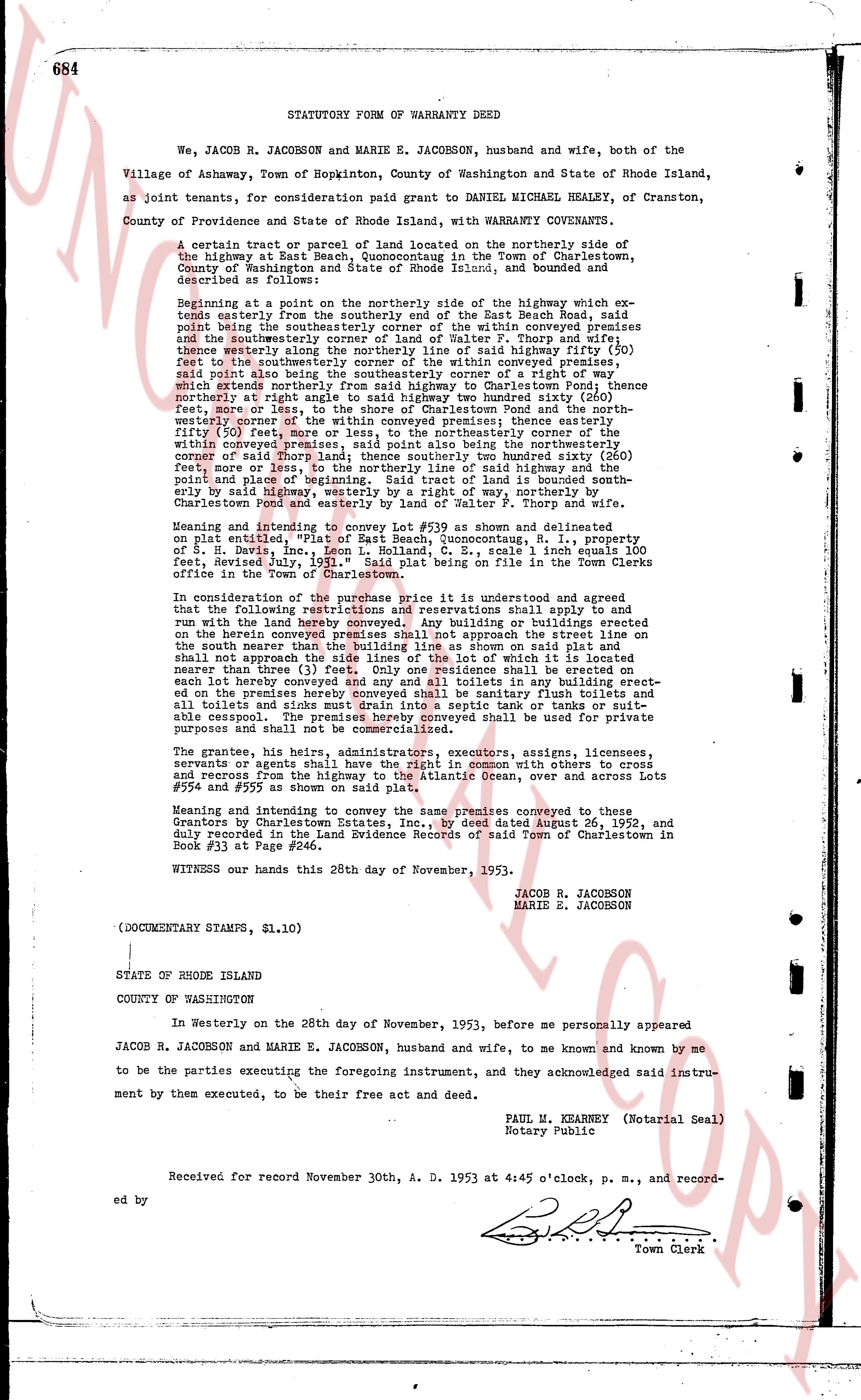
684 STATUTORY FORM OF WARRANTY DEED
We, JACOB R. JACOBSON and MARIE E. JACOBSON, husband and wife, both of the
Village of Ashaway, Town of Hopkinton, county of Washington and State of Rhode Island,
as joint tenants, for consideration paid grant to DANIEL MICHAEL HEALEY, of Cranston,
County of Providence and State of Rhode Island, with WARRANTY COVENANTS.
A certain tract or parcel of land located on the northerly side of the
highway at Beach East, Quonocutaug, in the Town of Charlestown,
County of Washington and State of Rhode Island, and bounded and
described as following:
Beginning at a point on the northerly side of the highway which extends
easterly from the southerly end of the street Beach Road, said
point being the southeasterly corner of the within conveyed Premises
and the southeasterly corner of land of Walter F. Thorp and wife;
thence westerly along the northerly side of said highway fifty (50)
feet to the southwesterly corner of the within conveyed premises,
said point also being the southwesterly corner of a strip of land which
extends northerly from said highway to Charlestown Pond; thence
northerly at right angles to said highway one hundred sixty (160)
feet, more or less, to the shore of Charlestown Pond and the north-
easterly corner of the within conveyed premises; thence easterly
fifty (50) feet, more or less, to the northeasterly corner of the
within conveyed premises, said line being the northerly boundary
corner of said Thorp land; thence southerly one hundred sixty (160)
feet more or less, to the northerly side of said highway, at the
point and place of beginning. Said tract of land is bounded south-
easterly by said highway, westerly by a right of way, northerly by
Charlestown Pond and easterly by land of Walter F. Thorp and wife.
Meaning and intending to convey Lot #39 as shown and delineated
on plat entitled, "Plat of Beach East, Quonocutaug, R. I., property
of S. Neves, Inc." dated October 1, 1931, scale 1 inch equals 100
feet, Revised July, 1931." Said plat being on file in the Town Clerks
office in the Town of Charlestown.
In consideration of the purchase the price is understood and agreed
that the following restrictions and reservations shall apply to and
run with the land herein conveyed: No building or buildings erected
on the herein conveyed premises shall approach the street line on
the south fence the distance of less than 25 feet as shown on said plat
shall not approach the side lines of the lot of which it is located
nearer than three (3) feet; only one residence shall be erected on
each lot herein conveyed; no other toilets or buildings erected
on the premises hereby conveyed shall be sanitary flush toilets and
all toilets and sinks shall be connected to a septic tank or sewage
suitable cesspool. The premises hereby conveyed shall be used for private
purposes and for no other purpose.
The grantee, his heirs, administrators, executors, assigns, licensees,
servants or agents shall have the right in common with others to cross
and recross from the highway to the Atlantic Ocean, over and across Lots
#554 and #555 as shown on said plat.
Meaning and intending to convey the same premises conveyed to these
Grantors by Charlestown Estates, Inc., by deed dated August 26, 1952, and
duly recorded in the Land Evidence Records of said Town of Charlestown in
Book #33 at Page #246.
WITNESS our hands this 28th day of November, 1953.
JACOB R. JACOBSON
MARIE E. JACOBSON
(DOCUMENTARY STAMPS, $1.10)
STATE OF RHODE ISLAND
COUNTY OF WASHINGTON
In Westerly on the 28th day of November, 1953, before me personally appeared
JACOB R. JACOBSON and MARIE E. JACOBSON, husband and wife, to me known and known by me
to be the parties executing the foregoing instrument, and they acknowledged said instru-
ment by them executed, to be their free act and deed.
PAUL M. KEARNEY (Notarial Seal)
Notary Public
Received for record November 30th, A. D. 1953 at 4:45 o'clock, p. m., and record-
ed by [?]
[Signature] Town Clerk
The page as recorded