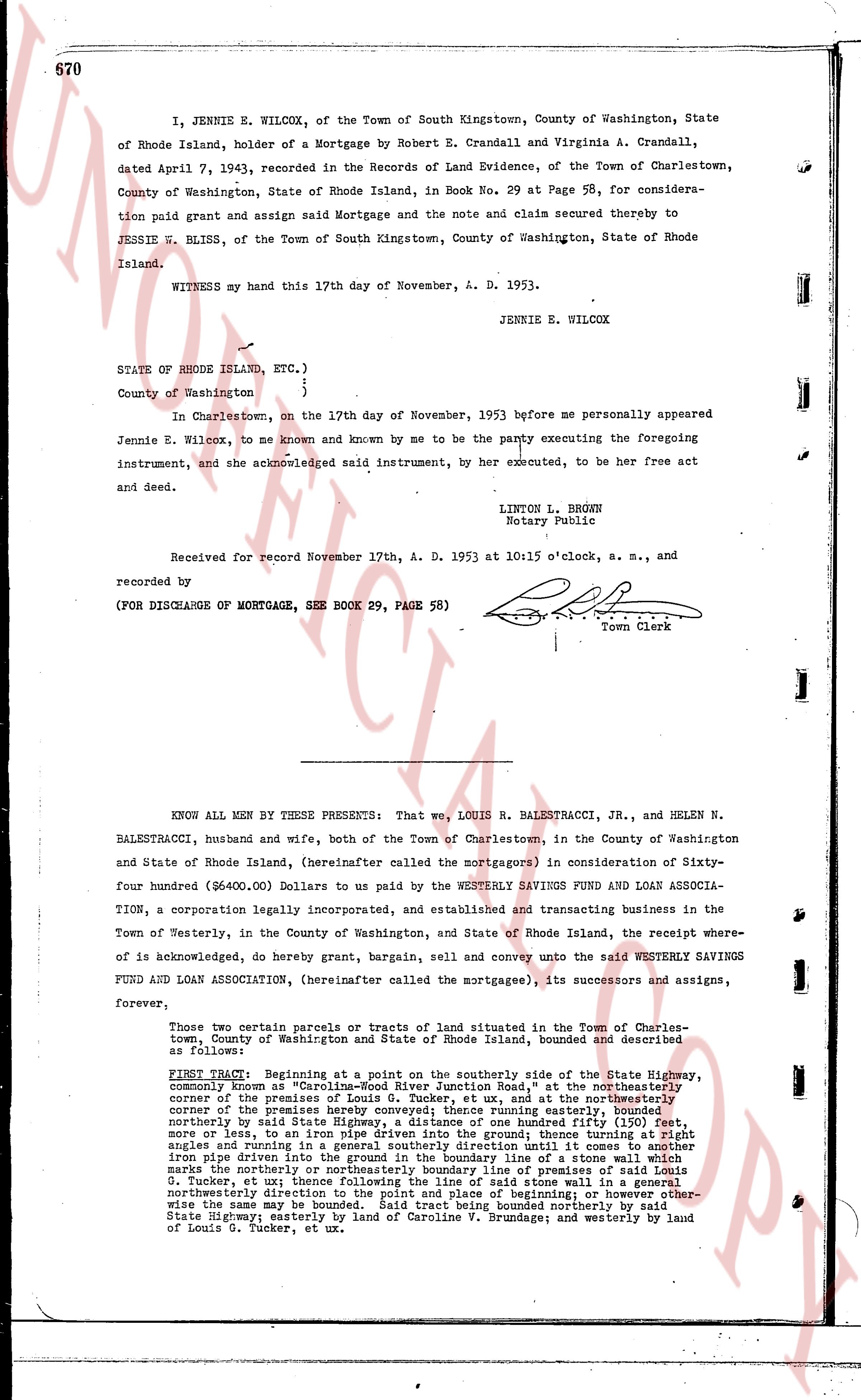
The instrument's own words
page 1 · read by Gemma vision
670
I, JENNIE E. WILCOX, of the Town of South Kingstown, County of Washington, State of Rhode Island, holder of a Mortgage by Robert E. Crandall and Virginia A. Crandall, dated April 7, 1943, recorded in the Records of Land Evidence, of the Town of Charlestown, County of Washington, State of Rhode Island, in Book No. 29 at Page 58, for consideration paid grant and assign said Mortgage and the note and claim secured thereby to JESSIE W. BLISS, of the Town of South Kingstown, County of Washington, State of Rhode Island.
WITNESS my hand this 17th day of November, A. D. 1953.
JENNIE E. WILCOX
STATE OF RHODE ISLAND, ETC.)
)
)
County of Washington )
In Charlestown, on the 17th day of November, 1953 before me personally appeared Jennie E. Wilcox, to me known and known by me to be the party executing the foregoing instrument, and she acknowledged said instrument, by her executed, to be her free act and deed.
LINTON L. BROWN
Notary Public
Received for record November 17th, A. D. 1953 at 10:15 o'clock, a. m., and recorded by [signature]
Town Clerk
(FOR DISCHARGE OF MORTGAGE, SEE BOOK 29, PAGE 58)
----
KNOW ALL MEN BY THESE PRESENTS: That we, LOUIS R. BALESTRACCI, JR., and HELEN N. BALESTRACCI, husband and wife, both of the Town of Charlestown, in the County of Washington and State of Rhode Island, (hereinafter called the mortgagors) in consideration of Sixty-four hundred ($6400.00) Dollars to us paid by the WESTERLY SAVINGS FUND AND LOAN ASSOCIA-TION, a corporation legally incorporated, and established and transacting business in the Town of Westerly, in the County of Washington, and State of Rhode Island, the receipt whereof is acknowledged, do hereby grant, bargain, sell and convey unto the said WESTERLY SAVINGS FUND AND LOAN ASSOCIATION, (hereinafter called the mortgagee), its successors and assigns, forever,
Those two certain parcels or tracts of land situated in the Town of Charlestown, County of Washington and State of Rhode Island, bounded and described as follows:
FIRST TRACT: Beginning at a point on the southerly side of the State Highway, commonly known as "Carolina-Rod River Junction Road," at the northeasterly corner of the premises of Louis G. Tucker, et ux, and at the northeasterly corner of the premises herein conveyed, running easterly, measuring seventy-eight feet more or less, northerly by said State Highway, a distance of one hundreded fifty feet (150 feet more or less), to an abutment of a stone wall, thence running thence southerly ninety degrees and angles and running in a general southerly direction until it comes to another iron pipe, then running easterly to the boundary line of a stone wall which marks the northerly or northeasterly boundary line of premises of said Louis G. Tucker, et ux; thence following the line of said stone wall in a general northeasterly direction to the point of beginning; however, the mortgagee will likewise the same be bounded. Said tract being bounded northerly by said State Highway, easterly by land of Caroline V. Brundage; and westerly by land of Louis G. Tucker, et ux.
The page as recorded