The instrument's own words
page 1 · read by Gemma vision
667
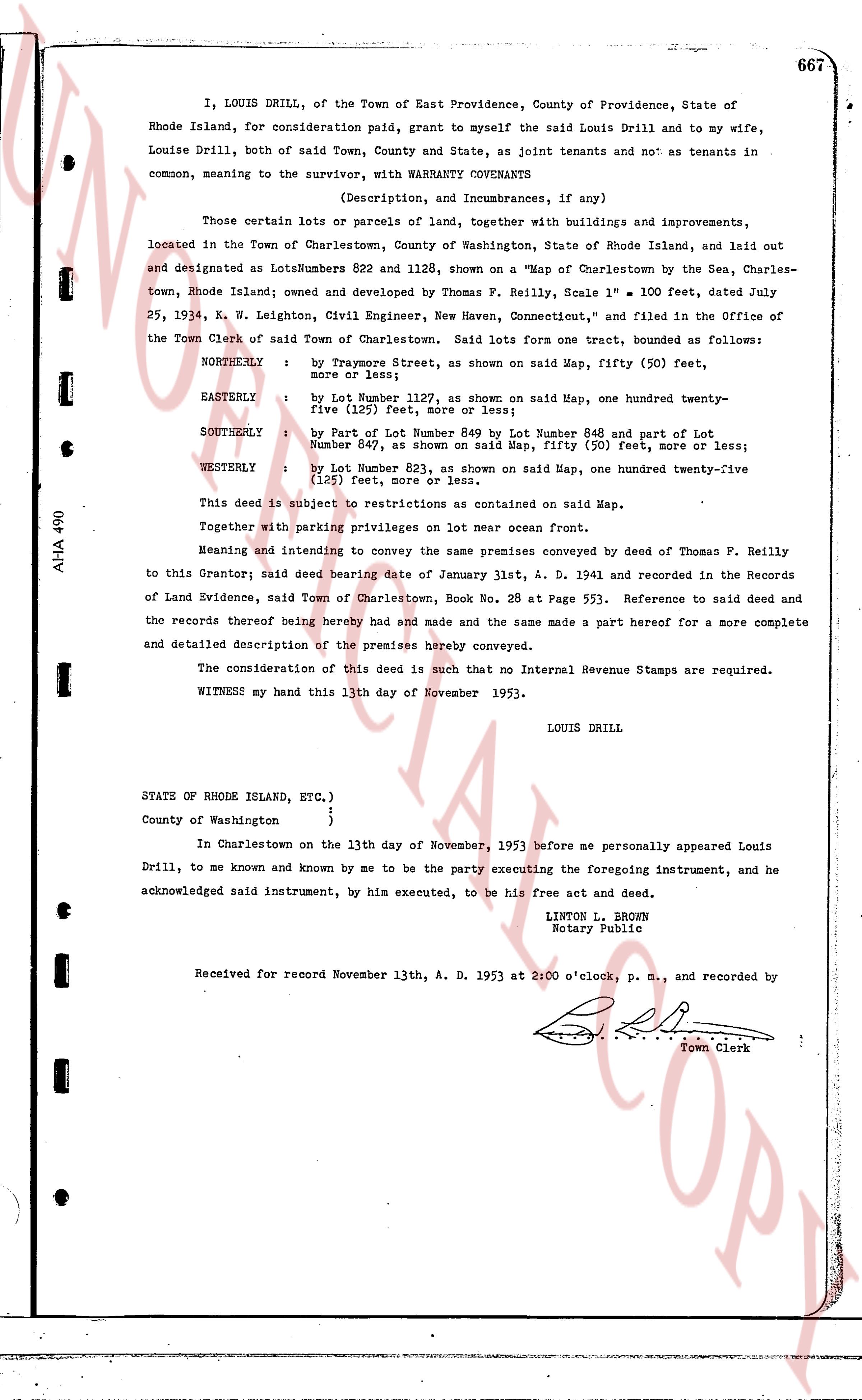
I, LOUIS DRILL, of the Town of East Providence, County of Providence, State of Rhode Island, for consideration paid, grant to myself the said Louis Drill and to my wife, Louise Drill, both of said Town, County and State, as joint tenants and not as tenants in common, meaning to the survivor, with WARRANTY COVENANTS
(Description, and Incumbrances, if any)
Those certain lots or parcels of land, together with buildings and improvements, located in the Town of Charlestown, County of Washington, State of Rhode Island, and laid out and designated as Lots Numbers 822 and 1128, shown on a "Map of Charlestown by the Sea, Charlestown, Rhode Island; owned and developed by Thomas F. Reilly, Scale 1" = 100 feet, dated July 25, 1934, K. W. Leighton, Civil Engineer, New Haven, Connecticut," and filed in the Office of the Town Clerk of said Town of Charlestown. Said lots form one tract, bounded as follows:
NORTHERLY : by Taymone Street, as shown on said Map, fifty (50) feet, more or less;
EASTERLY : by Lot Number 1127, as shown on said Map, one hundred twenty-five (125) feet, more or less;
SOUTHERLY : by part of Lot Number 849 by Lot Number 848 and part of Lot Number 847, as shown on said Map, fifty (50) feet, more or less;
WESTERLY : by Lot Number 821, as shown on said Map, one hundred twenty-five (125) feet, more or less.
This deed is subject to restrictions as contained on said Map.
Together with privileging on lot near ocean front.
Meaning and intending to convey the same premises conveyed by deed of Thomas F. Reilly to this Grantor; said deed bearing date of January 31st, A. D. 1941 and recorded in the Records of Land Evidence, said Town of Charlestown, Book No. 28 at Page 553. Reference to said deed and the records thereof being hereby had and made and the same made a part hereof for a more complete and detailed description of the premises hereby conveyed.
The consideration of this deed is such that no Internal Revenue Stamps are required.
WITNESS my hand this 13th day of November 1953.
LOUIS DRILL
STATE OF RHODE ISLAND, ETC.)
County of Washington }
}
In Charlestown on the 13th day of November, 1953 before me personally appeared Louis Drill, to me known and known by me to be the party executing the foregoing instrument, and he acknowledged said instrument, by him executed, to be his free act and deed.
LINTON L. BROWN
Notary Public
Received for record November 13th, A. D. 1953 at 2:00 o'clock p. m., and recorded by
[Signature]
Town Clerk
The page as recorded