The instrument's own words
page 1 · read by Gemma vision
635
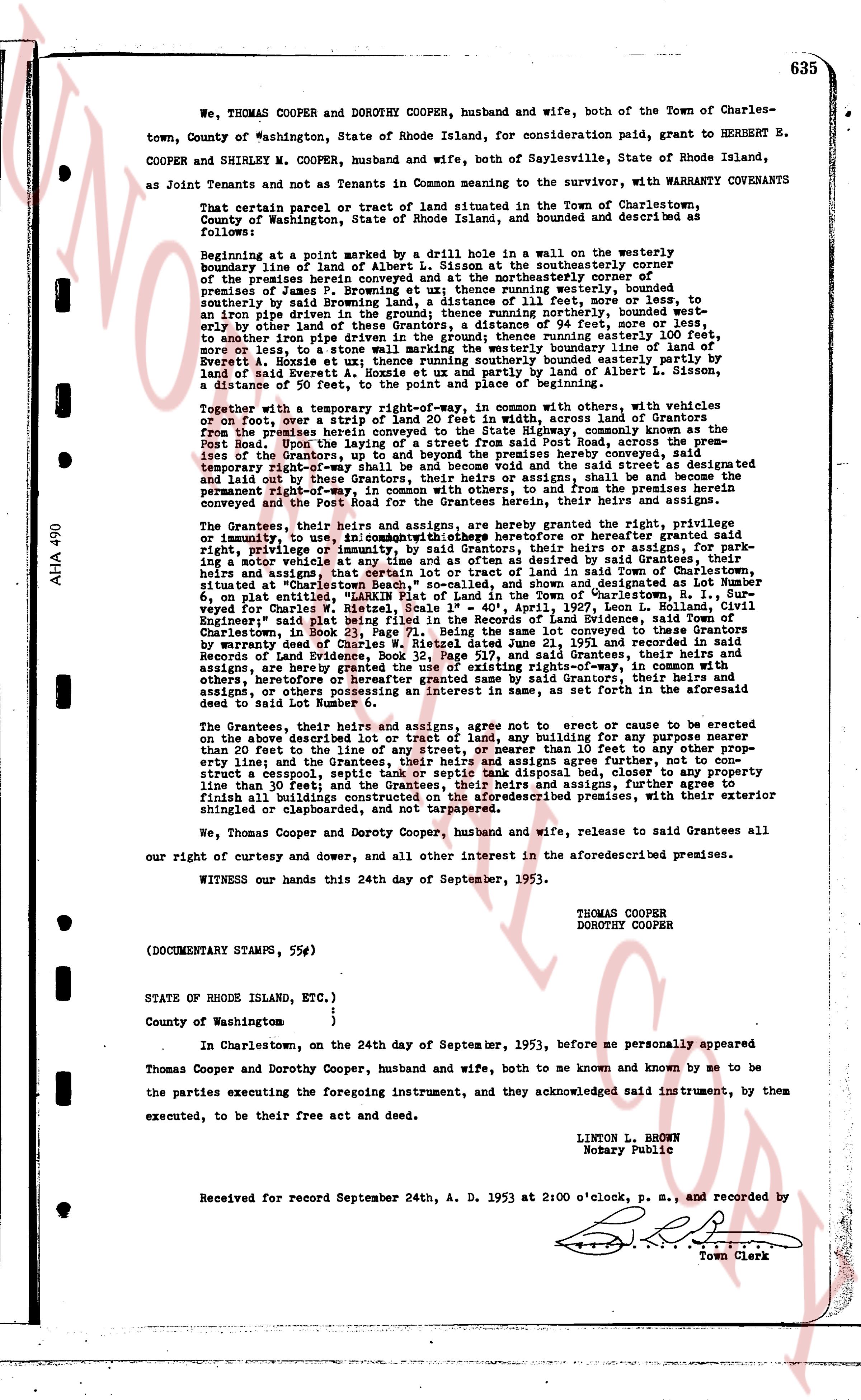
We, THOMAS COOPER and DOROTHY COOPER, husband and wife, both of the Town of Charlestown, County of Washington, State of Rhode Island, for consideration paid, grant to HERBERT E. COOPER and SHIRLEY M. COOPER, husband and wife, both of Saylesville, State of Rhode Island, as Joint Tenants and not as Tenants in Common meaning to the survivor, with WARRANTY COVENANTS
That certain parcel or tract of land situated in the Town of Charlestown, County of Washington, State of Rhode Island, and bounded and described as follows:
Beginning at a stone marker set by a drill hole in a wall in the westerly boundary line of land of Albert L. Sisson at the southeasterly corner of the premises herein conveyed and at the northeasterly corner of premises of Isaac R. Moore; thence running easterly, bounded partly north easterly by an iron pipe driven in land of the Grantors, a distance of 111 feet, more or less, to an iron pipe driven in land of the Grantors, bounded partly northerly, bounded partly northerly by dior land of the Grantors, a distance of 94 feet, more or less, to an iron pipe driven in the ground; thence running northerly, bounded partly easterly by land of David A. Moore, a distance of 111 feet, more or less, to the northerly boundary line of land of Everett A. Hoxie at its zenith; thence running southerly bounded easterly partly by land of David A. Moore and partly by land of Albert L. Sisson for a distance of 50 feet, to the point and place of beginning and summed.
Together with a temporary right-of-way, in common with others, with vehicles or on foot, over a strip of land 20 feet wide, running east from the lands of Grantors from the premises herein conveyed to the State Highway, commonly known as the Post Road; bounded partly northerly and partly south east, along the premises of the Grantors, up to and beyond the premises hereby conveyed, said temporary right-of-way being 20 feet wide, running northerly, bounded partly easterly and laid out by these Grantors, their heirs or assigns, shall be and become the permanent right-of-way for the State of Rhode Island and from the premises herein conveyed and the Post road for the Grantees, their heirs and assigns,
The Grantees, their heirs and assigns, are hereby granted the right, the privilege, or immunity to, use in common with others the heretofore described right-of-way, for their heirs and assigns, for parking a motor vehicle at any time and as often as desired and set designated by said Grantees, their heirs and assigns, that is to be used for parking a motor vehicle in said right-of-way situated at "Charlestown Beach," so called, and shown and described as designated Lot Number 6, on a map entitled "Plan of the Beach Section of Charlestown" recorded in the town of Charlestown, in book 3, page 141, filed 1st day of April, 1927, Leon L. Collind, Civil Engineer's map which is referred to herein as the map of the Beach Section of Charlestown, in book 23, page 71. Being the same lot conveyed to these Grantees by warranty deed of Chad and Dorothy Cooper, dated September 1, 1953 and recorded in the Records of Land Evidence, Book 33, Page 517, and said Grantees, their heirs and assigns, are hereby granted the right, the privilege, or immunity to, use in common with others, heretofore or hereafter granted same by said Grantors, their heirs and assigns, or others possessing an interest in same, as are set forth in the aforesaid deed to said Lot Number 6.
The Grantees, their heirs and assigns, agree not to erect or cause to be erected on the above described lot or tract of land, any building for any purpose nearer than 20 feet to the line of the State Highway, nor nearer than 10 feet to the property line; and the Grantees, their heirs and assigns agrees further, not to construct a carport, septic tank, swimming pool or any other structure nearer than the property line than 30 feet; and the Grantees, their heirs and assigns, further agree to finish all building exteriors on the above described premises, with their exterior shingled or clapboarded, and not tarpapered.
We, Thomas Cooper and Dorothy Cooper, husband and wife, release to said Grantees all our right of curtesy and dower, and all other interest in the aforesaid premises.
WITNESS our hands this 24th day of September, 1953.
THOMAS COOPER
DOROTHY COOPER
(DOCUMENTARY STAMPS, 55¢s)
STATE OF RHODE ISLAND, ETC.)
County of Washington )
)
In Charlestown, on the 24th day of September, 1953, before me personally appeared
Thomas Cooper and Dorothy Cooper, husband and wife, both to me known and known by me to be the parties executing the foregoing instrument, and they acknowledged said instrument, by them the executers, to be their free act and deed.
LINTON L. BROWN
Notary Public
Received for record September 24th, A. D. 1953 at 2:00 o'clock, p. m., and recorded by
[Signature]
Town Clerk
AHA 490
The page as recorded