The instrument's own words
page 1 · read by Gemma vision
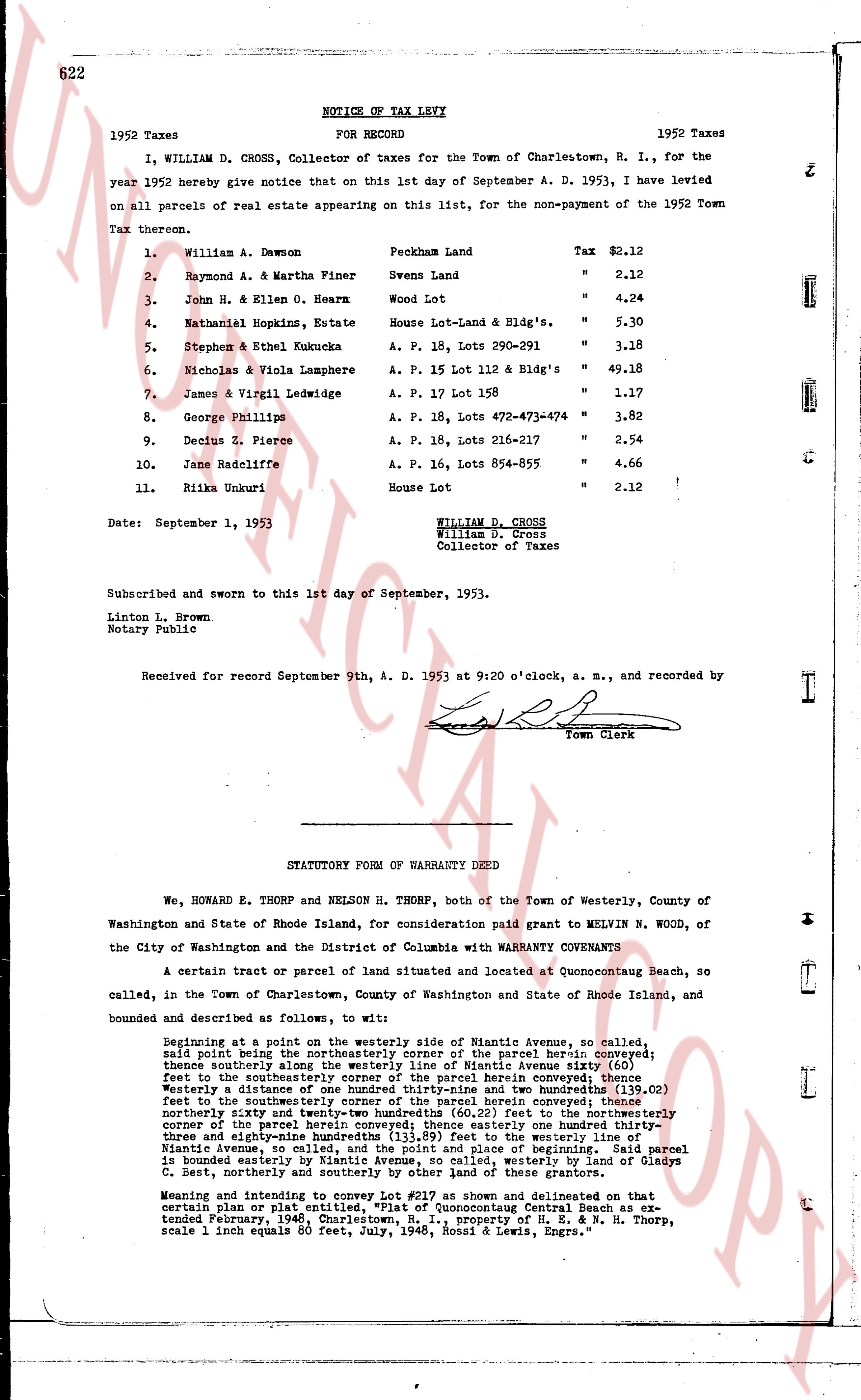
622 NOTICE OF TAX LEVY
1952 Taxes FOR RECORD 1952 Taxes
I, WILLIAM D. CROSS, Collector of taxes for the Town of Charlestown, R. I., for the year 1952 hereby give notice that on this 1st day of September A. D. 1953, I have levied on all parcels of real estate appearing on this list, for the non-payment of the 1952 Town Tax thereon.
1. William A. Dawson Peckham Land Tax $2.12
2. Raymond A. & Martha Finer Svens Land " 2.12
3. John H. & Ellen O. Hearn Wood Lot " 4.24
4. Nathaniel Hopkins, Estate House Lot-Land & Bldg's. " 5.30
5. Stephen & Ethel Kukucka A. P. 18, Lots 290-291 " 3.18
6. Nicholas & Viola Lamphere A. P. 15 Lot 112 & Bldg's " 49.18
7. James & Virgil Ledwidge A. P. 17 Lot 158 " 1.17
8. George Phillips A. P. 18, Lots 472-473-474 " 3.82
9. Decius Z. Pierce A. P. 16, Lots 216-217 " 2.54
10. Jane Radcliffe A. P. 16, Lots 854-855 " 4.66
11. Rikka Unukuri House Lot " 2.12 !
Date: September 1, 1953 WILLIAM D. CROSS
William D. Cross
Collector of Taxes
Subscribed and sworn to this 1st day of September, 1953.
Linton L. Brown
Notary Public
Received for record September 9th, A. D. 1953 at 9:20 o'clock, a. m., and recorded by [signature]
Town Clerk
----
STATUTORY FORM OF WARRANTY DEED
We, HOWARD E. THORP and NELSON H. THORP, both of the Town of Westerly, County of Washington and State of Rhode Island, for consideration paid grant to MELVIN N. WOOD, of the City of Washington and the District of Columbia with WARRANTY COVENANTS
A certain tract or parcel of land situated and located at Quonocutong Beach, so called, in the Town of Charlestown, County of Washington and State of Rhode Island, and bounded and described as follows, to wit:
Beginning at a point on the westerly side of Riantic Avenue, so called, westerly from the northeasterly corner of the parcel herein conveyed; thence southerly along the westerly line of Riantic Avenue seventy six (76.00) feet to the southwesterly corner of the parcel herein conveyed; thence westerly a distance of one hundred twenty-three and two hundredths (123.02) feet to the southwestern corner of the parcel herein conveyed; thence northerly forty eight and seventy-four hundredths (48.74) feet to the northwestern corner of the parcel herein conveyed; thence easterly one hundred twenty-three and eighty-nine hundredths (123.89) feet to the westerly line of Riantic Avenue, so called, and thence northeasterly to the beginning. Said parcel is bounded easterly by Riantic Avenue, so called, westerly by the land of Gladys C. Best northerly and southerly by the lands of these tractors.
Meaning and intending to convey Lot #217 as shown and delineated on that certain plan or plat entitled, "Plat of Quonocutong Central Beach as extended February, 1948, Charlestown, R. I., property of E. H. & N. H. Thorp, scale 1 inch equals 80 feet, July, 1948, Rossi & Lewis, Engrs."
The page as recorded