The instrument's own words
page 1 · read by Gemma vision
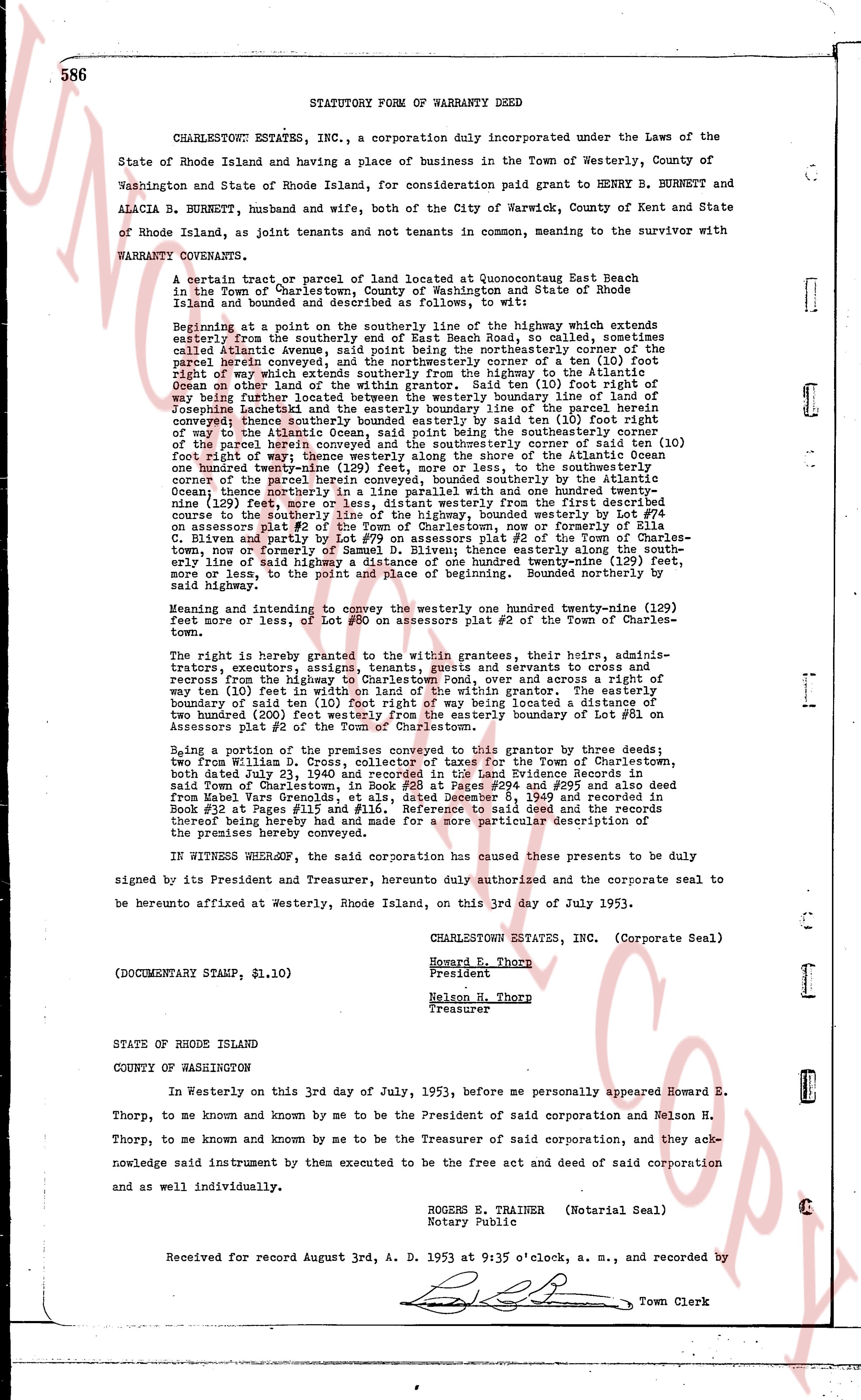
586 STATUTORY FORM OF WARRANTY DEED Used
CHARLESTOWN ESTATES, INC., a corporation duly incorporated under the Laws of the State of Rhode Island and having a place of business in the Town of Westerly, County of Washington State of Rhode Island, for consideration paid grant to HENRY B. BURNETT and ALACIA B. BURNETT, husband and wife, both of the City of Warwick, County of Kent and State of Rhode Island, as joint tenants and not tenants in common, meaning to the survivor with WARRANTY COVENANTS.
A certain tract or parcel of land located at Quonsetpoint East Beach in the Town of Charlestown, County of Washington and State of Rhode Island is bounded and described as follows, to wit:
Beginning at a point on the southerly line of the highway which extends easterly from the southerly end of East Beach Road, so called, sometimes called Atlantic Avenue, said point being the northeasterly corner of the parcel herein conveyed, and the northeasterly corner of a ten (10) foot right of way being run parallel to and on the easterly line of the parcel herein conveyed, and the northeasterly corner of the Atlantic Ocean on the other land of the within grantor. Said ten (10) foot right of way being run parallel to and on the easterly boundary line of the parcel herein conveyed, between the southerly boundary line of the parcel herein conveyed and the line of Josephine Lackstocki and the easterly boundary line of the parcel herein conveyed, between the southerly boundary line of the parcel herein conveyed, and the line of Josephine Lackstocki and be guided by said ten (10) foot right of way to the Atlantic Ocean, said point being the southeasterly corner of the parcel herein conveyed, thence southerly to the southeasterly corner of said ten (10) foot right of way; thence westerly along the shore of the Atlantic Ocean one hundred twenty (120) feet more or less, thence northerly to the southeasterly corner of the parcel herein conveyed, thence northerly and then north east and home and one hundred twenty nine (129) feet more or less, distant westerly from the first described course to the southerly line of the highway, bounded westerly by a lot #2 of the parcel herein conveyed, and bounded northerly by lot #3 or formerly of Ella C. Oliveness plat #2 of the parcel herein conveyed, and bounded northerly by lot #7y on Assessors plat #2 of the parcel herein conveyed, and bounded northerly by lot #7y on Assessors plat #2 of the Town of Charlestown, now formerly of Ella C. Oliveness, thence easterly along the highway to the point of beginning, bounded easterly along the southerly line of said highway a distance of one hundred twenty nine (129) feet, more or less, to the point and place of beginning. Bounded northerly by said highway.
Meaning and intending to convey the entire one hundred twenty nine (129) feet more or less, lot #7y on Assessors plat #2 of the Town of Charlestown.
The right is hereby granted to the within grantees, their heirs, admins- trators, executors, assigns, tenants, tenants and servants to cross and regress from the highway to Charlestown Pond, over and across a right of way ten (10) feet in width parallel to the easterly line of the grantor. Said right of boundary said ten (10) foot right of way being located a distance of two hundred (200) feet westerly from the easterly boundary of lot #31 on Assessors plat #2 of the Town of Charlestown.
Being a portion of the premises conveyed to this grantor by three deeds; two from William D. Cross, collector of taxes for the Town of Charlestown, both dated July 3, 1936, recorded in Charlestown Land Evidence Book 24, page 284 and recorded said Town of Charlestown, in Book #24 at Pages #284 and #295 and also deed from Noel Van Steen recorded in Charlestown Land Evidence Book #24 and recorded Book #24 at Pages #115 and #116. Reference to said deed and the records thereof being hereby made for a more particular description of the premises hereby conveyed.
IN WITNESS WHEREOF, the said corporation has caused these premises to be duly signed by its President and Treasurer, hereby duly authenticated and the corporate seal to be hereunto affixed at Westerly, Rhode Island, on this 3rd day of July 1953.
CHARLESTOWN ESTATES, INC. (Corporate Seal)
Norman G. Thorp
President
Nelson H. Thorp
Treasurer
(DOCUMENTARY STAMP, $1.10)
STATE OF RHODE ISLAND
COUNTY OF WASHINGTON
In Westerly on this 3rd day of July, 1953, before me personally appeared Howard E. Thorp, to me now and known by me to be the President of said corporation and Nelson H. Thorp, to me now and known by me to be the Treasurer of said corporation, and they acknowledge said instrument by them executed to be the free act and deed of said corporation and as well individually.
ROGERS E. TRAINER (Notarial Seal)
Notary Public
Received for record August 3rd, A. D. 1953 at 9:35 o'clock, a. m., and recorded by
[Signature] Town Clerk
The page as recorded