The instrument's own words
page 1 · read by Gemma vision
537
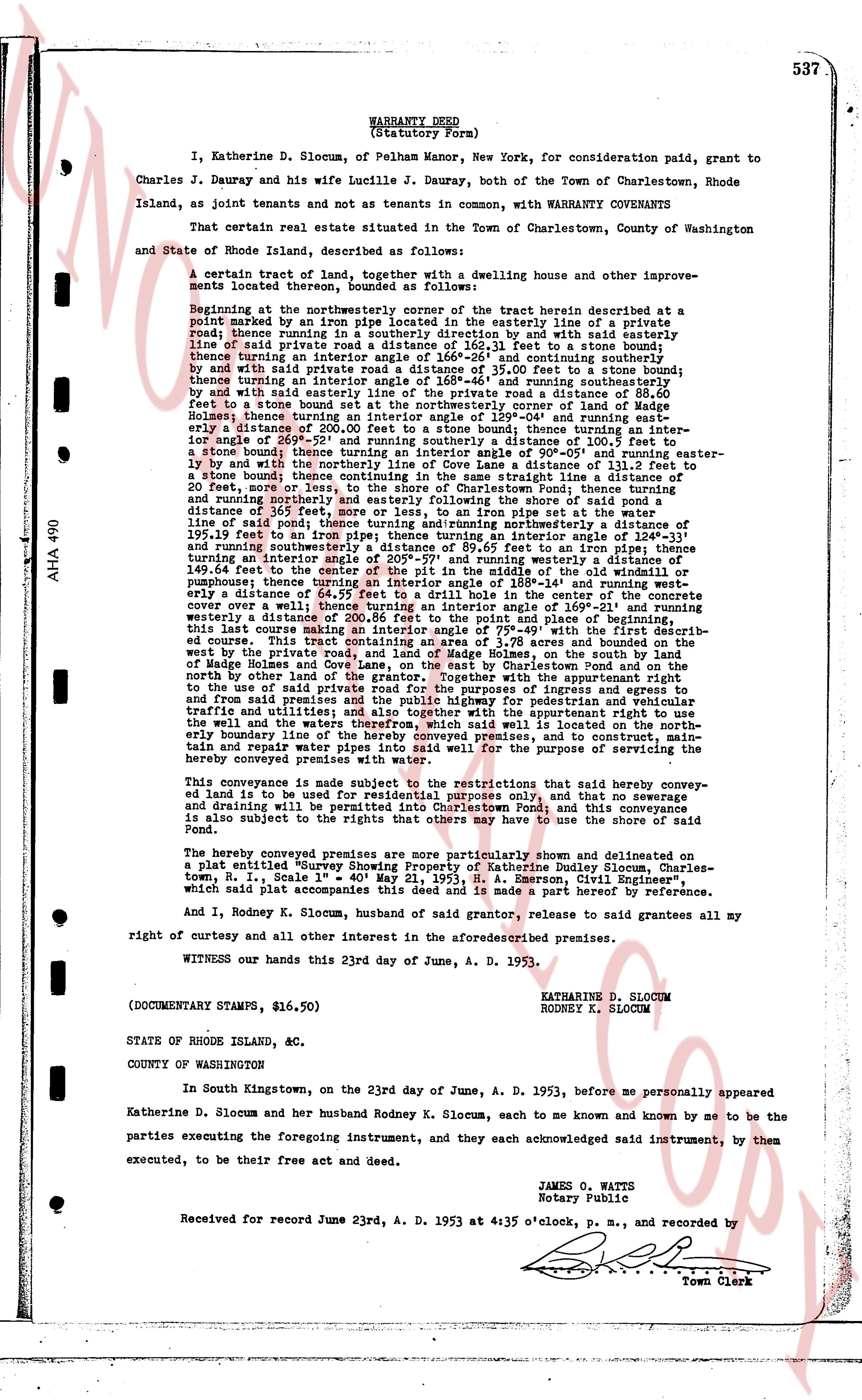
WARRANTY DEED
(Statutory Form)
I, Katherine D. Slocum, of Pelham Manor, New York, for consideration paid, grant to
Charles J. Dauray and his wife Lucille J. Dauray, both of the Town of Charlestown, Rhode
Island, as joint tenants and not as tenants in common, with WARRANTY COVENANTS
That certain real estate situated in the Town of Charlestown, County of Washington
and State of Rhode Island, described as follows:
A certain tract of land, together with a dwelling house and other improvements located therein, bounded and described as follows:
Beginning at the northwestern corner of the tract herein described at a point marked by an iron pipe located in the easterly line of a private road between two running stones in a stone wall, running by said wall easterly and with said easterly line of said private road a distance of 162.31 feet to a stone boundary;
thence turning an interior angle of 118° 24' and running southeasterly to a stone boundary;
by and with said private road a distance of 35.00 feet to a stone boundary; then
thence turning an interior angle of 165° 46' and running southeasterly by and
by and with a stone wall a distance of 109.54 feet to a stone boundary; thence running a distance of 20.00
feet to a stone bound set at the northwestern corner of land made a part of this
deed; thence turning an interior angle of 135° 24' and running southeasterly to a
boundary a distance of 200.00 feet to a stone boundary; thence turning an interior angle of 95° 30'
once again of 90° 05' turning and running easterly a distance of 101.12 feet to a
stone boundary; thence turning an interior angle of 90° 05' and running easterly to
by and with said stone wall a distance of 111.12 feet to a stone boundary; thence
to a stone boundary; thence continuing in the same straight line a distance of
20.00 feet, now running south 15° 00' west to a stone boundary; thence turning
and running northerly and easterly following the shore of said pond a distance
of 36.50 feet, now running south 15° 00' west to the wall at the northwestern line
of said pond; thence turning and running northerly a distance of 195.31 feet to a
line of said pond; thence turning and running northerly a distance of 195.31 feet to
195.31 feet to a stone boundary; thence turning an interior angle of 124° 17' and
running southeasterly a distance of 89.65 feet to an iron pipe set at the corner
turning an interior angle of 205° 57' and running southeasterly a distance of
149.60 feet to the corner of the tract herein described at the intersection of a
pump house; thence turning an interior angle of 182° 14' and running westerly a
distance of 144.00 feet to a stone boundary in the center of the private road, the
cover over a well; thence turning an interior angle of 169° 21' and running
westerly a distance of 111.12 feet to a stone boundary; thence turning an interior
this last course making an interior angle of 79° 47' with the first described boundary course. This tract contains 2.76 acres and bounds the highway
by the private road, and lands of Madge Holmes, on the south by land
of Madge Holmes and the private road to Charlestown Pond and on the north
on north by other land of the grantor. Together with the appurtenant right
to the use of said private road for the purpose of ingress and egress to and from
and from said premises and the public highway for pedestrian and vehicular traffic and utilities, and the appurtenant right to use the private road to
the well and the waters therefrom, which said well is located on the north
easterly boundary line of the herein conveyed premises, and to construct, main-
tain and repair water pipes and pumps for the purpose of conveying water to
the hereby conveyed premises with water rights.
This conveyance is made subject to the restrictions that said hereby conveyed land is to be used for residential purposes only, and that no sewerage
and drainage will be permitted into Charlestown Pond, and this conveyance
is also subject to the rights of any persons who have a use the shore of said
Pond.
The hereby conveyed premises are more particularly shown and delineated on
a plat entitled "Survey Showing Property of Katherine Dudley Slocum, Charles-
town, R. I., Scale 1" = 40' May 21, 1953, H. A. Emerson, Civil Engineer",
which said plat accompanies this deed and is made a part hereof by reference.
And I, Rodney K. Slocum, of husband of said grantor, release to said grantees all my
right of curtesy and all other interest in the aforesaid described premises.
WITNESS our hands this 23d day of June, A. D. 1953.
KATHARINE D. SLOCUM
RODNEY K. SLOCUM
(DOCUMENTARY STAMPS, $16.50)
STATE OF RHODE ISLAND, &c.
COUNTY OF WASHINGTON
In South Kingstown, on the twenty third day of June, A. D. 1953, before me personally appeared
Katherine D. Slocum and her husband Rodney K. Slocum, each to me and known by me to be
the parties executing the foregoing instrument, and they each acknowledged said instrument, by them
executed, to be their free act and deed.
JAMES O. WATTS
Notary Public
Received for record June 23rd, A. D. 1953 at 4:35 o'clock, p. m., and recorded by
Town Clerk
The page as recorded