The instrument's own words
page 1 · read by Gemma vision
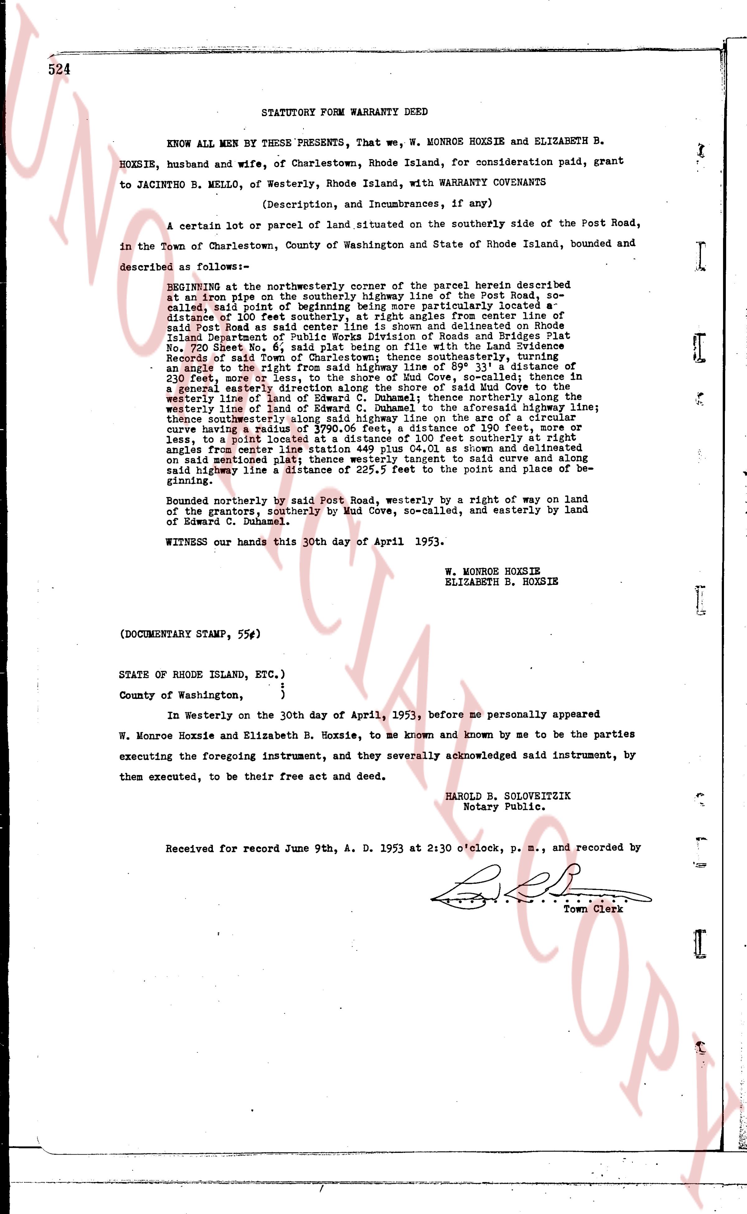
524 STATUTORY FORM WARRANTY DEED
KNOW ALL MEN BY THESE PRESENTS, That we, W. MONROE HOXSIE and ELIZABETH B. HOXSIE, husband and wife, of Charlestown, Rhode Island, for consideration paid, grant to JACINTHO B. MELLO, of Westerly, Rhode Island, with WARRANTY COVENANTS
(Description, and Incumbrances, if any)
A certain lot or parcel of land situated on the southerly side of the Post Road, in the Town of Charlestown, County of Washington and State of Rhode Island, bounded and described as follows:—
BEGINNING at the northwesterly corner of the parcel herein described at an iron pipe on the southerly high line of the Post Road so-called, said pipe being at the northwesterly corner more particularly located a distance of 100 feet southerly, at right angles from center line of said Post Road at said pipe, as shown and delineated on Rhode Island Department of Public Works Division of Roads and Bridges Plat No. 700 Sheet 6 of 14, and further described in the land evidence Records of said Town of Charlestown hence southerly, traversing an angle to the right of the high line of Edward C. Duhamel, thence northerly along the line of said Edward C. Duhamel, thence northerly along the line of 230 feet, more or less, to the shore of Mud Cove, so-called; thence in a general easterly direction along the shore of said Mud Cove to the westerly line of land of Edward C. Duhamel, to the aforesaid high line; thence westerly along the line of Edward C. Duhamel to the aforesaid high line; thence northwesterly along said high line on the arc of a circle having a curve radius of 3790.06 feet, a distance of 130 feet, more or less, to a post located at right angles 100 feet southerly from the right angles from center line station 449 plus 04.01 as shown and delineated on said aforementioned plat, along said curve and along the high line said high line a distance of 225.5 feet to the point and place of beginning.
Bounded northerly by said Post Road, westerly by a right of way on land of the grantors, southerly by Mud Cove, so-called, and easterly by land of Edward C. Duhamel.
WITNESS our hands this 30th day of April 1953.
W. MONROE HOXSIE
ELIZABETH B. HOXSIE
(DOCUMENTARY STAMP, 55¢)
STATE OF RHODE ISLAND, ETC.)
County of Washington, }
} In Westerly on the 30th day of April, 1953, before me personally appeared
W. Monroe Hoxsie and Elizabeth B. Hoxsie, to me known and known by me to be the parties executing the foregoing instrument, and they severally acknowledged said instrument, by them executed, to be their free act and deed.
HAROLD B. SOLOVREITZ
Notary Public.
Received for record June 9th, A. D. 1953 at 2:30 o'clock, p. m., and recorded by
[Signature]
Town Clerk
The page as recorded